Winter in 2017 Returns with Vigor
Breaking Weather Events
Winter is not through with the eastern U.S. yet. In fact, the next 7 days could bring some of the most significant snow of the season for parts of the East. Even for areas that miss out on the snow, it is going to feel very much like mid-January temperature-wise as cold, Arctic air blasts down across the eastern U.S. this weekend and continues well into next week. Here's a quick summary of what you can expect:
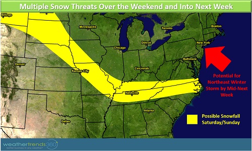
- Accumulating Snow in the East over the next week
- Coldest Mid-March in the North Central U.S. in 18 years
- Coldest Mid-March in the Great Lakes and Northeast in 24 years
- Freezes in the Southeast; Vegetation injury likely
Please see the video below for a quick synopsis of the weather pattern over the next week. The storm track and snow totals are subject to change (this is just one computer model's opinion on the pattern) but there is no doubt that the middle of March is on-track to be cold and potentially snowy.
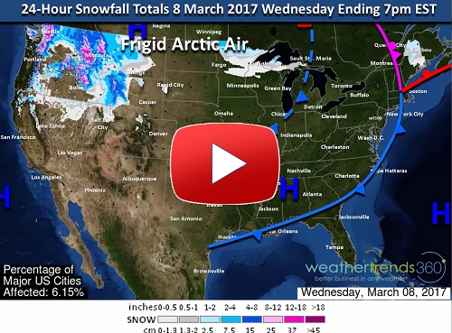
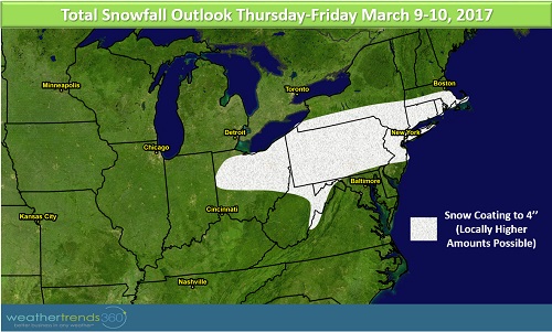
The first system we're monitoring is an Alberta Clipper system that is currently forecast to bring a quick couple of inches across Ohio, Pennsylvania (especially closer to the I-80 corridor), West Virginia, northern New Jersey, New York City, Long Island, Connecticut, Massachusetts, and Rhode Island. While this system may have an impact on the Friday morning commute, the recent warmth should help to limit accumulations on paved surfaces. This storm will usher in a wave of Arctic air across the northern Plains, Midwest, Great Lakes, and Northeast. Below normal temperatures will extend down into parts of the Mid-South as well. Again, although not everyone will see snow, frigid air will make it feel more like winter, in fact, this may be some of the coldest air we've seen since January.
Our attention then turns to a system that will be developing in the South over the weekend. The forecast of this storm is a bit more complicated so the confidence in the exact track and impacts from the system are low. Currently, the expectation is that the storm will move across the South and could bring some snow from Missouri to North Carolina and Virginia. Forecasting snow this far south this late in the season is very tricky, but regardless of snow it will be frigid for this time of year.
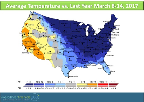
Consider also that this time last year temperatures soared into the 70s and 80s across the eastern U.S. This year is a HUGE change from last year across the North and eastern U.S. Temperatures will be on the order of -30 to -40F colder compared to last year over the next 7 days across much of the North and -10 to -20F colder compared to last year across parts of the South.
Finally, there is a potential for a significant winter storm mid-next week for the Northeast. It's too early to pinpoint exactly where and how much snow will fall, but there is definitely a signature for a possible significant event.