Southeast Braces for Winter Storm
Scientific Meteorology
 No, the above image isn't a view of current conditions in North Carolina, but you get the idea…. It's going to snow in the Southeast. And when it snows in the South, normal daily activities tend to be interrupted. A winter storm is moving out of the Southern Rocky Mountains on Thursday and will head across the Texas panhandle, Oklahoma, and Arkansas and end up in the Southeast by Friday evening.
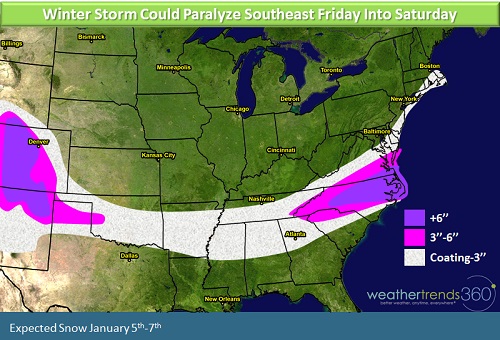 In the first winter storm of the season for the Southeast snowfall amounts will range from a coating to 3'' across Oklahoma, Arkansas, and into Georgia. Heavier snow is expected in North Carolina, especially northeastern parts of the state, and in coastal Virginia and Delaware. Charlotte will see 3-6'', maybe even more, andover 6'' likely in Raleigh. Although Atlanta is forecast to receive less snow, it doesn't take much to cause chaos on the roads in the Southeast where they are less prepared to handle accumulating snowfall. You may recall the snowstorm in January 2014 that paralyzed Atlanta and shut down major highways leaving many stranded for extended periods of time asjust 2.6'' of snow fell across the city: http://www.cbsnews.com/news/atlanta-other-parts-of-south-paralyzed-by-ice-snowstorm/
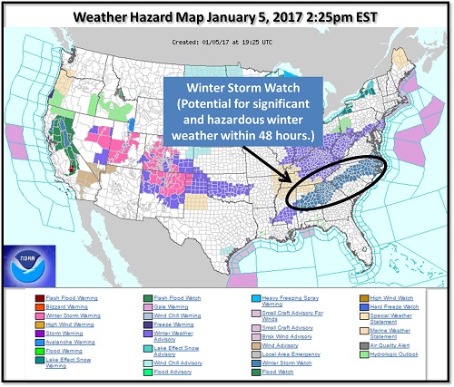
Hopefully Atlantais a little more prepared this time having learned from the chaos of previous winter storms. The National Weather Service has posted winter storm watches from Alabama northeastward to coastal Virginia to alert emergency management, school officials, business owners, and residents to the potential for significant weather.
 The storm is over for the Southeast by Saturday afternoon, but the snow will be slow to melt as Arctic air pushes in behind the system. Atlanta will struggle to get out of the 30s on Saturday and Sunday and Charlotte may be hovering right near the freezing mark both days. Warmer weather returns to the Southeast by the middle of next week.
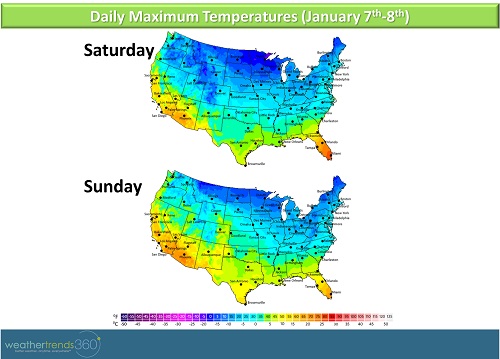 Farther north, the impacts and exact snowfall amounts are a little less clear. The storm heads to the Mid-Atlantic coast after dumping snow in the Southeast but how close the storm tracks to the coast will make the difference between a few flakes and a few inches for coastal areas. Right now it looks as though coastal New Jersey, Long Island, and Cape Cod could see a couple of inches of snow, but a track closer to the coast would bring those snowfall totals up.
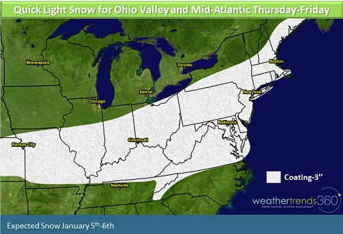
This storm will come on a the heels of a Clipper-type system which will bring a quick coating to 3'' of snow from the Ohio Valley to the Mid-Atlantic late Thursday and into Friday. Here, the snow should be mostly a nuisance, but kids you can still get excited as school will probably be at least delayed (fingers crossed for an impromptu long weekend!).The map below pertains only to the Clipper system late Thursday into early Friday NOT the Southeast storm.