Star Date: 18 July 2016 Monday
Captain's Log
Happy Monday folks!
The dog days of Summer are here.
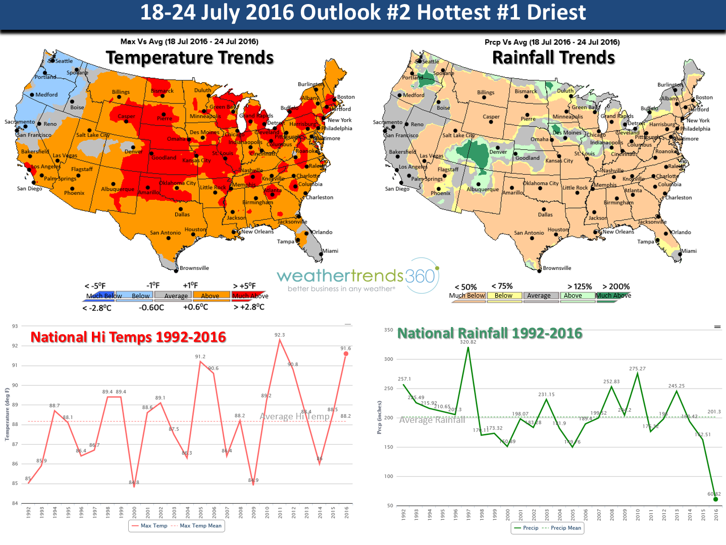
THIS WEEK (18-24 JULY): Is a scorcher trending 2nd hottest in 121 years and the driest in at least 28 years for the nation as a whole. Many areas from the Plains to the Middle Atlantic will have 100F+ temps and heat indices as high as 115F. The peak of this major heat-wave appears to be Friday followed by a slight cool down over the weekend before round two sets up next week. Hawaii will need to watch to their East as Tropical Storm Darby or the remnants could move through the Island chain the 23rd - 24th.

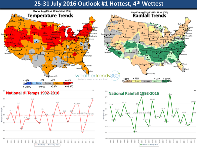
NEXT WEEK (25-31 JULY): A brief cool down over the weekend but the big ridge of high pressure looks to build back out of the Rockies into the Central U.S. all the way into North Central Canada. A tropical wave that moved off Africa looks like it could move into the Southeast around the 26th and interact with a stalled frontal boundary bringing the first widespread rains in quite some time. TBD if it will be this heavy as it's contingent on the path of the tropical disturbance. For the nation as a whole the last week of July is the hottest on record.
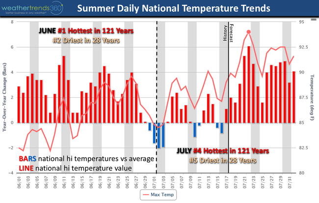
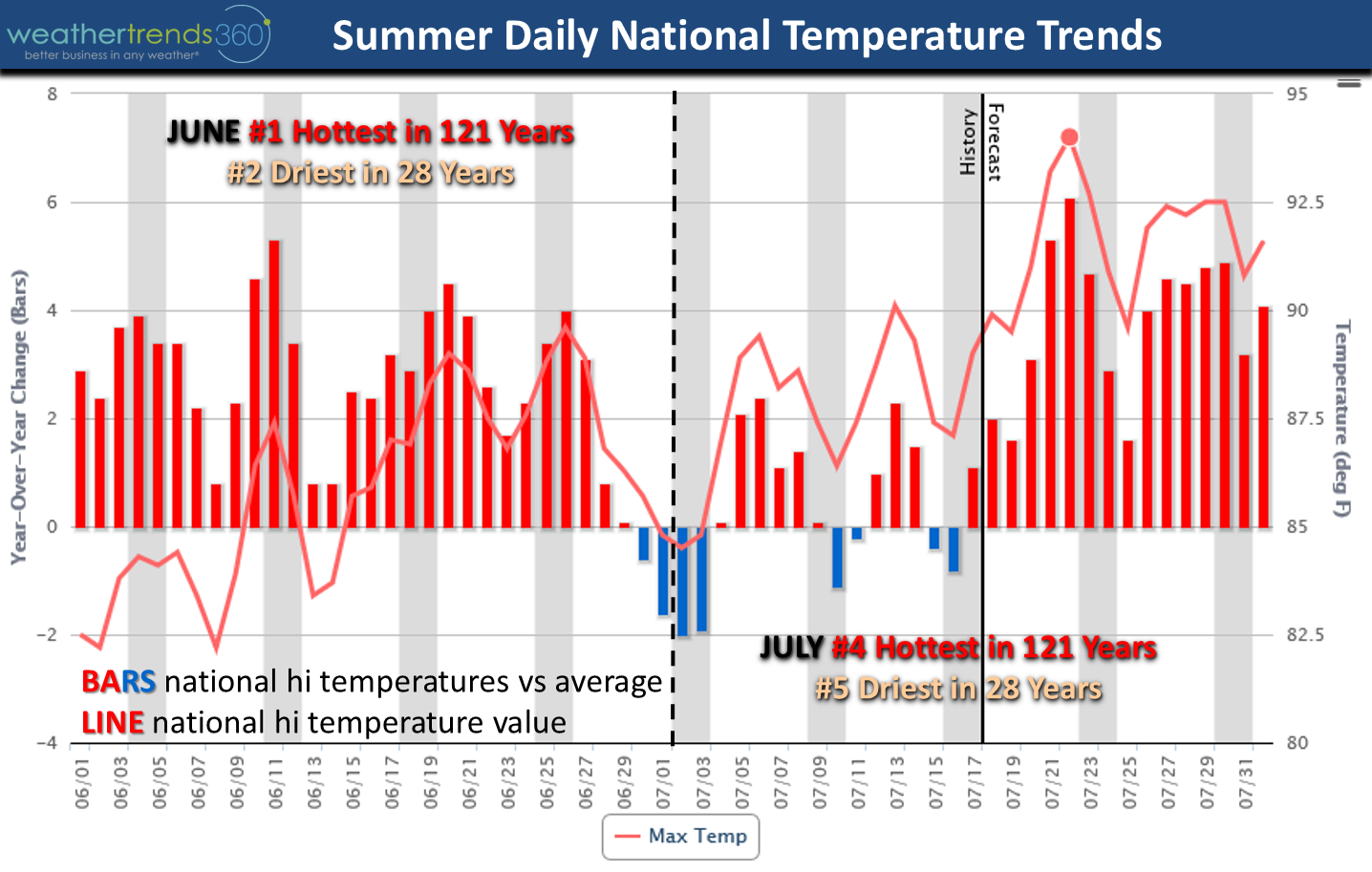
So far meteorological Summer is trending the 2nd hottest in 25+ years (very likely a top 3 hottest in 121 years) and 3rd driest in 28 years. National temperatures trending +2.2F above average with rainfall 14% below average nationally. The chart below shows the day-by-day hi temperature trends vs 30-year average (bars) and line is the national HI temperature observed. Looks like this Friday national temperatures peak at 94F which is a record breaking 121 year event.
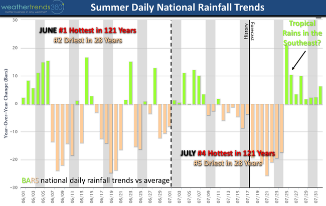
Daily national rainfall trends. Bars show daily rainfall vs average for the nation as a whole.
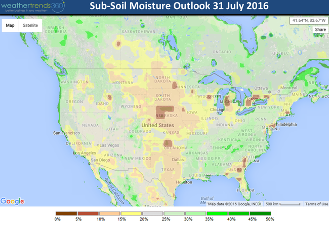
The big wet period next week in the South is subject to change depending on how this tropical wave interacts in the Southeast but at this time we don't expect it to become a named storm. By late July expect your grass, gardenand crops to suffer with this hot/dry end to July as many areas in the Central U.S., Great Lakes and Northeast will have soil moisture levels plummeting after this heat-wave.
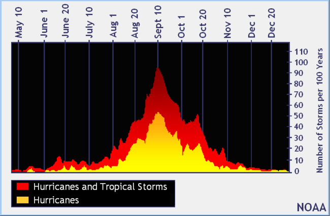
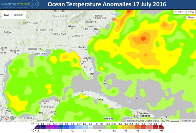
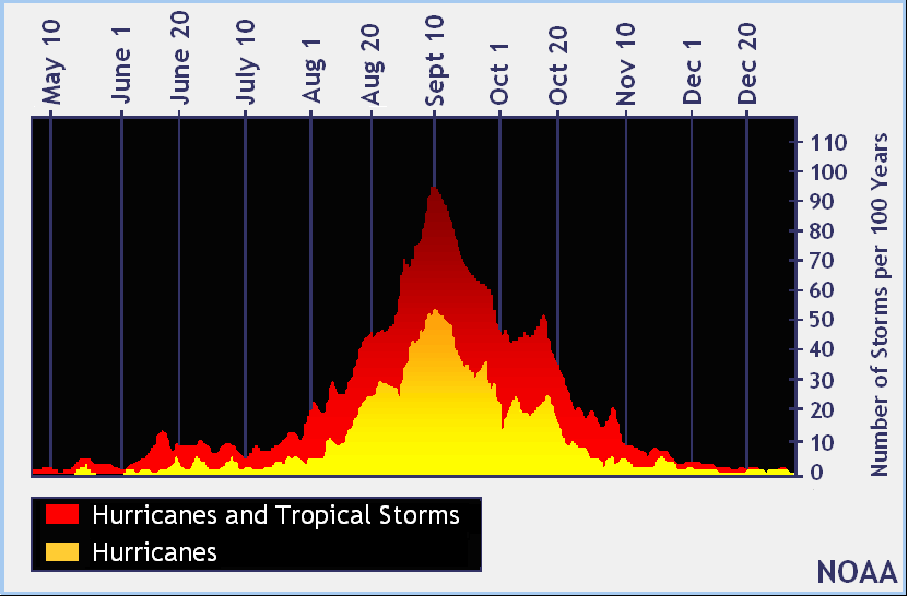
The gulf of Mexico is exceptionally warm and we are getting close to the middle August period where hurricane activity accelerates quickly.
We hope you like this new Capt's log format with graphics...a picture is worth a thousand words. :)
Have a great week folks and stay cool! We'll have another update on Thursday
- Capt Kirk out.
The dog days of Summer are here.
THIS WEEK (18-24 JULY): Is a scorcher trending 2nd hottest in 121 years and the driest in at least 28 years for the nation as a whole. Many areas from the Plains to the Middle Atlantic will have 100F+ temps and heat indices as high as 115F. The peak of this major heat-wave appears to be Friday followed by a slight cool down over the weekend before round two sets up next week. Hawaii will need to watch to their East as Tropical Storm Darby or the remnants could move through the Island chain the 23rd - 24th.
NEXT WEEK (25-31 JULY): A brief cool down over the weekend but the big ridge of high pressure looks to build back out of the Rockies into the Central U.S. all the way into North Central Canada. A tropical wave that moved off Africa looks like it could move into the Southeast around the 26th and interact with a stalled frontal boundary bringing the first widespread rains in quite some time. TBD if it will be this heavy as it's contingent on the path of the tropical disturbance. For the nation as a whole the last week of July is the hottest on record.

So far meteorological Summer is trending the 2nd hottest in 25+ years (very likely a top 3 hottest in 121 years) and 3rd driest in 28 years. National temperatures trending +2.2F above average with rainfall 14% below average nationally. The chart below shows the day-by-day hi temperature trends vs 30-year average (bars) and line is the national HI temperature observed. Looks like this Friday national temperatures peak at 94F which is a record breaking 121 year event.
Daily national rainfall trends. Bars show daily rainfall vs average for the nation as a whole.

The big wet period next week in the South is subject to change depending on how this tropical wave interacts in the Southeast but at this time we don't expect it to become a named storm. By late July expect your grass, gardenand crops to suffer with this hot/dry end to July as many areas in the Central U.S., Great Lakes and Northeast will have soil moisture levels plummeting after this heat-wave.

The gulf of Mexico is exceptionally warm and we are getting close to the middle August period where hurricane activity accelerates quickly.

We hope you like this new Capt's log format with graphics...a picture is worth a thousand words. :)
Have a great week folks and stay cool! We'll have another update on Thursday
- Capt Kirk out.