Star Date 19 March 2018 Monday
Happy Monday! Especially happy if you're counting down to Spring that is now just over 1 day away according to the sun. Spring officially arrives 12:16pm EDT 20 March 2018.

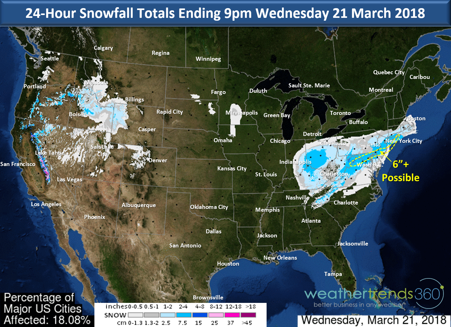
Don't get too excited about Spring as Mother Nature intends to come in like a lion with yet another moderate snow storm from the Ohio Valley into the Middle Atlantic and coastal southern Northeast Tuesday into Wednesday. Upwards of 6" of very wet snow could fall from Northern Virginia, Maryland and Southern NJ with this system. Models have been shifting a bit north with a secondary low so even up here near wt360 accumulating snowfall is again likely. CLICK ON IMAGES FOR LARGER VIEW.
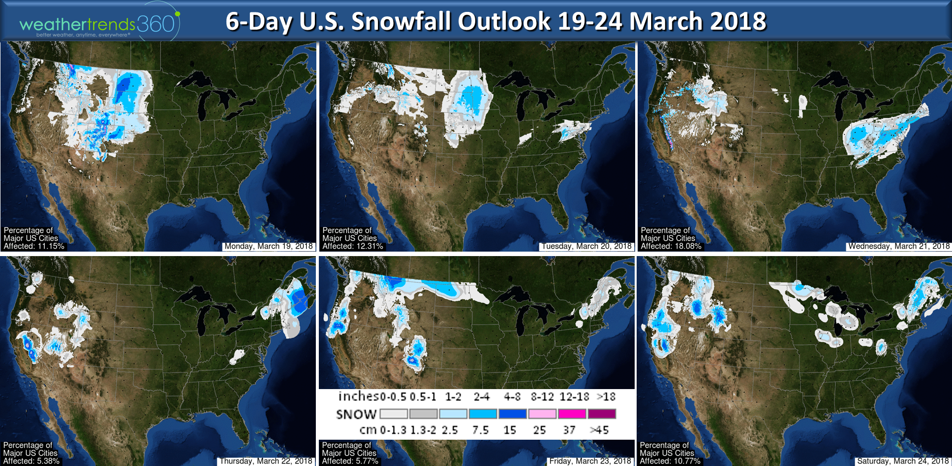
This time of year nighttime events are much more favorable for accumulating snowfall so any snow that falls during the day may look like a blizzard but it packs down quickly and tends to melt very quickly on paved surfaces...so it won't last too long despite the continued below normal temperatures across much of the country. Recent models runs have been tracking further north with more precip and if you believe the Euro...it's a pretty big storm with 10"-14" from northern MD to Boston including Philly and NYC so this one has potential to again surprise folks Tuesday pm to Wednesday afternoon.
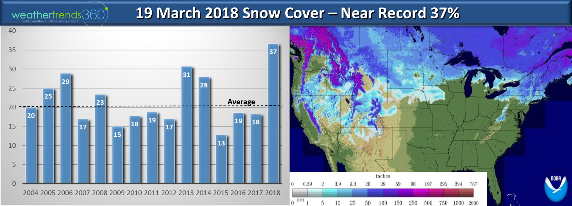
Snow cover across the U.S. is still very impressive with 37% of the U.S. with some snow on the ground (over twice as much as last year), well above the average of 20% and the most in decades. We'll be adding to this early this week in the Plains and Middle Atlantic.
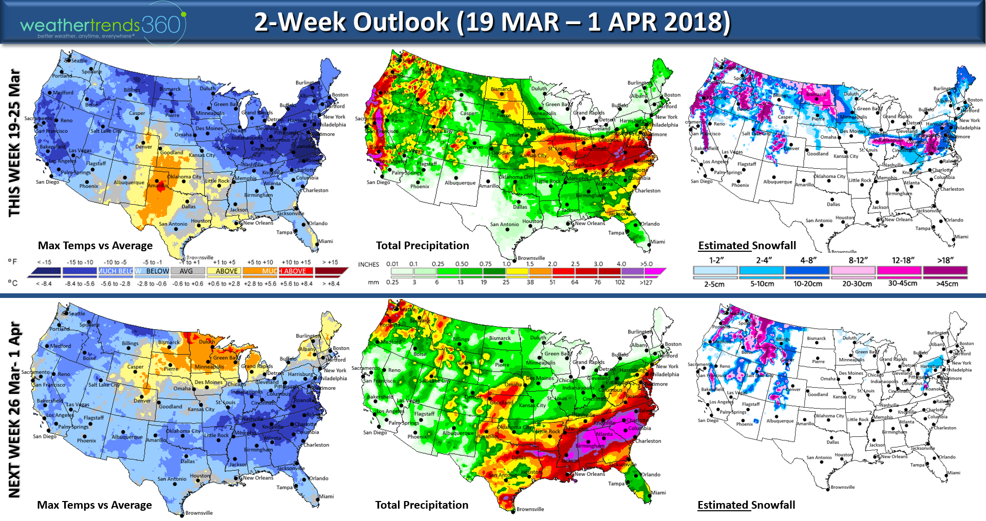
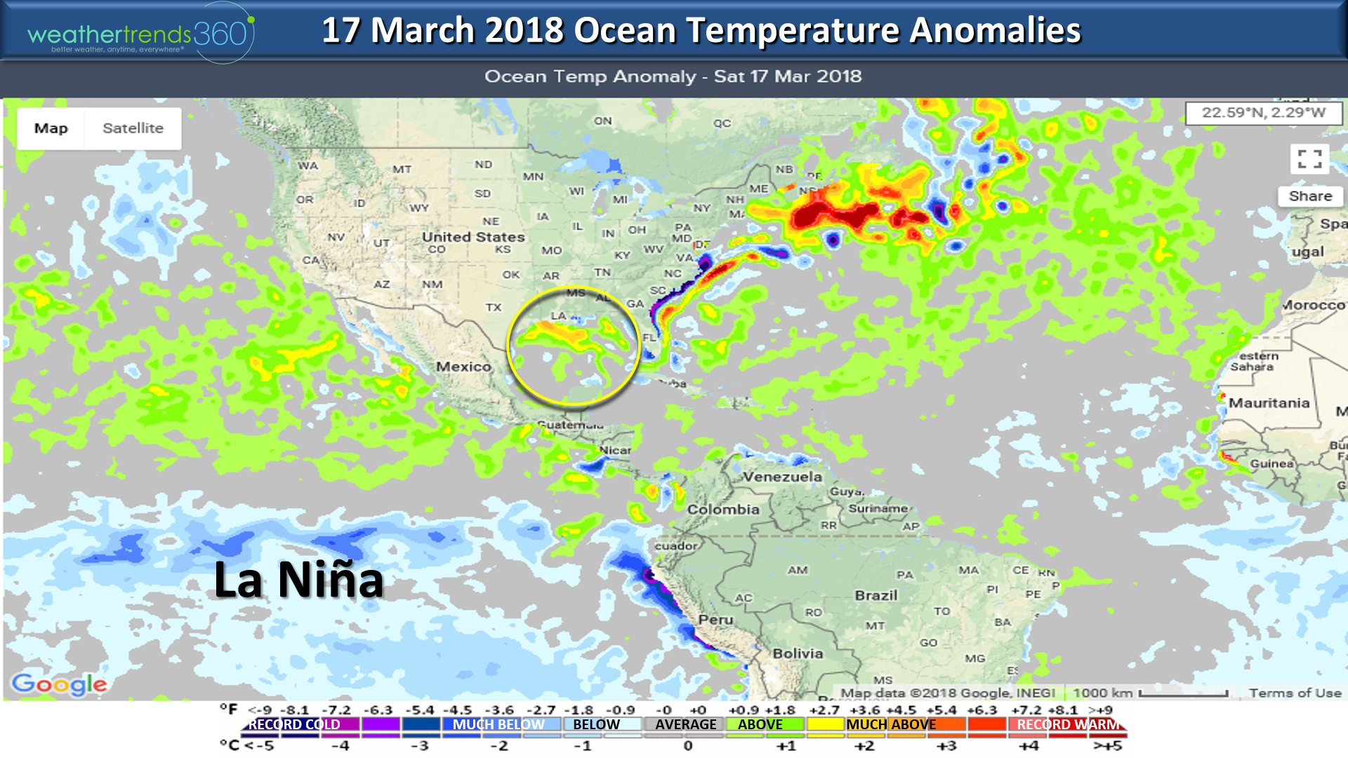
The 2-week outlook continues to show a predominantly cold pattern for most of the U.S. with the "Miracle March" continuing for California with heavy rain and heavy mountain snow. They needed it after such a warm/dry Winter.
It's been a very slow start to the severe weather tornado season but the first more significant outbreak is likely this week in the Southeast. The Gulf of Mexico water temperatures are well above average and that is fuel for the severe thunderstorm season as we go into April and May so expect things to be particularly active.
April and May were active months last year with 498 tornadoes (6% above average) and 10 deaths and this year likely to top those numbers. Next week looks even more active with very heavy rain as well.
 Did you know? For 16 years Weather Trends has been supporting over a hundred global Fortune 500 companies and thousands of small businesses worldwide with year ahead weather forecasts and intel on seasonal sales trends, but did you know that we are also the ones behind some global almanacs (Almanaque de Bristol) and movie support? Back in 2011 we helped an award winning movie location scout (Lori Balton) pick Hawaii over Puerto Rico for better filming conditions for Pirates of the Caribbean #4 and now supporting the upcoming movie "Disney Jungle Cruise" staring Dwayne Johnson! It's top secret where they're filming but we'll give you a hint...it's in a Jungle! ;) We produce the year-ahead forecasts in the Spanish Almanacs for the U.S. version but also the Caribbean, Colombia, Central America, Bolivia, Ecuador, Peru and Africa Almanacs!
We hope you have a great week and please follow us on Facebook and Twitter for frequent updates. - Captain Kirk out.