Star Date 23 August 2018 Thursday
Captain's Log
23 August 2018 9am EDT Hurricane Lane (cat 4) Update
Captain's Log Hurricane Lane (cat 5) Update 22 Aug 2018 Wednesday.
Happy Monday! :)
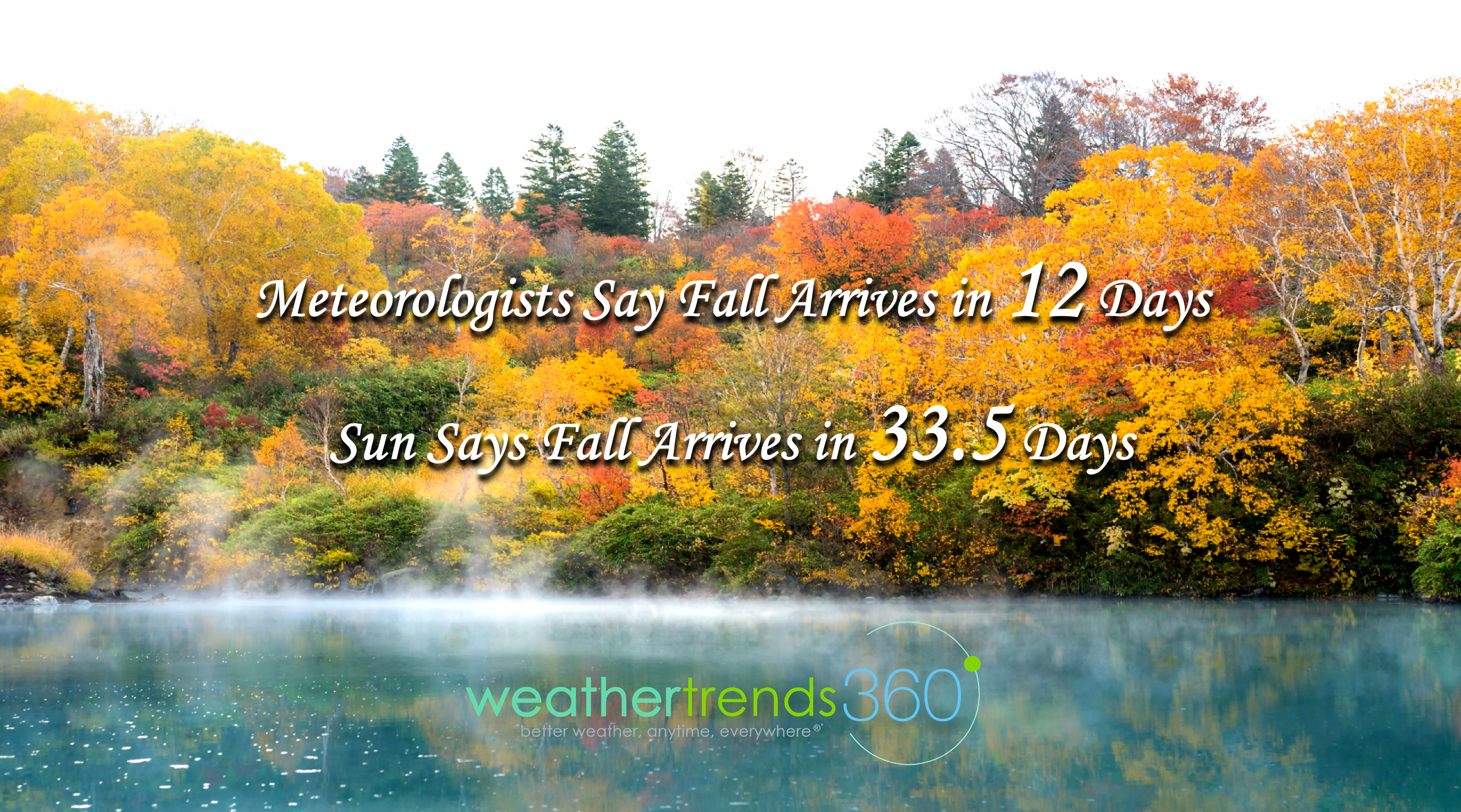
Can you believe there are only 12 days left of "meteorological" Summer? We prefer to think like the sun as that buys us 33.5 more days before Autumn officially arrives at 9:54pm EDT 22 September. CLICK ON IMAGES FOR LARGER VIEW.
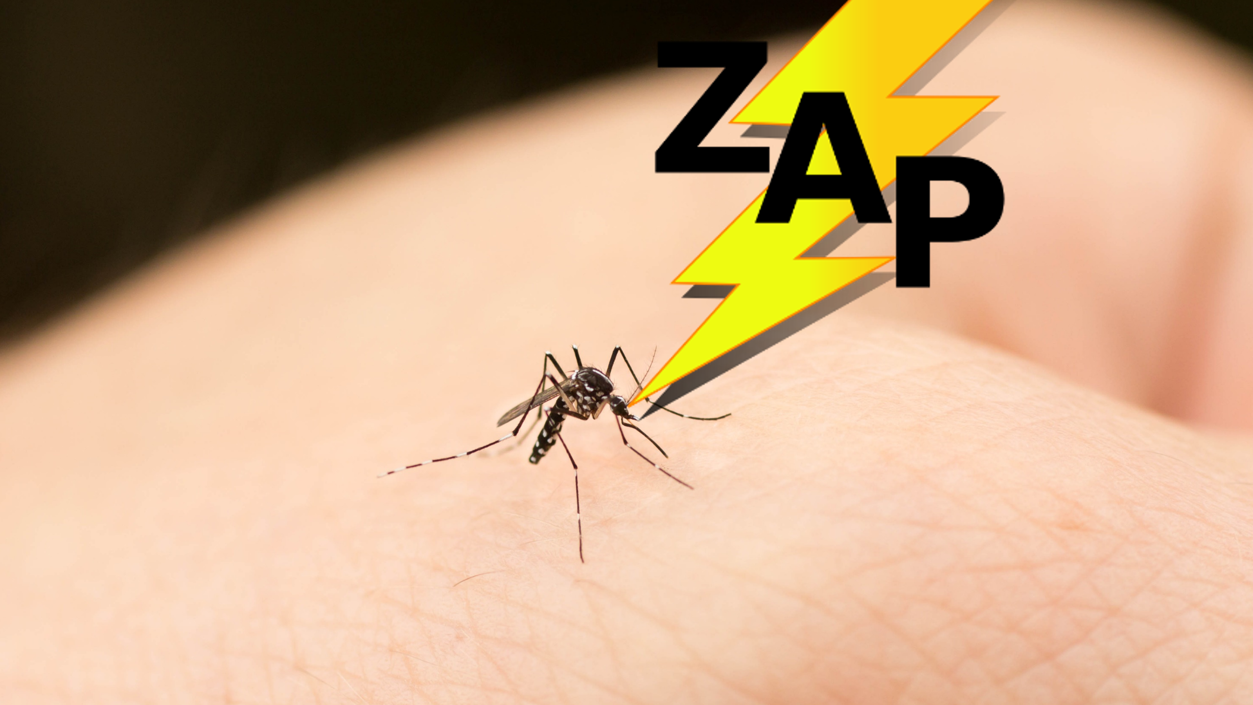
In many soggy areas of the Eastthe mosquitoes are breeding like crazy with infestation levels. Here in Eastern PA we've had 20-30" of rain in the past 60 days with mosquitoes the size of small birds. A drier couple weeks in the East should help reduce the over populations a bit.
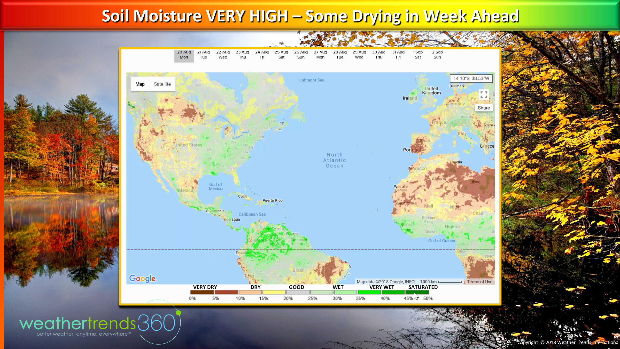
But the rain never made it to New England where most of Maine has less than 2-4" and parched lawns. Soil moisture levels remain very high in the East but it looks like they'll start to dry out over the next couple weeks from TX to the Northeast.
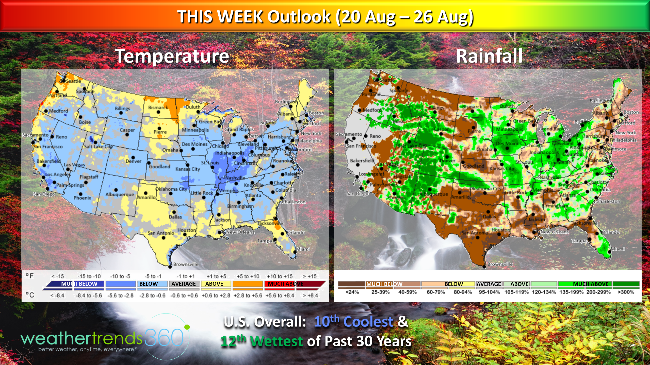
THIS WEEK (20-26 AUG)is cool for many areas, especially the Midwest and that's good news for Back2school sales. A much cooler pattern in the West is a plus for crews containing the wild fires. For the U.S. overall the week is the 10th coolest and 12th wettest of the past 30 years.
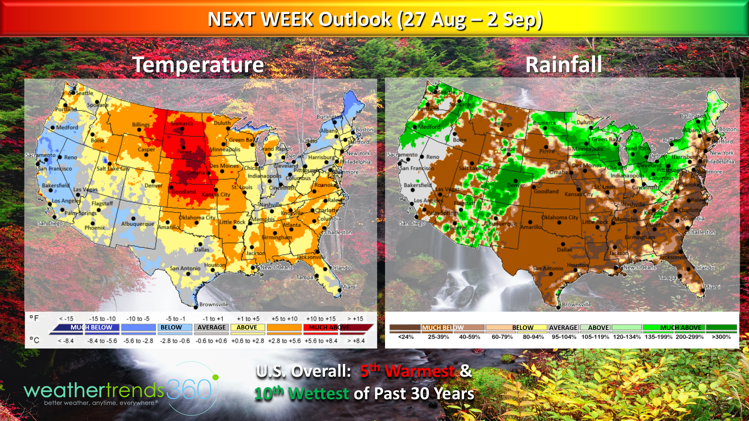
NEXT WEEK (27 AUG - 2 SEP) The heat builds again across much of the country and especially in the Plains. The heavier rains look to shift a bit to the Upper Midwest, Great Lakes and Easter Rockies while the South and East get a much needed break. For the U.S. overall the last week of meteorological Summer trends 5th warmest and 10th wettest of the past 30 years.
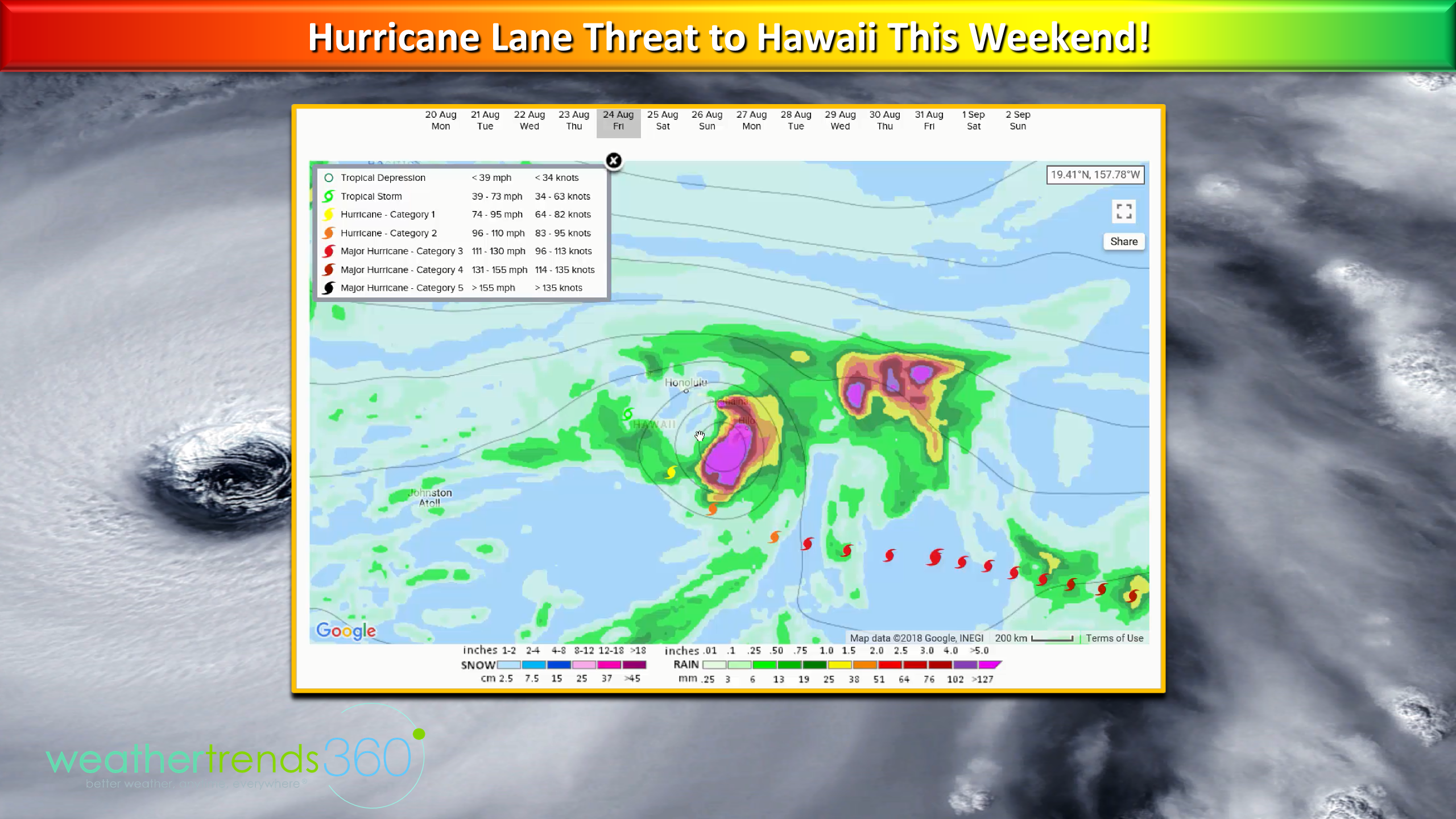
Hawaii needs to watch Hurricane Lane late this week into the weekend as the Cat 3 hurricane track has shifted much closer to the Islands. Some models plow it right through the Islands so a very close call. It does weaken to a Cat 1 or strong Tropical Storm when and if it makes landfall but still a concern for the Islands.
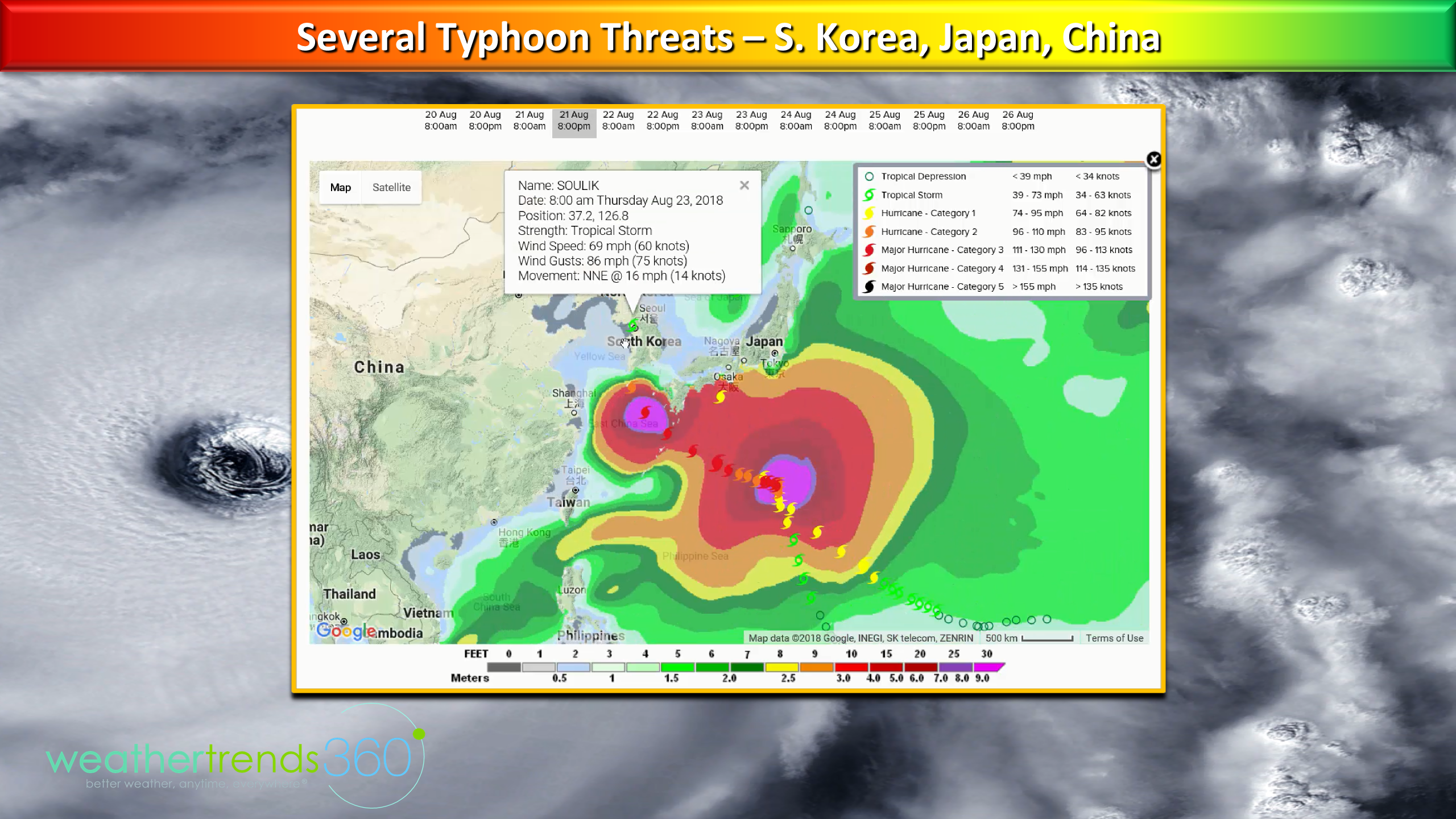
In the West Pacific there are about 4 tropical threats over the next couple weeks with landfalls likely in South Korea, Southern Japan and Eastern China. Amazing that Japan will have a hurricane by Thursday after just recording the earliest snowfall on record 17 August in the Hokkaido Mountains well to the North.
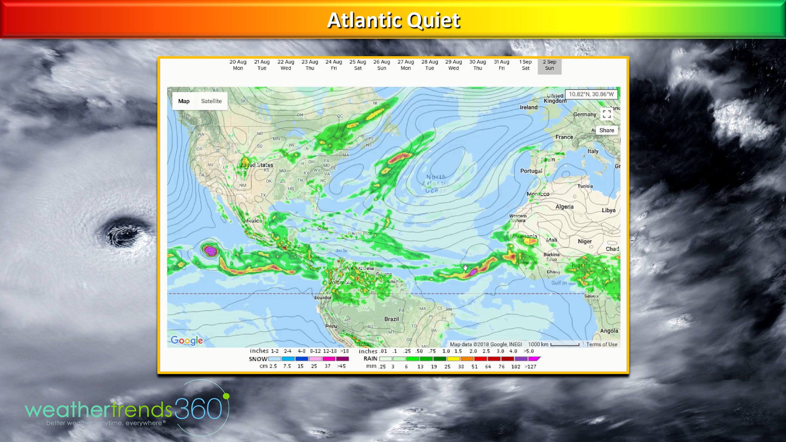
While the tropical waves moving off Africa look to increase the overall pattern and MJO Cycle 3 is just not favorable for a parade of storms like this time last year. The peak of the hurricane season is the next month but for now nothing is brewing.
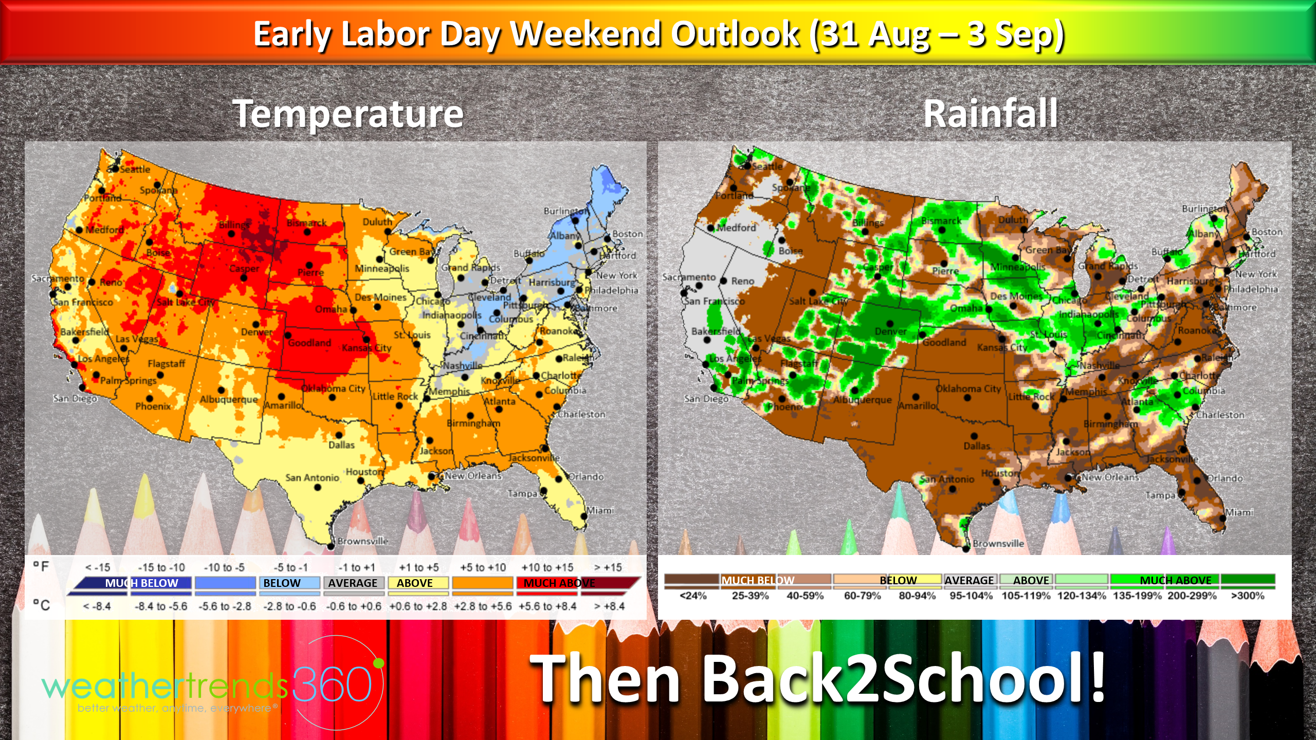
The early Labor Day weekend outlook (31 Aug - 3 Sept) looks to be warm for most with maybe some cooler weather for the interior Northeast. Fingers crossed the drier pattern holds for the South and East.
We will be issuing our Fall foliage outlook soon but if you've had a ton of rain that can make for a somewhat muted fall show. To much rain is not good and extreme dryness isn't either so it may not be the best year for amazing color. :( At least our wt360 protected tree below is showing signs of Fall. :)

Have a great week and follow us on social media for frequent updates.Facebook,Twitter,YouTube,PinterestandLinkedin
- Captain Kirk out.
P.S. As an owner of a small company with fantastic employees I found this story very touching. I honestly believe they would all bring me an empty pot. :) Enjoy the rest of the story: http://runwonder.com/wup/a-lesson-in-integrity-07085.html