Star Date 21 November 2016 Monday
Captain's Log
Happy Monday! :)
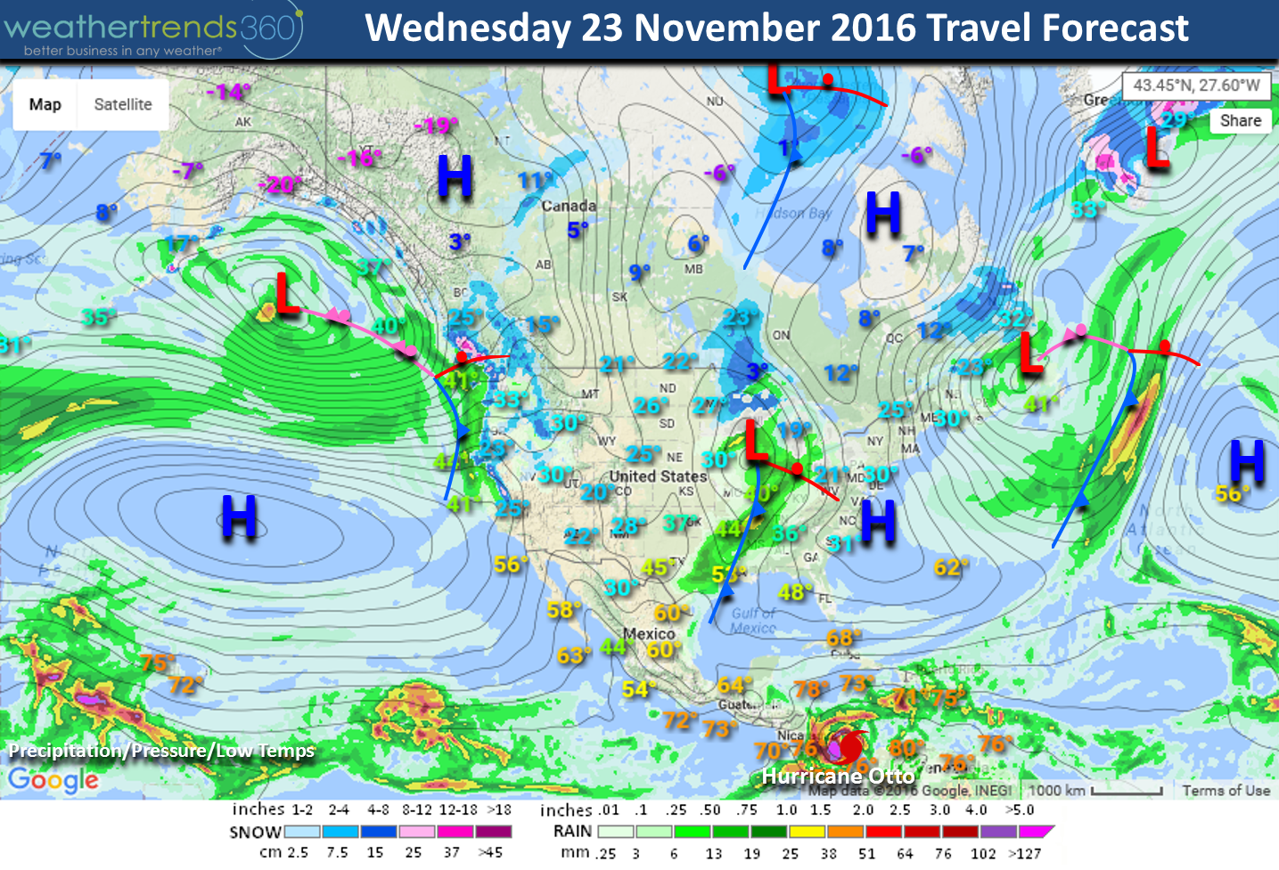
It's hard to believe it's Thanksgiving week already! We have your travel weather outlook and it's on the stormy side with some travel headaches. The surface map below shows Wednesday (23 Nov) travel weather with a messy storm for the Northwest and Great Lakes. Expect travel delays in these areas. Cool high pressure dominates the immediate East Coast with pretty good travel weather. There will be snow on the ground in Eastern South Dakota, Minnesota and the interior Northeast. Feet of snow on the ground in the higher terrain of New York after the first major lake effect snow event of the season early this week. Our worst travel cities on Wednesday are likely to be Seattle, San Francisco, Chicago, Memphis and Detroit. Way South in the Caribbean, Hurricane Otto is likely to make landfall in Nicaragua/Costa Rica Thursday afternoon.

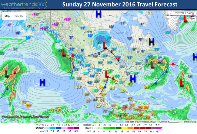
Returning home on Sunday (27 Nov) is not much different in the Northwest with continued stormy weather with another weaker system moving into the South Central U.S. A strong southerly wind flow ahead of this storm will make it quite windy in the South Central U.S. The East Coast is milder but remains dry except extreme coastal Maine where a strong Nor'easter will bring some snow with greater impacts to Nova Scotia in Canada. The worst travel cities are again in Seattle and Memphis.
The last week of November into early December it looks to get colder and snowier across much of the country with an active weather pattern. The cold builds in the West and gradually spreads East. We will have daily updates on Facebook and Twitter throughout the holiday. Have a wonderful Thanksgiving folks!
- Capt Kirk out.
It's hard to believe it's Thanksgiving week already! We have your travel weather outlook and it's on the stormy side with some travel headaches. The surface map below shows Wednesday (23 Nov) travel weather with a messy storm for the Northwest and Great Lakes. Expect travel delays in these areas. Cool high pressure dominates the immediate East Coast with pretty good travel weather. There will be snow on the ground in Eastern South Dakota, Minnesota and the interior Northeast. Feet of snow on the ground in the higher terrain of New York after the first major lake effect snow event of the season early this week. Our worst travel cities on Wednesday are likely to be Seattle, San Francisco, Chicago, Memphis and Detroit. Way South in the Caribbean, Hurricane Otto is likely to make landfall in Nicaragua/Costa Rica Thursday afternoon.
Returning home on Sunday (27 Nov) is not much different in the Northwest with continued stormy weather with another weaker system moving into the South Central U.S. A strong southerly wind flow ahead of this storm will make it quite windy in the South Central U.S. The East Coast is milder but remains dry except extreme coastal Maine where a strong Nor'easter will bring some snow with greater impacts to Nova Scotia in Canada. The worst travel cities are again in Seattle and Memphis.

The last week of November into early December it looks to get colder and snowier across much of the country with an active weather pattern. The cold builds in the West and gradually spreads East. We will have daily updates on Facebook and Twitter throughout the holiday. Have a wonderful Thanksgiving folks!
- Capt Kirk out.