Star Date 25 June 2018 Monday
Happy Monday! :)
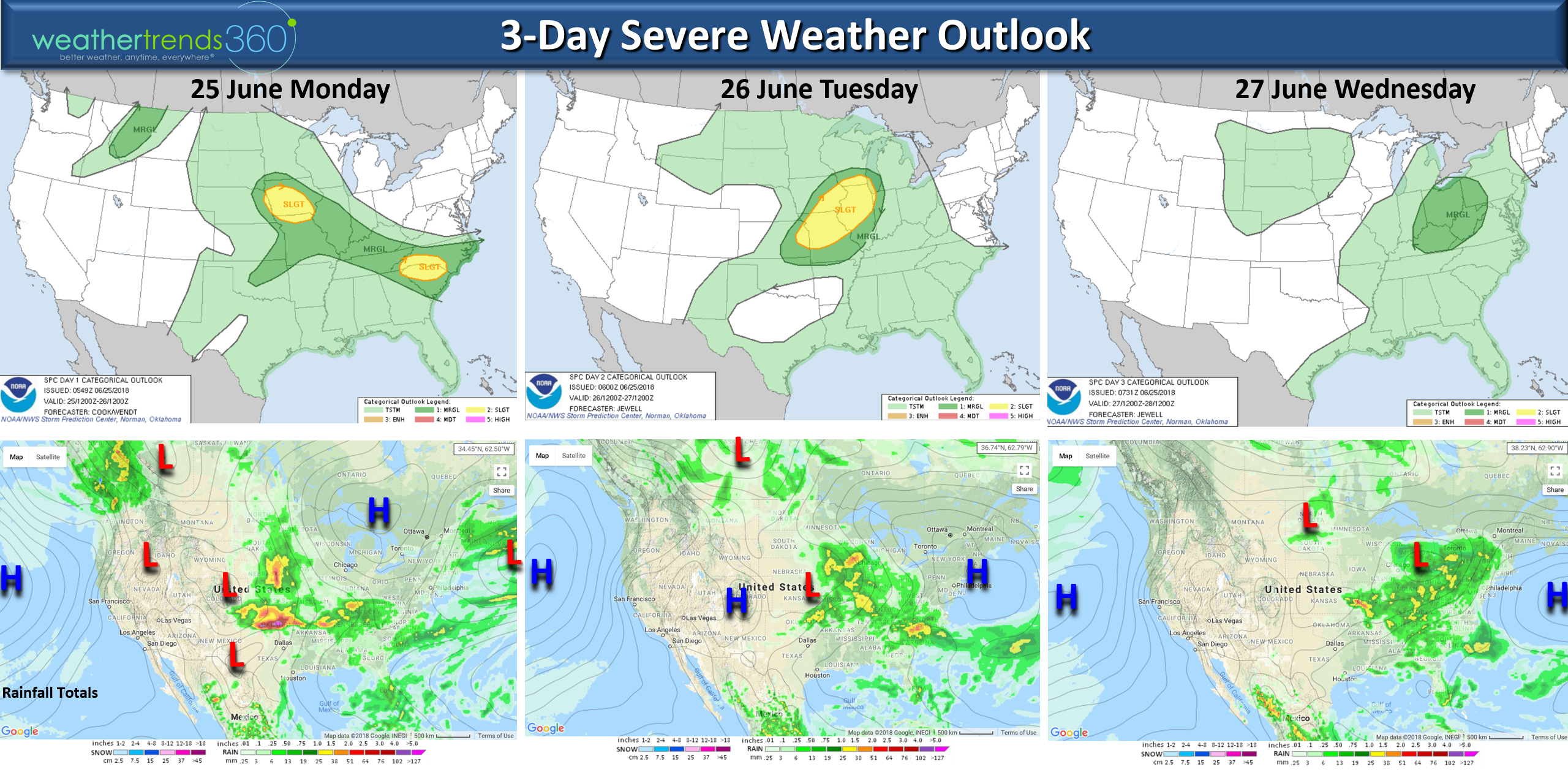
A stormy start to the week before the big heat-wave sets up across the Eastern half of the U.S. late this week into July 4th. The severe weather threat is highest in the Heartland and Southeast Middle Atlantic today and tomorrow and then things look to diminish a bit. CLICK ON IMAGES FOR LARGER VIEW.
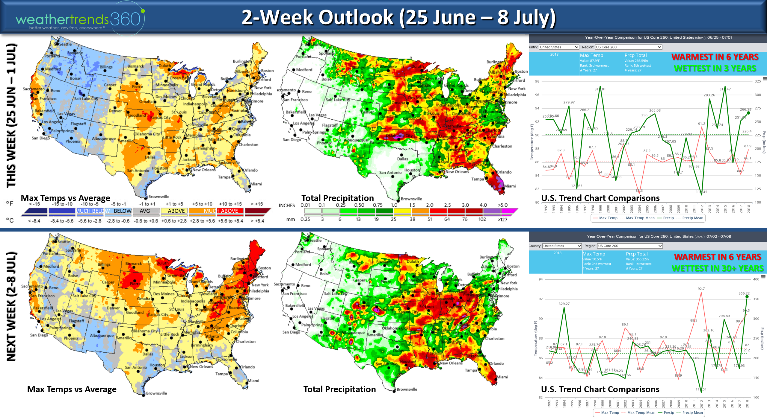
The 2-week outlook shows a hot and steamy pattern for much of the Eastern half of the country. This week the U.S. overall trends 2nd hottest in 30+ years and hottest in 6 years with the wettest conditions in 3 years. Next week trends even hotter and on the stormy wet side for the U.S. as a whole. The cooler spots are generally in the West Rocky Mountains.
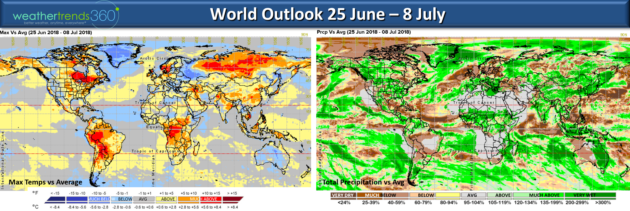
Across the World the next couple weeks show the hot spots in Southeast Canada - Northeast U.S., China, Siberia, Northern Europe and much of South America. The cooler spots relative to what's typical for this time of year are in Australia, the Central Mediterranean, Western Russia and Greenland/North Pole. Much of Europe is pretty wet as is the U.S. and Australia with dry spots in Brazil, U.K. and the Caribbean.
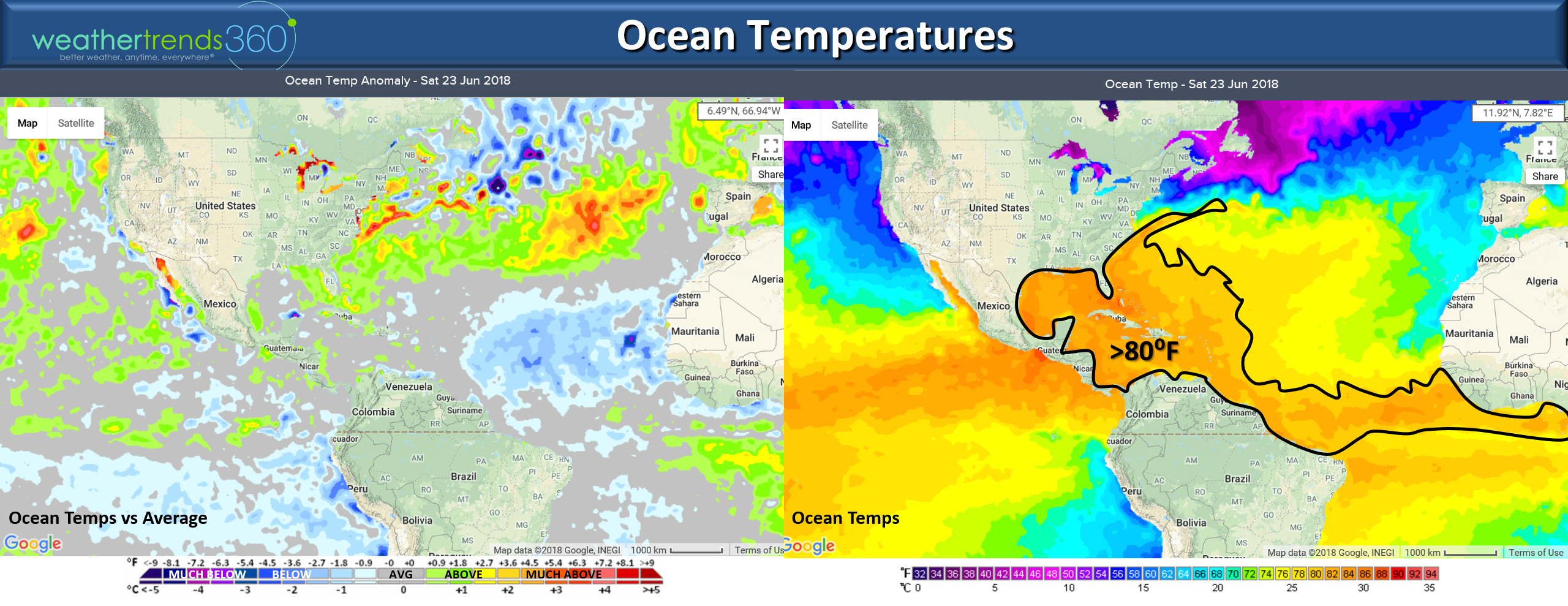
The Ocean temperatures continue to show the colder than normal conditions way out in the tropical Atlantic but areas around the Coastal U.S. are actually warmer than average. Ocean temperatures are at or above 80F for much of the tropical areas so this is more than warm enough to support tropical activity and the waters around Florida and the Bahamas are approaching 90F so that suggests the East Coast is a target this hurricane season. In the near term, a couple more hurricanes possible in the Eastern Pacific well off Mexico with "fish storms" not impacting land.
We hope you have a great week!Follow us on social media for frequent updates. Facebook,Twitter,YouTube,PinterestandLinkedin
- Captain Kirk out.