Star Date 27 February 2017 Monday
Captain's Log
Happy Monday!
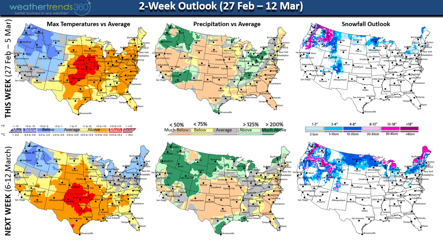
A volatile Spring pattern over the next couple weeks with more wild swings in temperatures for the Northern tier of the U.S. The Northwest and Northeast are the most likely areas to see a greater chance for colder and snowier weather as we transition into March.

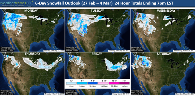
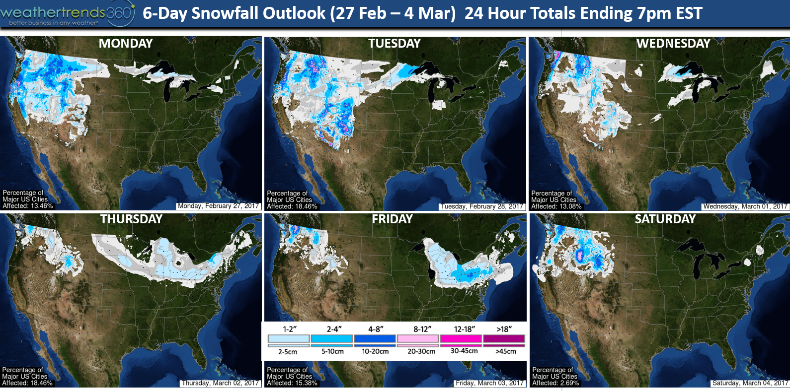
The 6-day snowfall outlook shows mainly light snow events at this stage but models have been hinting at a bigger threat for the Northeast in early March. TBD on exact storm tracks.
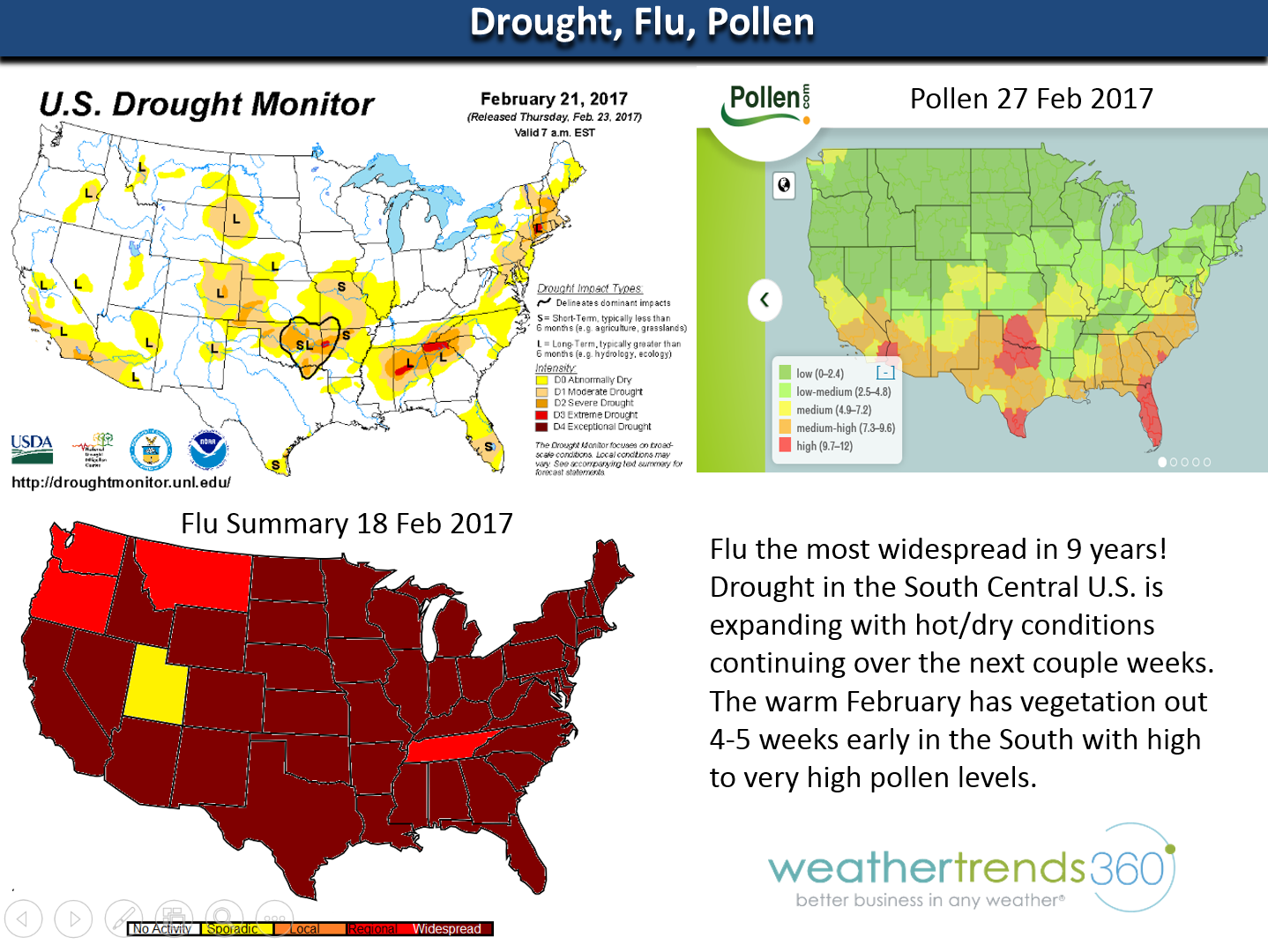
Flu remains the most widespread in 9 years, so if you're not sick you're the lucky one! To make things worse, folks in the South are also suffering with high to very high pollen levels with vegetation out 4-weeks early due to the very warm February. With hot/dry weather likely to continue in the South Central U.S., drought will expand with high risk for Spring wild/brush fires.

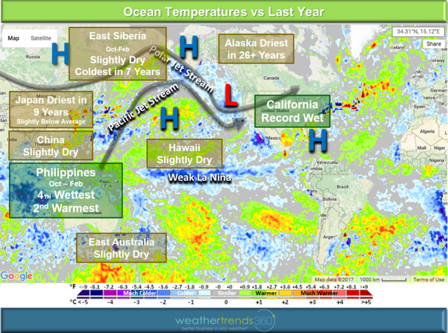
For folks in California, we worked up some crazy math to help quantify just how much heavier your state is with all the Winter rain and snowfall. We explain the "atmospheric river" and what caused the non-stop parade of storms (See video)
For now you're getting a reprieve but all that snow will melt and that will mean more Spring flooding threats.
Have a great week folks! - Captain Kirk out.
A volatile Spring pattern over the next couple weeks with more wild swings in temperatures for the Northern tier of the U.S. The Northwest and Northeast are the most likely areas to see a greater chance for colder and snowier weather as we transition into March.
The 6-day snowfall outlook shows mainly light snow events at this stage but models have been hinting at a bigger threat for the Northeast in early March. TBD on exact storm tracks.
Flu remains the most widespread in 9 years, so if you're not sick you're the lucky one! To make things worse, folks in the South are also suffering with high to very high pollen levels with vegetation out 4-weeks early due to the very warm February. With hot/dry weather likely to continue in the South Central U.S., drought will expand with high risk for Spring wild/brush fires.
For folks in California, we worked up some crazy math to help quantify just how much heavier your state is with all the Winter rain and snowfall. We explain the "atmospheric river" and what caused the non-stop parade of storms (See video)

For now you're getting a reprieve but all that snow will melt and that will mean more Spring flooding threats.
Have a great week folks! - Captain Kirk out.