Star Date 28 Dec 2017 Thursday Update
Captain's Log
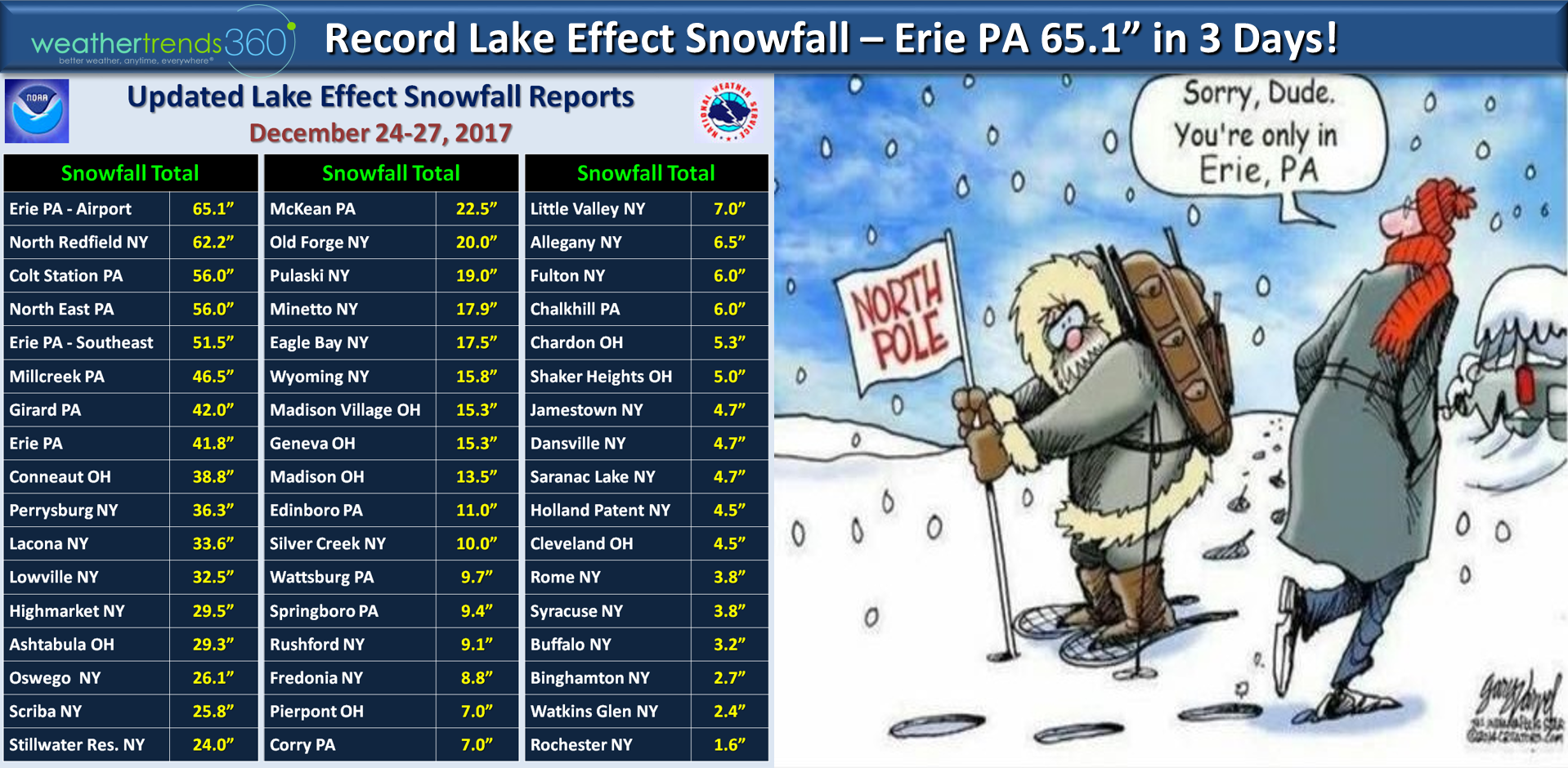
Thursday 28 Dec 2017 Update:The Lake Effect snow this past week around Christmas was epic and record shattering for some areas like Erie PA. Over 5 feet in just a few days. The culprit was frigid Arctic air moving over still relatively warm lakes.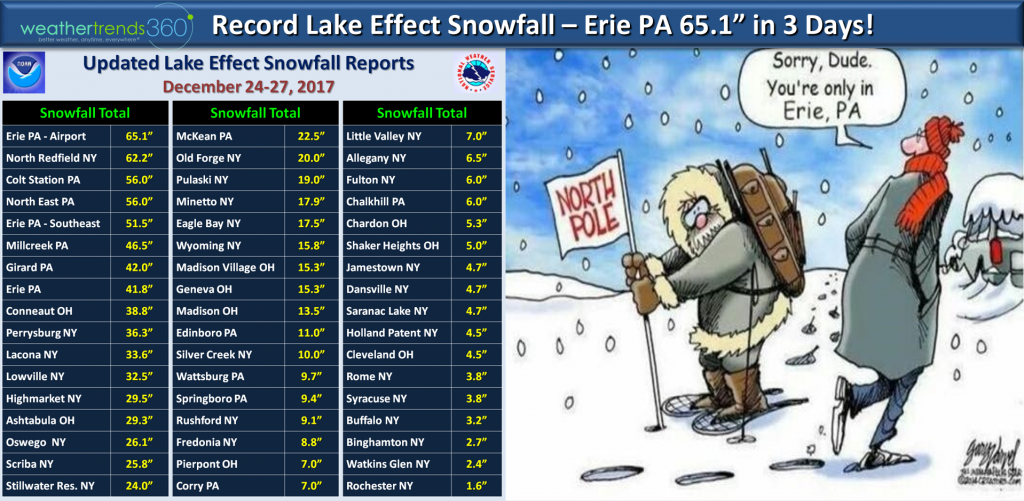 Now gear up for an absolutely frigid New Year's Eve which is likely to be the 2nd coldest in 123 years for New York City! Well below zero for much of the Central U.S.
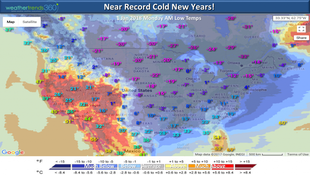 Many locations in the Eastern half of the U.S. will be some 20 to 50 degrees colder than last year with record or near record cold. Out West they're basking in very warm conditions.
 Have a great New Year and we'll have our next update on 2 Jan Tuesday.
Happy Tuesday.
This Arctic blast is pretty epic encompassing a huge area of North America over the next couple weeks. Any precipitation that does fall in the Eastern U.S. and Eastern Canada will fall as snow. CLICK ON IMAGES FOR LARGER VIEW.
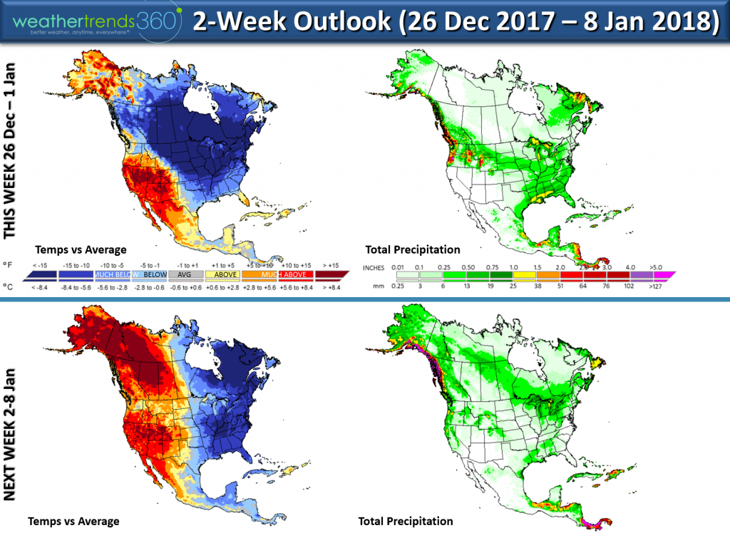
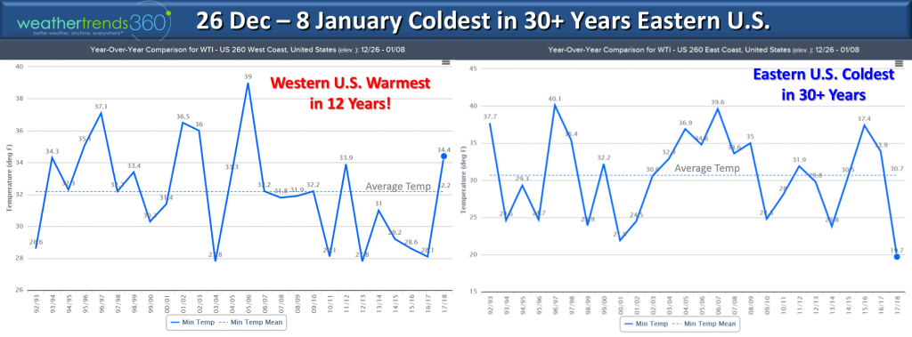
The temperatures in the Eastern U.S. are the coldest in 30+ years over the next couple weeks while the Western U.S. is the warmest in 12 years.
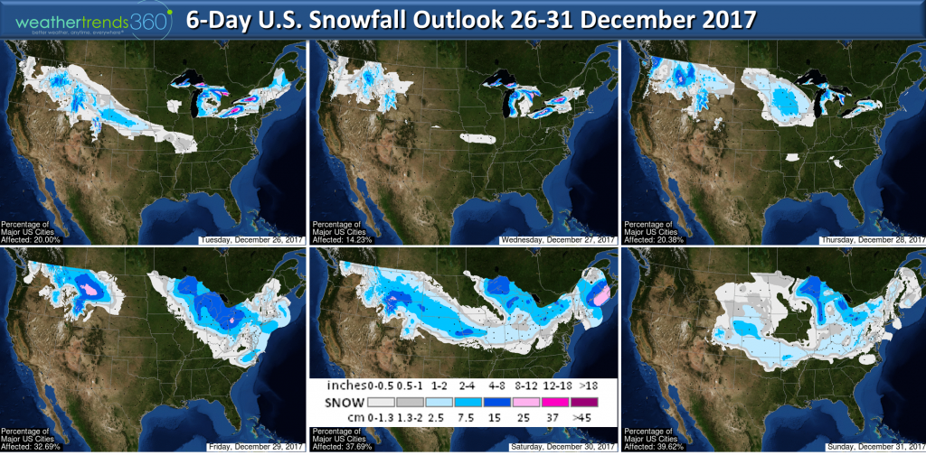
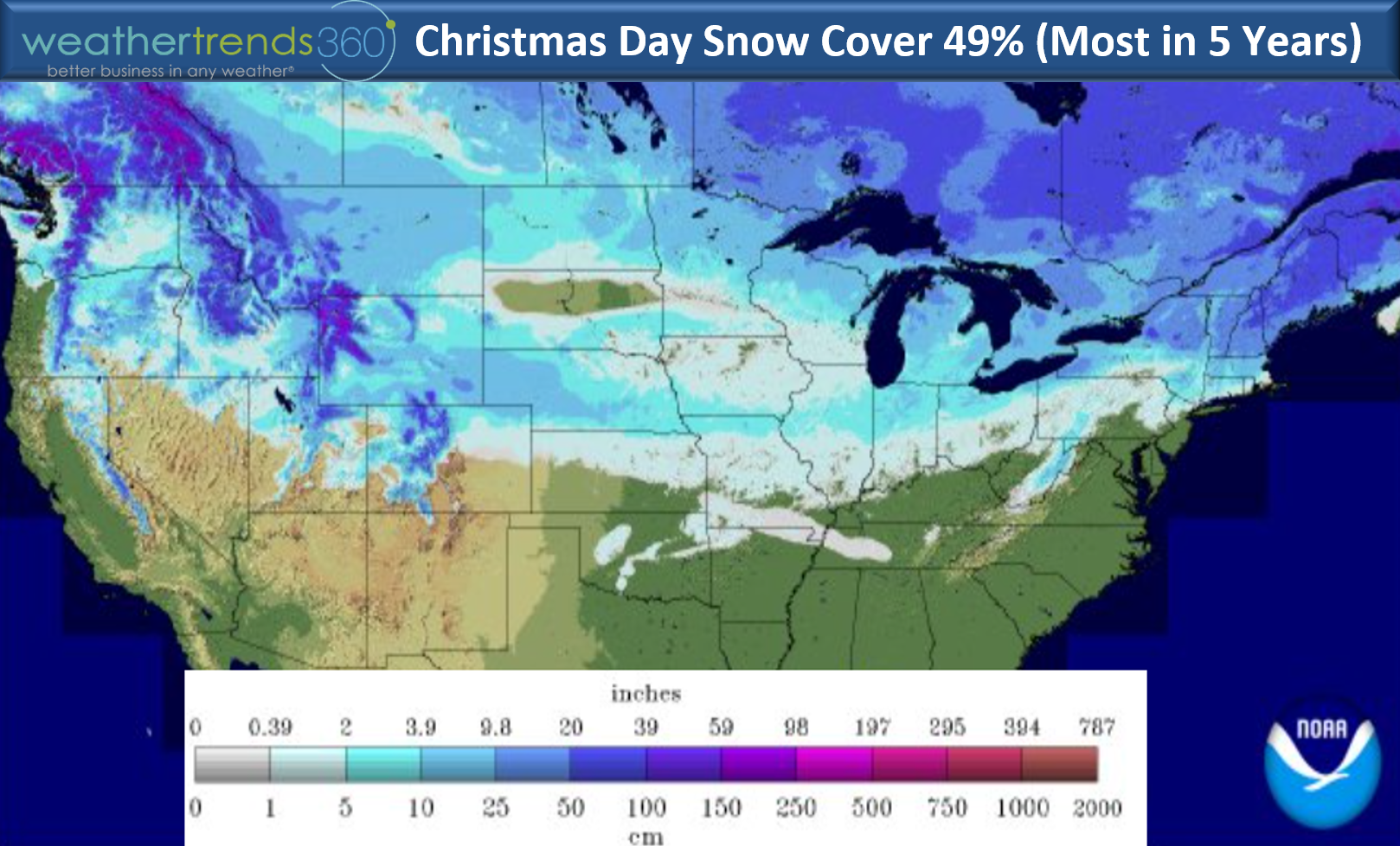
Snow cover Christmas Day was the most in 5 years with 49% of the U.S. blanketed in some snow after a Christmas Eve and Christmas Day storm in the Northeast.

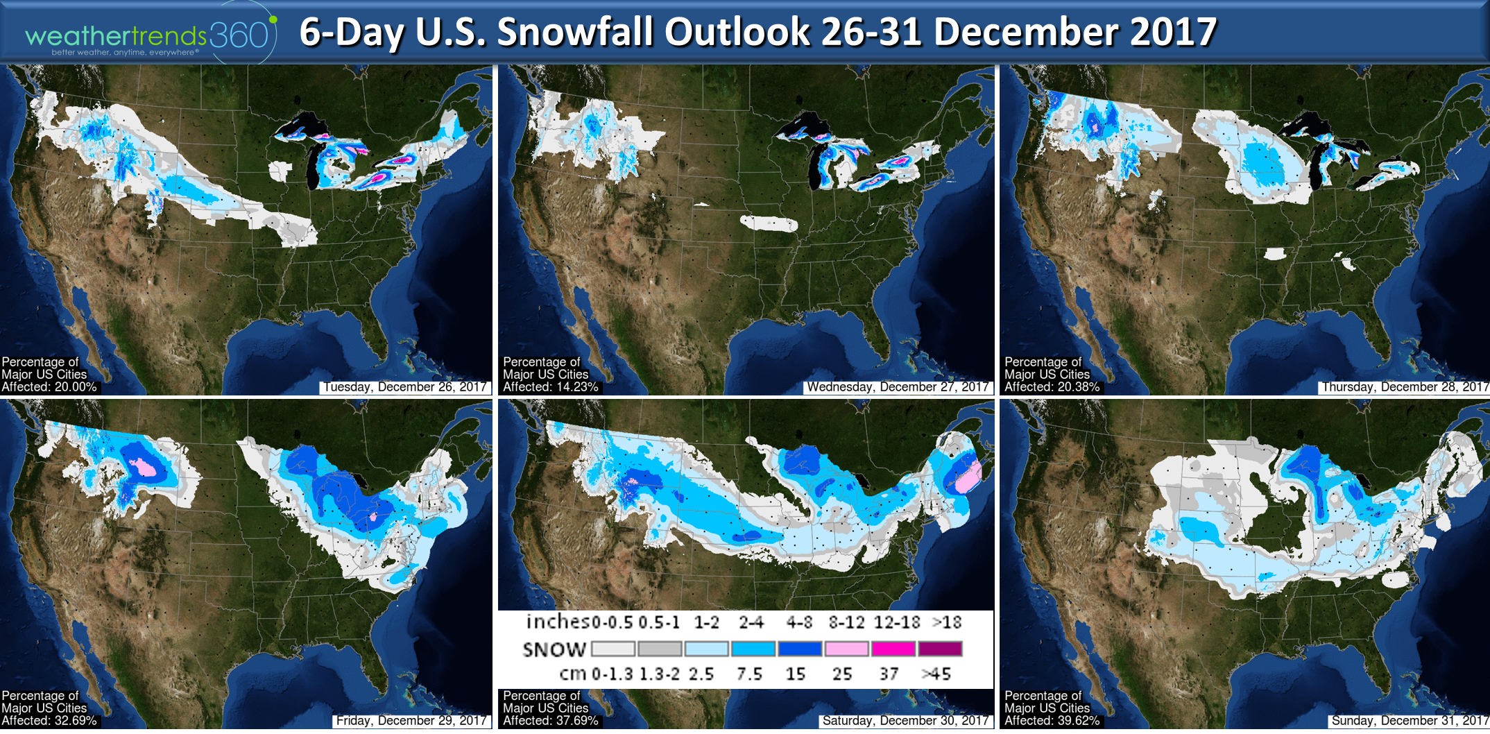
Several more snow threats over the next couple weeks with the potential for a bigger storm along the East Coast.
Enjoy these last few days of 2017!
-Captain Kirk out.
 Now gear up for an absolutely frigid New Year's Eve which is likely to be the 2nd coldest in 123 years for New York City! Well below zero for much of the Central U.S.
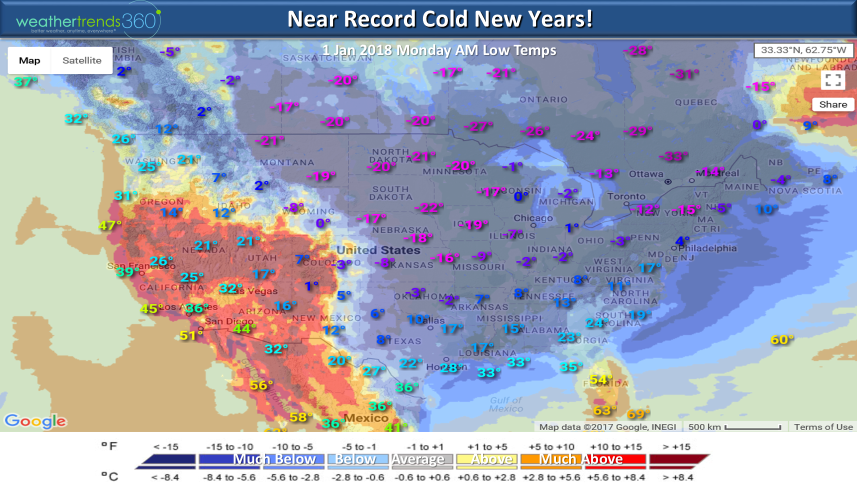 Many locations in the Eastern half of the U.S. will be some 20 to 50 degrees colder than last year with record or near record cold. Out West they're basking in very warm conditions.
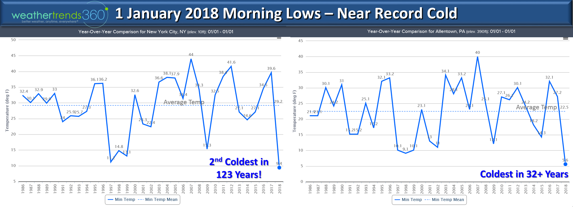 Have a great New Year and we'll have our next update on 2 Jan Tuesday.
Happy Tuesday.
This Arctic blast is pretty epic encompassing a huge area of North America over the next couple weeks. Any precipitation that does fall in the Eastern U.S. and Eastern Canada will fall as snow. CLICK ON IMAGES FOR LARGER VIEW.
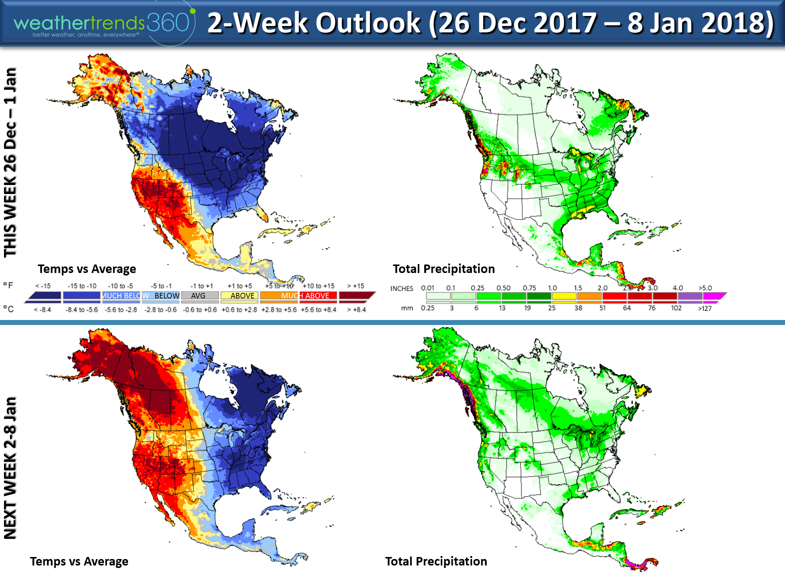
The temperatures in the Eastern U.S. are the coldest in 30+ years over the next couple weeks while the Western U.S. is the warmest in 12 years.

Snow cover Christmas Day was the most in 5 years with 49% of the U.S. blanketed in some snow after a Christmas Eve and Christmas Day storm in the Northeast.
Several more snow threats over the next couple weeks with the potential for a bigger storm along the East Coast.
Enjoy these last few days of 2017!
-Captain Kirk out.