Star Date 29 January 2018 Monday
Happy Monday! :)
The January Thaw in the Eastern half of the U.S. is coming to an end with a return to a below normal temperature pattern for the next few weeks. With the colder pattern will come several threats for snow, for now the threats appear light to moderate but it only takes a couple things to come together to make a bigger storm possible. Historically the 2nd and 3rd weeks of February are favored periods for big snow storms assuming cold air is in place, so we have that.CLICK ON IMAGES FOR LARGER VIEW.
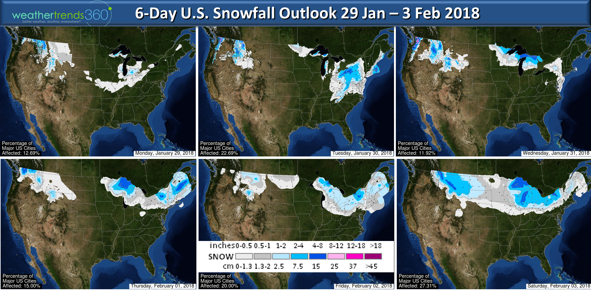
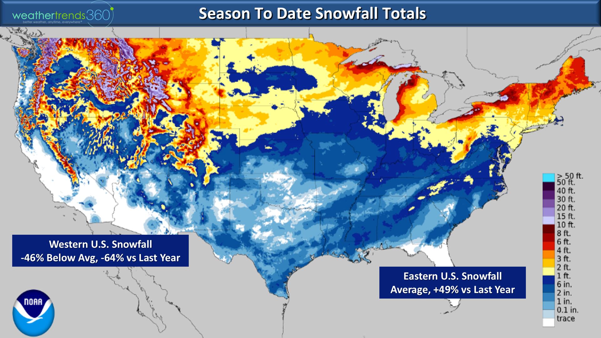
Snowfall so far this season has generally been average to above average in the East while most locations in the Western U.S. are well below average, a complete flip flop from last year when the West was snowy and the East not so much. For the Eastern U.S. overall snowfall is near average but up a whopping +49% vs last year and the most in 4 years. The West is down 46% below average and 64% less than last year.
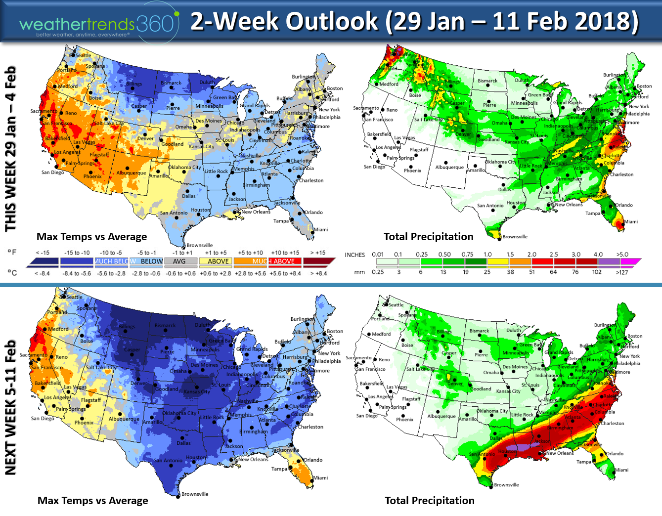
The 2-week outlook shows a return to cold and snow in the Eastern U.S. while the West continues to remain in a generally warm/dry pattern, common for La Nina Winters.
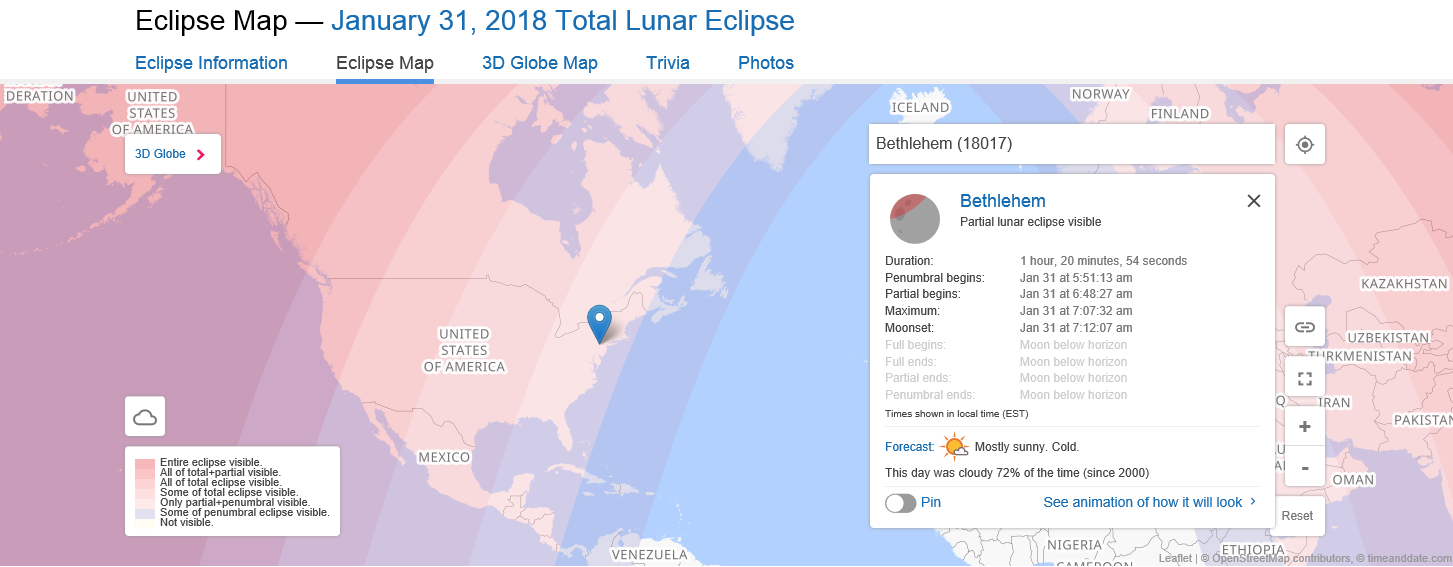
Don't forget about the rare blue moon eclipse this Wednesday! It will be the 2nd full moon in the month of January (that makes it a blue moon) and an eclipse that will be best seen from the Pacific Northwest. To see the details for your area visithttps://www.timeanddate.com/eclipse/map/2018-january-31#
We hope you have a great week ahead! - Captain Kirk out.