Star Date 30 April 2018 Monday
Happy Monday! :)
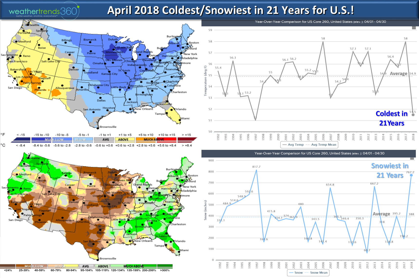
We can't wait for this coldest/snowiest April in 21 years for the U.S. to end today! Warmer days ahead for May, more on that later. CLICK ON IMAGES BELOW FOR LARGER VIEW.
April made one of the greatest YOY drops (6.5F colder than last year) in temperatures in 123 years going from near record hot last year to much below normal this year for the U.S. as a whole. This was a very big negative for retail and seasonal Spring sales.
The good news is May looks to be the warmest in 6 years for the U.S. overall and while drier than last year it's still likely to be the 8th wettest of the past 30 years with above average rainfall and above average severe weather. Expect a big pent-up demand surge in seasonal merchandise sales this month to kick of Q2 (May - Jul) and especially this week.
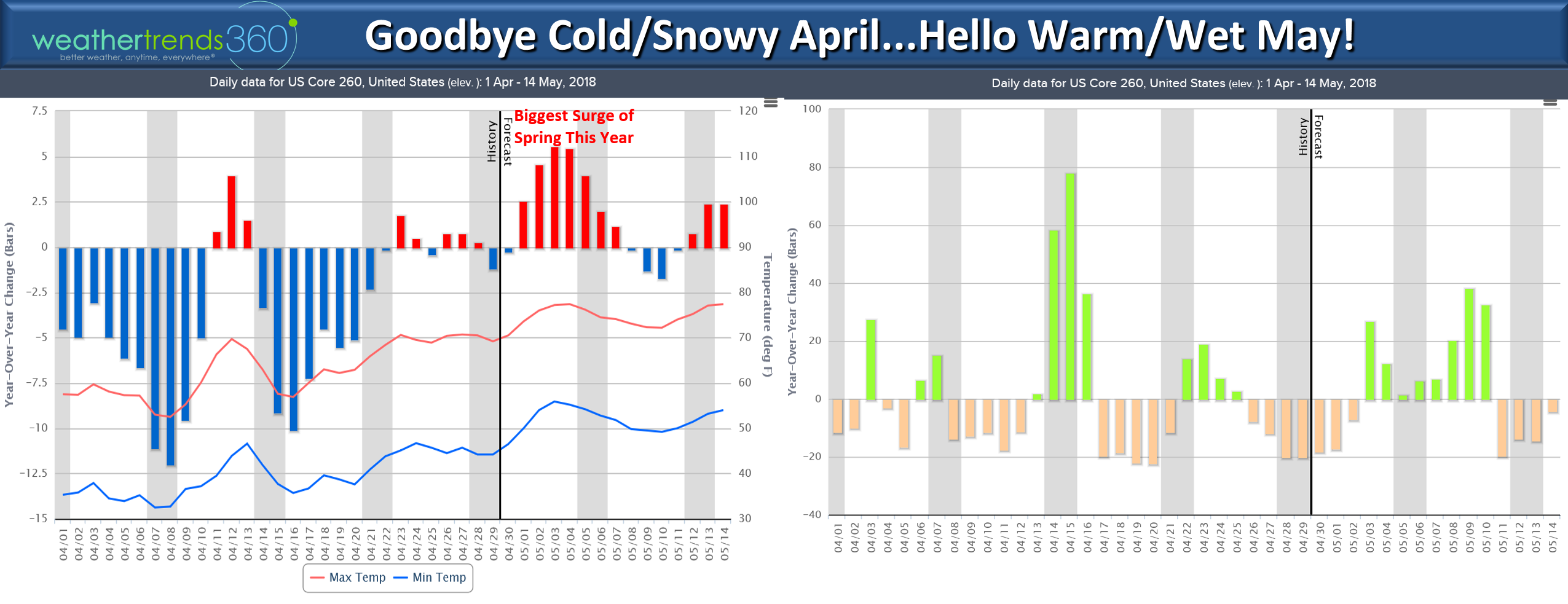
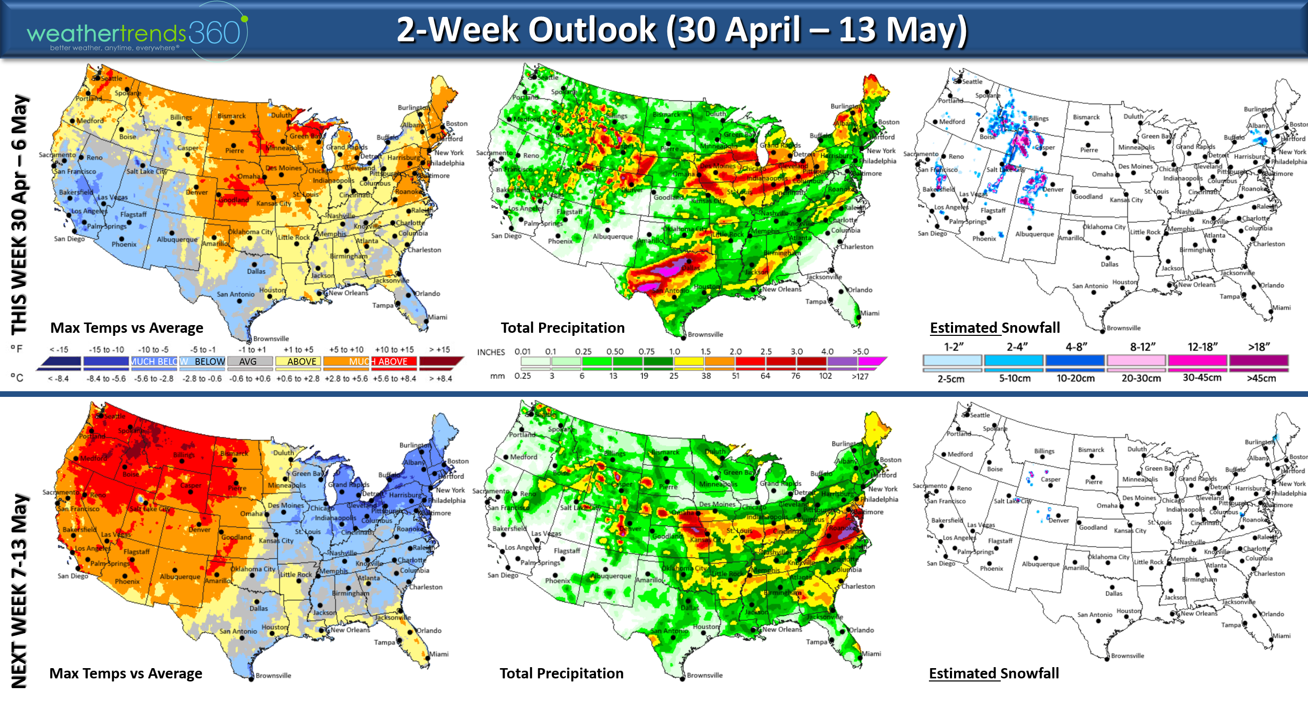
This week (30 April - 6 May) looks to trend the warmest in 6 years for the U.S. overall with much above average temperatures and 3rd warmest of the past 30 years. Rainfall is the least in 3 years but still a bit above average for the U.S. overall.
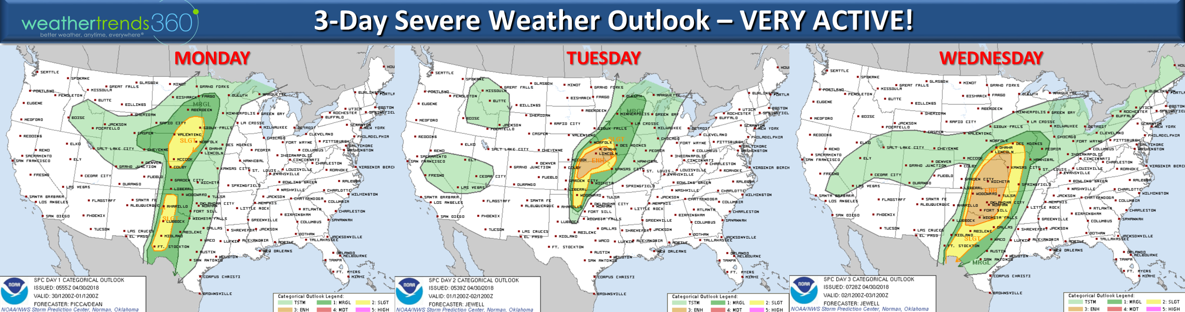
The big news this week will be a major severe weather outbreak in the Central U.S. with several days of tornadic activity possible. The Jan - Mar 2018 severe weather season got off to a very slow start with the # of reported tornadoes down at least 52% vs average but April has picked up and 30 tornadoes today would push the month above average. May is likely to be above average so get ready! wt360 meteorologist and CTO Matt Alonso has one of the wt360 drones so we might capture some nasty weather this week.
Next week (7-13 May) looks to be a bit cooler (below average U.S. temperatures) but still a tad warmer than last year and the wettest in 4 years. The cool weather will shift from the Southwest to the East while the Pacific Northwest remains hot. Some risk for frost in the Midwest and Northeast for this 2nd week of May.
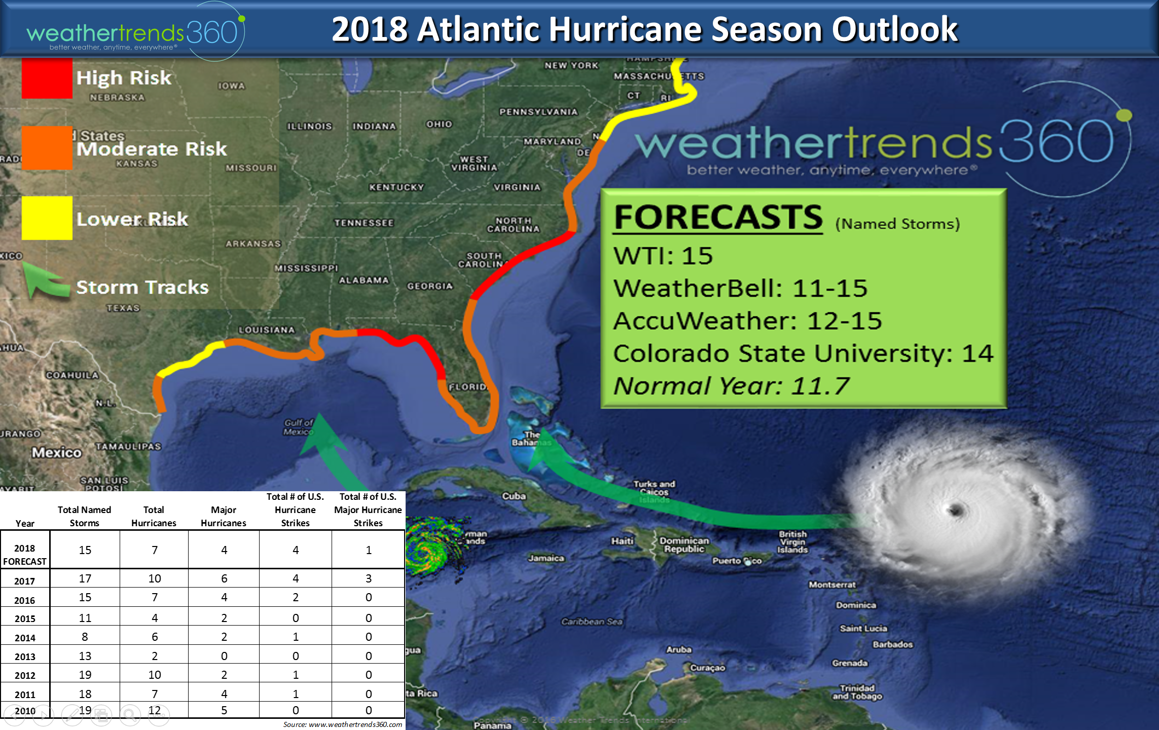
Our hurricane outlook for the 2018 season is projecting another above average season with at least 15 named storms. We believe the highest risk areas this year are from Florida and the East Coast as far north as NJ. We have partnered with Weather2020 to provide much more detailed outlooks on likely development areas and timing for hurricanes and severe weather months in advance so contact sales@weathertrends360.com or 610-807-0118 for more information and fees.
We expect the season to get off to a quick start in June with 6 areas that could bring early tropical storms or even a hurricane so it won't be long before we mention some of these names: 1 Albert0, 2 Beryl, 3 Chris, 4 Debby, 5 Ernesto, 6 Florence, 7 Gordon, 8 Helen, 9 Isaac, 10 Joyce, 11 Kirk, 12 Leslie, 13 Michael, 14 Nadine, 15 Oscar, 16 Patty, 17 Rafael, 18 Sara, 19 Tony, 20 Valerie and 21 William. We hear that #11 and #21 will be WARP SPEED STORMS! ;)
Follow us on Facebook , YouTube and Twitter for daily updates.
We hope you have a great week! - Captain William Kirk out.