Star Date 7 October 2016 Friday
Captain's Log
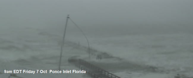
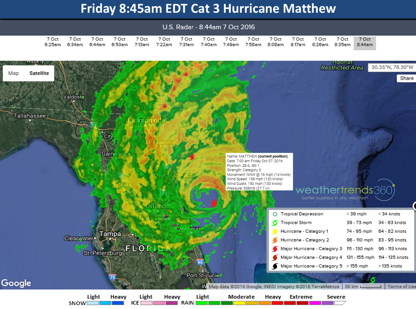
For millions in the Southeast U.S. this Columbus Day weekend will be spent cleaning up and assessing damage from Hurricane Matthew. Fortunately the storm so far has remained just off the Florida coast keeping the most dangerous right front quadrant of the Eyewall off shore. The highest wind gust we found so far was 107 mph at the Kennedy Space Station in Cape Canaveral. This is the closest Matthew has come to Florida so far. A buoy off Melbourne reported a wave of 24 feet but again the storm surge would be on the right side of the eye and that so far has not moved on shore.

9am web cam Ponce Inlet, Florida - moderate storm surge.
From here Matthew will continue to plaque the Georgia and South Carolina coasts through Saturday before moving further off shore.
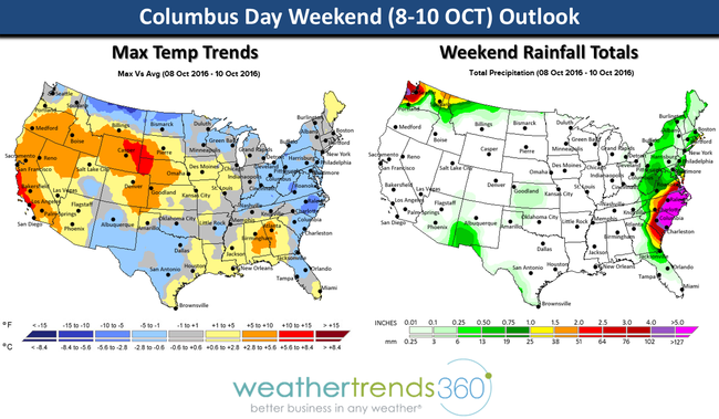
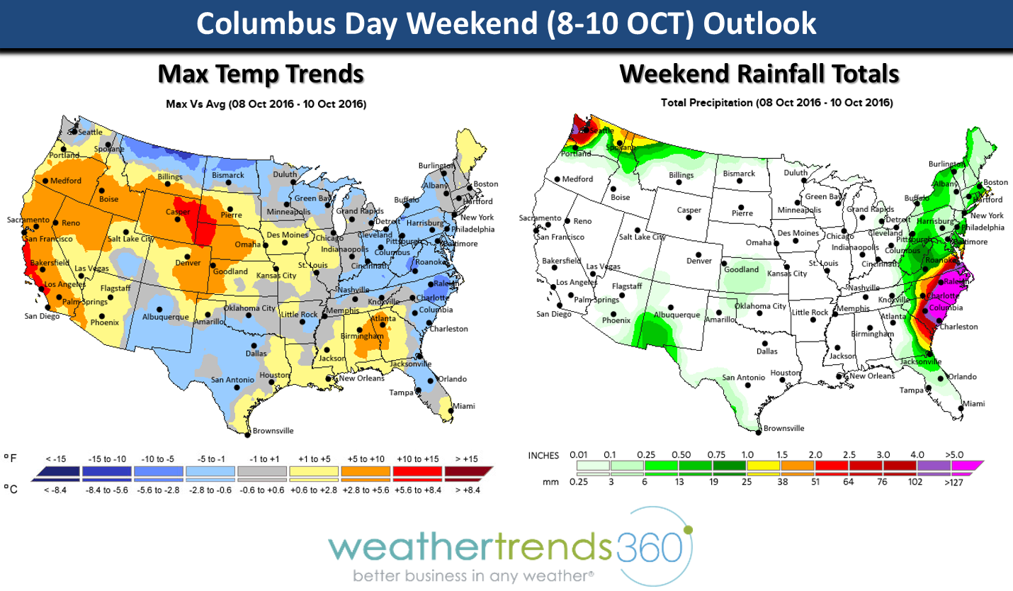
For the rest of us the Columbus Day weekend will be Fall-like in the Northeast, Great
Lakes and Northern Plains with cooler conditions while the West and Rockies are pretty warm for this time of year. Rainfall will be in the 5-12" range along the Southeast Coast as some of Matthew's energy gets sheared Northeast.
Sadly hundreds have died across Haiti and the Bahamas with complete devastation to thousands of homes.
For frequent updates on Matthew visit our Facebook and Twitter fan pages.
Have a good weekend and prayers for all that were impacted by Matthew.
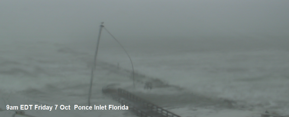
9am web cam Ponce Inlet, Florida - moderate storm surge.
From here Matthew will continue to plaque the Georgia and South Carolina coasts through Saturday before moving further off shore.
For the rest of us the Columbus Day weekend will be Fall-like in the Northeast, Great
Lakes and Northern Plains with cooler conditions while the West and Rockies are pretty warm for this time of year. Rainfall will be in the 5-12" range along the Southeast Coast as some of Matthew's energy gets sheared Northeast.
Sadly hundreds have died across Haiti and the Bahamas with complete devastation to thousands of homes.
For frequent updates on Matthew visit our Facebook and Twitter fan pages.
Have a good weekend and prayers for all that were impacted by Matthew.