Star Date Monday 14 November 2016
Captain's Log
Happy Monday folks! :)
Enjoy the mild dull drums for now as all signs point to a major pattern change beginning to set up for late month into December!
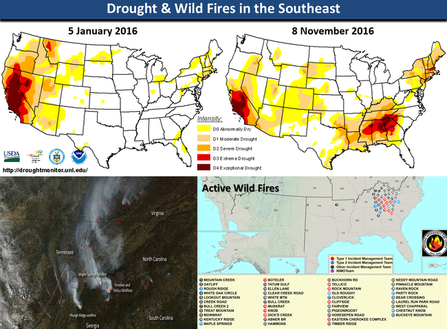
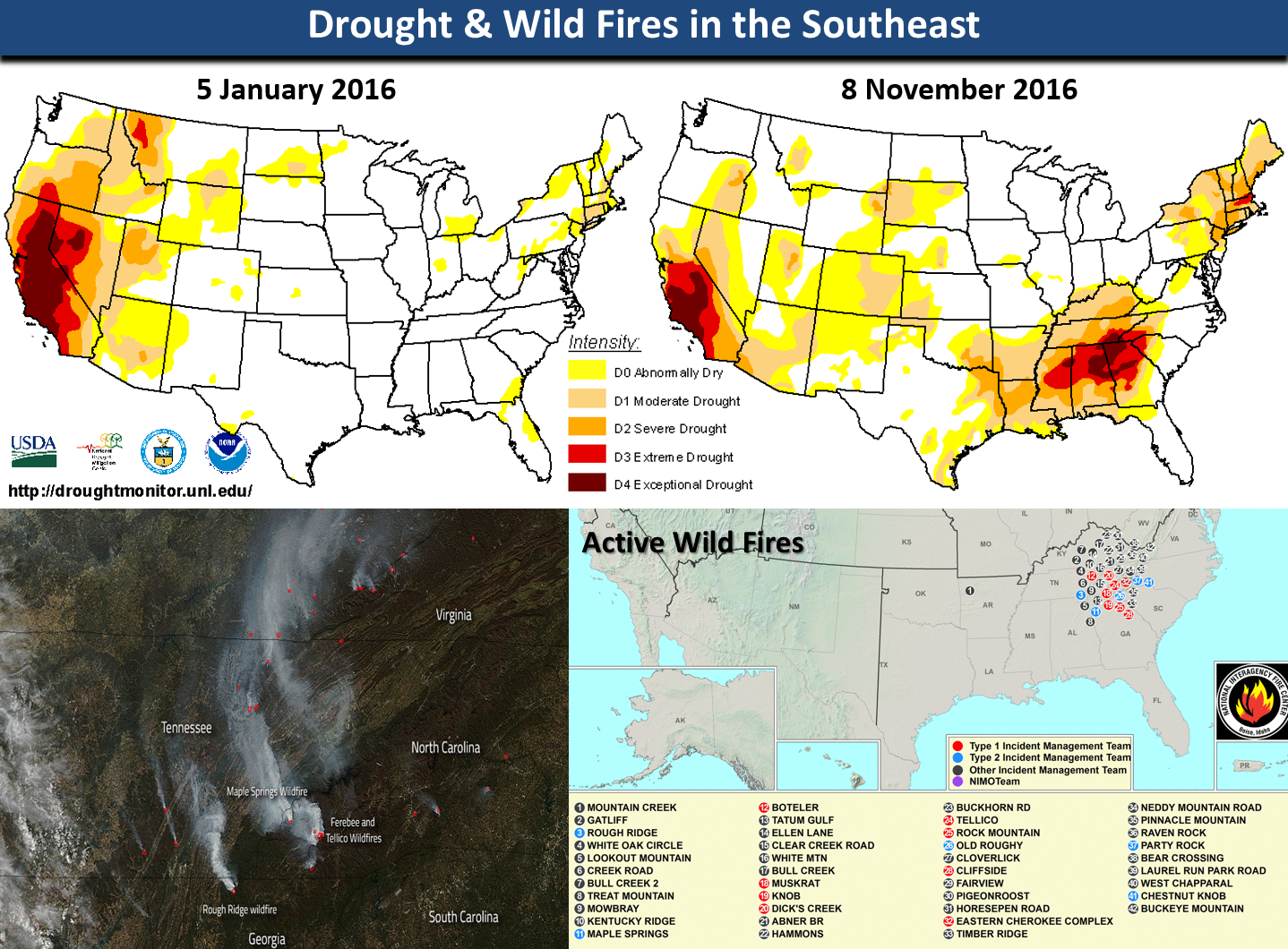
THIS WEEK (14-20 NOV)This week will trend the warmest in 15 years for the U.S. overall and 8th driest in 25 years. The dry has become a major problem in the Southeast where there are dozens of wild fires burning and some big ones visible from satellite. Unfortunately there doesn't appear to be much relief in terms of rain.
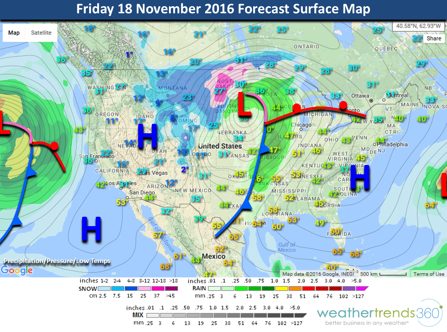
The biggest weather event to watch this week is going to be a rather intense storm that will bring the first big snow storm to the Rocky Mountains and Upper Plains Thursdayinto Saturday.

On the heels of this big Central U.S. storm is another storm slated for Northern California into the Pacific Northwest by the weekend with potentially very heavy rainfall for the Northern half of California even into the San Francisco Bay Area. The Southwest Caribbean bears watching as we could see Hurricane Otto form and head Northeast toward Hispaniola toward the weekend. This would be the 16th systems of the 2016 season.
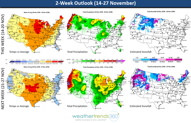
NEXT WEEK (21-27 NOV)Starting to see a pattern change here with a parade of storms and building cold air for the Eastern U.S. While the week overall is warmest in 4 years for the nation as a whole, that's about to change! The Northeast is the cool spot trending coolest Thanksgiving week in 3 years and 2nd snowiest in 25+ years (interior higher elevations). Veryheavy snowfall is also likely for much of the West and Upper Plains. Pre-Thanksgiving travel headaches appears to be on the West Coast with a big storm and the Great Lakes-Ohio Valley with a weaker systems bringing rain and snow. Enough to make it a more challenging travel period than last year when it was pretty warm and dry.
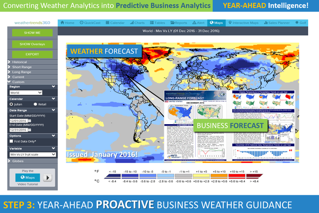
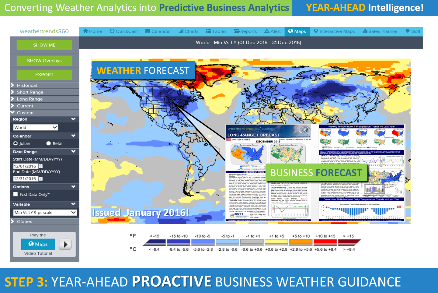
Returning home from Thanksgiving into early December looks like Arctic finally decides to invade much of the Eastern U.S. with the potential for a coastal storm as well. Way out there but short range models are starting to agree with our year-ahead statistical/climate cycle model. The pattern clearly looks to be setting up for a very cold and snowy December with a very strong -AO pattern for those of you who like to talk climate indices (just 1 of 24 that we factor in)! Below is an example of our forecast issued a year-ago for December 2016. COLD/SNOWY! That's all we have to say about that! :)
So for now enjoy the extended mild weather.
Have a great week folks! - Capt Kirk out.
Enjoy the mild dull drums for now as all signs point to a major pattern change beginning to set up for late month into December!
THIS WEEK (14-20 NOV)This week will trend the warmest in 15 years for the U.S. overall and 8th driest in 25 years. The dry has become a major problem in the Southeast where there are dozens of wild fires burning and some big ones visible from satellite. Unfortunately there doesn't appear to be much relief in terms of rain.
The biggest weather event to watch this week is going to be a rather intense storm that will bring the first big snow storm to the Rocky Mountains and Upper Plains Thursdayinto Saturday.
On the heels of this big Central U.S. storm is another storm slated for Northern California into the Pacific Northwest by the weekend with potentially very heavy rainfall for the Northern half of California even into the San Francisco Bay Area. The Southwest Caribbean bears watching as we could see Hurricane Otto form and head Northeast toward Hispaniola toward the weekend. This would be the 16th systems of the 2016 season.

NEXT WEEK (21-27 NOV)Starting to see a pattern change here with a parade of storms and building cold air for the Eastern U.S. While the week overall is warmest in 4 years for the nation as a whole, that's about to change! The Northeast is the cool spot trending coolest Thanksgiving week in 3 years and 2nd snowiest in 25+ years (interior higher elevations). Veryheavy snowfall is also likely for much of the West and Upper Plains. Pre-Thanksgiving travel headaches appears to be on the West Coast with a big storm and the Great Lakes-Ohio Valley with a weaker systems bringing rain and snow. Enough to make it a more challenging travel period than last year when it was pretty warm and dry.
Returning home from Thanksgiving into early December looks like Arctic finally decides to invade much of the Eastern U.S. with the potential for a coastal storm as well. Way out there but short range models are starting to agree with our year-ahead statistical/climate cycle model. The pattern clearly looks to be setting up for a very cold and snowy December with a very strong -AO pattern for those of you who like to talk climate indices (just 1 of 24 that we factor in)! Below is an example of our forecast issued a year-ago for December 2016. COLD/SNOWY! That's all we have to say about that! :)
So for now enjoy the extended mild weather.
Have a great week folks! - Capt Kirk out.