Winter Returned with the March 2017 Snowstorm
Winter is back in the eastern U.S. and it's not going anywhere for at least the next 7 days. Parts of the Mid-Atlantic and Northeast woke up to a winter "refresher" this morning with a couple of inches of snow on the ground but this is mostly just a nuisance snow with little consequence to store traffic. However, with snow on the ground and a shot of very cold Arctic air on its way, retailers can expect a significant decline in interest for spring categories compared to last year when, at this time, temperatures in the East were in the 70s and 80s. The big story this weekend will be the absolutely frigid air over the eastern U.S. and then a bit of snow in the Plains and Mid-South. Then our attention turns to what could be a rather significant Nor'easter late Monday into Tuesday for the East Coast.
Cold, Arctic air is currently on its way south and will encompass much of the eastern U.S. over the weekend. Freezing temperatures will dip down almost reaching the Gulf Coast by late in the weekend and into next week. Over the next 7 days temperatures will dip down into the single digits and teens in New England, teens and 20s in the Mid-Atlantic, and 20s and 30s in the Mid-South. Unseasonably warm weather back in February caused vegetation to "spring" to life early and now this vegetation could be at risk of injury due to the prolonged period of frigid weather. Unfortunately this dip in temperature is coinciding with some university's spring break period bringing colder than normal temperatures to some of the popular Southeast coastal spring break hot spots. Compared to last year, temperatures will be anywhere from -10F to -50F colder than the same time last year in the East over the next 7 days!
While the arrival of cold air is pretty much set in stone, the big question for next week is, "Will there be a big snowstorm on the East Coast?" What we can tell you at this point is that the confidence for a significant event is building in the Northeast.
First, a swath of snow will race down across the Plains starting tomorrow (Saturday, March 11th) bringing mainly light to moderate snow accumulations from Montana to the Dakotas, eastern Nebraska, southwestern Iowa, and Missouri. Snow may also fall in extreme northern Arkansas, Tennessee, North Carolina and southern Virginia before the weekend is through. Snowfall totals are expected to be light, about a coating to 4'', with locally heavier accumulations and heavier snow in the mountains. Snow will likely have a hard time accumulating on road surfaces but the wintry scene and colder temperatures are sure to put a damper on interest in spring categories.
The energy from the system that will bring snow to the Plains and Mid-South will then head just off the Southeast Coast, and here is where things get both interesting and tricky in the forecast. Currently, several computer forecasting models agree that the energy takes a turn up the East Coast and fuses with energy coming in from the west. In almost a text-book case scenario, a Nor'easter develops with the potential for over a foot of snow in parts of the Northeast.
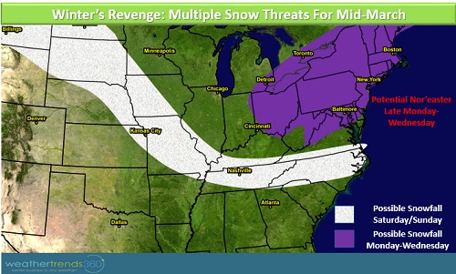
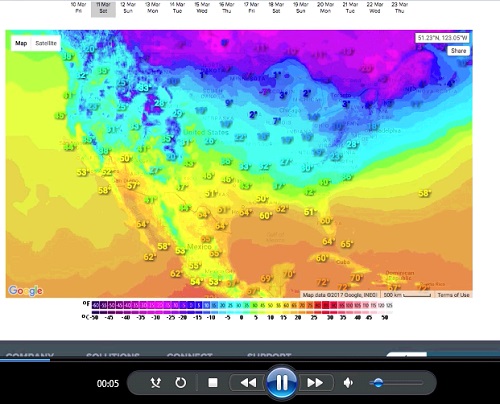
We stress that while there has been some agreement and consistency in suggesting a big storm in the Northeast for late Monday and into Tuesday, there is still plenty of time for this forecast to change. We don't want to focus on exact snowfall accumulations in any one place at this time because a shift as small as 50 miles east or west will dramatically change the snowfall forecast. At this point, here's what we expect (the image below is linked to a video with audio that quickly summarizes the upcoming weather features):
- Late Monday into Tuesday and maybe even Wednesday, Nor'easter impacts Northeast
- Snow is possible anywhere from interior Virginia and Maryland up through the New England Coast; blizzard conditions possible
- Potential for over 1' of snow in parts of the Northeast
- Strong winds, coastal flooding and beach erosion
- Negative impacts to store traffic late Monday through Wednesday
- Airport delays, cancellations, maybe even closures
We are intensely monitoring this situation as there is very good potential for a significant storm. Updates will be issued in the next couple of days on this storm. Please check www.wt360.com for your specific forecasts. Also, please "like" our Facebook page or follow us on Twitter for intermittent updates.
Bundle up and have a warm and safe weekend!