2020 Nor'easter Snow Storm
Captain's Log
Happy Monday! :)
The big news this week is going to be the potential major Nor'easter impacting the Middle Atlantic and Southern New England. CLICK ON IMAGES FOR A LARGER VIEW.
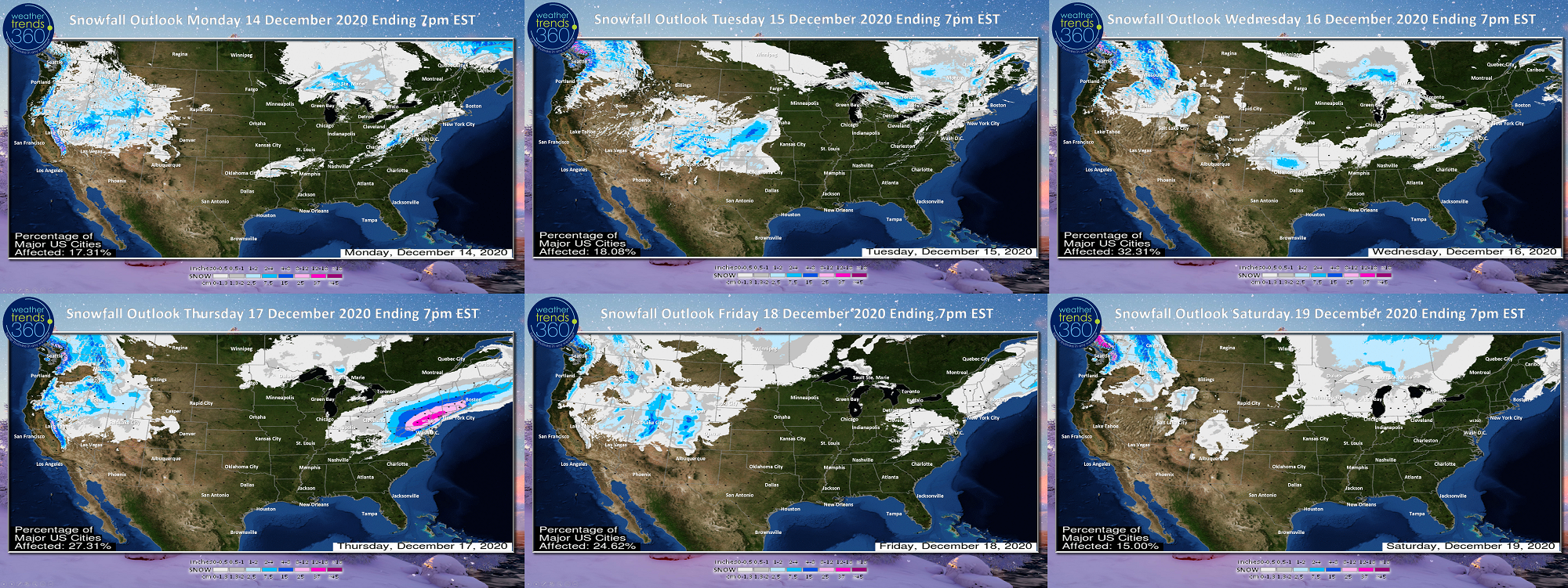
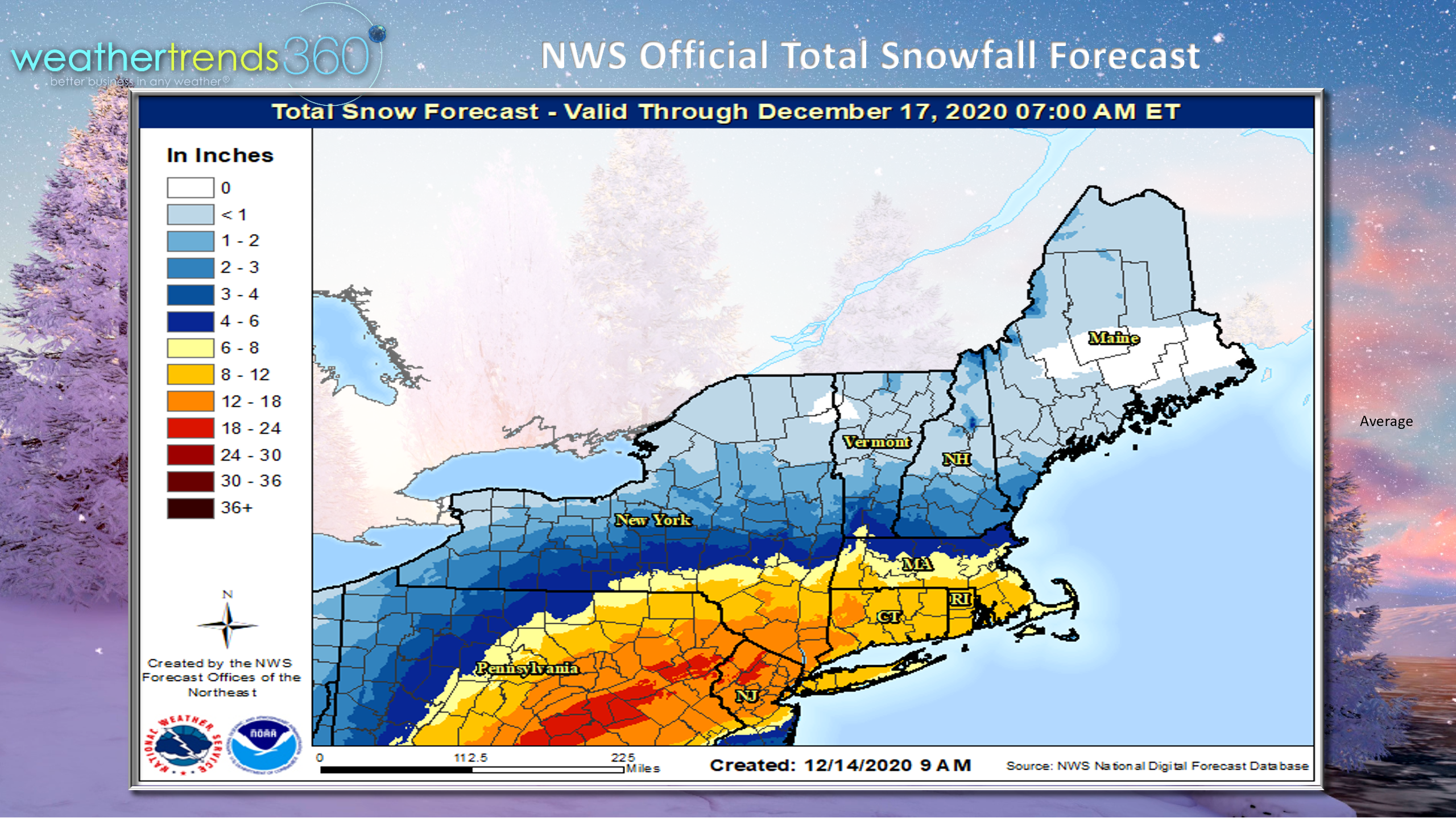
The potential for a big 12-18" snow storm by December standards is very high especially in the Eastern PA, Northern New Jersey and SW Connecticut areas mid-day Wednesday into Thursday morning. Obviously this impacts 50+ million people, so the benefit to Winter seasonal merchandise is significant.
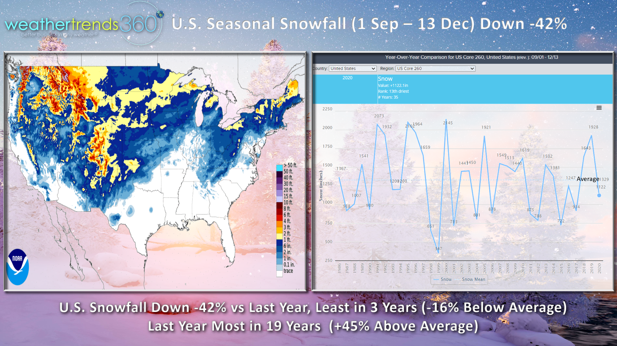
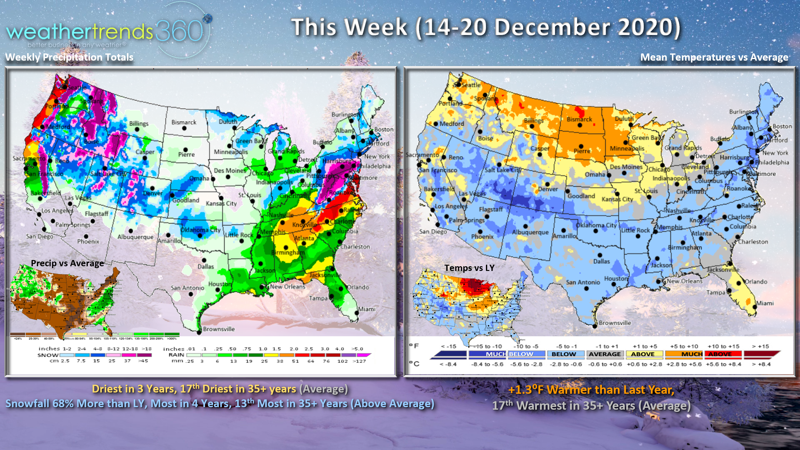
Season-to-date snowfall through today is trending down 42% compared to last year for the U.S. overall and 16% below average. This is a significant change from last year when the season was trending the most in 19 years and 45% above average. We'll boost the trends a bit after this Nor'easter, but still likely to be trending below average nationally for the season.
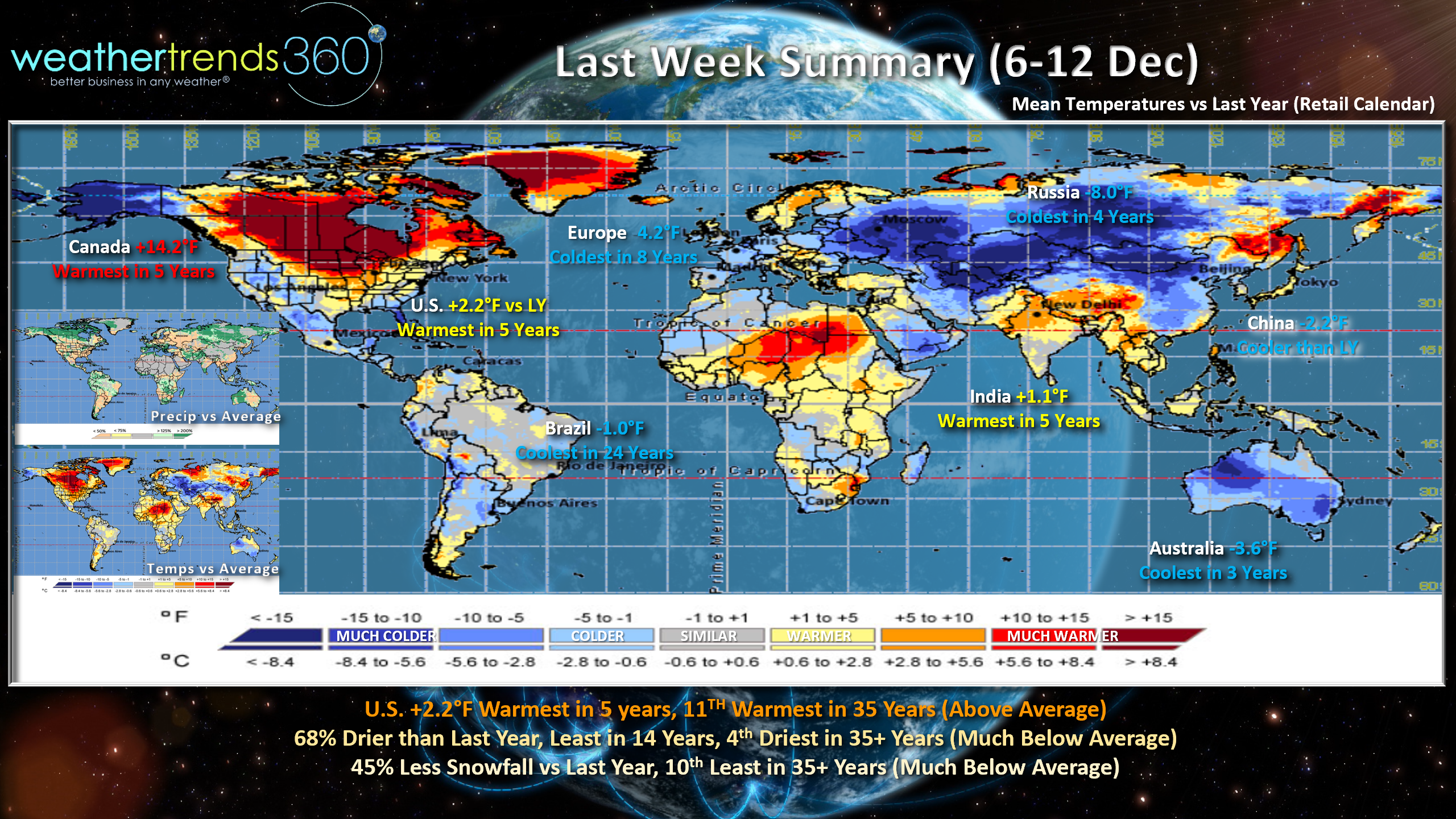
Last week (6-12 Dec) across the world showed coast-to-coast much above average temperatures across Canada yet we're talking cold and heavy snow in the East this week? The culprit was the frigid weather in Alaska that got pulled into a storm system diving deep into the Southern U.S. from the Pacific Ocean. An unusual path for cold to invade the East, but the result is a perfect set-up for a big snow storm. Europe was the coolest in 8 years, great for seasonal merchandise sales as was Russia, coldest in 4 years.
This week (14-20 Dec) the U.S. overall looks to trend 1.3F warmer than last year or 17th warmest of the past 35 years - about average national temperatures - but warm North, cold South and East. Rainfall the least in 3 years and also 17th driest while snowfall looks to be up 68% over last year and most in 4 years due in large part to the midweek snow storm in the East.
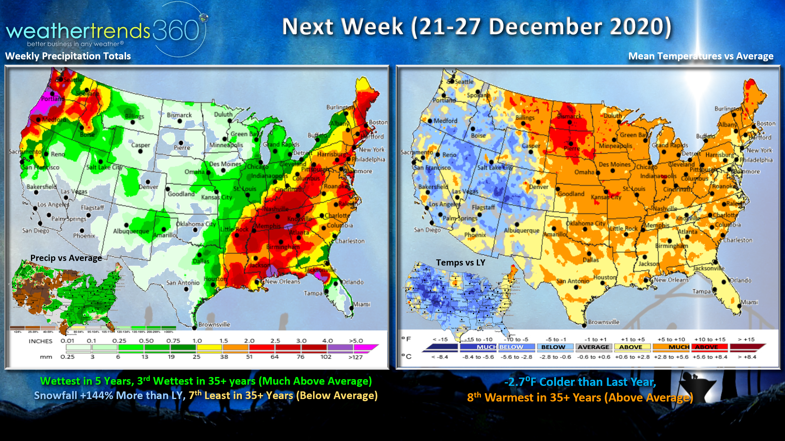
Next week (21-27 Dec) trends 2.7F cooler than a year ago, but that's still 8th warmest of the past 35 years. With Canada trending well above average, the source regions for cold to invade the U.S. are limited. But, there is another potential big storm around Christmas Eve into Christmas for the East! That system appears to be more wet than white for the big cities of the Northeast with heavier snow back toward the Lakes and higher elevations of New England. Needs to be watched.
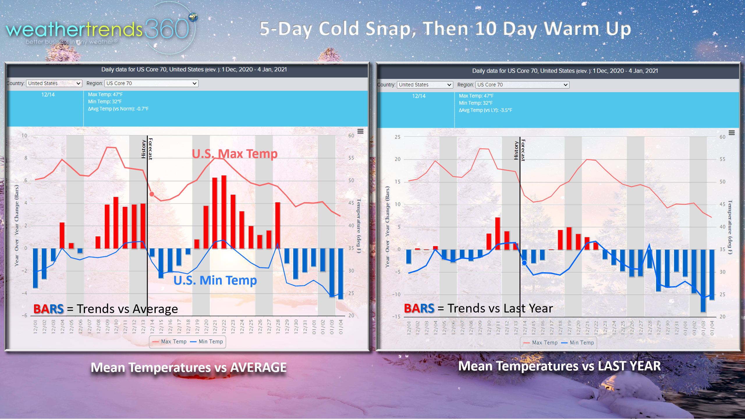
U.S. temperature trends show the big cool down will be short lived for about 5 days, but an uptick in Winter seasonal merchandise sales will be strong in light of pent-up-demand after such a warm November. The next bigger cool down likely late month into early January.
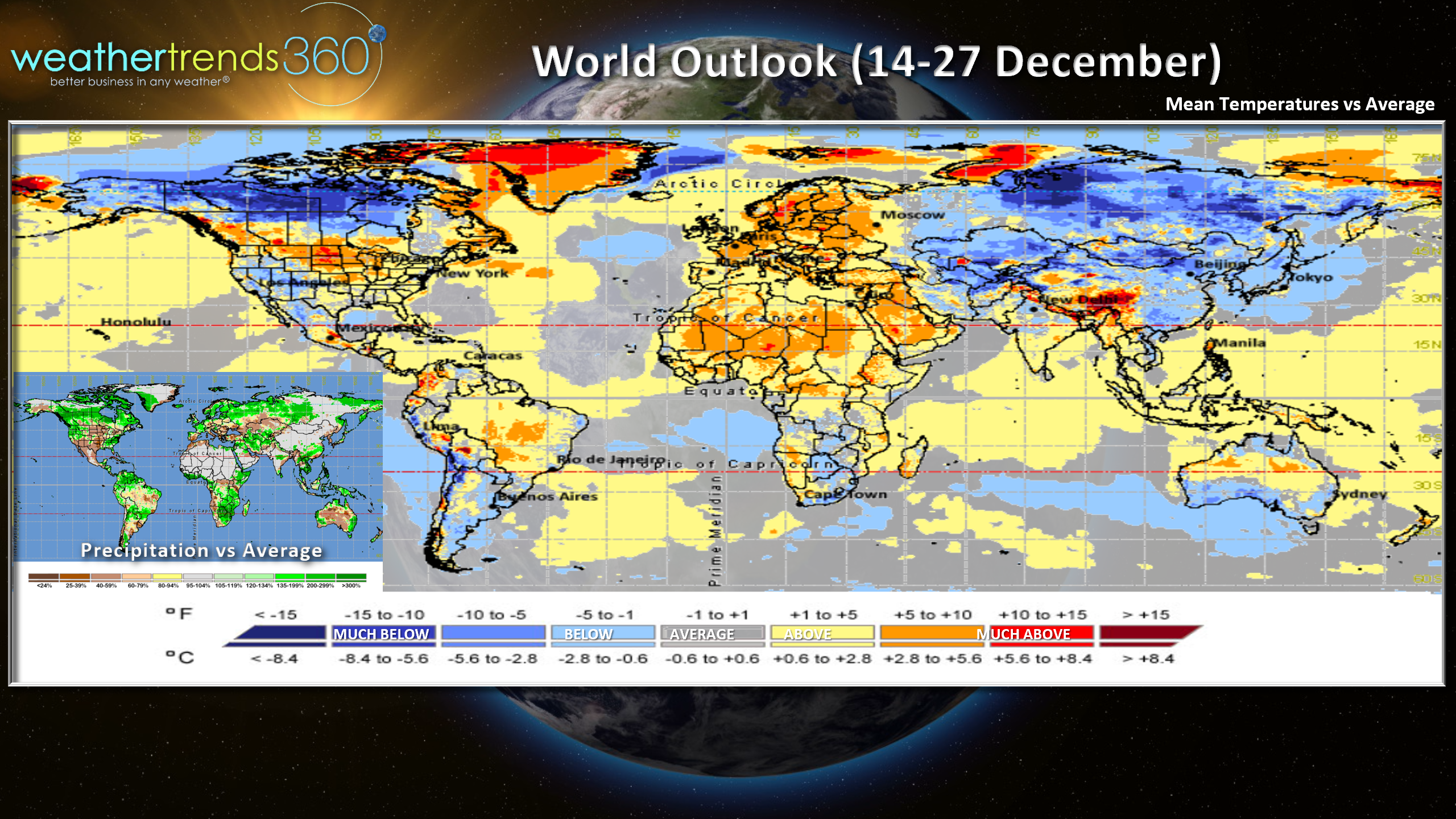
The World 2-week aggregate (14 -27 Dec) shows the bigger warm up in Europe While northern Canada gets much colder. That colder Canadian pattern should begin to push south into the U.S. late month.
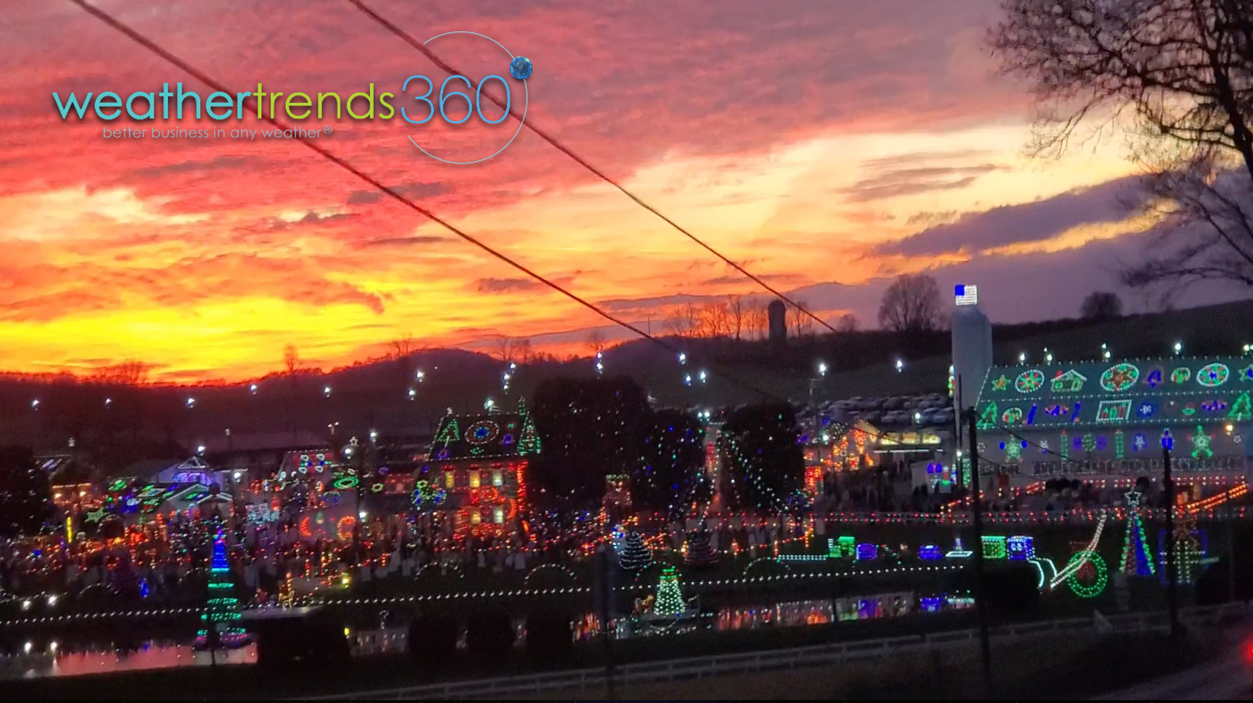
Do you have someone in your organization that seems to know everyone? We have one and his name is Billy Dunn, President! HE KNOWS EVERYONE. :) After visiting all the major light displays here in Eastern PA, the little soon to be 5 year old Angelina Kirk wanted to see more lights. Dads can never let down their little ones, so Billy to the rescue. Captain Kirk to Billy, "I need more lights!" Billy, "I know a place Captain...follow me! Wow did he not let us down! We headed to Christmas Village in Eastern PA for another spectacular light display with an amazing sunset as well. Certainly brought some joy to a little girl. :) THANK YOU. See the video end for the spectacular display.
Have a great week and don't forget to follow us on social media for frequent updates: Facebook, Twitter, YouTube, Pinterest and Linkedin
-Captain Kirk out.