November 2020 Weather Forecast
Captain's Log
Happy Monday! :)
The last week of October (25th-31st) around the World showed the U.S. trending 1.4F warmer than a year ago but still 4th coldest of the past 35+ years. Rainfall was down 35% vs a year ago but still 6th wettest in 35 years, while snowfall was 11% less than last year but still 4th snowiest of the past 35 years nationally. CLICK ON IMAGES FOR A LARGER VIEW.
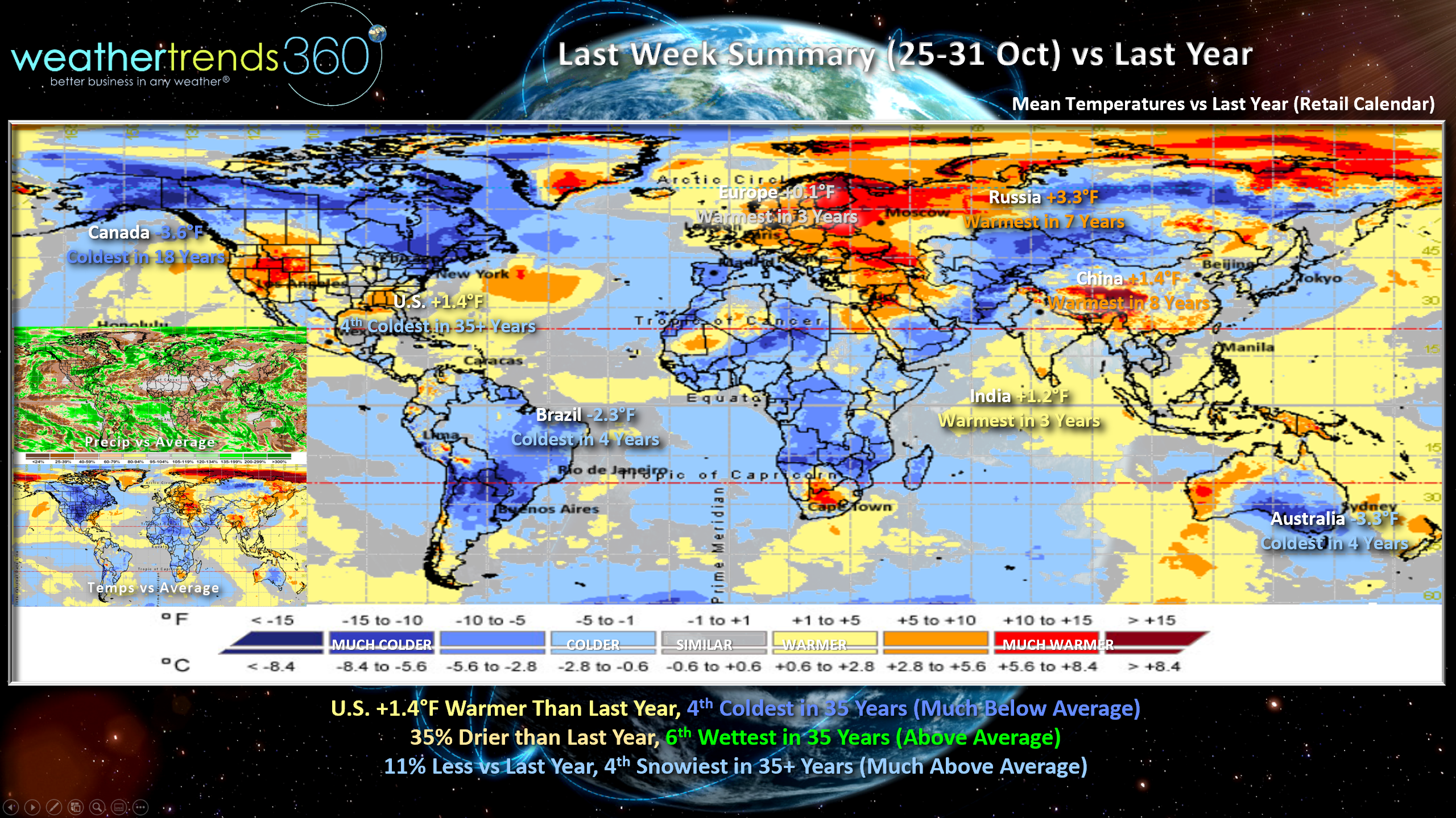
Canada continues to be very cold trending coldest in 18 years, China warmest in 8 years, Russia warmest in 7 years, India warmest in 3 years, Europe similar to last year and warmest in 3 years, Australia and Brazil coldest in 4 years.
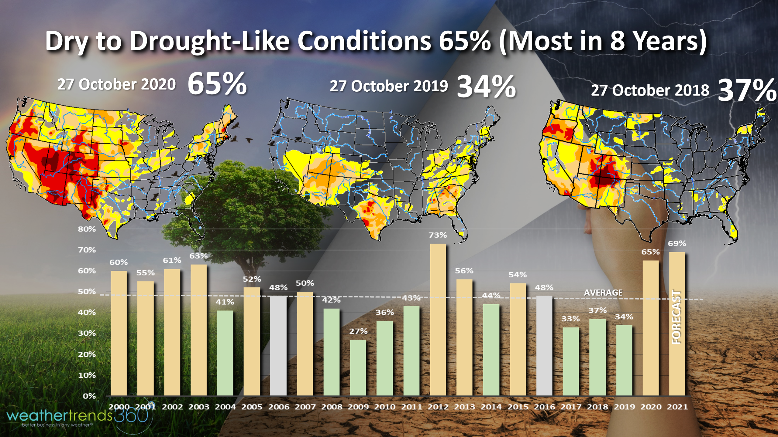
It's always interesting when there is one extreme that seems counter intuitive like the most dry to drought-like conditions in 8 years for the U.S., but also the most active hurricane season in 169 years! Dry to drought-like phases across the U.S. as of 29 October are around 65% which is the most widespread since 2012, and 2nd most in 20 years. WTI expects this to peak around 70% in the months ahead and continue well into 2021. On the flip side is the most active hurricane season on record with 29 systems and counting.

Hurricane ETA (system #29) will make landfall in Nicaragua early this week and then very likely makes a U-turn North toward Cuba and Florida next week!
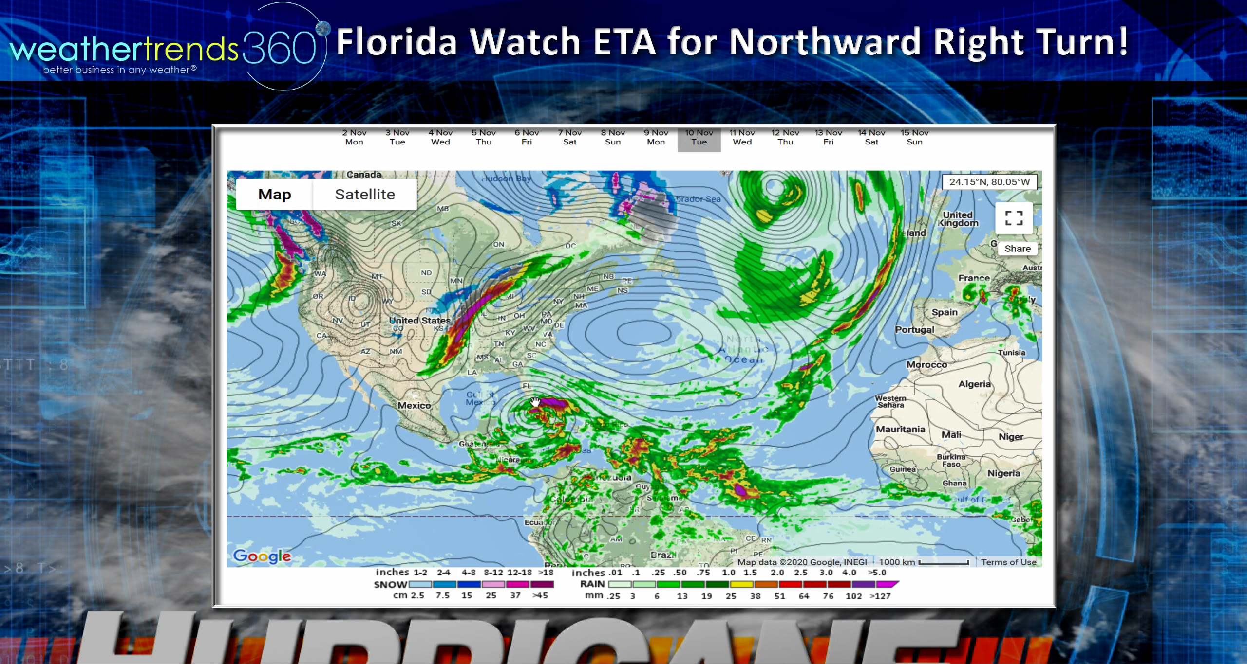
Models are hinting at a hurricane threat for South Florida and the Middle Atlantic next week - something to watch for now.
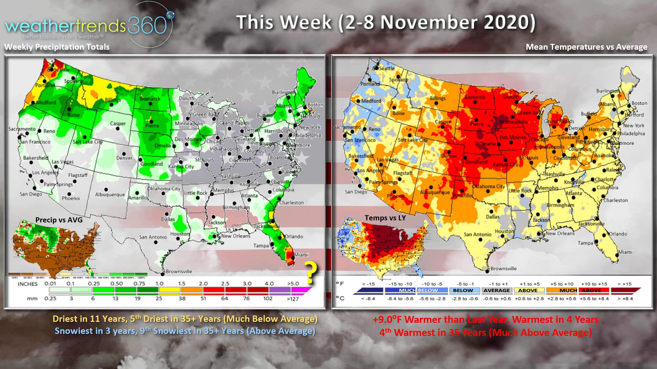
This week (2-8 November) trends a whopping 9F warmer than last year for the U.S. overall, making it the 4th warmest of the past 35+ years. This will dampen demand for Fall-Winter merchandise. Rainfall is the least in 11 years and 5th driest of the past 35 years while snowfall looks to be the most in 3 years, 9th snowiest of the past 35. Lake Effect snow and high elevation New England snow early this week and then the snow will shift back to the Northern Rocky Mountains next week.
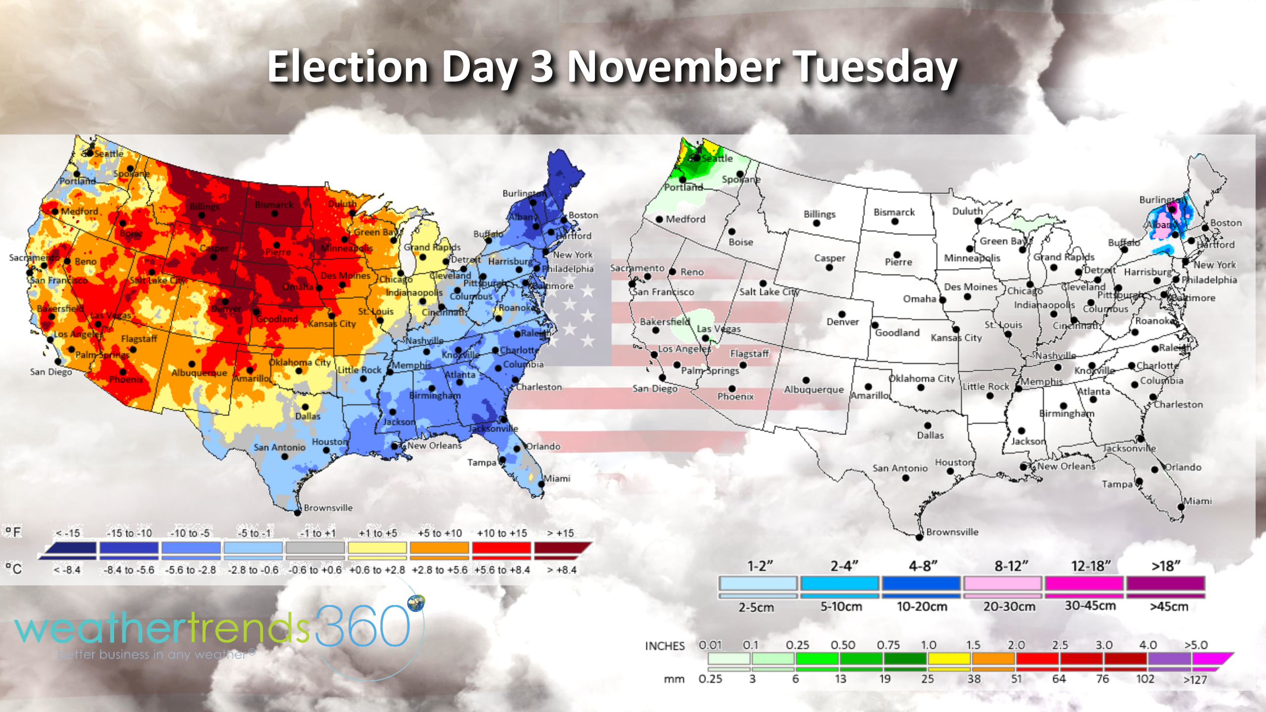
In case you've been hanging out on Pluto the past year, tomorrow is election day in the U.S. and the weather looks DRY for the vast majority of the country. Some lingering snow in the high elevations of New England and rain for Washington, but otherwise no issues standing in line to vote.
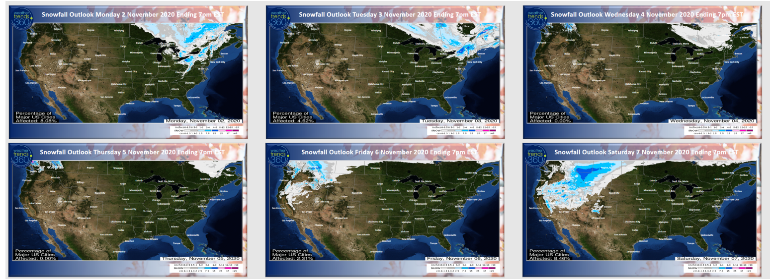
The 6-day snowfall outlook shows some lingering snow in New England early before the pattern shifts back to the Rockies.
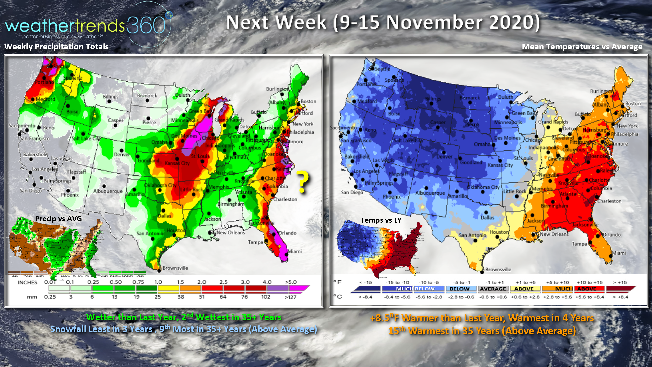
Next week (9-15 November) shows another shot of cold weather for the Western half of the country while the East remains much above average. Overall the week looks to trend 8.5F warmer than last year for the U.S. overall, warmest in 4 years and 15th warmest of the past 35 years. Rainfall looks to ramp up with the East Coast hurricane threat, heavy rain Central U.S. and Pacific Northwest. Overall rainfall is wetter than last year and 2nd wettest in 35 years, while snowfall is the least in 3 years and 9th most of the past 35 years.
Have a great week, and don't forget to follow us on social media for frequent updates: Facebook, Twitter, YouTube, Pinterest and Linkedin
- Captain Kirk out (USAF Gulf War Veteran 1989-1999)