Strong La Niña Coming in Late 2020?
Captain's Log
Happy Tuesday! :)
We hope you had a great Labor Day weekend, hard to believe there are less than 14 days of Summer left according to the sun. CLICK ON IMAGES FOR A LARGER VIEW.
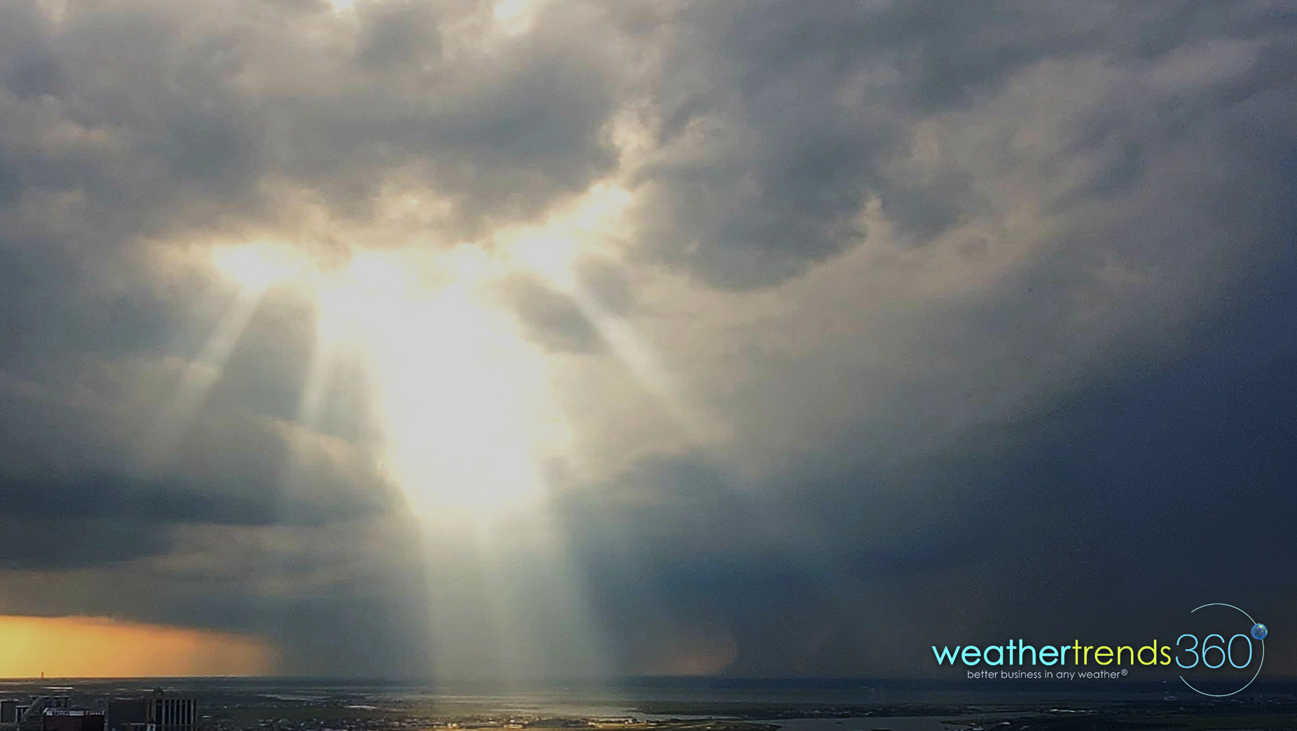
Over the holiday weekend we had an amazing cloud angel in the middle of a thunderstorm that appeared right after little Angelina Kirk had an accident at school, reassuring that all would be OK. :) Our schools have started up here, late by Southeast standards where kids started weeks ago.
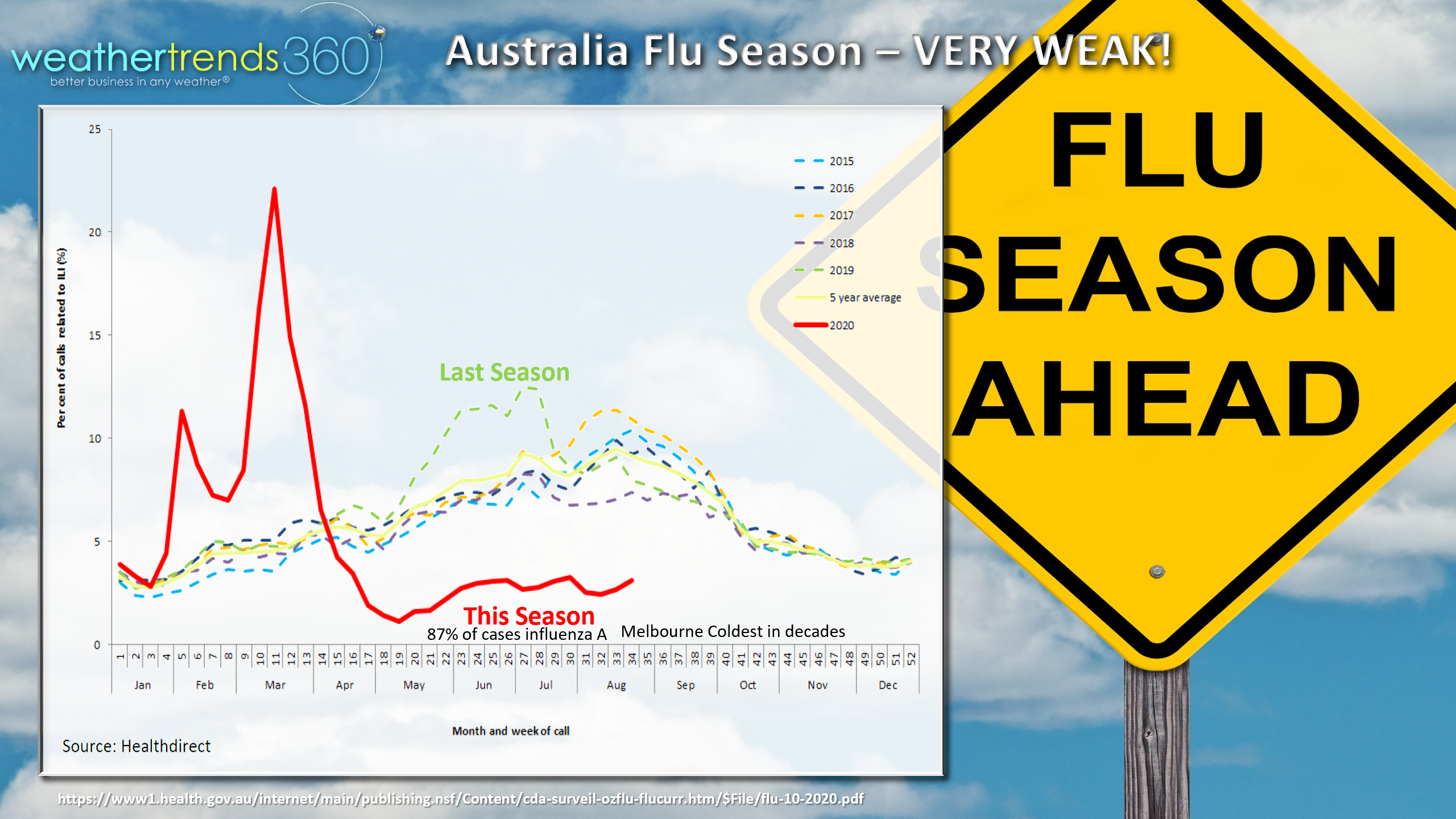
With kids going Back2School the concern in will be on the Flu season which historically starts in the South where kids go back to school earliest and then spreads across the U.S. The good news, Australia's Flu season has been nonexistent with the weakest season in decades. In part due to all the measures still in place with their COVID response. The red line shows this year's season vs last year's season in green. This despite that some areas in Australia like Melbourne in the Southeast had their coldest Winter in decades which is usually an indicator for a more severe Flu season...didn't happen...so good news for the U.S.
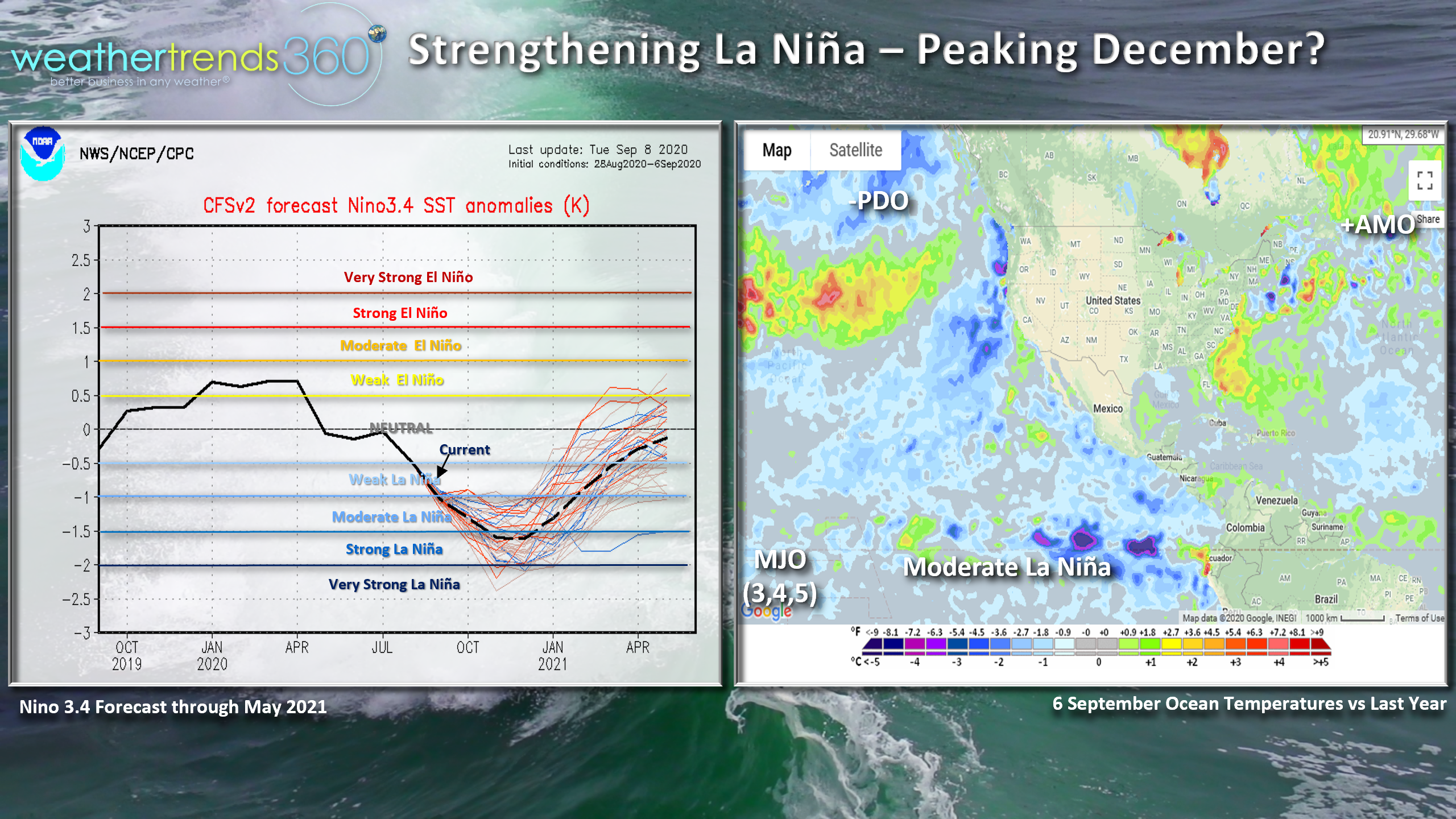
Several climate indices such as La Nina, a negative Pacific Decadal Oscillation (PDO) cycle, a positive Atlantic Multidecadal Oscillation cycle (AMO) and trillions of statistics all suggest the Winter in the U.S. will bring a West to East zonal flow which tends to be wet in the Pacific Northwest, dry in the South and Central U.S. and milder and wetter for the Eastern U.S. Winter overall likely to be a bit colder and snowier than last year's near record warm, not so snowy Winter, but highly unlikely to be the brutal cold and snow some of the Almanac's are hyping up.
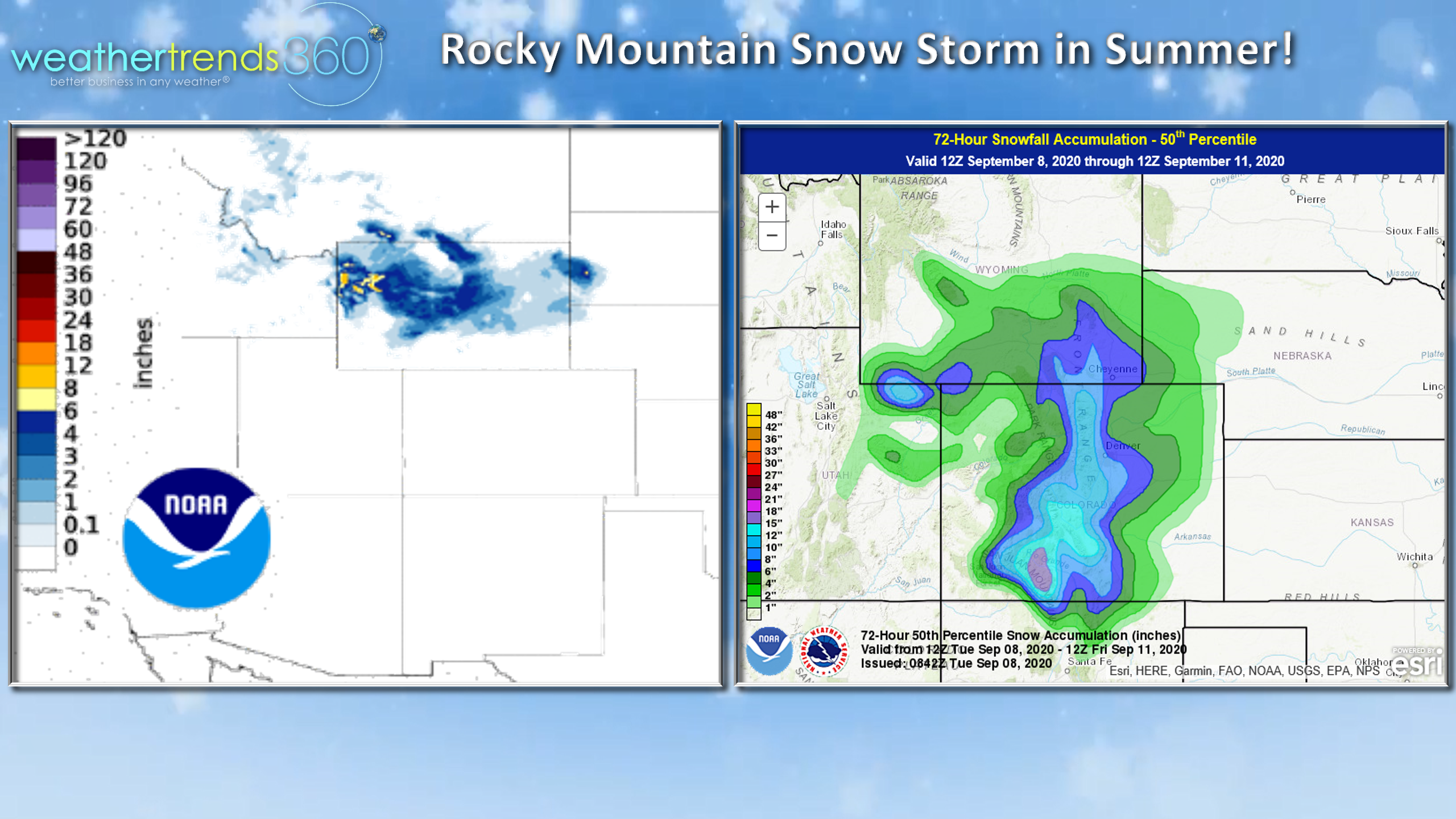
One thing deserving of some hype is the historic Summer snowfall in the Rocky Mountains this week, especially after 100F temps just a couple days ago. Even Denver looks to get a moderate first snowfall but then back to Summer next week.
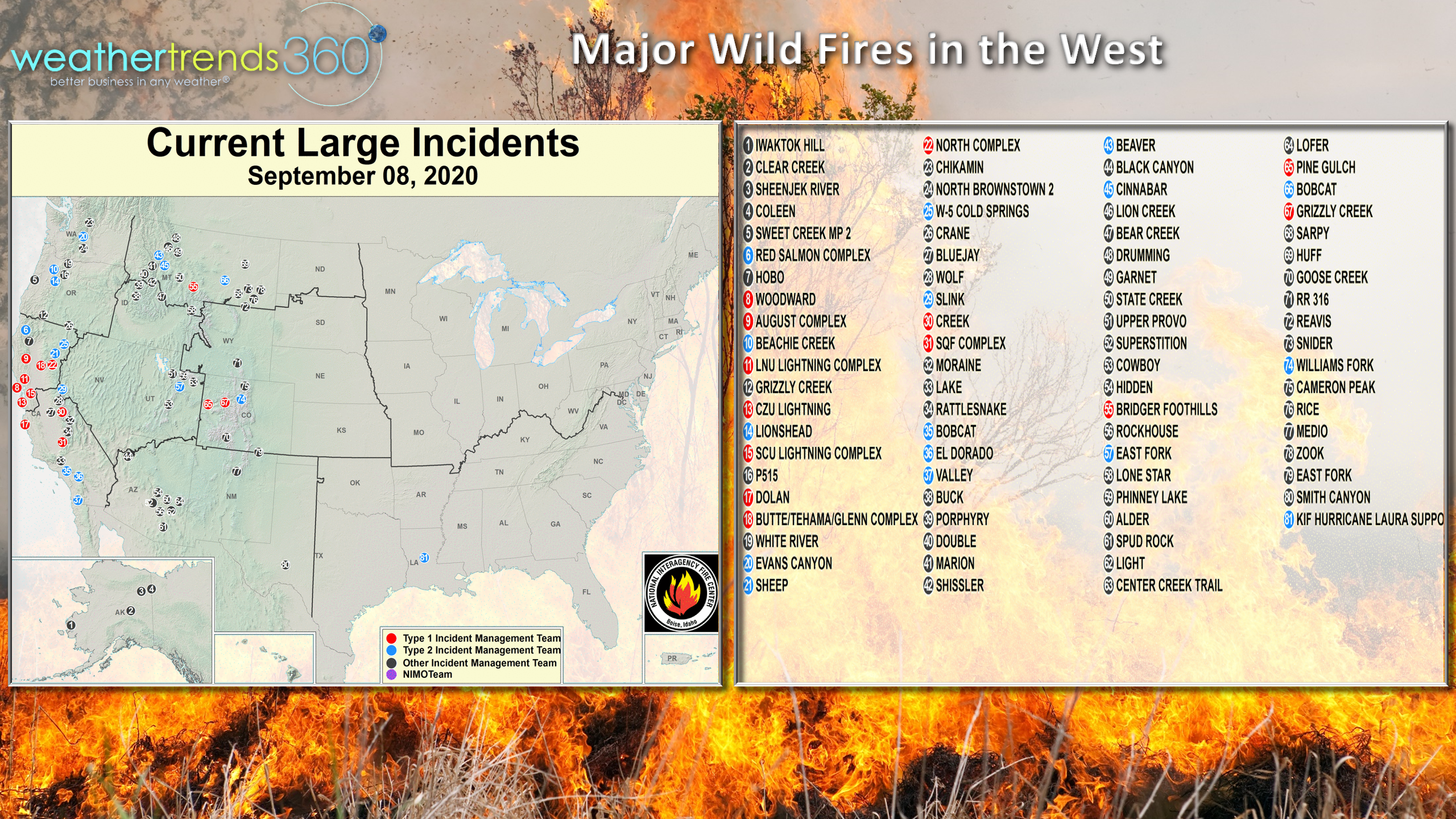
This cold front will also create a brief wind shift in the West that will have wildfires shifting directions making it particularly dangerous for crews battling these big fires in California.
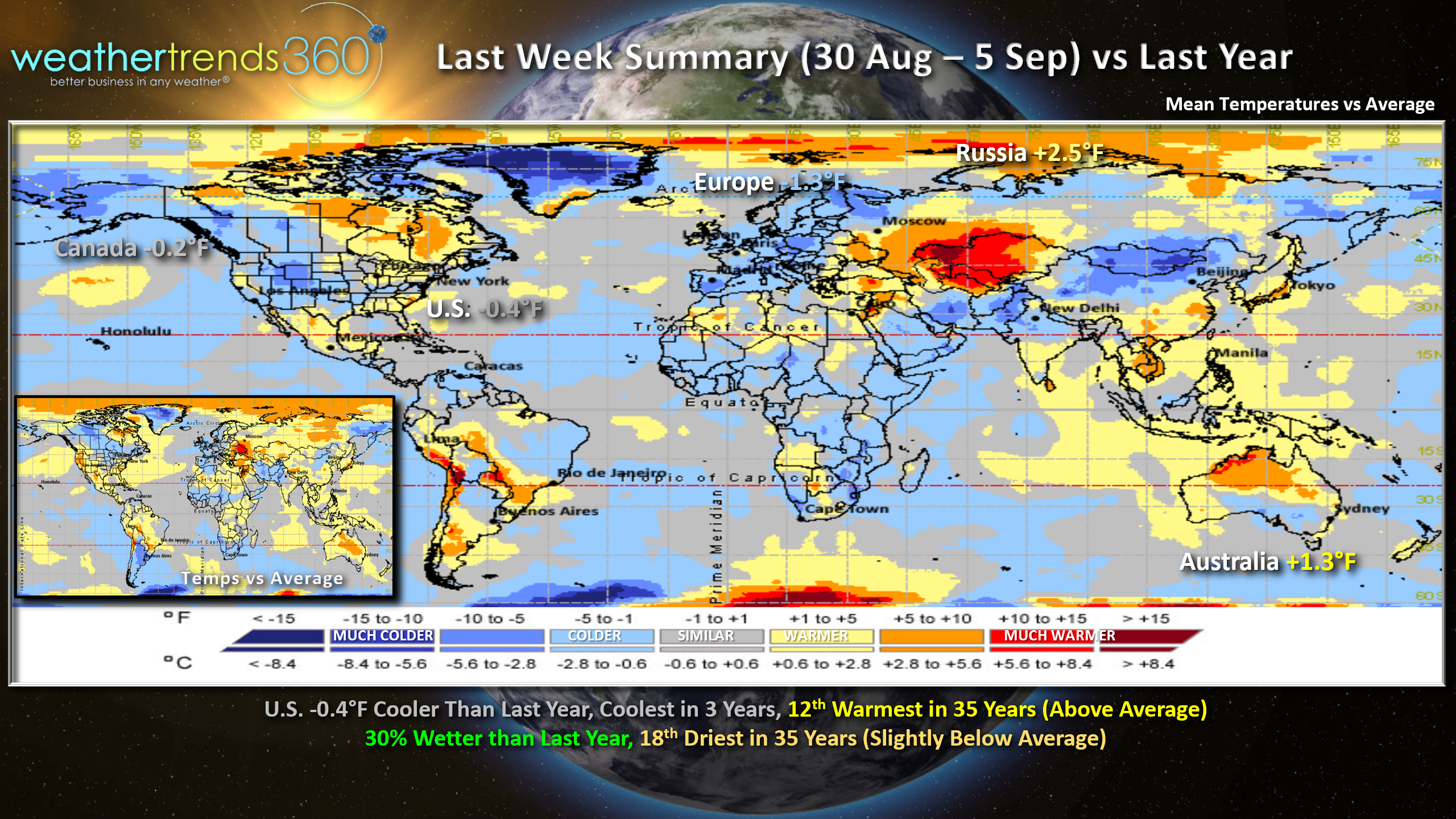
Last week (30 Aug - 5 Sep) across the World showed the U.S. overall trending the coolest in 3 years but still 12th warmest of the past 35 years with rainfall 30% more than a year ago but still below average and 18th driest of the past 35 years nationally.
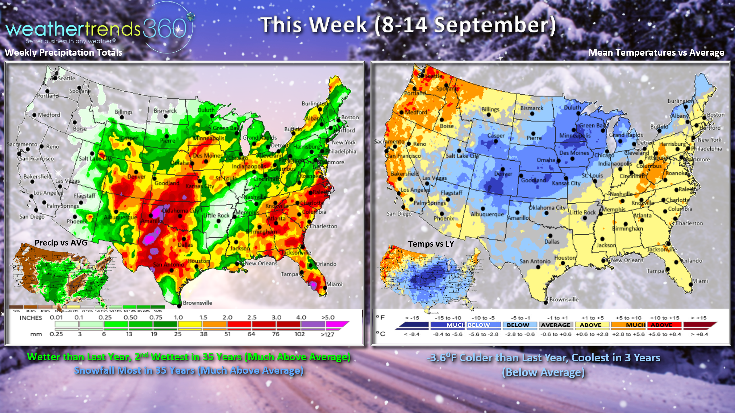
This week (8-14 Sept) the U.S. looks to trend 3.6F colder than last year, coolest in 3 years with slightly cooler than average national temperatures. There are 4 tropical threat areas in the Atlantic but most should remain "fish storms" not impacting land.
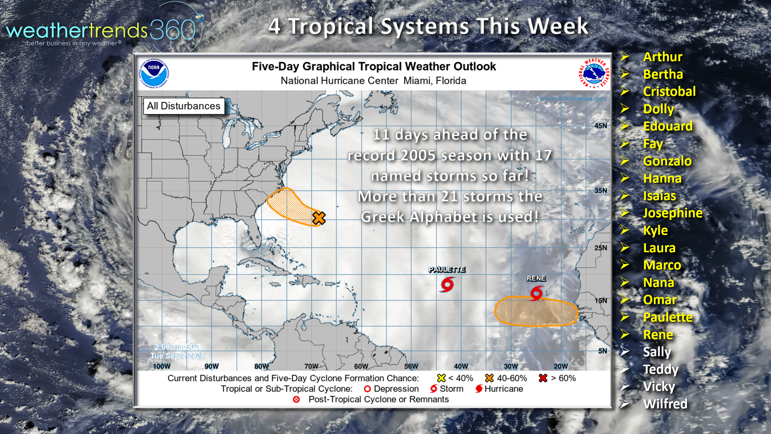
One system could pose a threat to the Middle Atlantic but likely to remain weak if it does develop. Need to watch Africa as there are many waves moving off the continent into the tropical Atlantic over the next few weeks, so the peak of the hurricane season is likely to become very active (latter half of September into much of October. The record fast start continues to outpace 2005, so very likely we're going to run out of "names" on the National Hurricane Center list. Then we'll have to go to the Greek Alphabet for any named systems after "Wilfred".
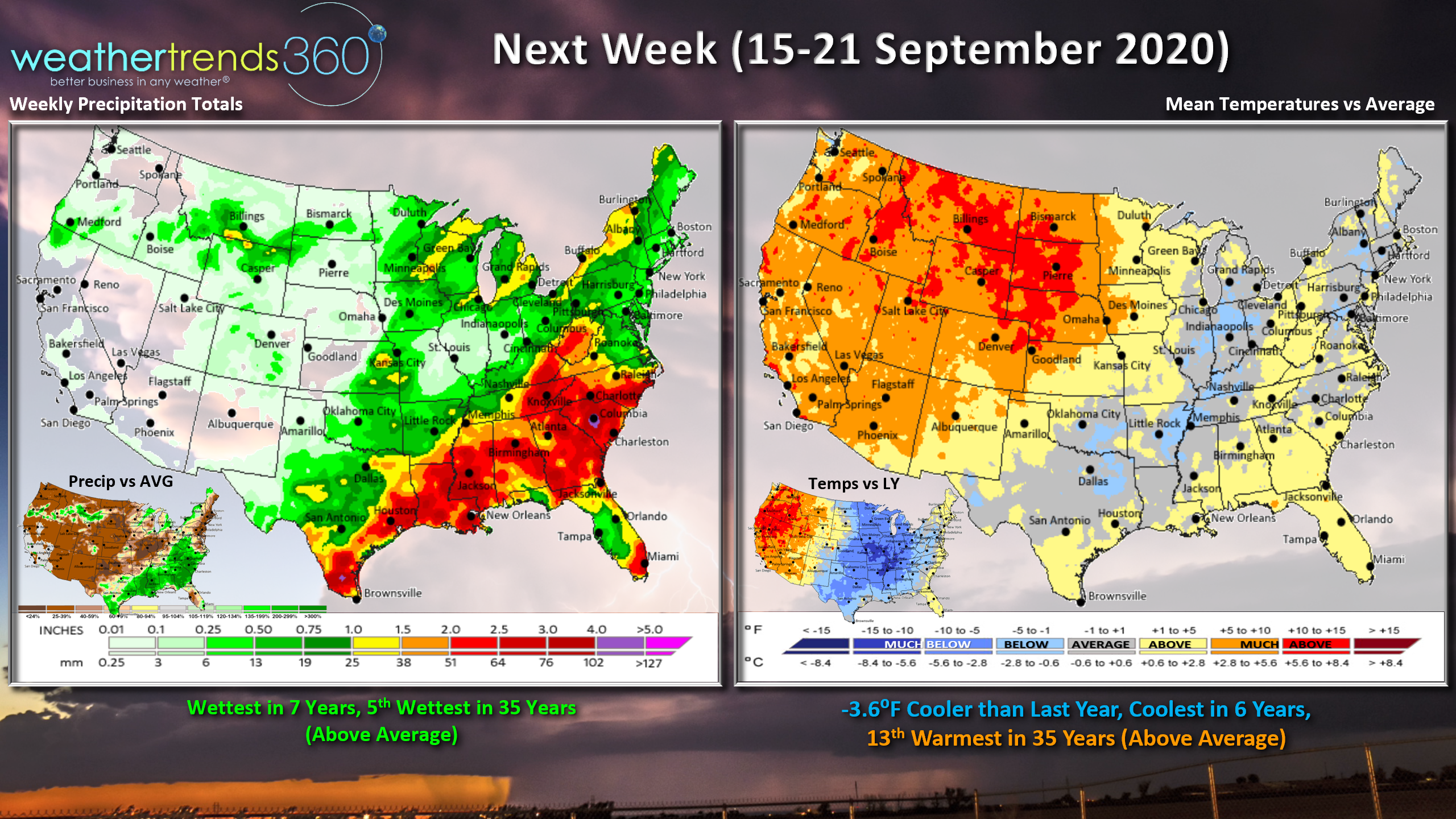
Next week (15-21 Sept) Where it snows this week will be back to Summer-like temperatures in the Rockies next week. The cool weather will abate as it traverses East, but some pockets of cooler conditions. From a year-over-year perspective, the Eastern 2/3rds of the U.S. is still much colder than this period last year with some benefit to early Fall and Back2School merchandise.
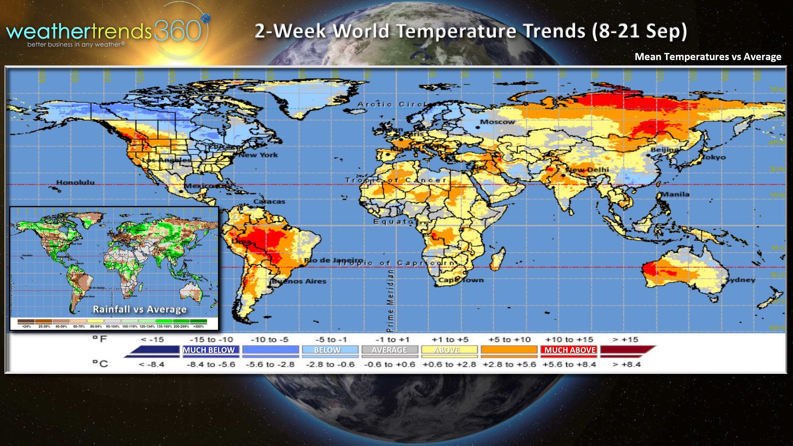
For the World overall, the next 2-weeks (8-21 Sep) show warming conditions across most areas of the world with Canada, Greenland and far Northern Europe the cold spots.
Have a great week and don't forget to follow us on social media for frequent updates: Facebook, Twitter, YouTube, Pinterest and Linkedin
- Captain Kirk out.