Helping Farmers Prepare for La Niña
Did you see the stories in the Wall Street journal last week that said government sources in Australia and NOAA say a 50% chance of La Nina this year. REALLY! Typical government where 50% is a high confidence forecast. How'bout this prediction wt360 made a year ago - moderate to strong La Nina by Summer and if you asked us now we'd say 100% certainty we're headed for strong to potentially near record strong La Nina; weak by June, moderate by July, strong by September and very strong during Winter.
You only need to look below the surface of the Pacific Ocean to see how quickly a massive area covering the entire Pacific Ocean with below normal water temperatures of 3C to 4C below average (5F to 7F below average). This graphic shows the rapid change in just the past couple months with the cold water now reaching the surface near the Galapagos Islands off Ecuador. The once mighty record El Nino is just about vaporized.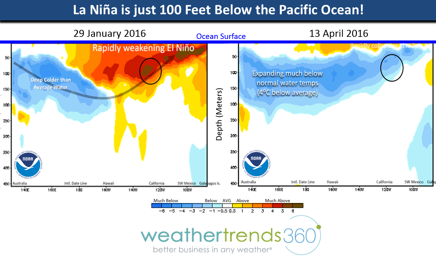
Looking at the surface water temperatures over the past month shows the colder than normal waters now bubbling up to the surface off South America in the Equatorial Pacific Ocean.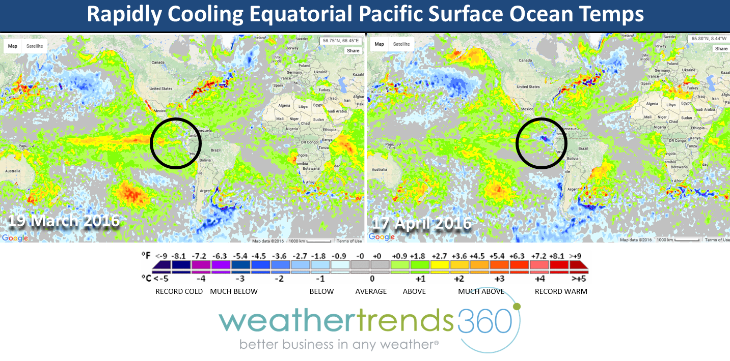 In just one month ocean temperatures in this region have plummeted some 10C (18F degrees colder)
Compared to last year at this time it's very clear the Pacific Ocean temperatures are rapidly cooling and the Easterly winds across the Eastern Pacific Ocean have already set up indicating a La Nina weather pattern is already taking shape. 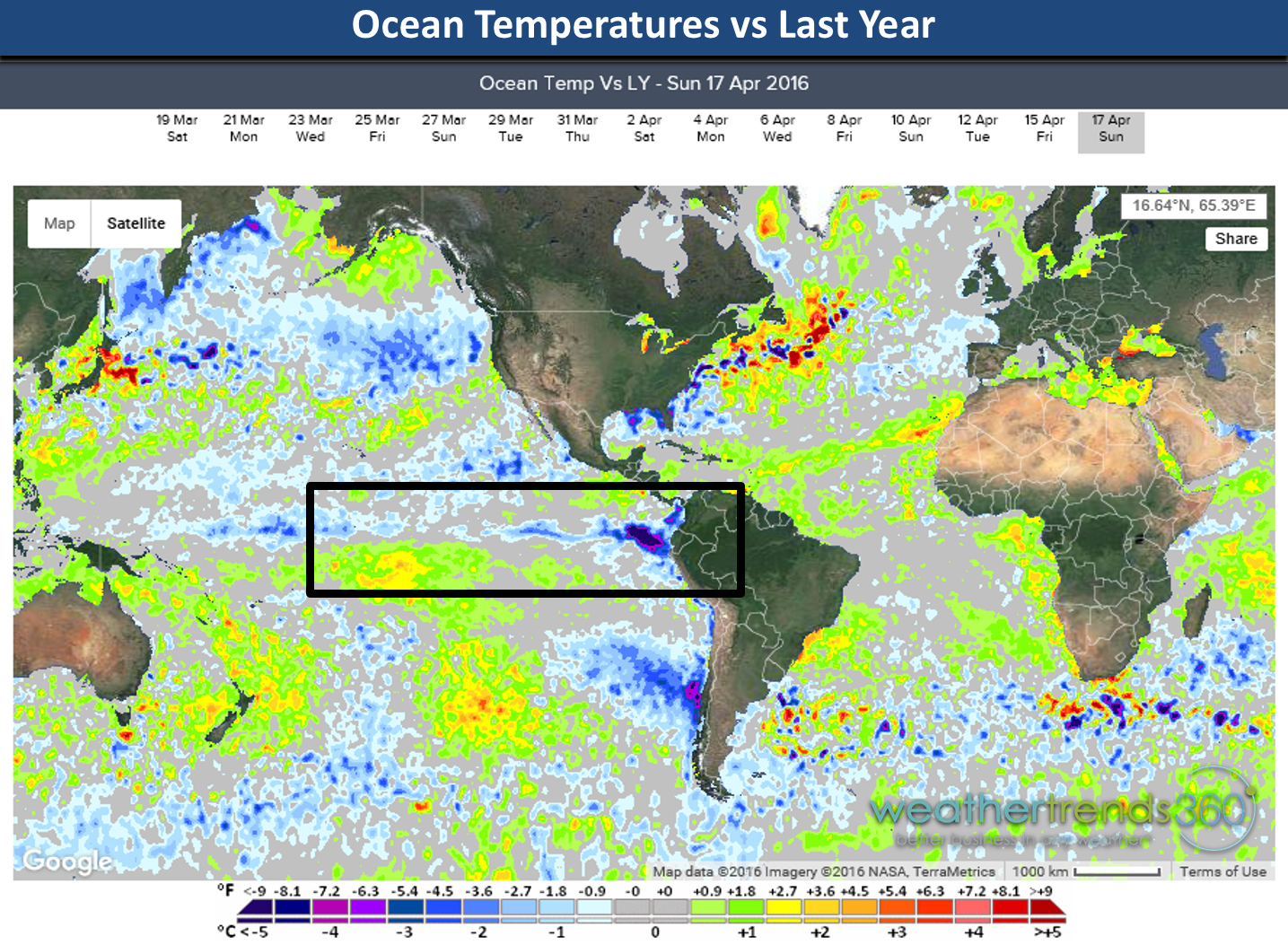
Most of the computer models now show a strong to potentially record strong La Nina in the making. Weak by June, moderate by July and strong to very strong by Fall. Not at all surprising as what goes way up...usually comes way down so very normal to have a record strong El Nino followed by a very strong to near record strong La Nina.
What's it all mean? Well if you just factored in ENSO (El Nino - La Nina cycle) you'd make some really bad long term projections but we factor in 24 and a boat of load of statistics which all say we're headed for a scorching hot/drought Summer in the Midwest and East, a very active hurricane season and then a very cold Fall-Winter. If you watched our Seeds of Success video series you'll see we made many of these projections a year ago including the devastating heat and drought that is plaguing Brazil's corn crop with a big rally likely in June and July this year. See our YouTube page for these videos. 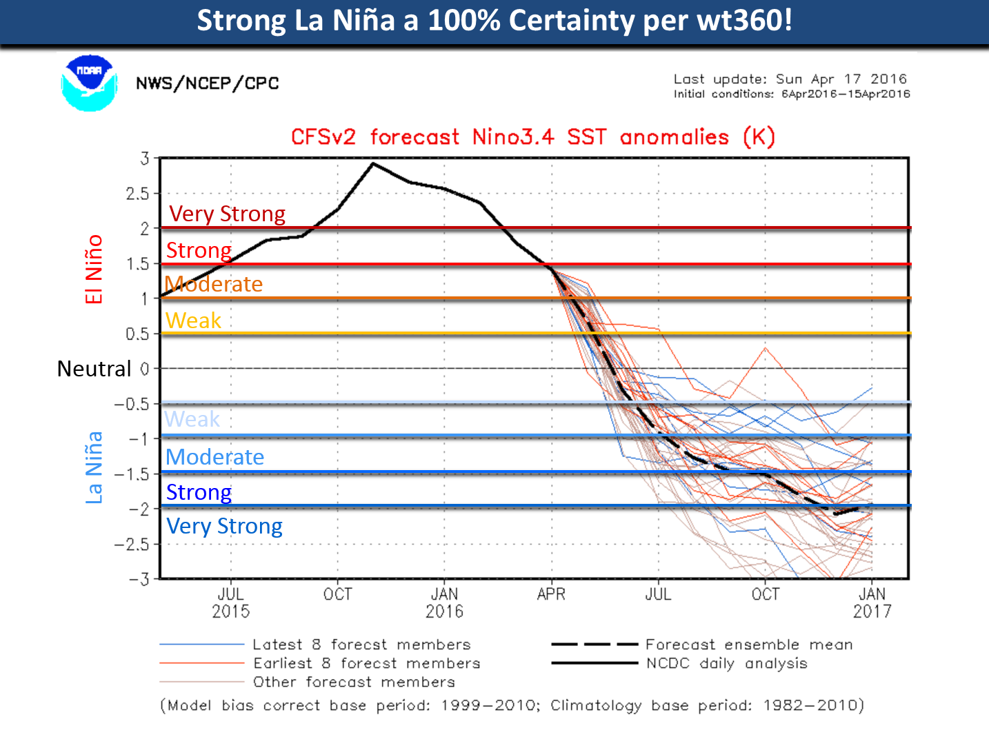
We've warned our farmer clients about this drought and big rally coming for commodity prices and last week we actually helped a local farmer get ready. We installed an elaborate weather station with soil moisture, soil temperature, leaf wetness and other sensors in Farmer Dan's farm to help him optimize his new center pivot irrigation system (aka crop circles). Keeping the corn cool during heat-waves and especially during silking and pollination makes all the difference in how much yield he'll get. We intend to help him get a PA state record yield in a very challenging hot/dry Summer!
- Captain Kirk out.