Star Date: 22 March 2018 Thursday
Spring has certainly come in like a lion for much of the country!
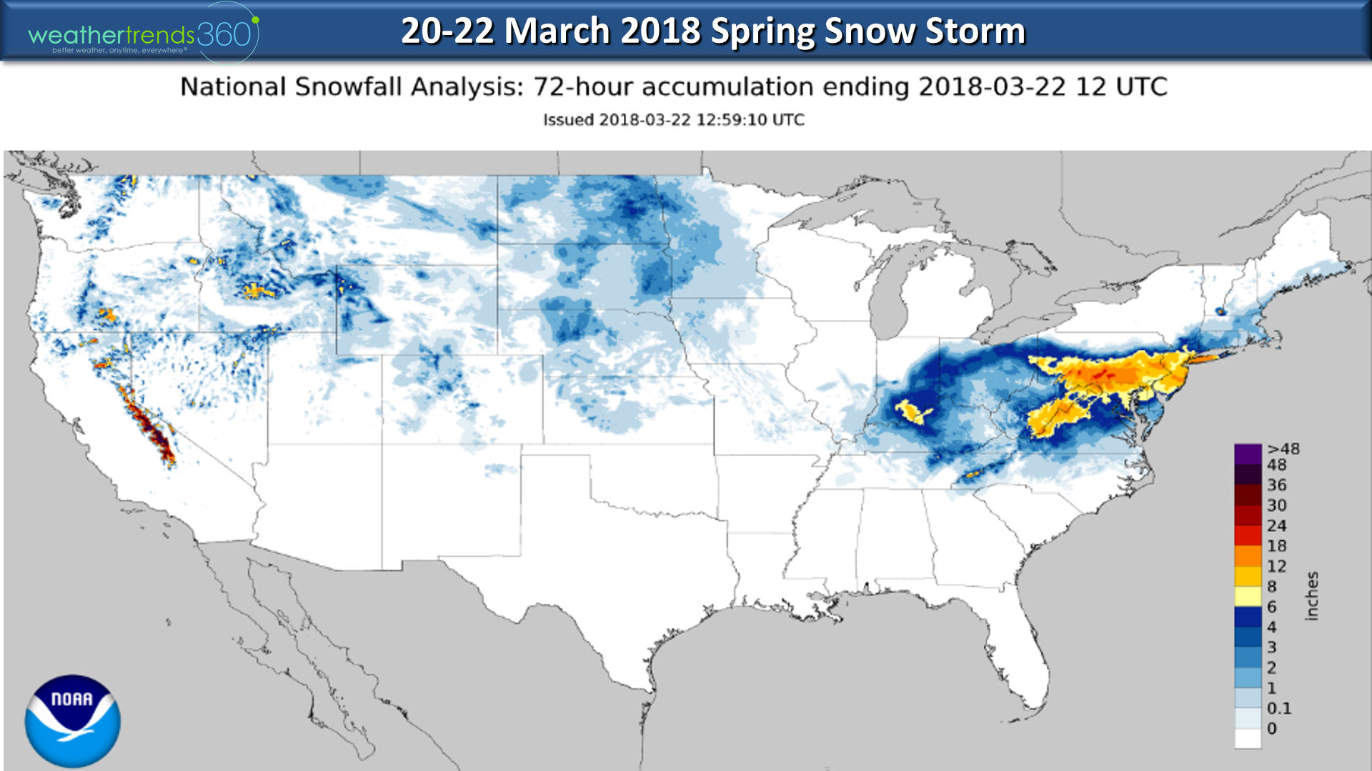
The Spring Nor'easter #4 was a whopper from Virginia to Long Island NY with widespread 12"+ totals and a few up near 20". CLICK ON IMAGES FOR LARGER VIEW. Map below shows storm total snowfall estimates over the past 72 hours.
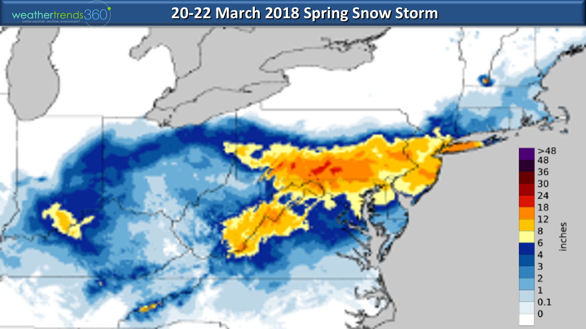
Close up of Northeast snow totals.
PA-NJ snow totals from the NWS.
NY-CT snow totals from NWS.
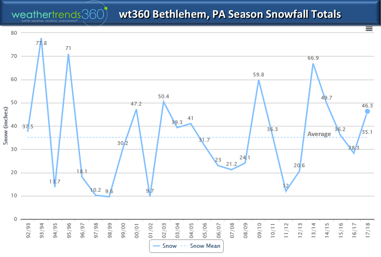
The storm brought our snow totals here in Bethlehem, PA to 46.3", well above average and most in 3 years. If you've read this blog let us know on Facebook and we'll post your seasonal snowfall chart on line.
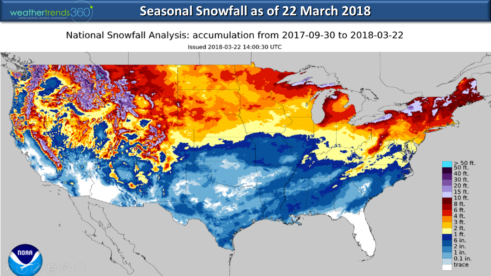
Season to date snowfall according to NOAA shows some record shattering snow totals in Erie PA and other spots in the Northeast.
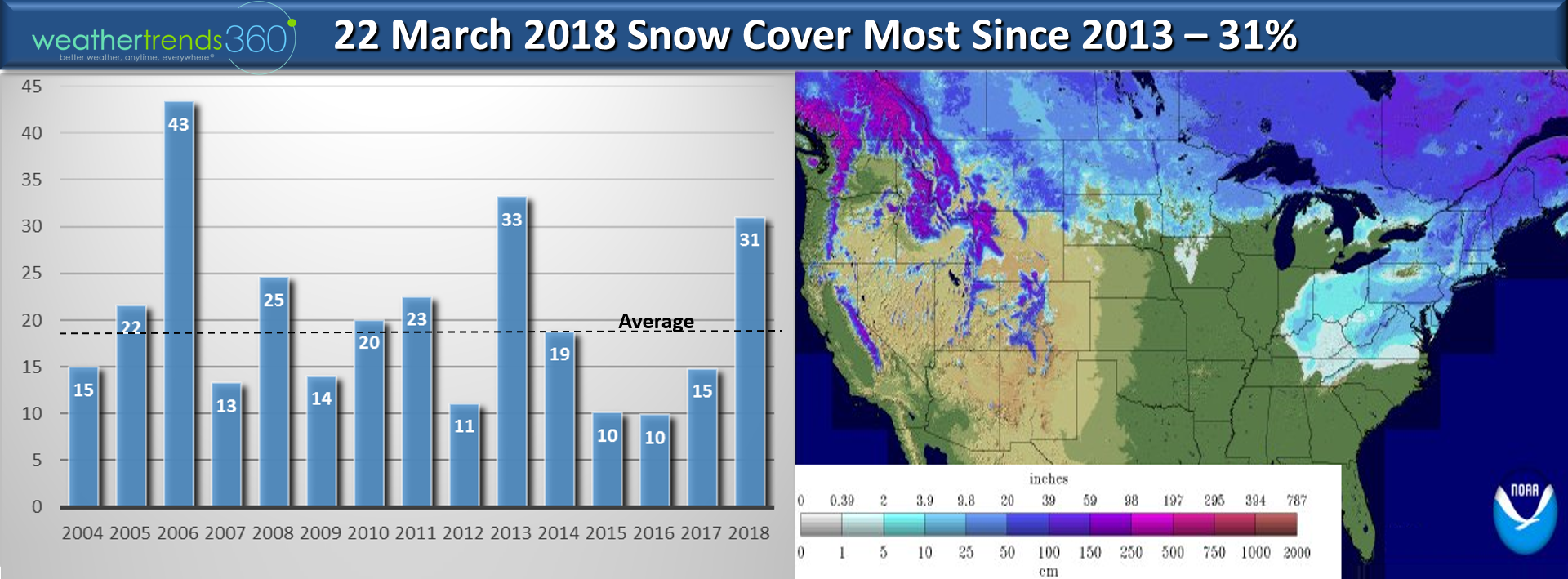
Snow cover across the U.S. is also well above average with 31% of the U.S. still blanketed in snow (most in 5 years) vs only 15% last year.
Ask any meteorologist and they'll tell you it was a childhood storm experience that got them interested in weather...little Angelina Kirk has certainly had some big weather events so far with the 34" record shattering blizzard when she was born in 2016 and now one of the biggest Spring storms on record.

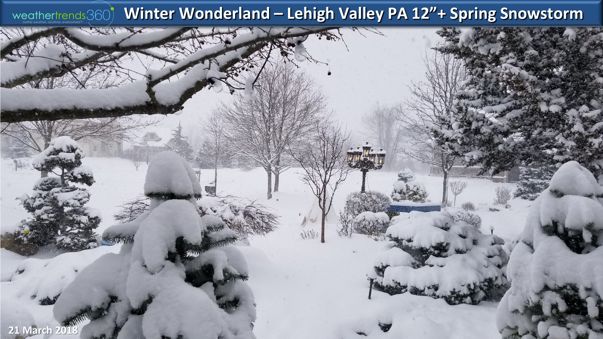
A winter wonderland here in the Lehigh Valley but we're all ready for Spring. Sadly the April outlook looks to bring very cold conditions to much of the Eastern 2/3rds of the country so there is still a good chance for more Spring snowstorms across the Northern half of the country in the weeks ahead!
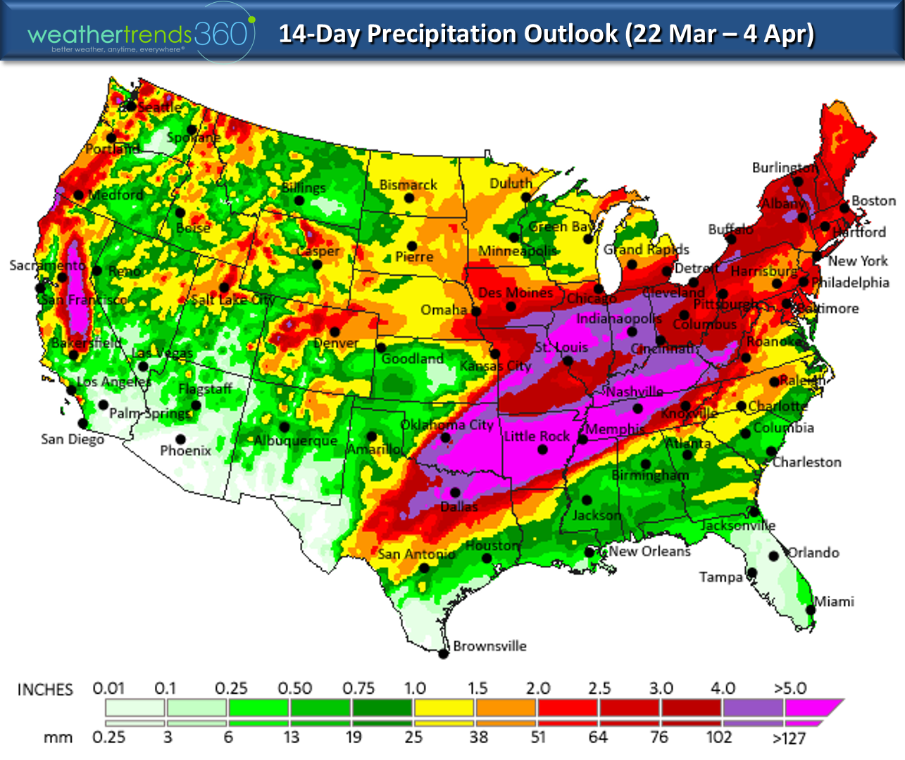
Rainfall and severe thunderstorms over the next two weeks will be a big headline as well so a nasty start to Spring. The slow start to the tornado season is about to get very active in the South Central and Southeast U.S.!
We hope you have a great weekendand follow us on Facebook and Twitter for frequent updates. - Captain Kirk out.