Star Date 4 June 2018 Monday
Happy Monday! :)
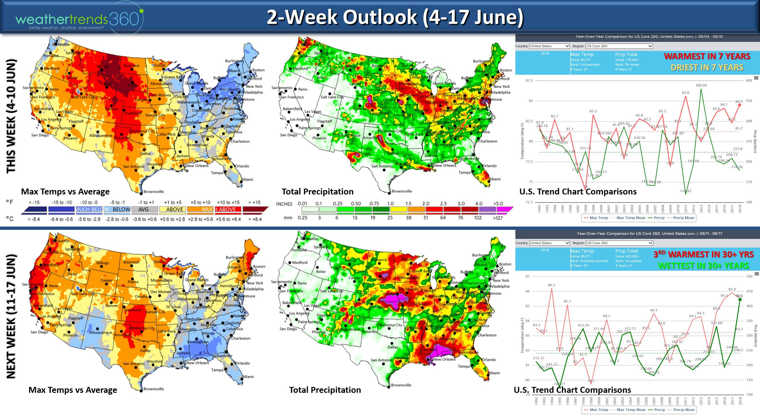
May is officially in the history books and it was a tale of two halves in the U.S. The Eastern U.S. was the warmest and wettest in over 30 years while the Western half was the 4th warmest of the past 30 but the 3rd driest. CLICK ON IMAGES FOR LARGER VIEW. June will also be on the warm/wet side and likely to trend 2nd warmest and 4th wettest of the past 30 years for the U.S. overall with a couple tropical threats.
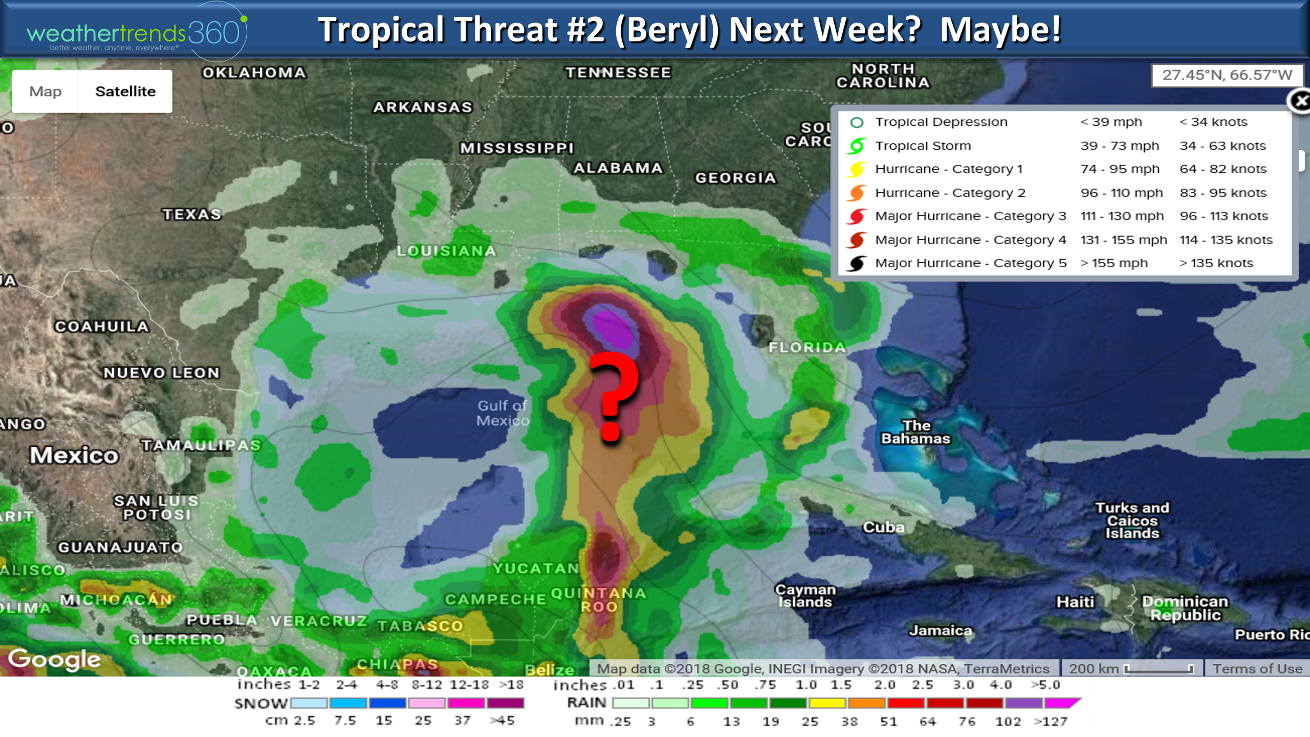
June 1st was the official start of the 2018 Atlantic Hurricane Season and models are already hinting at storm #2 next week for the same general area as Alberto. Way out there in computer model imagination land, but the cycle and conditions are still very favorable for development in the NE Gulf of Mexico.
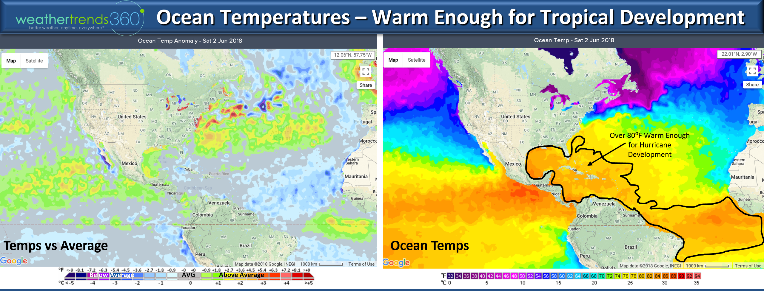
While the main development area forthe Cape Verde season (late Summer hurricane development area) is showing cooler than average water temperatures off West Africa, that doesn't mean the hurricane season will be a dud. In fact, the areas around the Southeast U.S. and Caribbean are plenty warm enough, 80°F ocean temps are favorable for sustaining hurricanes, so the season has a long way to go. Our major risk areas are Florida, Bahamas and the East Coast up to New Jersey this season.
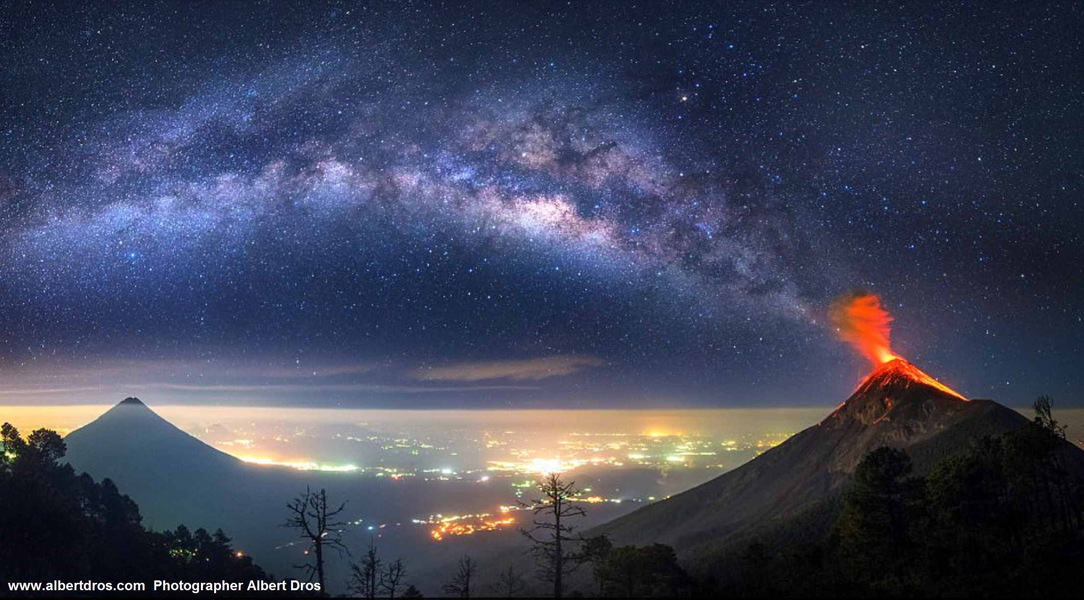
The other big news was the Guatemala volcanic eruption yesterday. The "ring of fire" in the Pacific is pretty active and that is worrisome for bigger Earthquakes which would include California. Photographer Albert Dros likely captured the most spectacular photo of the Fuego Volcano eruption.
We hope you have a great week. Follow us on our social media pages and see what 106,502 fans like about wt360:Facebook, Twitter,YouTube, Pinterest and Linkedinforfrequent updates. - Captain Kirk out.