Captain's Log 13 January 2020 Monday
Captain's Log
Happy Monday! :)
If you've been under the weather this season there is hope on the horizon! The FLU season may have peaked with an early intense season that was very different than last year. CLICK ON IMAGES FOR A LARGER VIEW.
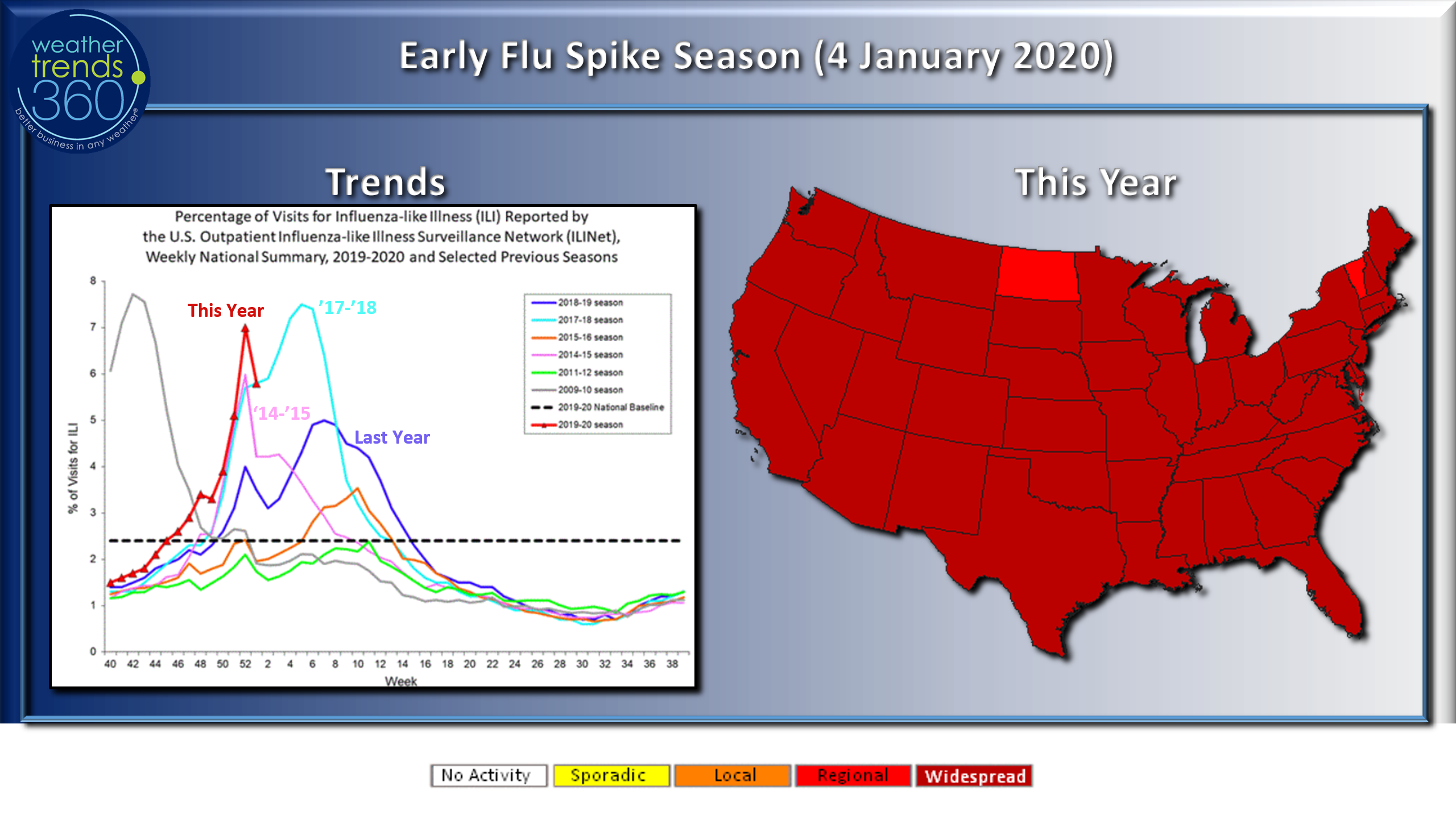
According to the CDC the very early spike in peak FLU activity may be starting its annual downward trend and hopefully not a repeat of the very intense 2017-2018 season and more like the 2014-2015 season. Last year the season was more of a slow gradual dome season that didn't peak until late February. Often overlooked, but widespread FLU in the December time-frame does have a negative influence on retail sales; that may have hurt some last month to the benefit of on-line sales.
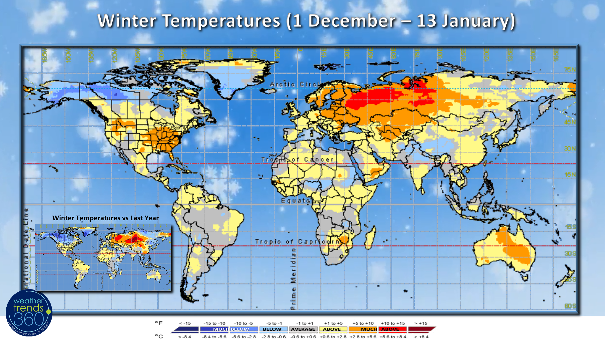
Winter (1 December - 13 January) is almost through the half way point of the season and it's been warm for many. The few cold spots have been more toward the Arctic Circle up in Alaska, Northwest Canada, Greenland and parts of Northeast Siberia.
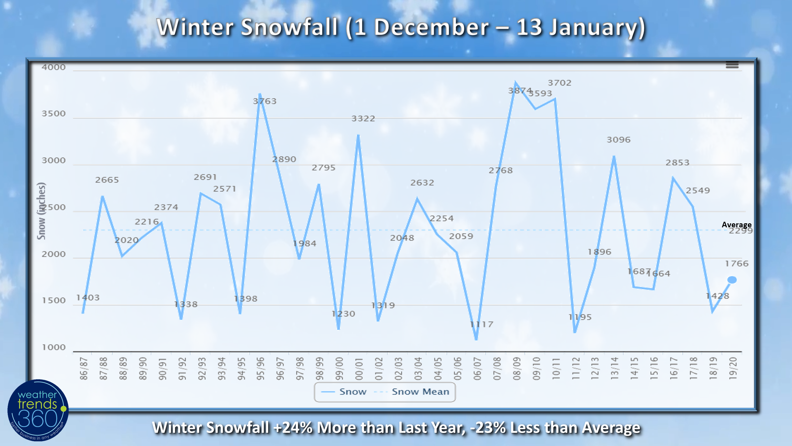
U.S. snowfall for the Winter months has been 24% more than last year but still 23% below average for the 1 December - 13 January period.
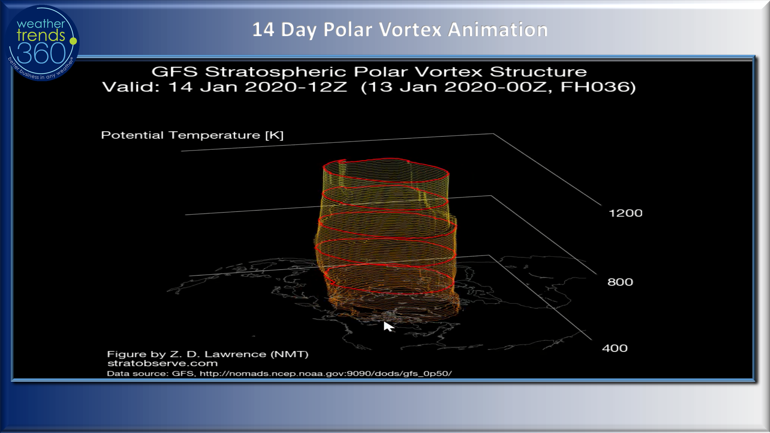
The Arctic region has been near normal trending at -17F below zero vs a typical season of -20F due in part to a very symmetrical and steady polar vortex. But that might be changing a bit with some wobbles noted in the recent 14-day outlook.
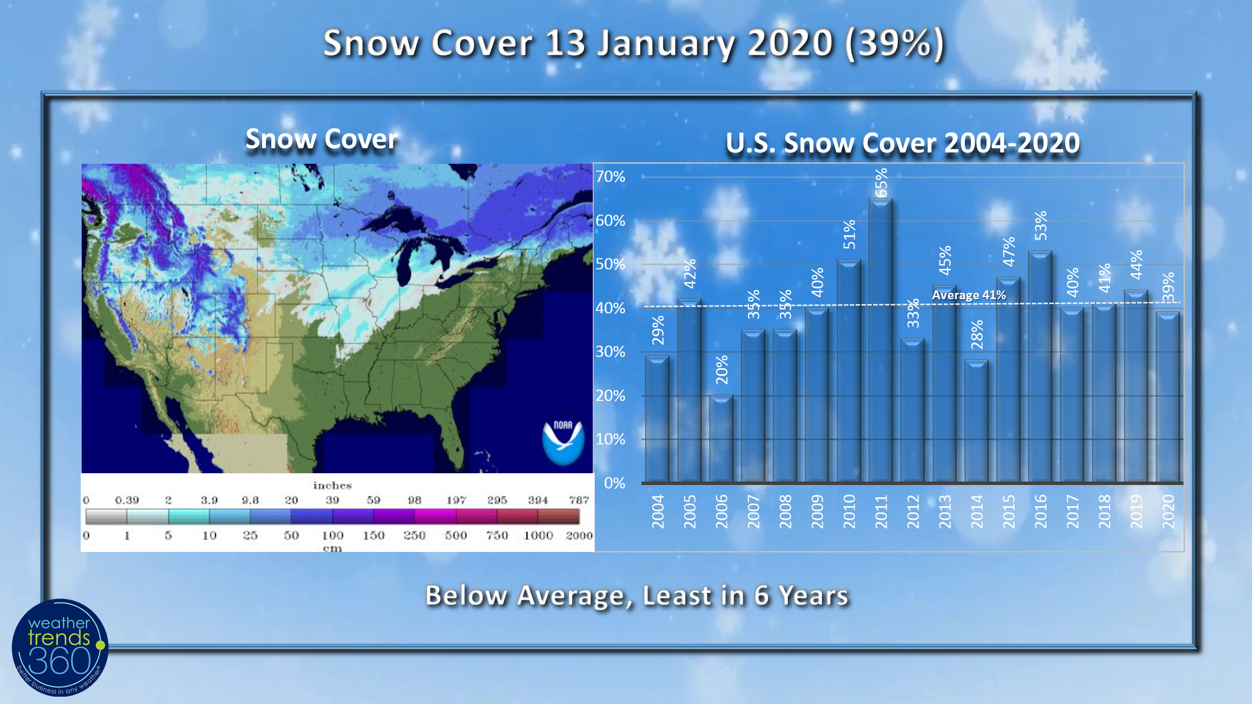 U.S. Snow Cover this morning (13 January) remains below average with 39% of the U.S. blanketed in snow, least in 6 years. But the 6-day snowfall outlooks shows a very snowy week ahead and even the Northeast may finally get their 1st bigger snow storm of the season this weekend.
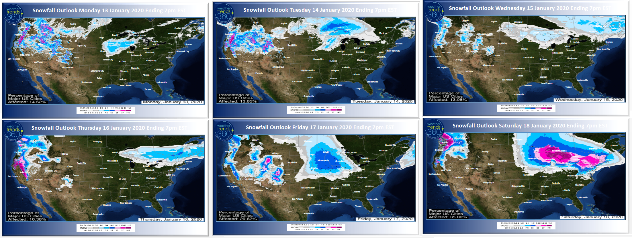
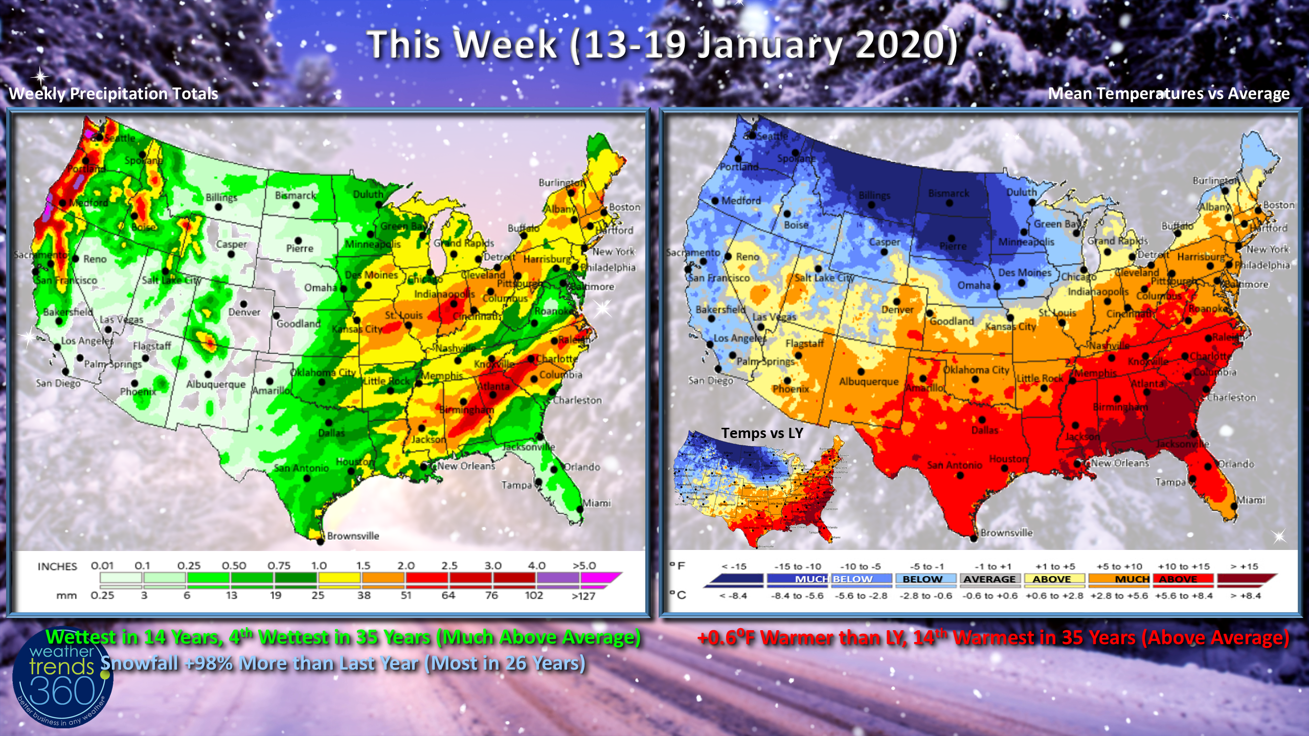
This week (13-19 January) shows very warm conditions in the Southeast but signs of cold intrusions for the Northwest and Upper Plains of the U.S. The West Coast looks to get a bigger rain and mountain snow event with rainfall well into South Central California. For the U.S. overall the week looks to trend +0.6F warmer than last year and 14th warmest of the past 35 years (above average) with rainfall trending the most in 14 years and 4th wettest of the past 35 years. Snowfall looks to be a whopping 98% more than last year with the late week Northeast snow threat making the week the snowiest in 26 years.
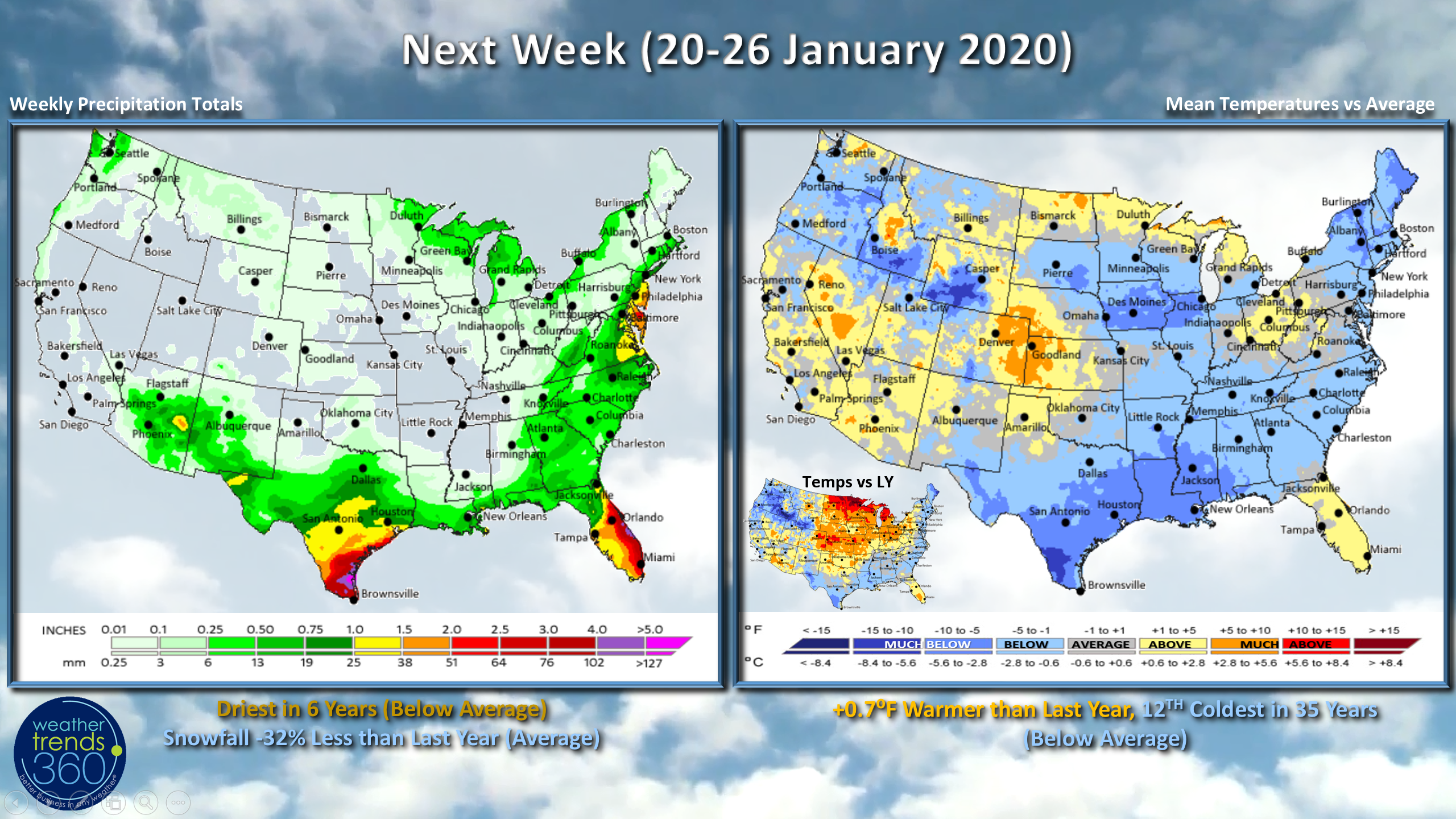
Next week (20-26 January) A colder drier pattern with the U.S. just a tad milder than last year but still 12th coldest of the past 35 years. A good Winter clearance opportunity and likely a peak week for auto battery sales and other Winter weather accessories. Precipitation is driest in 6 years and below average while snowfall is closer to average but still 32% less than last year.
We hope you have a great week and don't forget to follow us on social media for frequent updates. Facebook, Twitter, YouTube, Pinterest and Linkedin
- Kirk out