Captain's Log 15 June Warm/Dry La Nina Pattern
Captain's Log
Happy Monday. :) Only 5 days 8 hours 7 minutes 6 seconds until SUMMER!
We'd like to welcome two new employees to the wt360 family, Ed McClain EVP Sales & Marketing and Jon Heese Sr. Systems Engineer. We're very excited to have them on board even in these difficult times with everyone remote. CLICK ON IMAGES FOR A LARGER VIEW

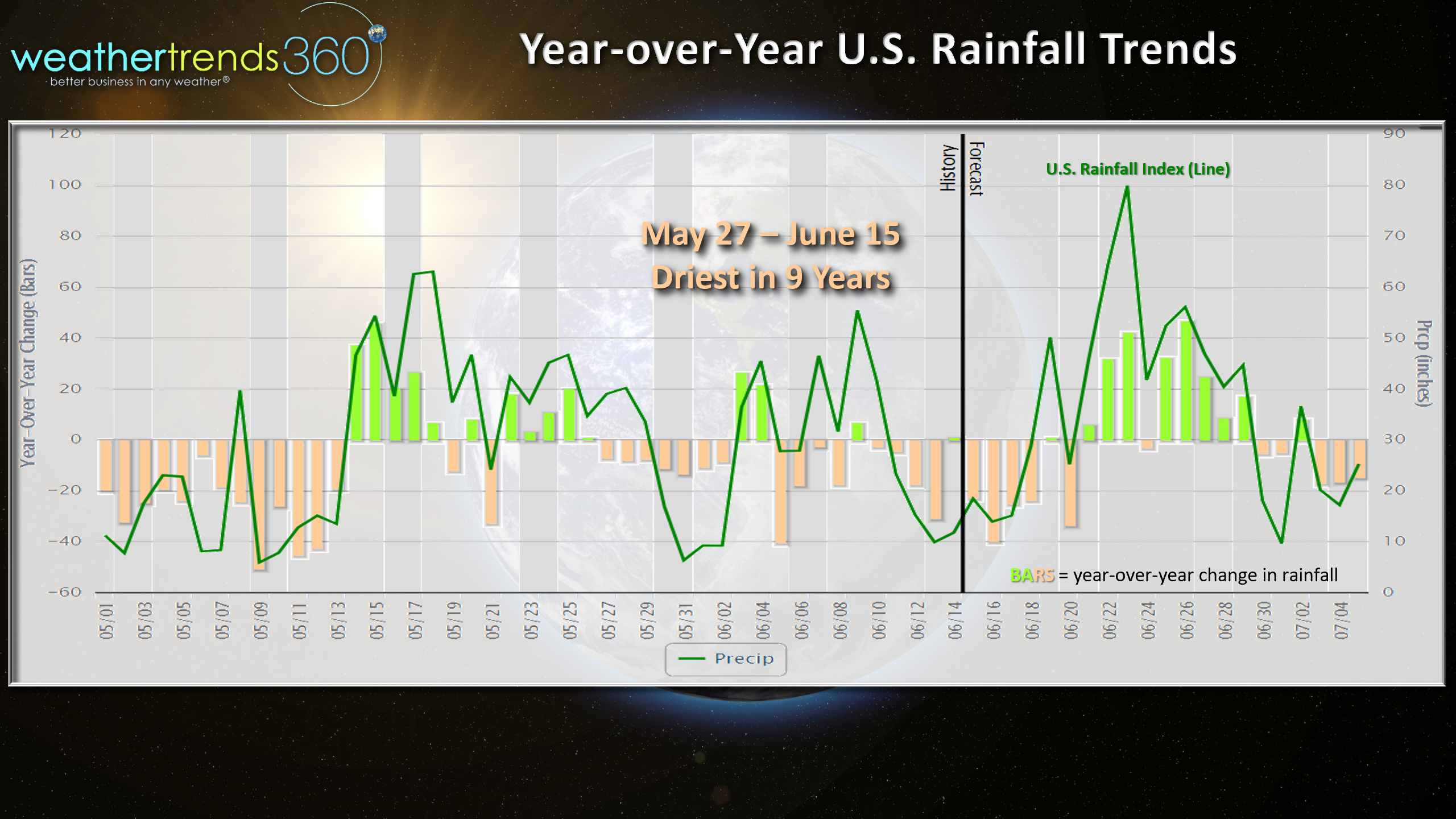
The weather pattern here in the U.S. shows a pretty big flip flop from a year ago with the past few weeks trending much warmer than last year, 5th warmest in 35 years and driest in 9 years nationally.
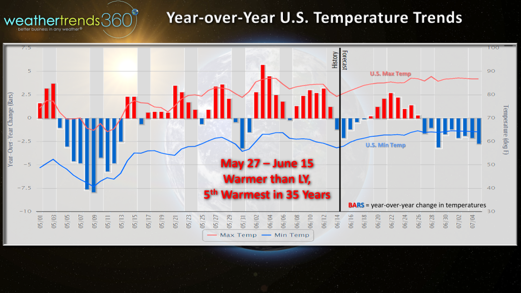
This same period (27 May - 15 June) last year was the coldest in 10 years and wettest in 3 so the warmer/drier trends are very favorable for seasonal merchandise sales, especially lawn and garden, outdoor decor and pool supplies.
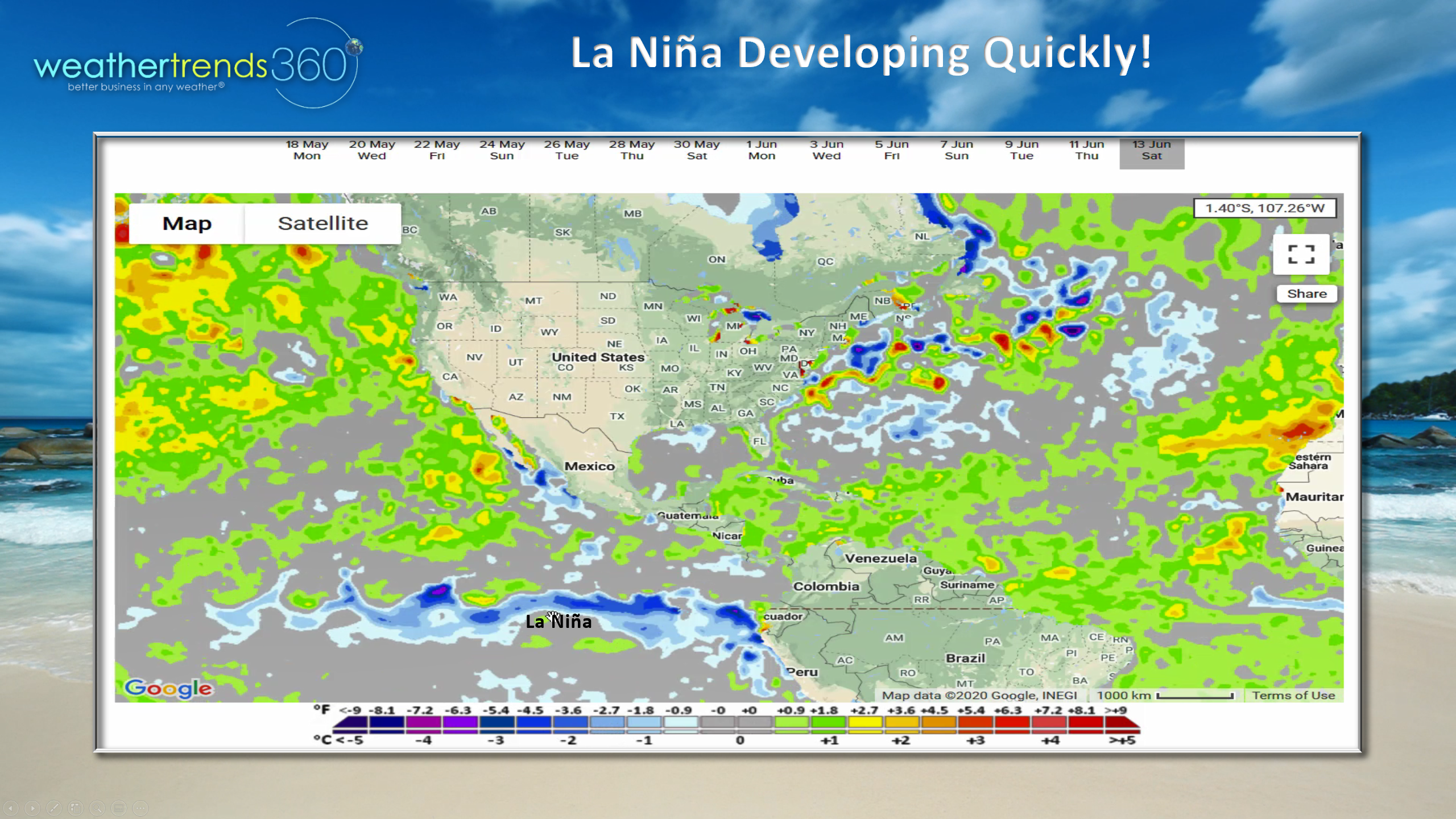
One reason for the warmer/drier trend is the developing La Nina pattern among other shifting cycles. The Equatorial Pacific Ocean shows a dramatic cooling trend with well below average water temperatures bubbling to the surface in just the past couple weeks.
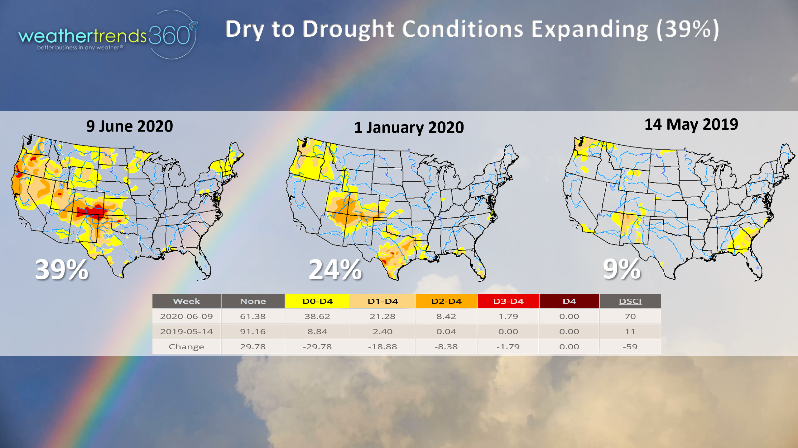
This in part explains why the U.S. is starting see drier conditions. In May last year the U.S. had the least drought in decades with only 9% of the country dry to drought-like and that has now jumped to 39%. We expect this trend to continue going to 50% by year end and possibly as high as 55% by Spring 2021 next year!
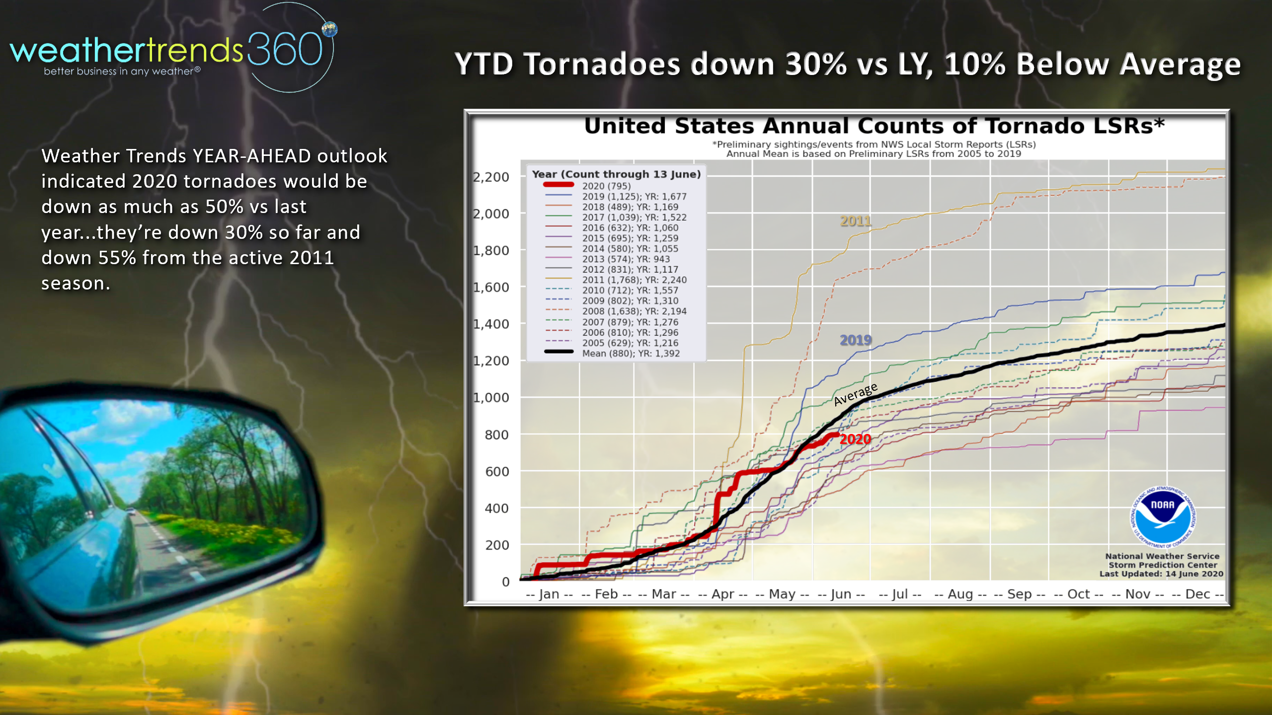
The drier cycle also has tornadoes down 30% from last year and 10% below average as WTI predicted a year ahead. Compared to the epic season of 2011, we're down a whopping 55%.
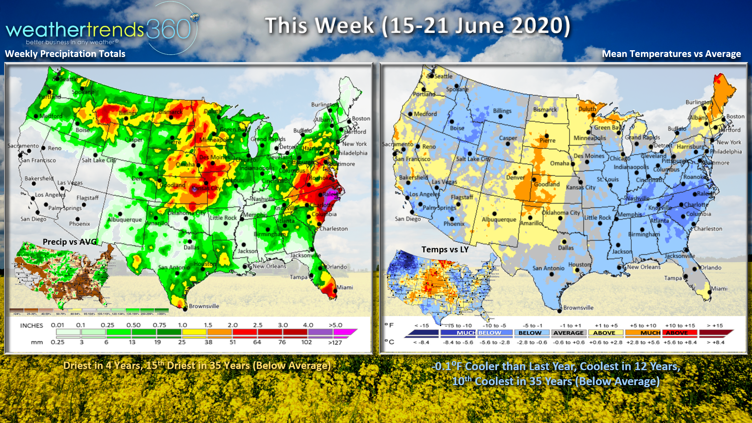
This week (15-21 June) trends just -0.1F cooler than last year making it the coolest in 12 years and 10th coolest in 35 years. But, the cool start with end with a much warmer period as we go through the week into the Father's Day weekend. Rainfall is the least in 4 years and 15th driest of the past 35 years. Summer officially arrives 5:44pm EDT on Saturday.
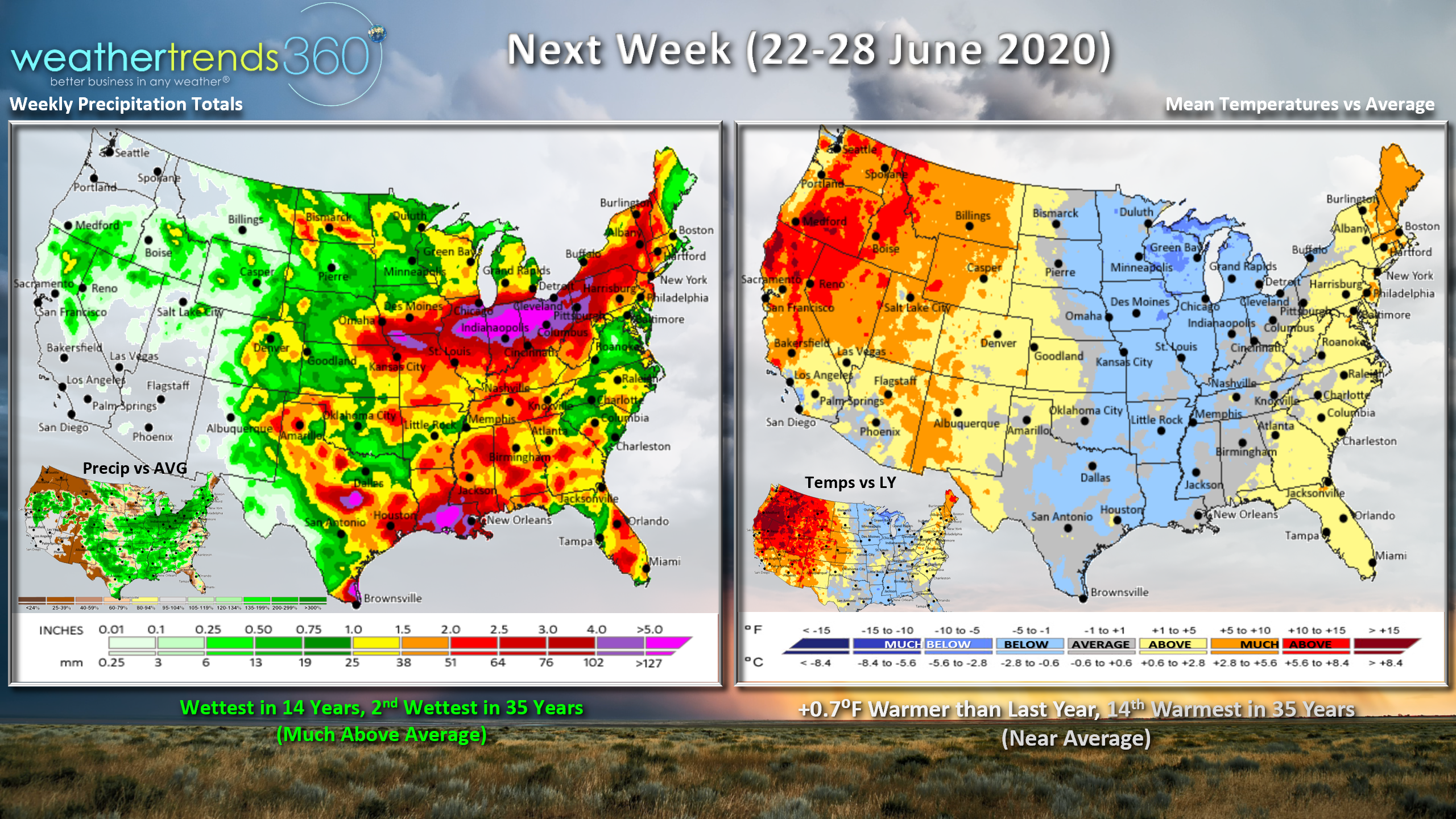
Next week (22-28 June) trends +0.7F warmer than last year and 14th warmest of the past 35 years with near average conditions for the U.S. as a whole. The West is the hot spot while the Central is the cool spot and warmer right along the East Coast. Rainfall could become a bit heavier after 4 weeks of drier weather with potentially the wettest conditions in 14 years, 2nd wettest in 35 years. The tropics might flare up again with a potential system for SW Texas but way out there in model imagination land. But tropics need to be watched as the season will be extremely active and devastating. Already the fastest start in over 165 years with 3 named systems.
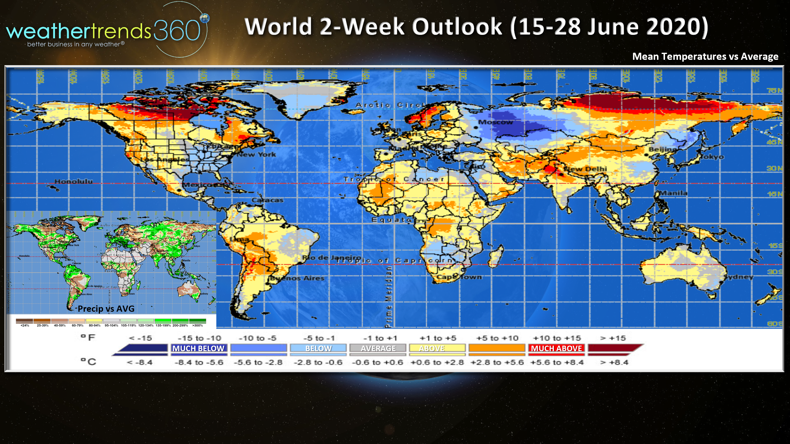
The world 2-week World outlook (15 -28 June) shows warm and wet conditions across Europe, cool and wet across the Mediterranean, cool/dry for Western Russia but warm for Siberia.
Have a great week and don't forget to follow us on social media for frequent updates. Facebook, Twitter, YouTube, Pinterest and Linkedin
- Captain Kirk out.