Captain's Log 20 Jan '20 Monday
Captain's Log
Happy Monday & Martin Luther King Jr. Holiday! :)
A glancing shot of the Polar Vortex invaded the U.S. but it's lifting out midweek followed by a much milder pattern for most of the country. CLICK ON IMAGES FOR A LARGER VIEW.
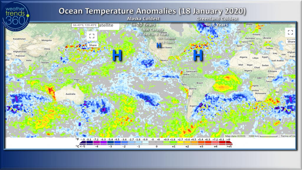 The Winter weather pattern this Winter can be explained by a few bigger features. The first has been a warm "blob" of water North of Hawaii that has allowed colder air to invade Alaska, NW Canada as opposed to the U.S. overall. When the blob is closer to Alaska and the West Coast, the cold weather is then more likely to head toward the Central and Eastern U.S., not this year. Alaska is having the coldest front half of Winter in 20 years, Greenland 8 years, NW Canada 6 years and North Dakota 3 years while much of the U.S. has been overall mild.
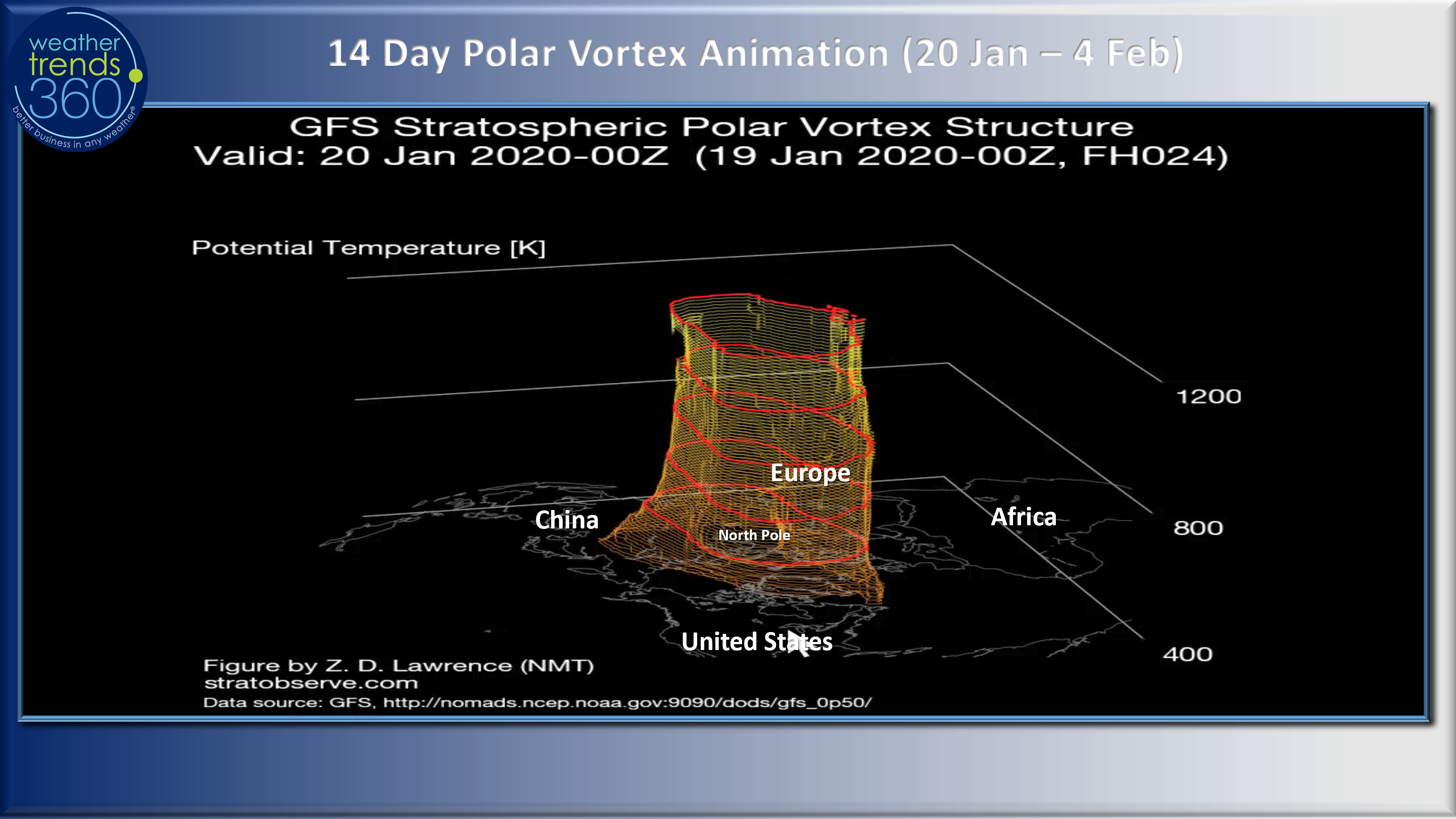
The Bermuda high in the Atlantic has been relentless not allowing cold air to stay very long in the Eastern U.S. keeping it bottled up in Greenland. The Equatorial Pacific is more La Niña like (colder) than a true weak El Niño (warmer). The final piece has been a very symmetrical Polar Vortex over the North Pole that hasn't moved much or wobbled thereby not allowing Arctic intrusions to dip too far South. We did get a bit of a fragment of the vortex this week but already signs it's lifting out. May return in a few weeks, briefly.
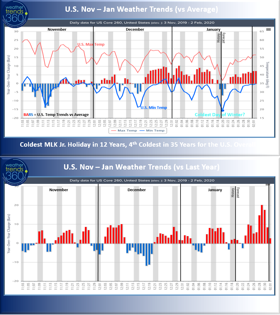
Fortunately, there have been several cold snaps in November and December, even the week before Christmas and now here over the MLK Jr. holiday weekend to help drive seasonal merchandise sales. From this point forward, warmer and drier weather is typically better for most retail outlets well into August. On-line e-commerce sales typically do better in extreme weather, cold, snowy, wet, etc.
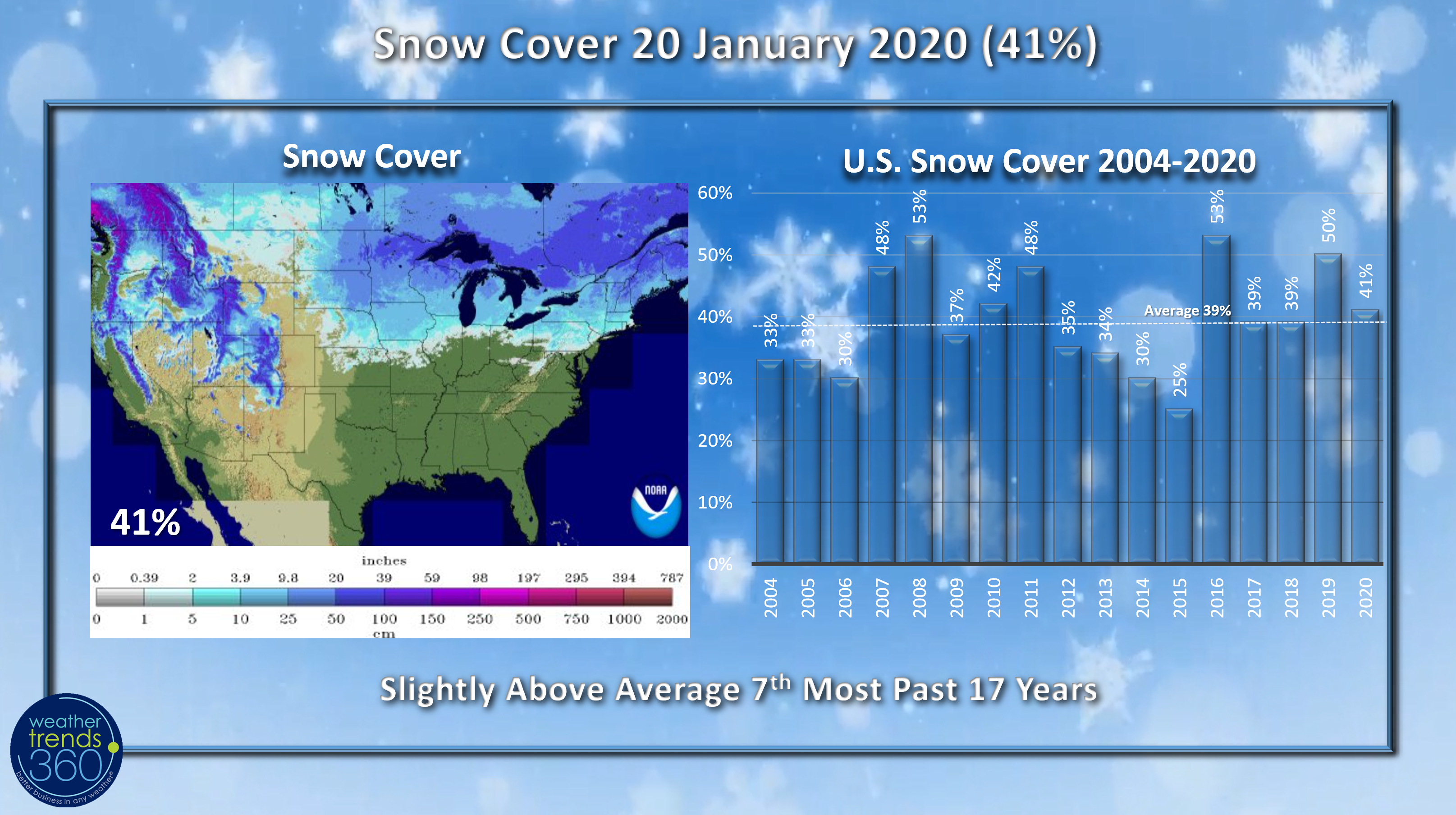
Snow cover this morning was already diminishing a bit, but today there is 41% of the U.S. with snow on the ground, a tad above average.
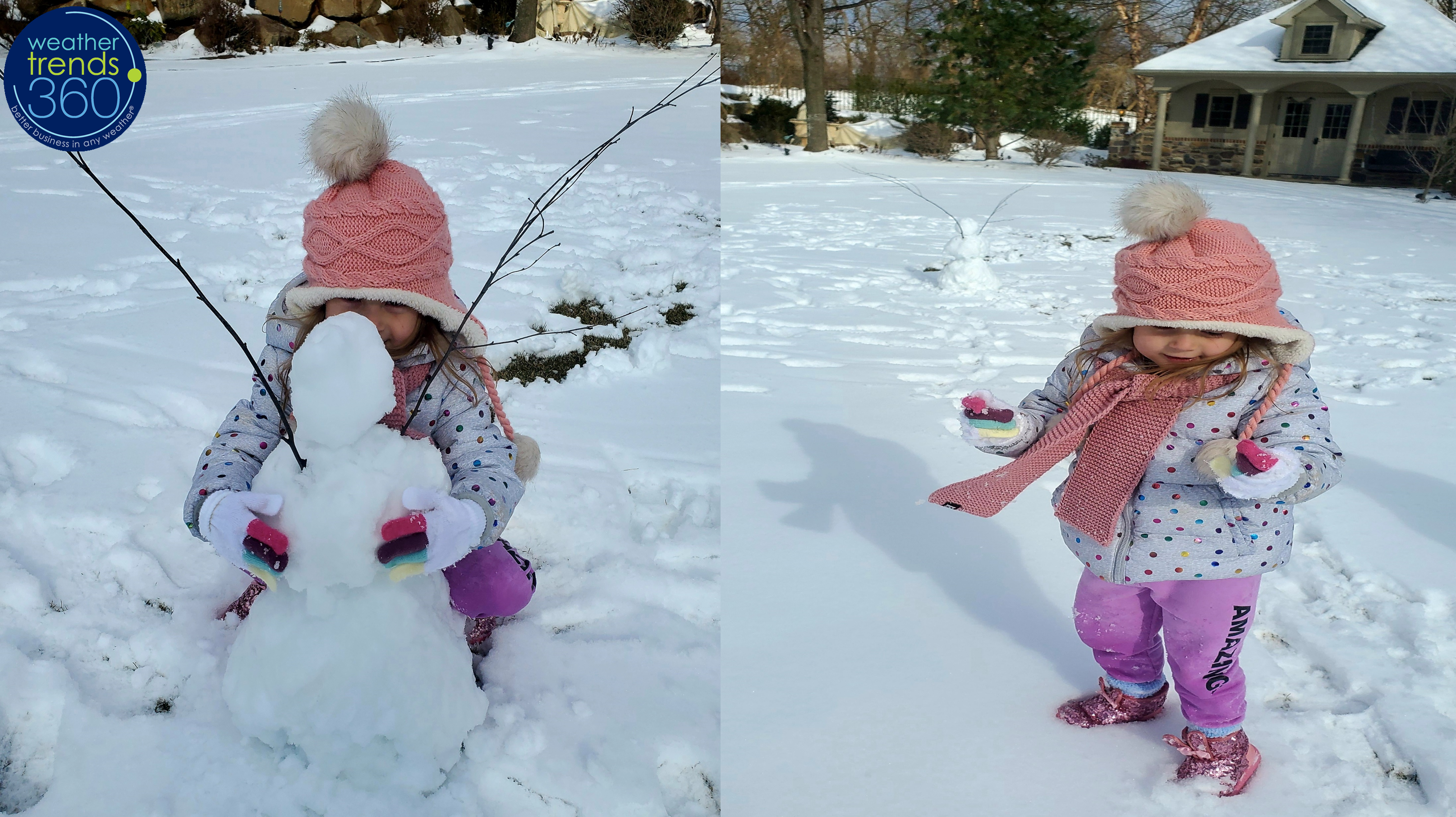
We enjoyed our first plowable snowstorm (only 3") this weekend to make a "snowgirl"...the younger you are the more likely you love snow which was certainly the case with the little Angelina Kirk.
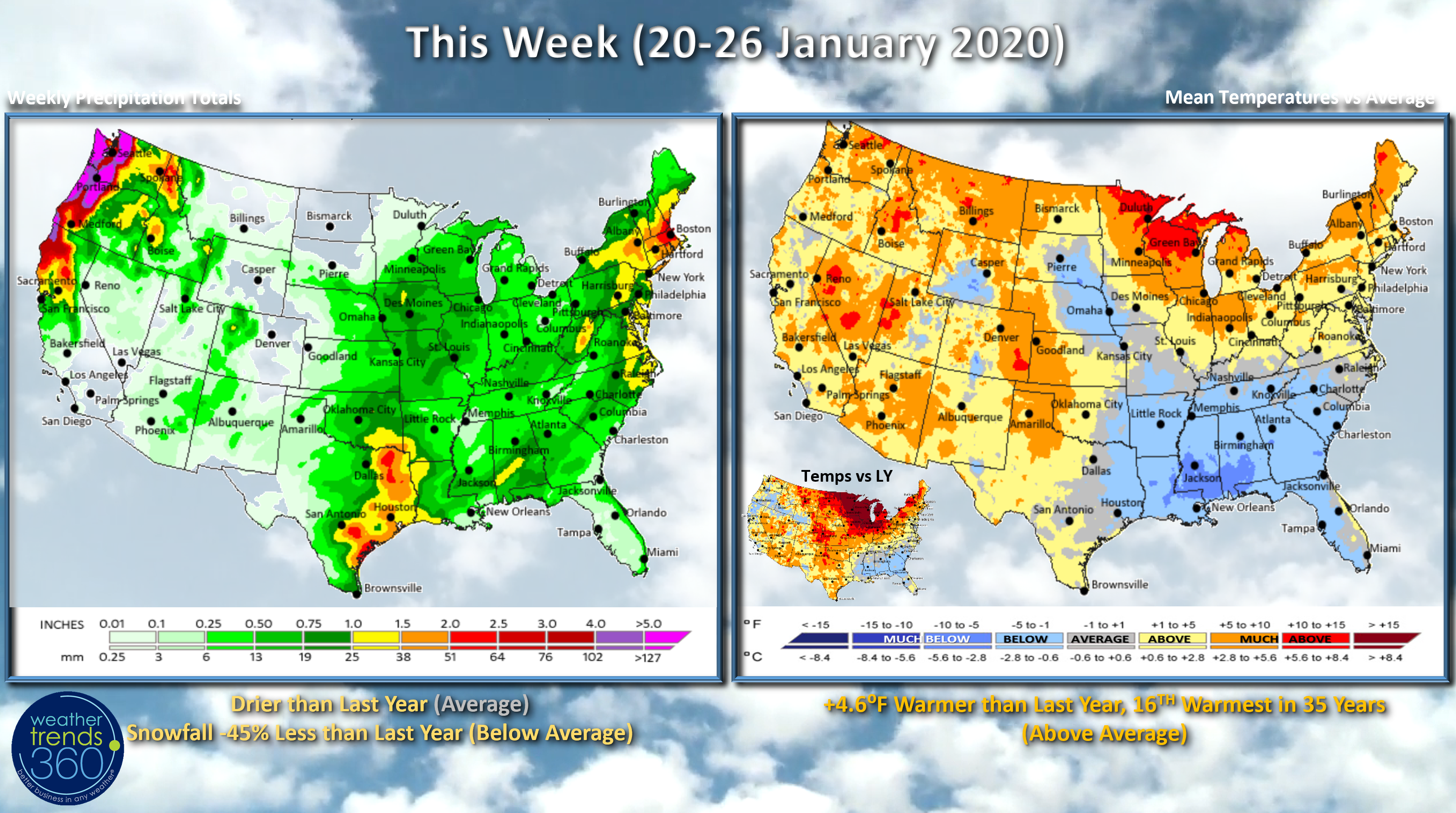
This week (20-26 January) will start off cold in the East but then a gradual moderating trend of milder weather for much of the country. Need to watch a snow storm potential in the Northeast by the weekend but overall snowfall for the week looks to be 45% less than last year and below average after a snowy week last week. U.S. temperatures overall look to trend warmer than last year and 16th warmest of the past 35 years while precipitation is drier than last year and near average nationally.
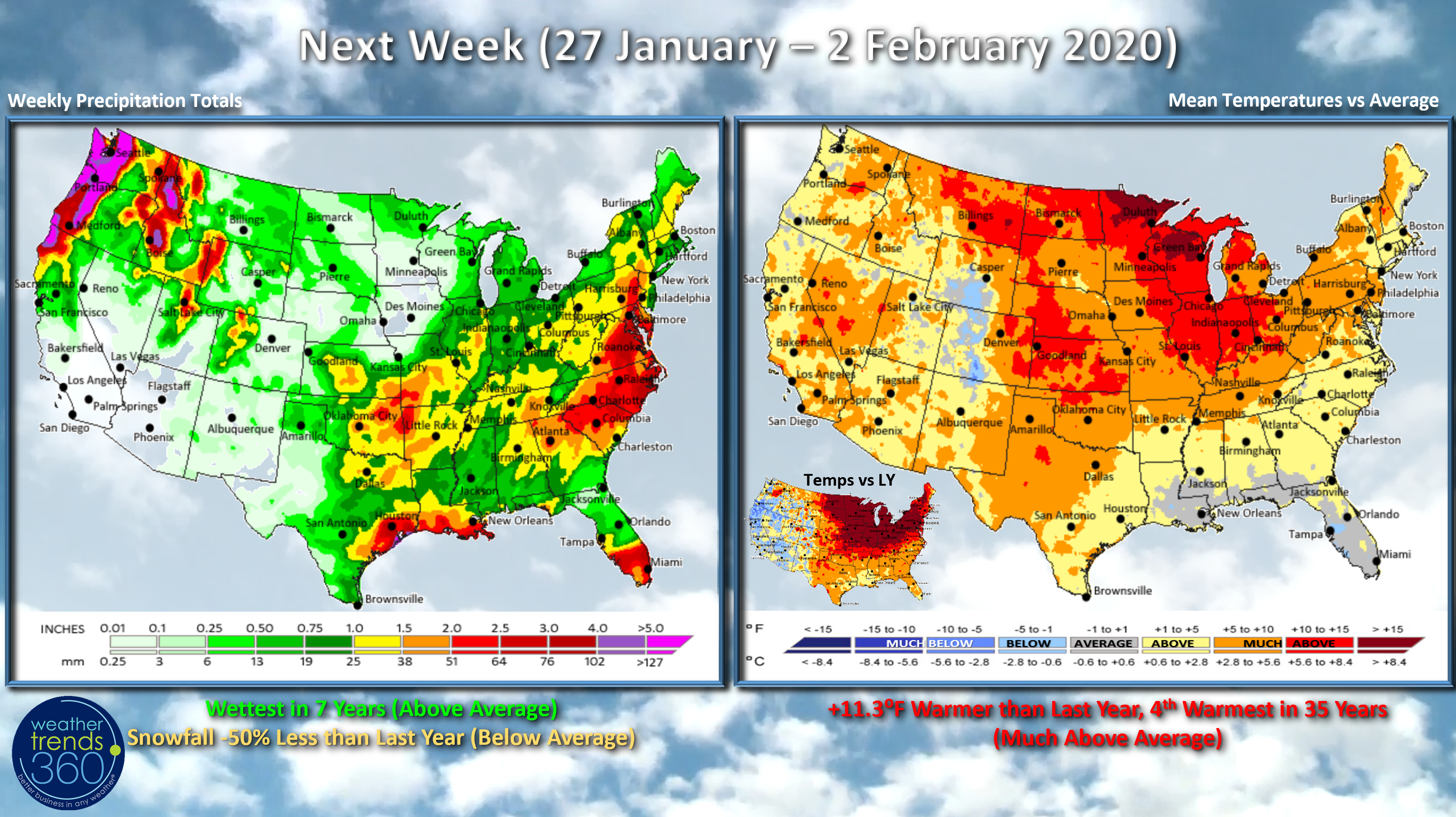
Next week (27 January - 2 February) Hard to find cold air but there are model differences that suggest it may not be quite this warm, warm but not near record warm next week. Right now, the week looks to trend 4th warmest of the past 35 years for the nation as a whole with precipitation on the wetter side vs white - wettest in 7 years, well above average.

The little Captain Angelina Kirk is now 4 and already knows the difference between a cumulonimbus cloud and a cumulus cloud and she's declared Spring is coming! Look out Punxsutawney Phil...he makes his late Winter prediction on 2 February.
Have a great week and don't forget to follow us on social media. Facebook, Twitter, YouTube, Pinterest and Linkedin
- Captain Kirk out.