Captain's Log 24 Feb '24: Wettest Pattern Ahead in 13 Years
Captain's Log
24 Feb '24: Happy Saturday! :)
Our wt360 weather cameras captured the second the parking garage collapsed with a demolition mishap (see video) yesterday morning, felt like an earthquake at wt360 HQ. CLICK ON IMAGES FOR A LARGER VIEW.

Hard to believe but we Spring Ahead in just 15 days. Gaining about 3-4 minutes of daylight every day.
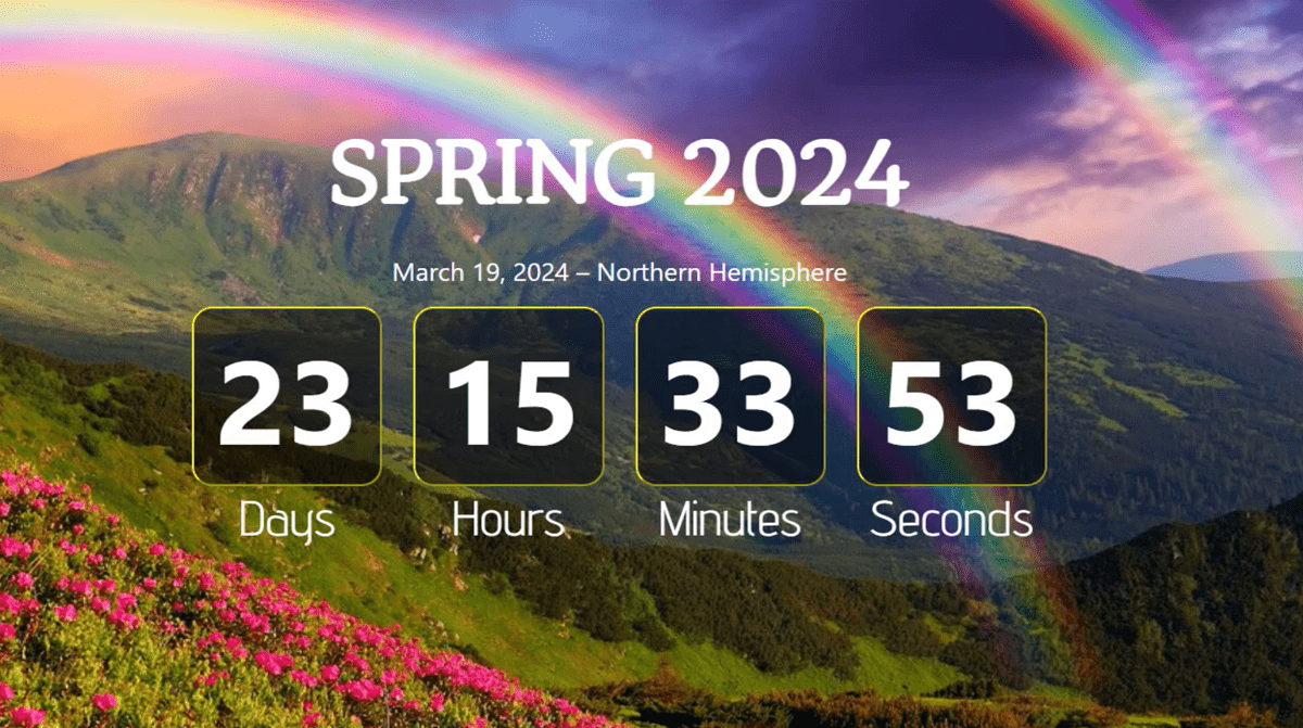
Spring officially arrives in 23 days on Tuesday 19 March 11:06pm EDT.
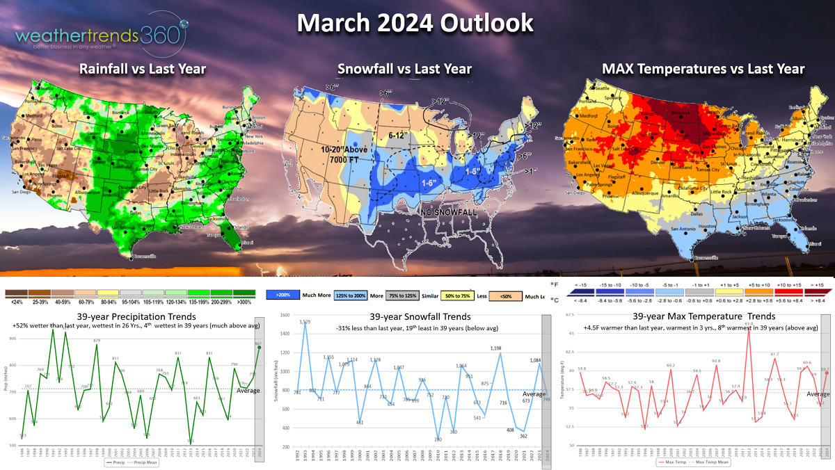
The wt360 March 2024 outlook vs a year-ago shows a warmer, much wetter with a couple snowstorms still possible. For the U.S. overall the calendar month looks to trend the warmest in 3 years, 8th warmest in 39 years. Snowfall down -31% vs last year and 19th least of the past 39 years (slightly below average) while Rainfall looks to be excessive with +52% more than a year ago, most in 26 years and 4th most in 39 years. Severe thunderstorms and tornadoes a big concern along with flooding.
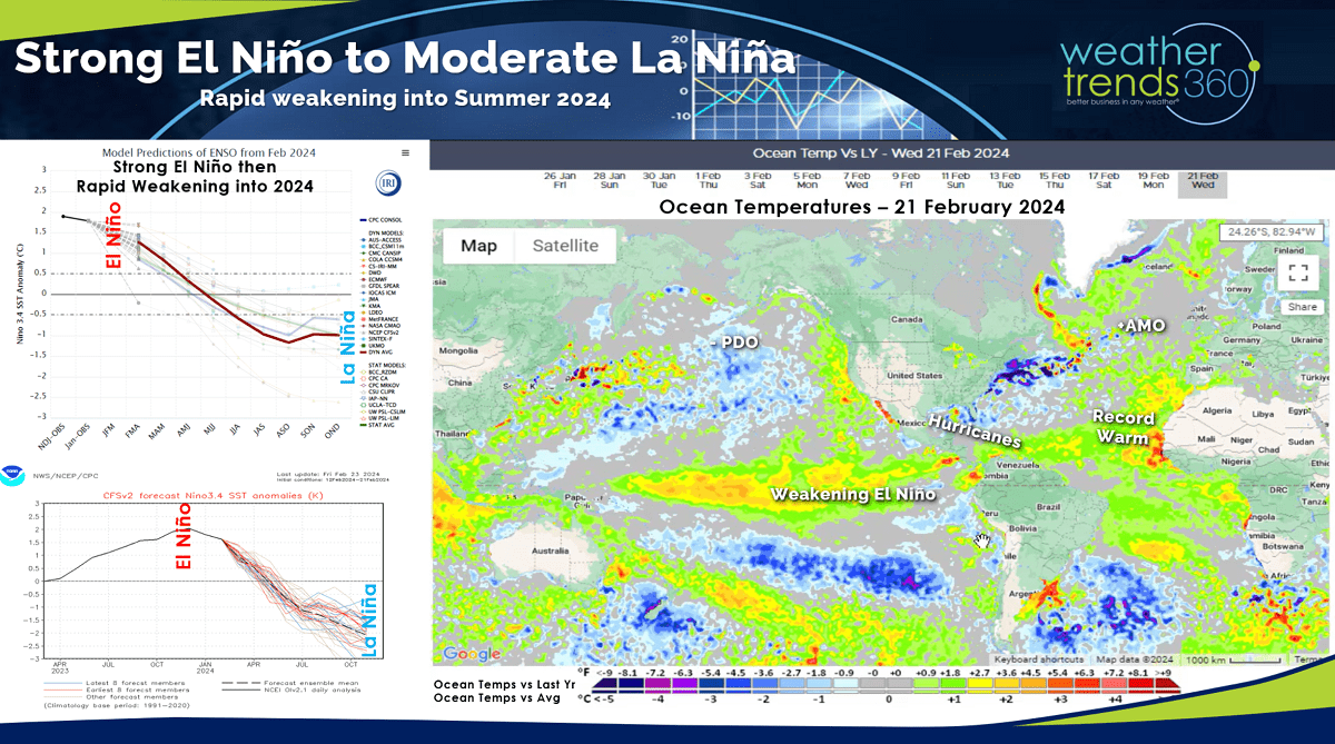
The rapidly weakening El Niño did not have a strong atmospheric response this year due in part to a broader warmer than average Pacific Ocean. It has responded by making the U.S. overall the wettest in 5 years since middle November and 4th wettest of the past 39 years.
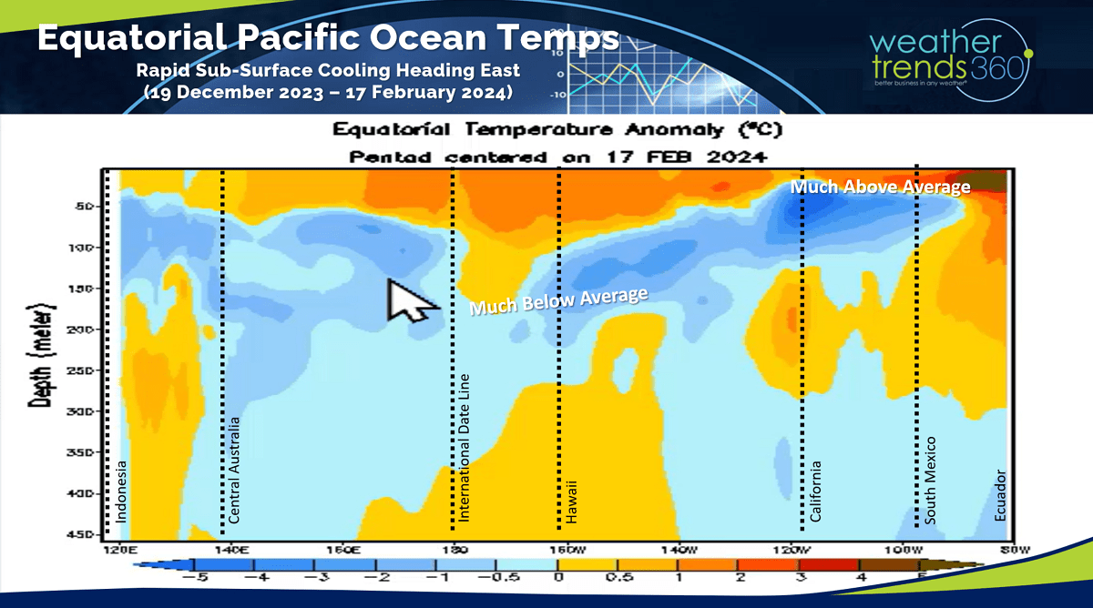
Now we transition to another La Niña cycle (colder than average Equatorial Pacific Ocean temperatures) which will have significant contrast to the broader warm Pacific. The sub-surface ocean temperatures show a much below average area of water temperatures moving rapidly to the surface. This suggests a very active hurricane season in the Atlantic, Spring flooding and severe weather in the weeks and months ahead.
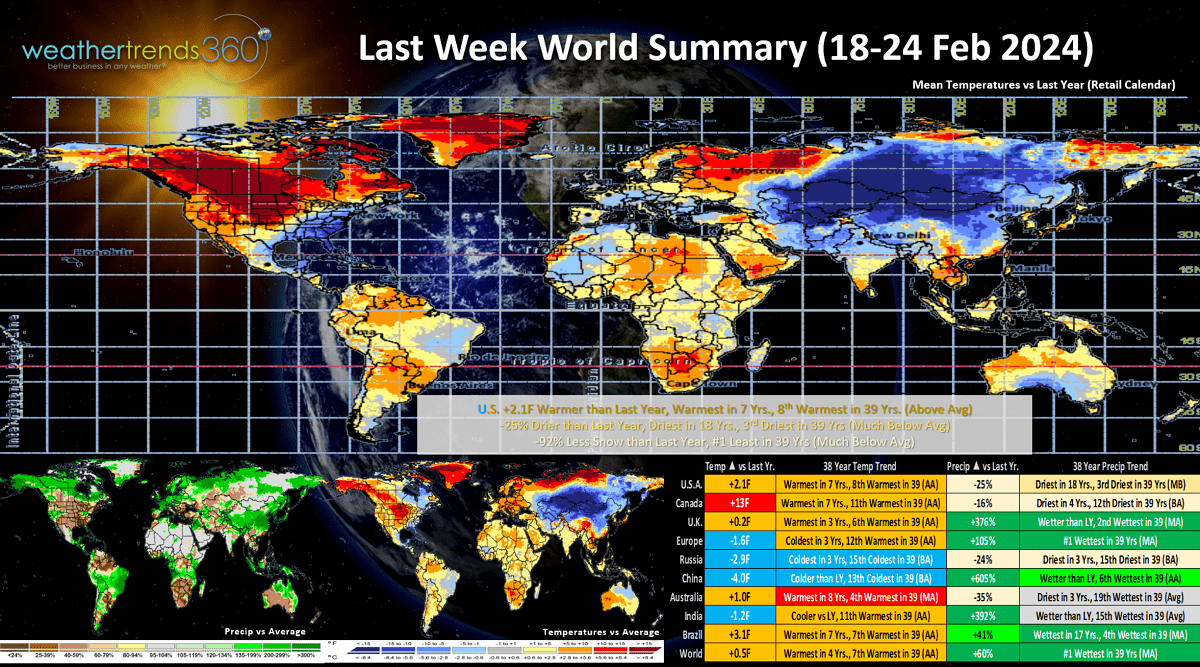
Last week (18-24 Feb) across the World shows the U.S. trending +2.1F warmer than last year, warmest in 7 years and 8th warmest of the past 39 years. Rainfall down -25% vs last year, driest in 18 years and 3rd driest of the past 39 years while snowfall was -92% less than a year ago and least in 39 years. These trends favor overall store traffic and benefit outdoor dining. Europe was exceptionally wet while Russia and China were the cold spots. Much needed heavy rainfall for Brazil.
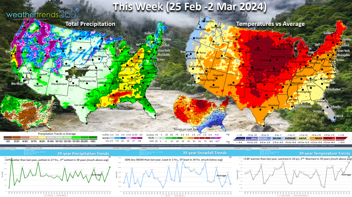
This week (25 Feb - 2 Mar) shows the start of a very stormy and active pattern with another storm impacting the West Coast. The week looks to trend +3.8F warmer than last year, warmest in 24 years and 2nd warmest of the past 39. Rainfall up +47% vs LY, the wettest in 27 years and 3rd wettest of the past 39, while snowfall is down -60% vs LY, least in 3 years and 5th least in 39 years. A snowstorm will traverse the West into the Midwest midweek.
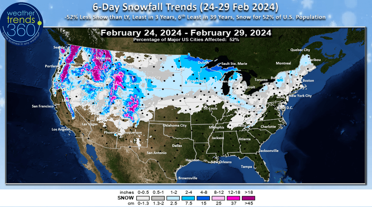
The 6-day snowfall outlook still shows 52% of the U.S. getting some snow with a light to moderate event in the Upper Midwest and heavy mountain snow in the West.
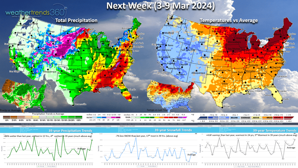
Next week (3-9 Mar) trends +4.6F warmer than last year, warmest in 24 years and 3rd warmest of the past 39 years. Rainfall again heavy trending +86% more than last year, wettest in 13 years and 4th wettest of the past 39 years, while snowfall is -7% less than a year ago but still 17th most in 39 years and slightly above average. Signs of a colder, wetter and even snowier pattern going into middle March.

The Polar Vortex is starting to weaken and that does increase the changes of some colder weather heading south into Canada and the U.S.
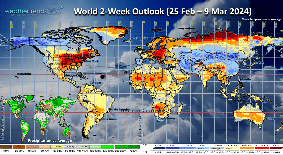
The World 2-week outlook (25 Feb - 9 Mar) shows the cold spots in Alaska, U.S. West Coast and China.
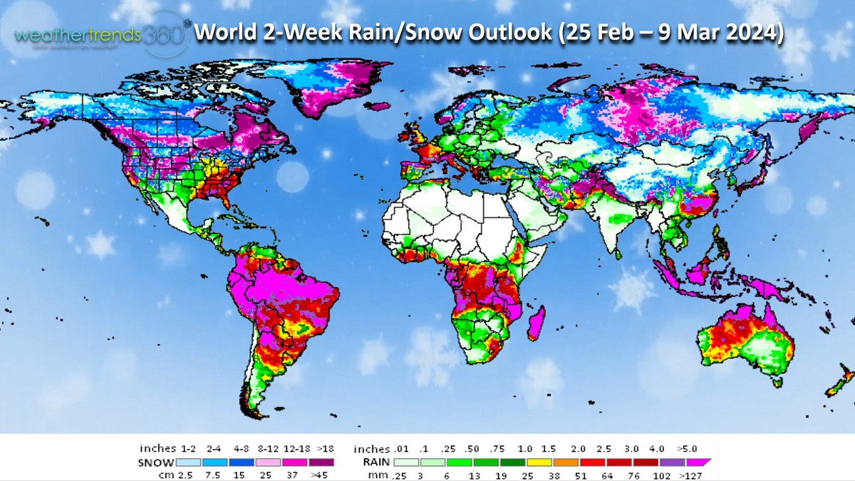
Rainfall looks excessive across North America with heavier snowfall possible for Canada.
Did you see the bright meteor on Wednesday around 6:49pm EST? Many reports from Virginia to Niagara Falls reported seeing it. wt360 weather camera west captured the brief encounter with the Earth's atmosphere (see the end of today's video).
We hope you have a great end to February, and don't forget to follow us on social media for frequent updates: Facebook, Twitter, YouTube, Pinterest and Linkedin.
- Captain Kirk out