Captain's Log 25 Nov 2019 Monday
Captain's Log
Happy Monday! :)
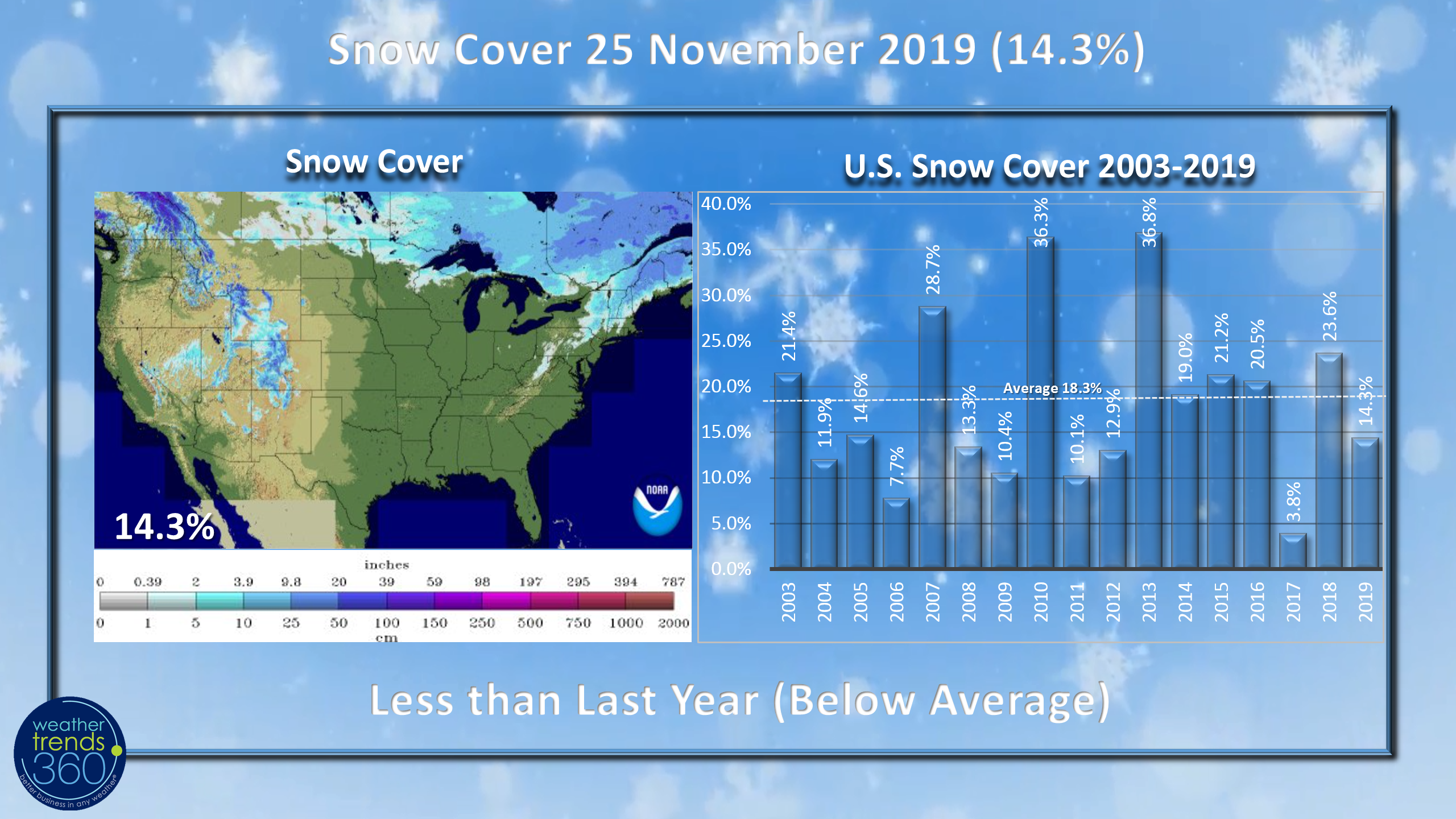
Snow Cover across the U.S. is below average with only 14.3% of the country blanketed in snow, but that's about to change. Average for the date is around 18.3% and last year was 23.6%. CLICK ON IMAGES FOR A LARGER VIEW.
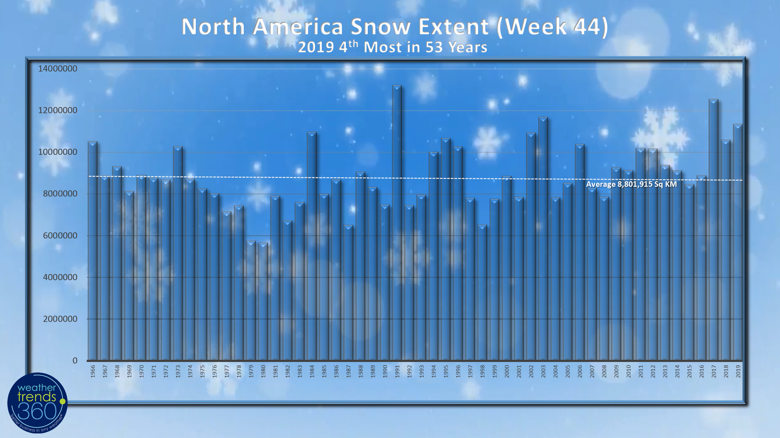
Looking at all of North America the snow extent is the 4th most in 53 years, 29% above average and 7% more than last year according to Rutgers Snow Lab.
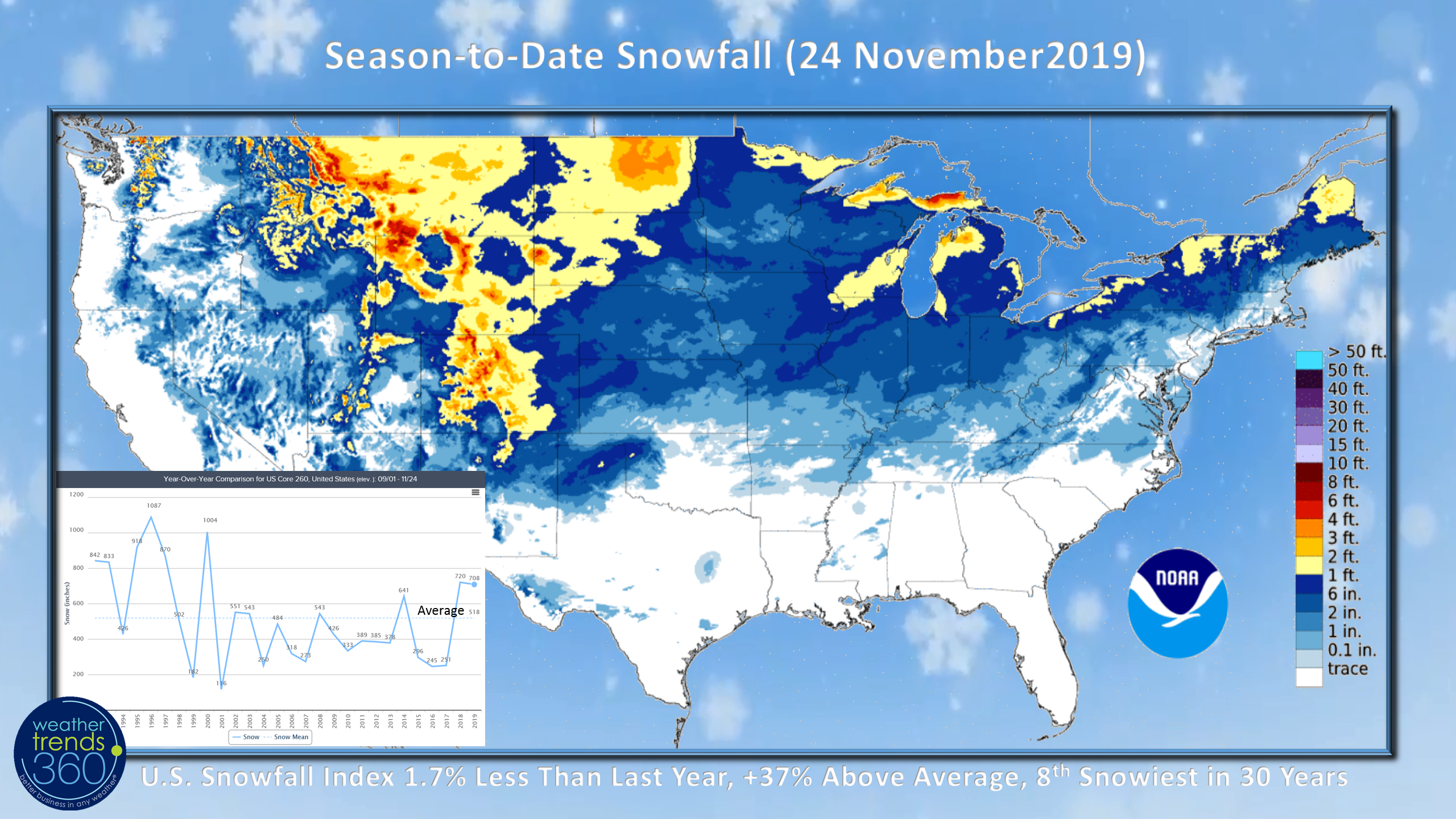
Snowfall season-to-date across the U.S. got off to a fast start like last year but now trending 1.7% less than last year but that's still 37% above average and the 8th snowiest start in 30 years.
We will be adding to the snow totals this week in the West with two big snow storms moving out of the Rocky Mountains into the Plains and Upper Midwest midweek and storm #2 late in the week with a slightly further north track.
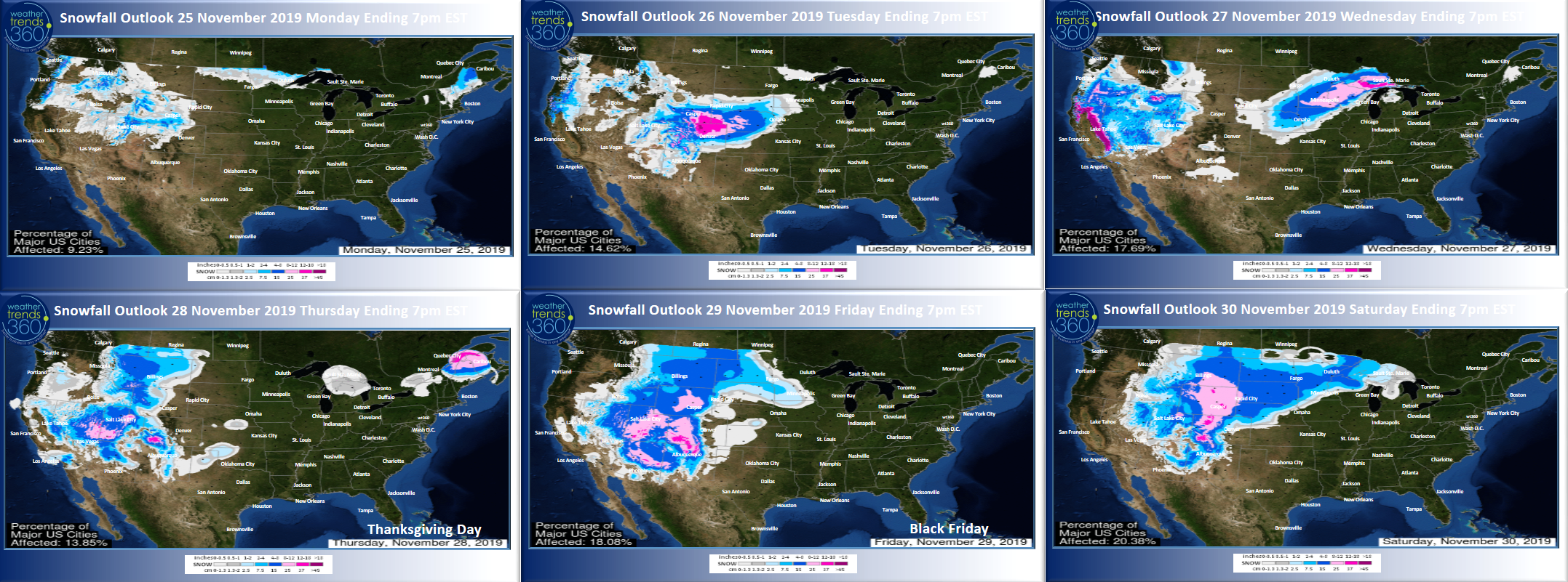
The 6-day snowfall outlook certainly suggests some travel delays over the Thanksgiving holiday weekend for the Western half of the country. Winds could certainly create some delays in the East.
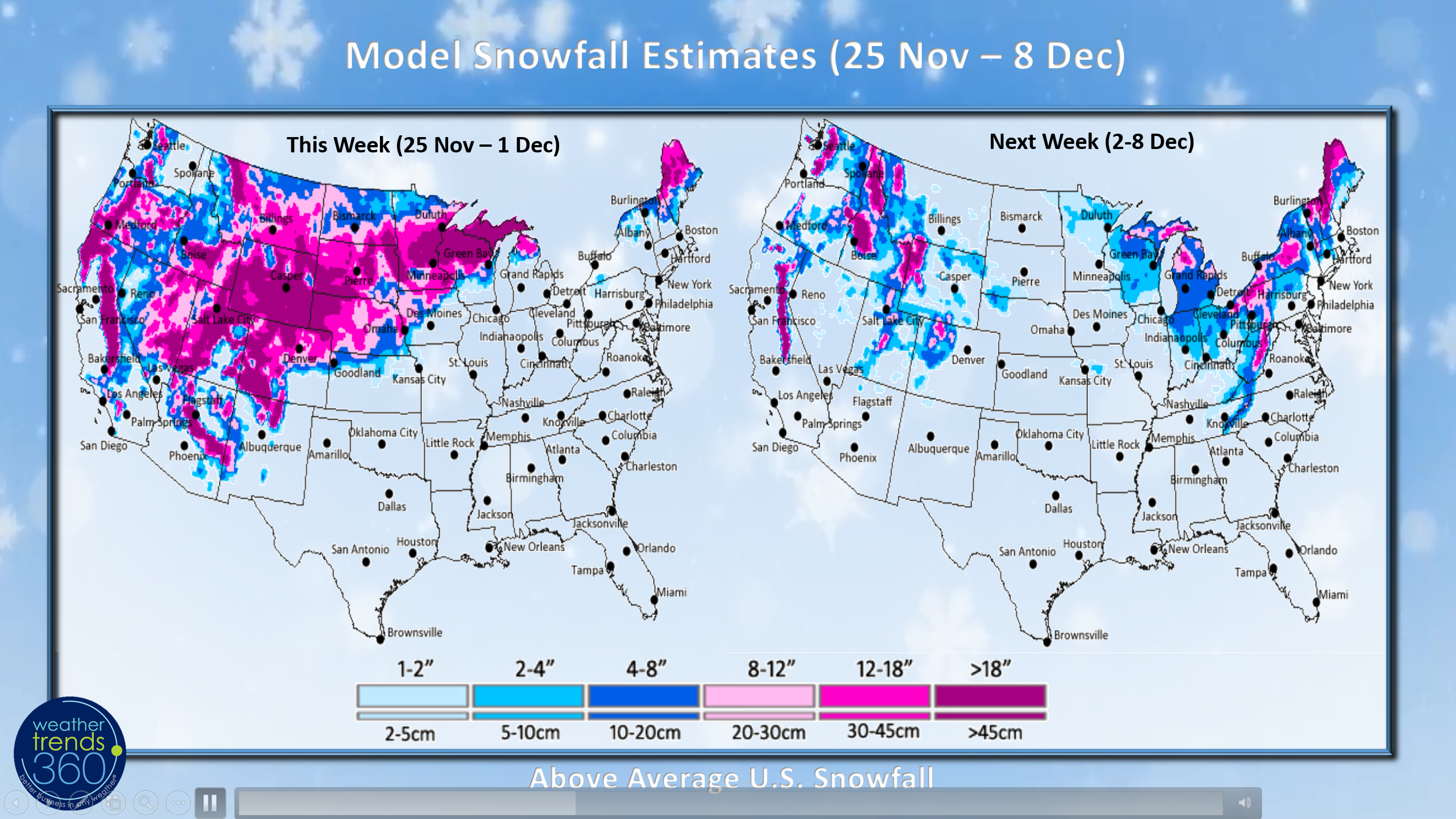
The snowy week 1 pattern will relax a bit next week as Lake Effect snows quick in for the Northeast higher elevations and Appalachian Mountains. This is just model estimates so likely a tad overdone but overall theme is cold and stormy West this week, shifting East next week.
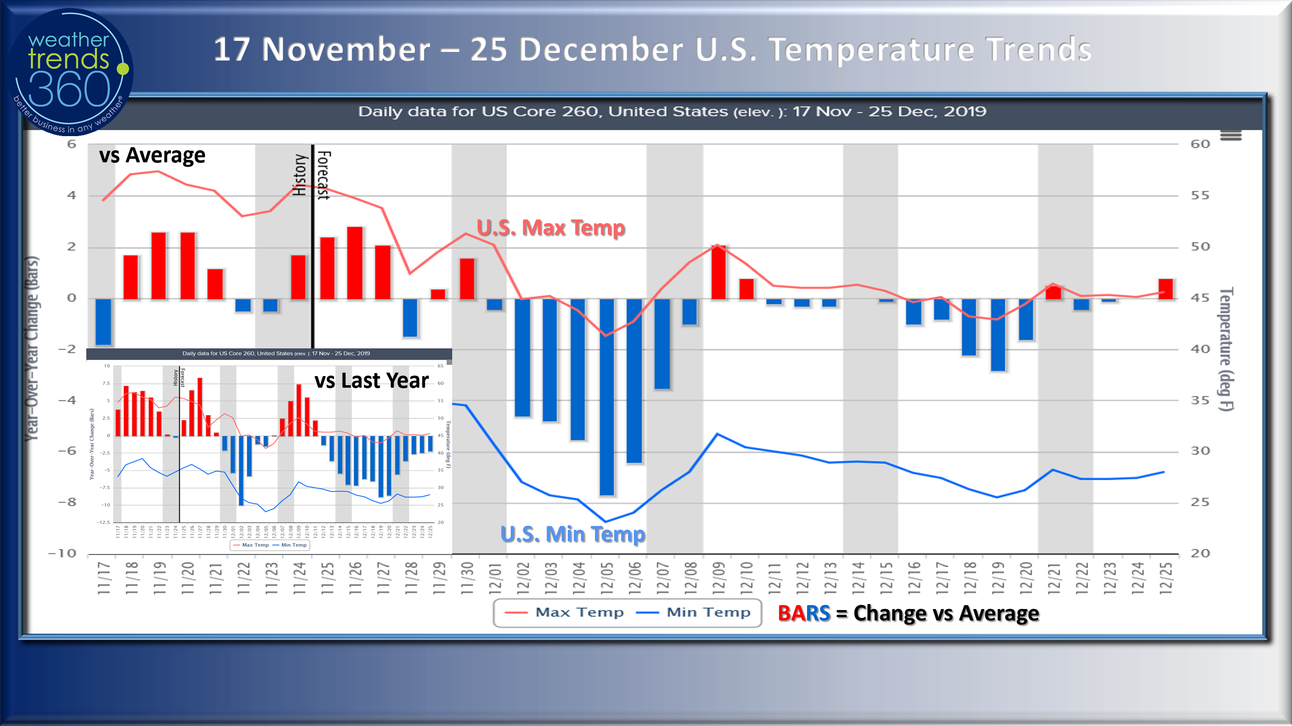
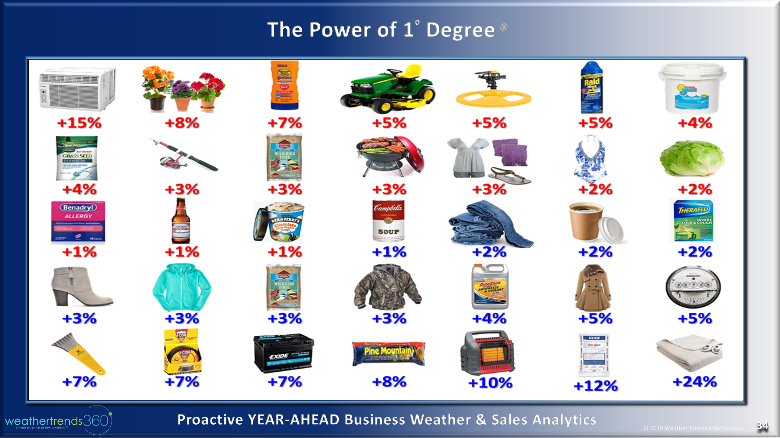
The latter half of November was warmer and less snowy than the front half but much colder year-over-year conditions are returning as we transition into December. Expect another strong surge in seasonal category sales through at least 8 December with temperatures trending some 5F colder than last year nationally. Applying our Power of 1 Degree rules of thumb, expect sales gains for warm beverages to be up 10%, boots up 15%, Birdseed up 15%, Anti-freeze up 20%, Coats up 25%, your electric consumption up 25%, battery failures up 35%, portable heaters up 50% and electric blankets up a whopping 120%.
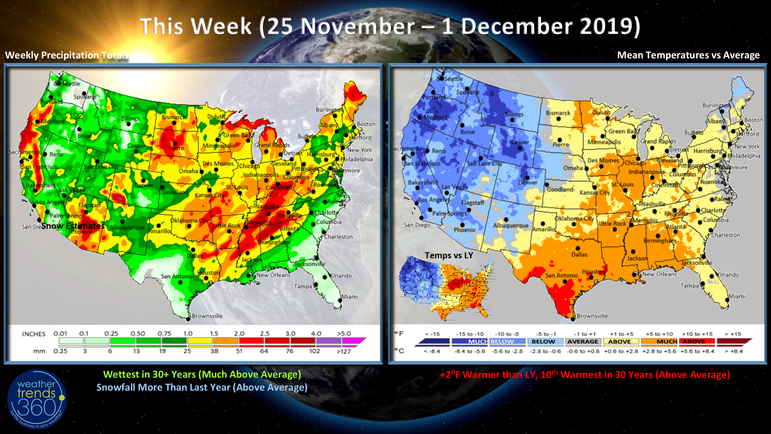
This week (25 Nov - 1 Dec) shows a very warm pattern out ahead of this strong midweek cold front with the U.S. overall trending 2F warmer than last year, 10th warmest in 30 years with above average national temperatures. Rainfall is wettest in 30 years but much of that will be snow in the West with above average snowfall and more than last year.
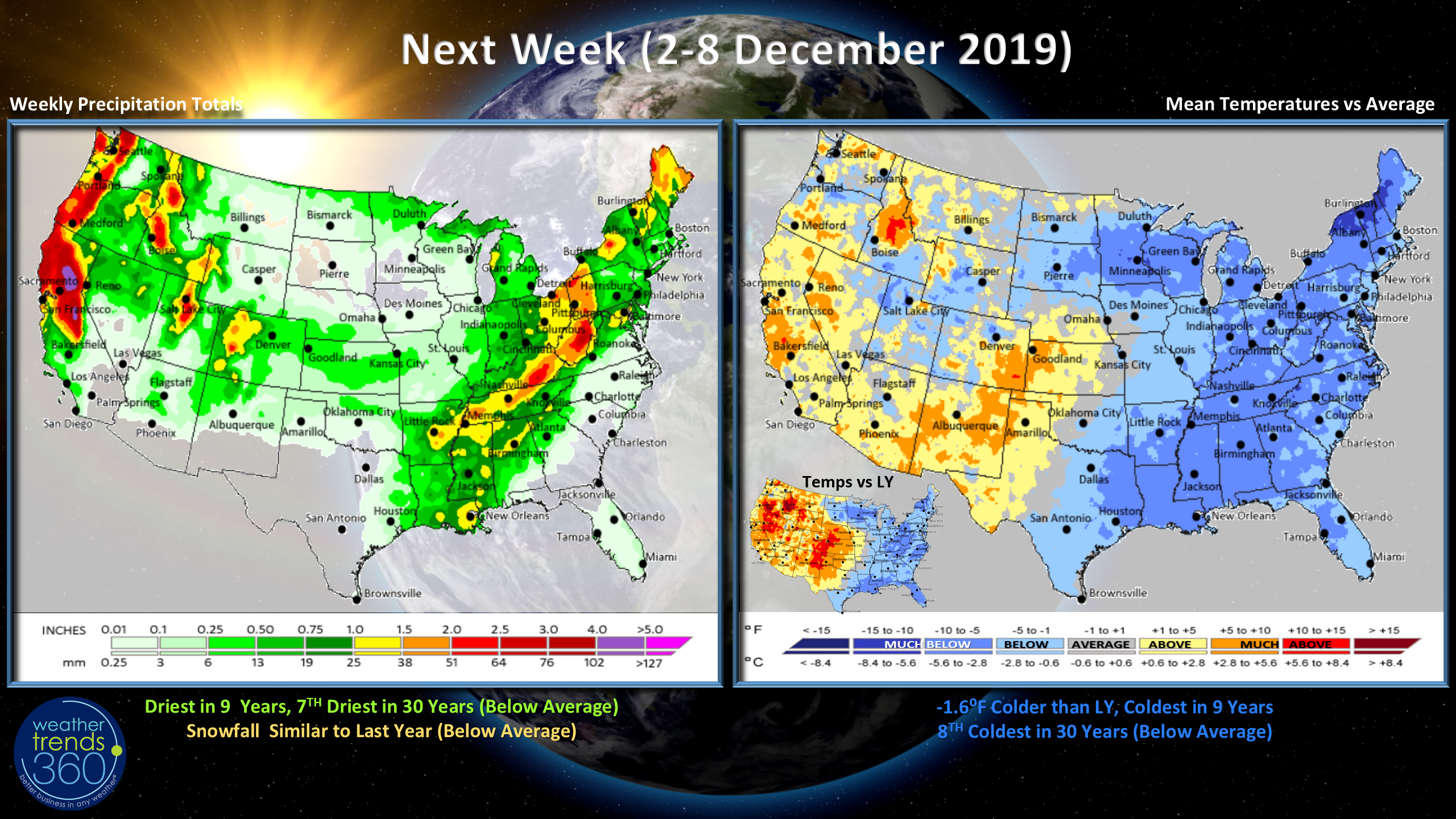
Next week (2-8 December) shows the fast pattern with the West warming up while the East is the cold spot. The nation trends 1.6F colder than last year and coldest in 9 years. This is a strong start for Winter seasonal merchandise but the cold and snow does have a negative impact on overall store traffic. On-line retail sales do well in colder stormier weather as does TV advertising viewership. We tend to be indoors more watching TV the more extreme the weather.
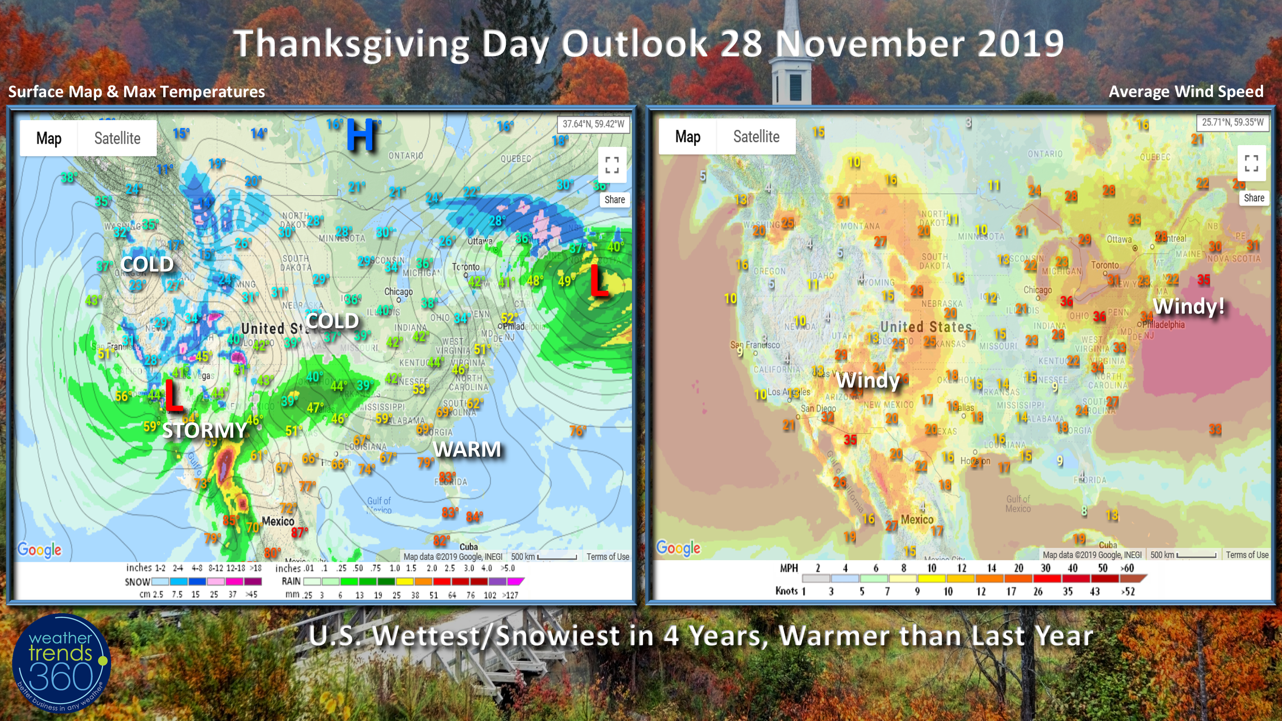
The Thanksgiving Day outlook shows the cold and stormy conditions in the West while storm #1 exits the Northeast. It will be very windy in the Northeast which will likely ground the big balloons for the Macy's day parade. Florida and the Southeast still have some lingering warm weather ahead of the cold front...that will change by the weekend.
We hope you have a wonderful Thanksgiving (see our video to you); we are truly THANKFUL for all the blessings bestowed upon Weather Trends, our employees, families and YOU!!!! THANK YOU!
Follow us on social media for frequent updates. Facebook, Twitter, YouTube, Pinterest and Linkedin
- Captain Kirk out.