Captain's Log 27 Aug '22 Hot & Dry...Watch the Tropics
Captain's Log
Happy Saturday! :)
A recap of last week (21-27 August) around the World shows the U.S. overall trending -1.7F cooler than last year, coolest in 3 years but still 9th warmest of the past 37 years. The really hot spot continued to be the Northwest while the Central and Eastern U.S. got a break from the heat. Rainfall was up +20% over last year, most in 20 years and 2nd most in 37 years for the U.S. overall. But, most of that came from the flooding remnants of Tropical Depression #4 that dumped on Texas and the North Central Gulf Coast. CLICK ON IMAGES FOR A LARGER VIEW.
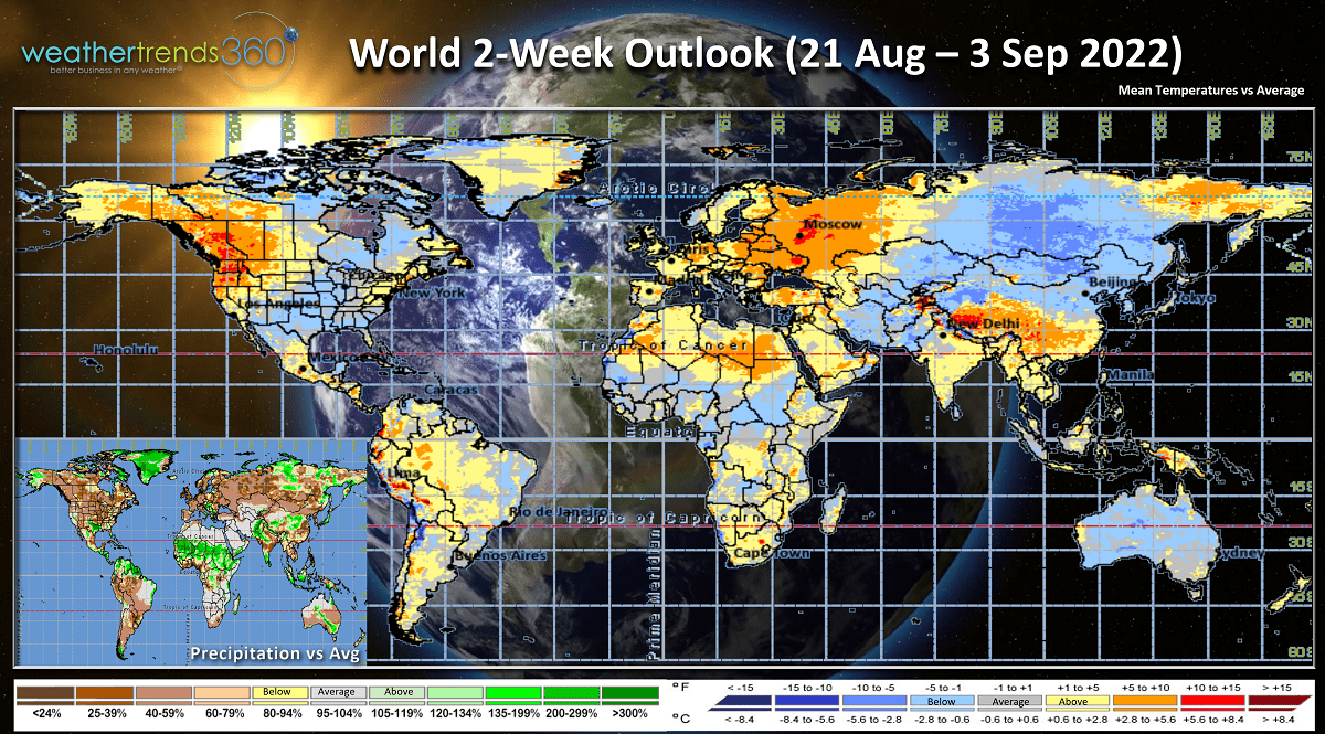
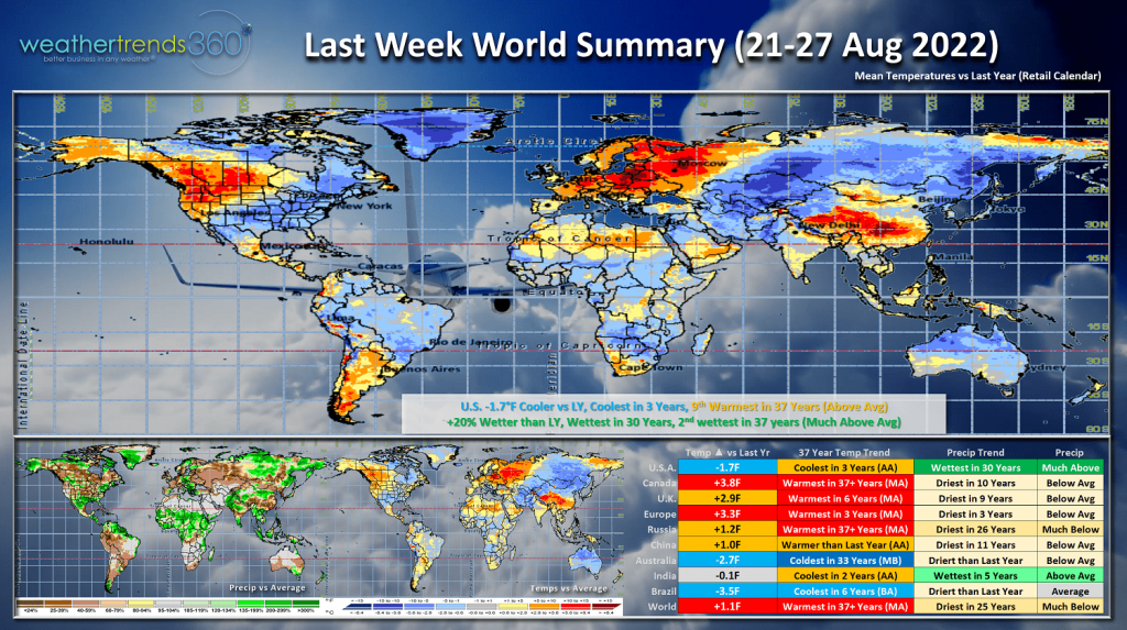 Much of the World was on the hot and dry side with Canada and Russia the hottest in over 37 years while down under in Australia it was the coldest in 33 years; also cool in Brazil.
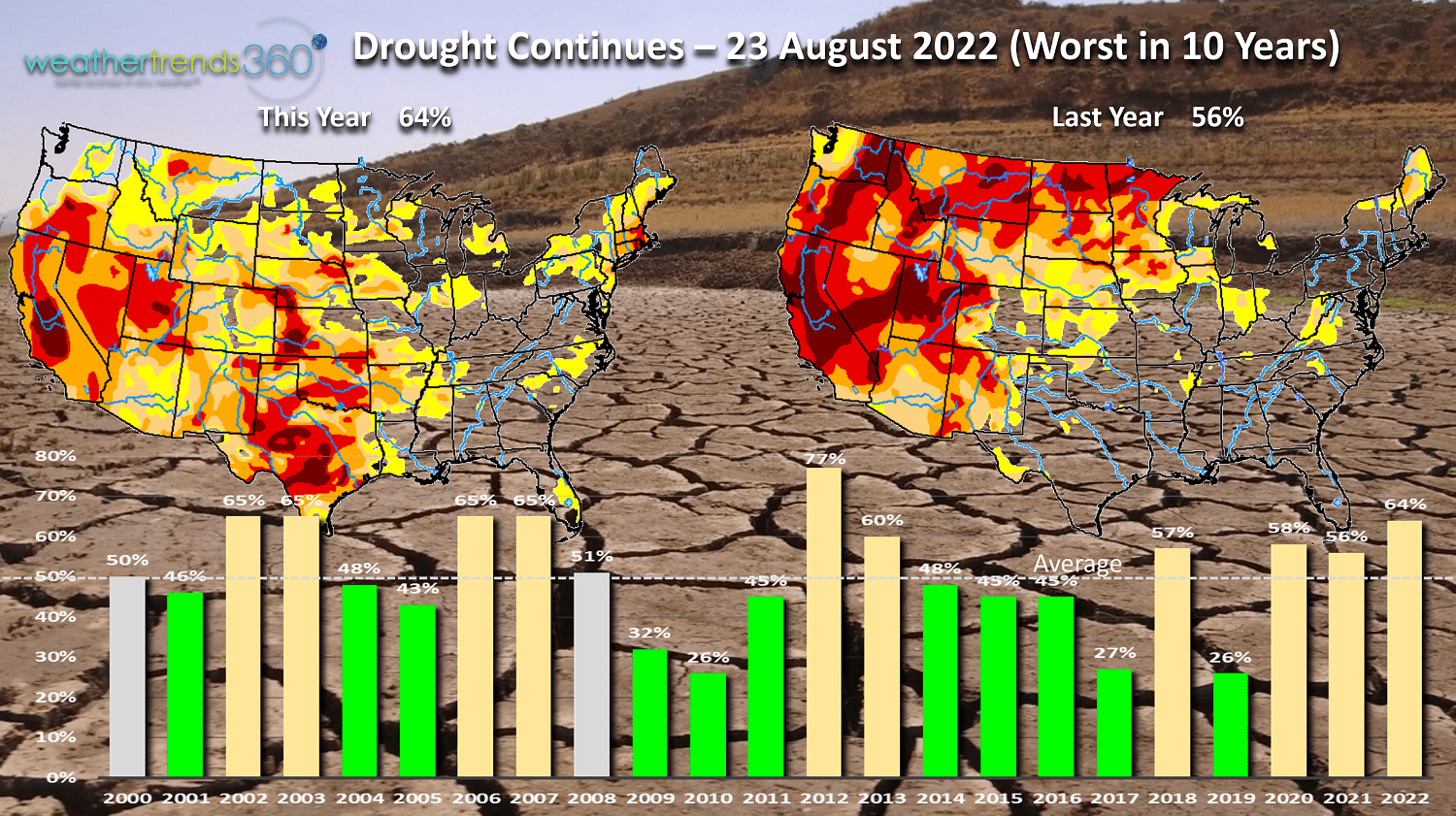
Dry to drought phases across the U.S. as of 23 August are down a bit from earlier in the month, but still the most coverage in 10 years with 56% of the U.S. in dry to drought phases. This drought cycle will end in 2023 and 2024 with a developing flooding cycle for the U.S.!

The culprit continues to be a La Niña cycle along with a dramatically warmer north Pacific Ocean. This time last year the North Pacific was the 2nd coldest in over 165 years, a wholesale change this year. This warm area is affectionately referred to as "The Blob" and in 2013-2015 that led to very cold and snowy U.S. Winter. We expect some of that colder weather late this Fall.
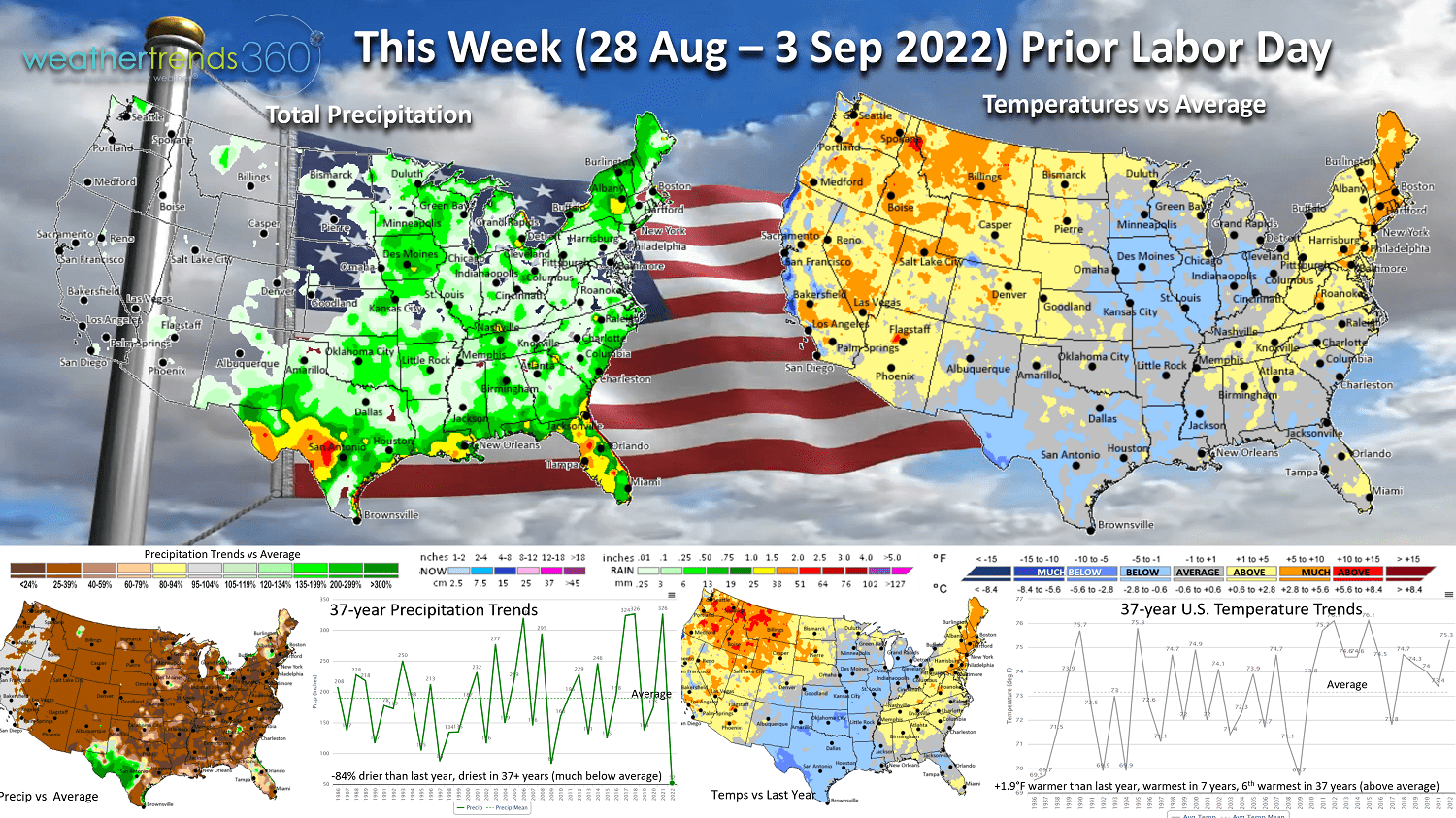
This week (28 Aug - 3 Sep) shows the same generally pattern of hot and dry weather for this week before Labor Day weekend. These are very bad conditions for Back2School seasonal categories, but will continue to benefit the hot Summer replenishment/consumable categories like cold beverages, pool chemicals, irrigation, fans and AC, fruit and vegetable categories. The U.S. overall trends +1.9F warmer than last year, warmest in 7 year and 6th warmest of the past 37 years. Heat remains in the Northwest, but a hotter trend in the East as well. Rainfall nonexistent trending down -84% vs last year's near record wet week, the least in over 37 years. Some much needed rain for SW Texas, but most of us very dry.
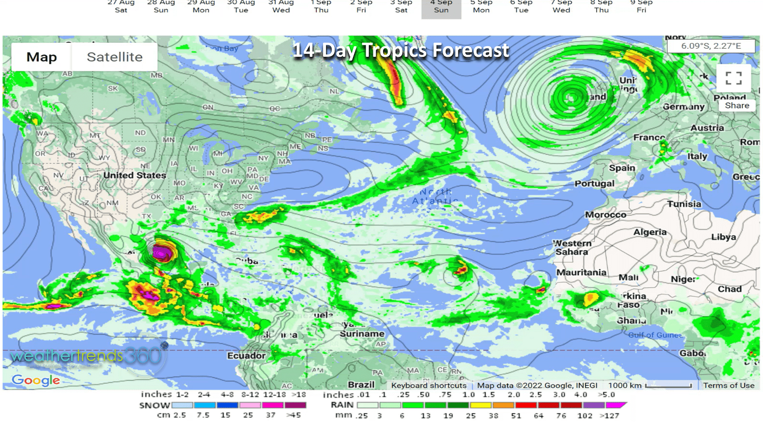
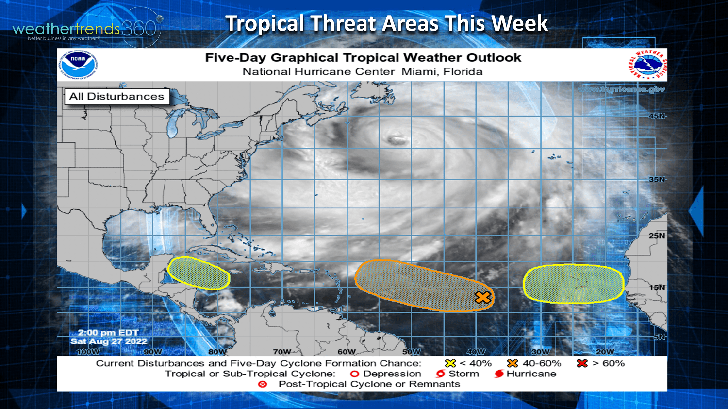
The tropics need to be watched as systems could develop quickly. Models hint at a potential 5th system late this weekend in the Southwest Caribbean/Western Gulf of Mexico. More tropical waves coming off Africa, so despite the slow start, still need to keep an eye out as we enter the historical peak period of the season. The National hurricane center has highlighted a few threat areas over the next 5 days, more beyond this period.
Next week (4-10 Sept) more of the same with the U.S. trending +0.6F warmer than last year, warmest in 6 years and 3rd warmest in 37 years. The West and Northwest look to be the hottest with more cool trends for the South Central and Southeastern U.S. Rainfall down -61% vs last year which again would make it the #1 driest start to September in over 37 years. The heavy rain along the Northwest Gulf of Mexico could be tropical in nature.

The 2-week World outlook (28 Aug - 10 Sep) shows the pattern stuck in a rut. It will take a strong hurricane in the Atlantic and or Typhoon in the Pacific that heads North to break this cycle.
We hope you have a great week, and don't forget to follow us on social media for more updates: Facebook, Twitter, YouTube, Pinterest and Linkedin.
- Captain Kirk out.