Captain's Log 27 Feb '22 Taste of Spring Then Winter Returns
Captain's Log
Sunday 27 February 2022
February 2022 is almost in the history book which trended +3.5F warmer than last year here in the U.S., but still 17th coldest of the past 37 years and just a bit below average nationally. CLICK ON IMAGES FOR A LARGER VIEW.
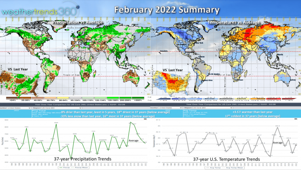 Rainfall was -8% drier than last year, least in 5 years and 18th driest of the past 37 years nationally (below average). Snowfall was also down 33% vs last year, 16th most in 37 years and a bit below average. Warmer and drier trends are a general plus for overall retail sales. The other cold spots were China and Australia, while Europe and Russia were relatively warm.
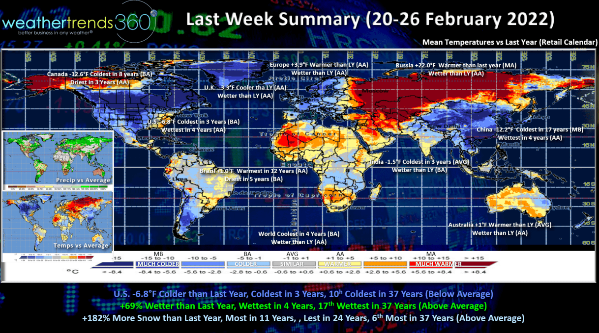
Last week (20-26 Feb) across the World shows the U.S. trending -6.8F colder than last year, coldest in 3 years and 10th coldest of the past 37 years with below average national temperatures. Rainfall was up +69% vs last year, wettest in 4 years and 17th wettest of the past 37 years with above average national rainfall. Snow was also up a whopping +182% vs last year, most in 11 years and 6th most in 37 years. This likely brought a slowdown in overall retail sales but a great opportunity to clear out any remaining Winter seasonal merchandise.
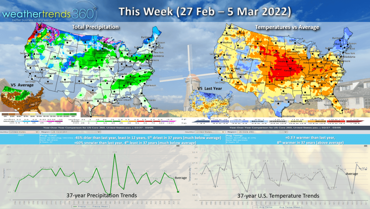
This week (27 Feb - 5 Mar) a tease of Spring, but it won't last! National temperatures trend +0.3F warmer than a year ago and 8th warmest of the past 37 years with above average national temperatures. A strong shot of Arctic air will invade the Western half of the U.S. by the weekend and begin its march toward the East. Rainfall down -45% vs last year, least in 12 years and 5th driest of the past 37 years (much below average). Snowfall up 60% over last year, but still much below average and 4th least of the past 37 years.
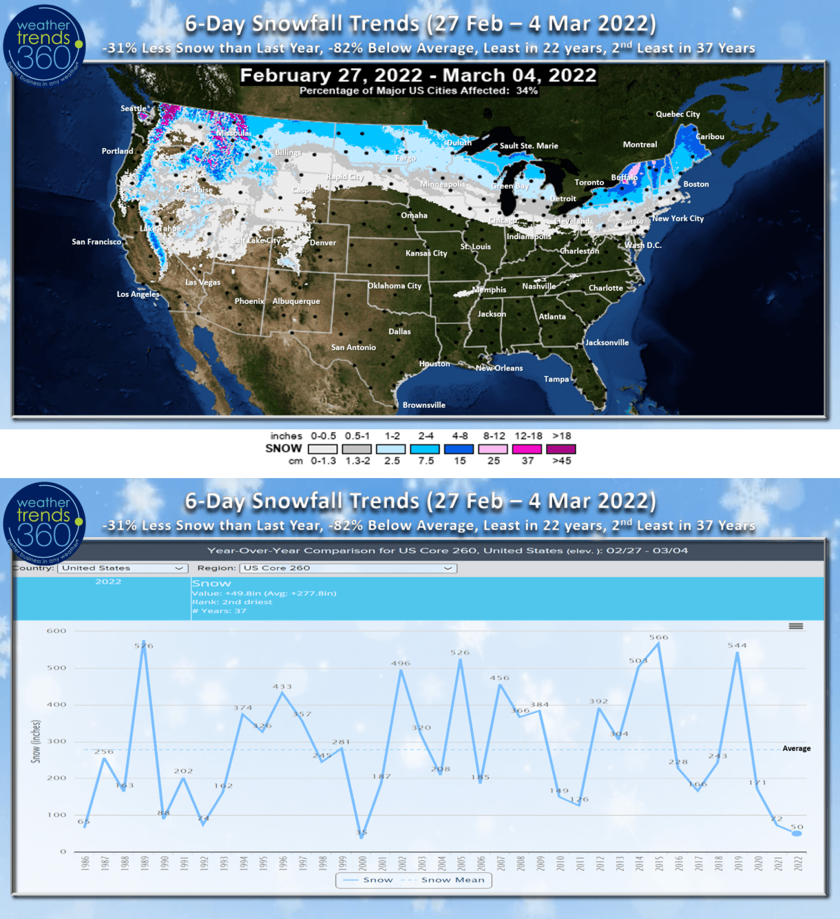
The 6-day snowfall trends show any snow is limited to the northern tier of the U.S. with a weaker Alberta like Clipper system. The 6-day snowfall trends through Friday are the least in 22 years, 2nd least in 37 years. More snow will move into the West by the weekend.
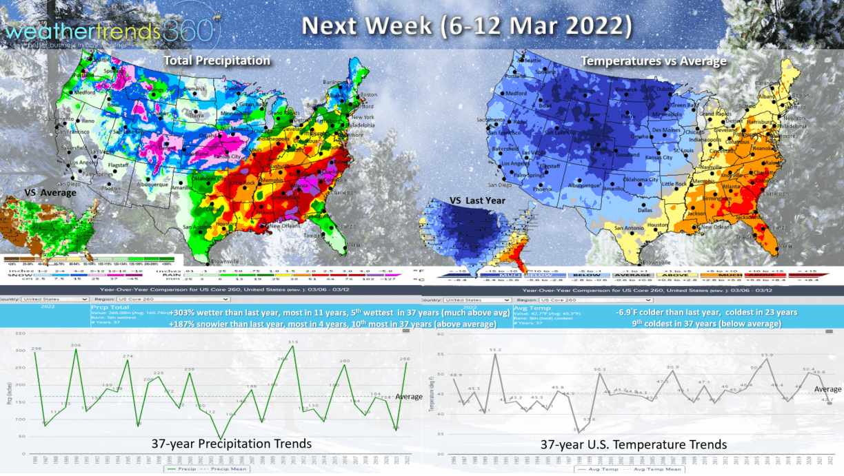
Next week (6-12 Mar) shows the frigid weather returning from West to East. The cold will reach the East Coast toward the weekend. For the U.S. overall, the week trends -6.9F colder than last year, coldest 2nd week of March in 23 years, 9th coldest of the past 37 years with below average national temperatures. Rainfall way up +303% vs last year, most in 11 years and 5th wettest in 37 years. Severe weather also a high risk in the South Central and Southeast U.S. as this strong cold front sweeps the country. Snowfall up +187% over last year, most in 4 years and 10th most in 37 years with above average national snowfall. This is a big negative for Spring seasonal merchandise sales after a very warm March last year.
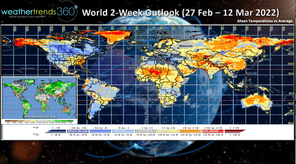
The World 2-week outlook shows the colder weather generally in North America with a cool down across Europe while Russia, China, and the Middle East warm up.
Have a great week, and don't forget to follow us on social media for frequent updates: Facebook, Twitter, YouTube, Pinterest and Linkedin.
- Captain Kirk out.