Captain's Log 27 Jan 2020 Monday
Captain's Log
Happy Monday! :)
We will explain the Bull in the blog below but you might want to avoid snow lovers in the East as they're all pretty cranky with an anemic season so far. CLICK ON IMAGES FOR A LARGER VIEW.
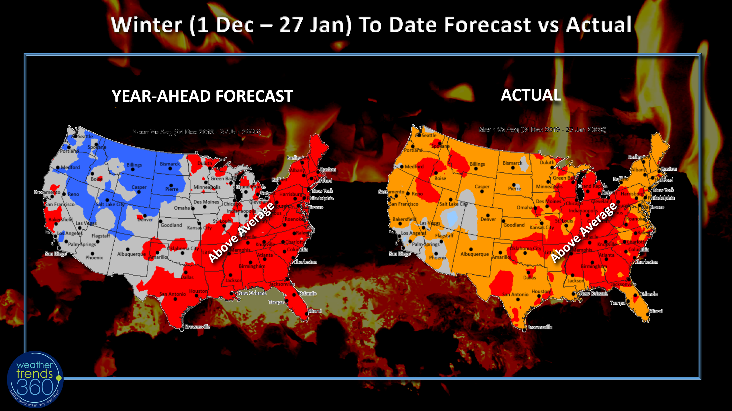
One thing we like about our fully automated year-ahead statistical/24 climate cycle approach to predicting year-ahead weather (temperatures, rainfall and snowfall by week by mile everywhere on Earth - 32 million locations), is to a big extent the human emotion is taken out of the forecast equation. Most meteorologists love epic cold, snow, storms so that bias frequently enters long range outlooks which was the case here in the Eastern PA - NJ - NYC areas. A lot of people here in the PA-NJ-NYC tri-state area thought we were headed for a blockbuster cold/snowy season like 2013-2014 when we had some of the coldest temperatures in decades and 68" of snow near wt360. Yes we were nervous projecting a not so snowy Winter but so far MATH is beating the HUMAN.
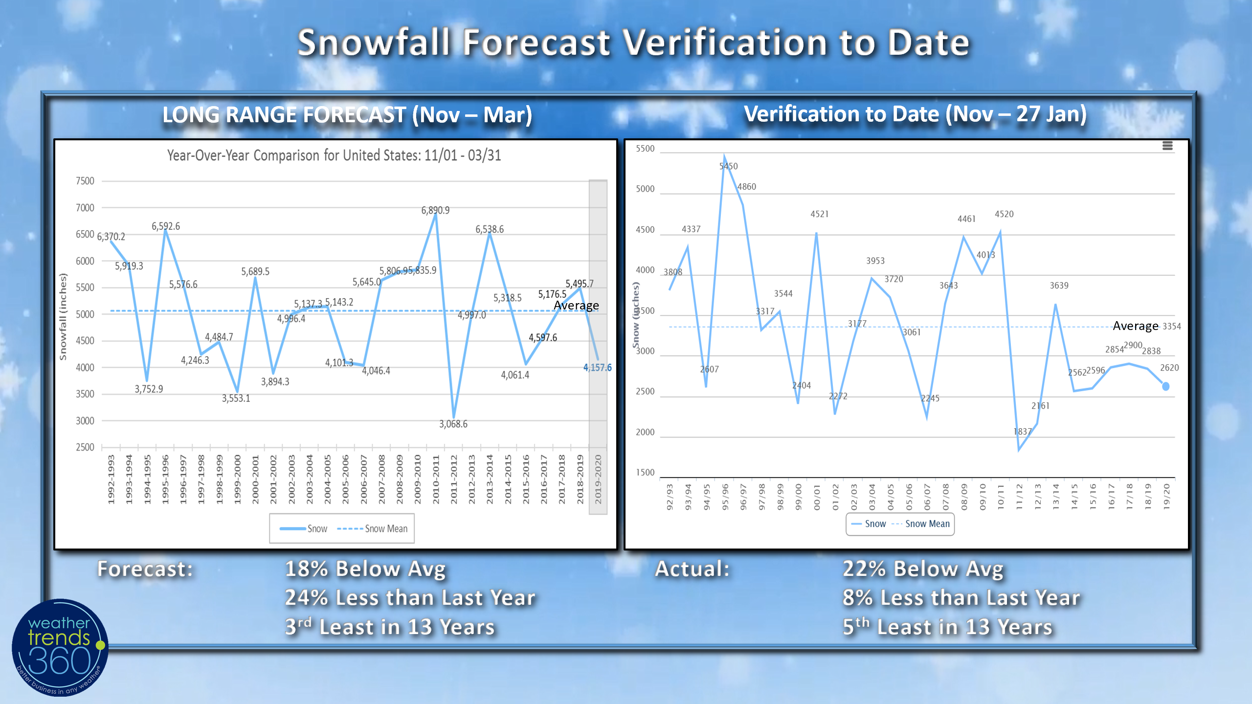
Weather Trends year-ahead Winter snowfall outlook projected the least snow in 4 years, 3rd least in 13 years, 18% below average and 24% less than last year for the U.S. overall, with below average snow for the coastal Northeast. So far that's been the case with snowfall trending 22% below average nationally and at least 50% below average in the coastal Northeast.
A green Winter for sure here in Eastern PA with only 5.3" of snow in Bethlehem, PA.
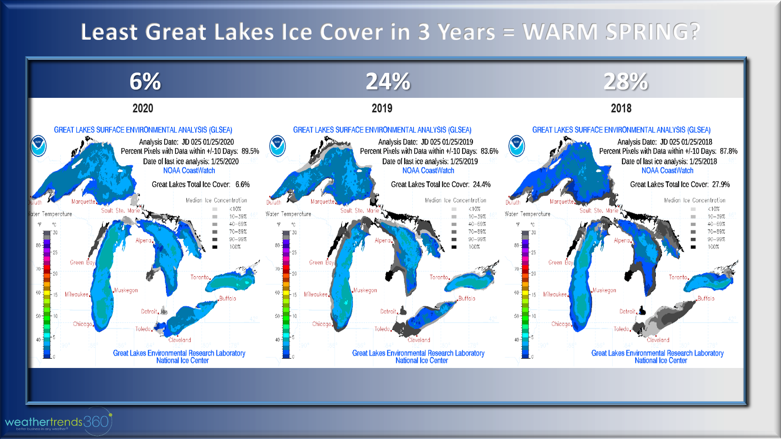
There is still some hope for snow lovers in the middle February time-frame and one positive is the lack of ice on the Great Lakes. Only 6% of the lakes have floating ice compared to 24% last year. This means any cold intrusion in the weeks ahead will have moisture to work with for bigger Lake Effect snows and something for the immediate Northeast coast as well...but we're running out of time.
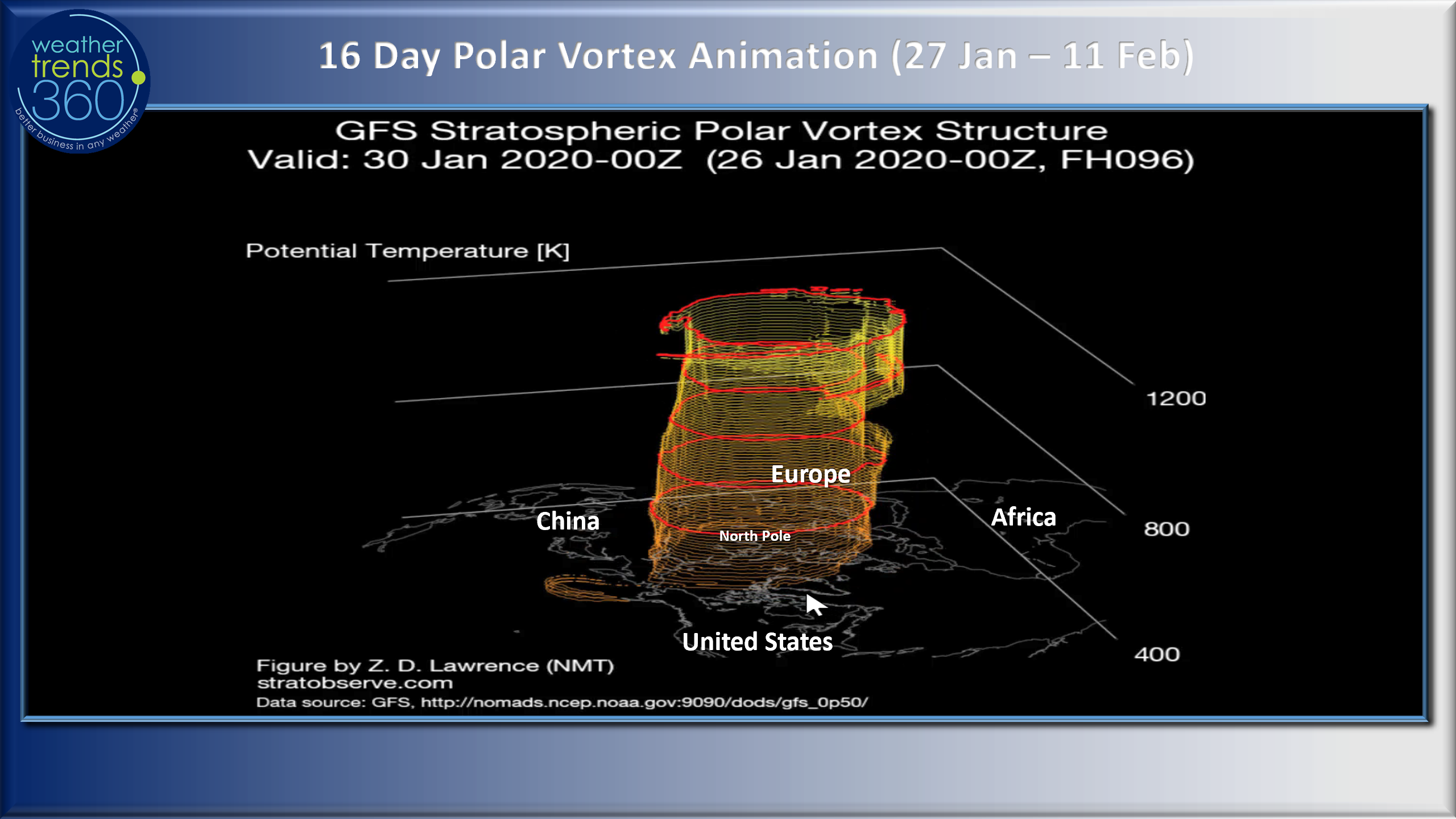
The other factor playing a big role this winter is a strong but very symmetrical Polar Vortex that has kept the frigid air bottled up at the North Pole, Alaska, NW Canada, NE Siberia and Greenland with only a couple quick intrusions into the U.S. (mainly the Plains). The pre-Christmas week (15-21 December) was one of the best weeks for Q4 with the greatest YOY change in temperatures of 7.1F nationally.
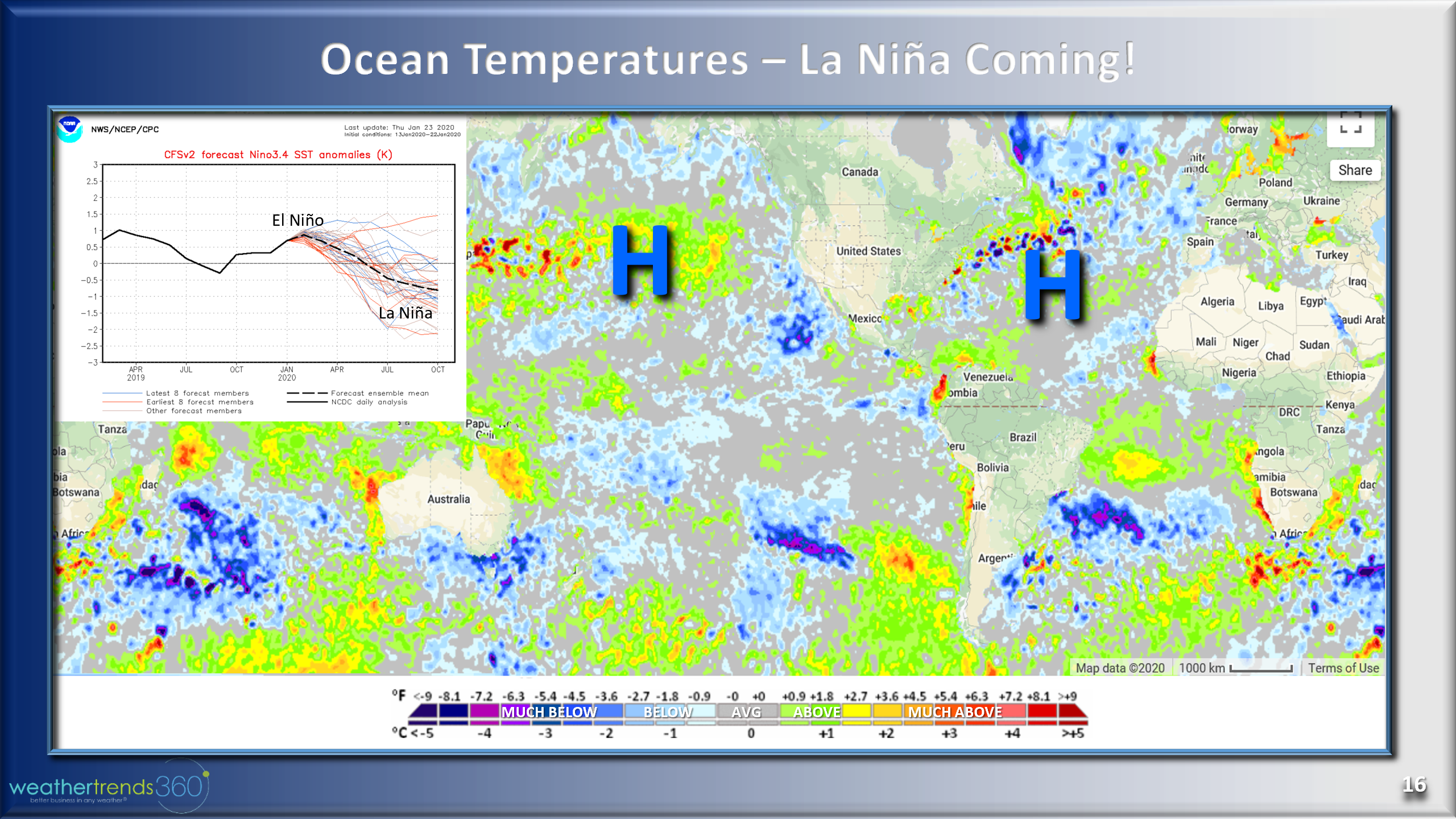
The Ocean temperature anomalies are also playing a big role with dueling High Pressure systems in the North Central Pacific and the Bermuda High in the Atlantic. With the warmer "blob" displaced more North of Hawaii and colder water temperature near Alaska, the downstream trough has been anchored more over Alaska, NW Canada as opposed to Central Canada or the Central/Eastern U.S. There are also clear indications that a La Niña event is likely for 2020 which is one of many factors that will lead to a very different year in 2020 compared to the soggy past couple years.
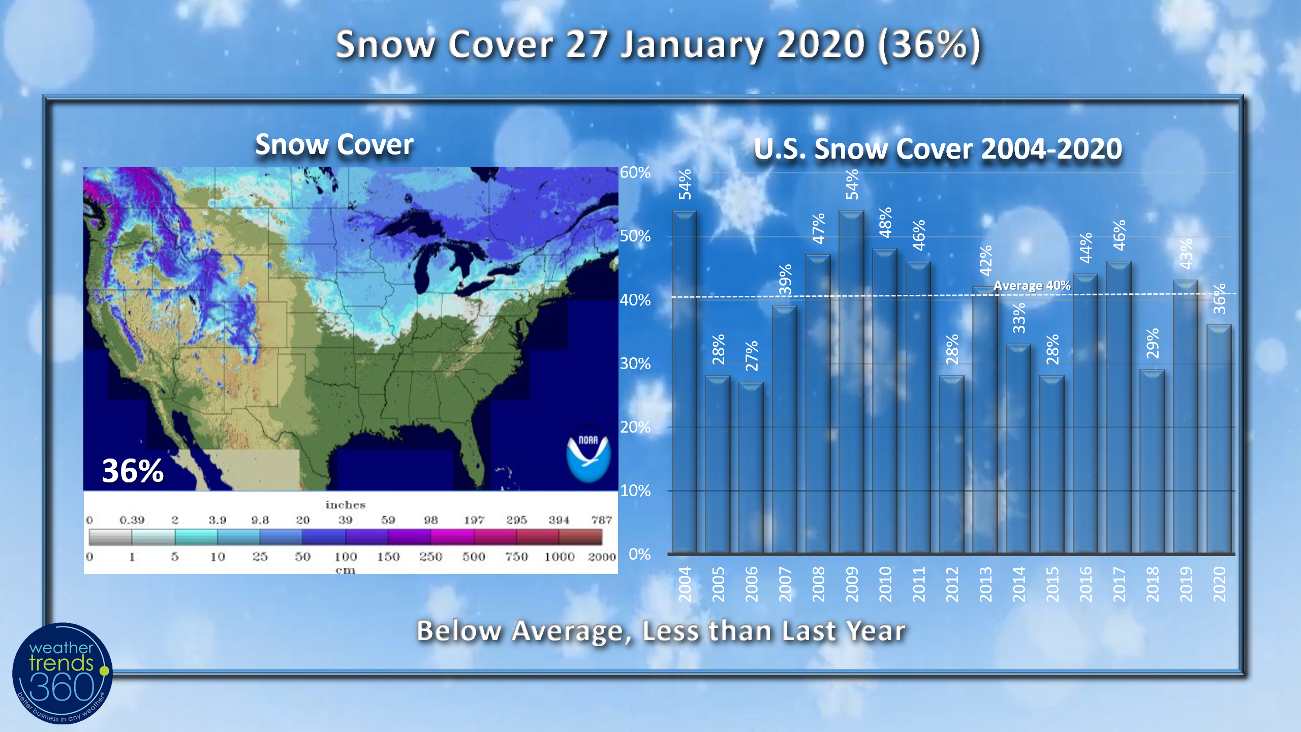
Snow Cover this morning is below average with 36% of the country blanketed in the white stuff compared to 43% last year and 40% average.
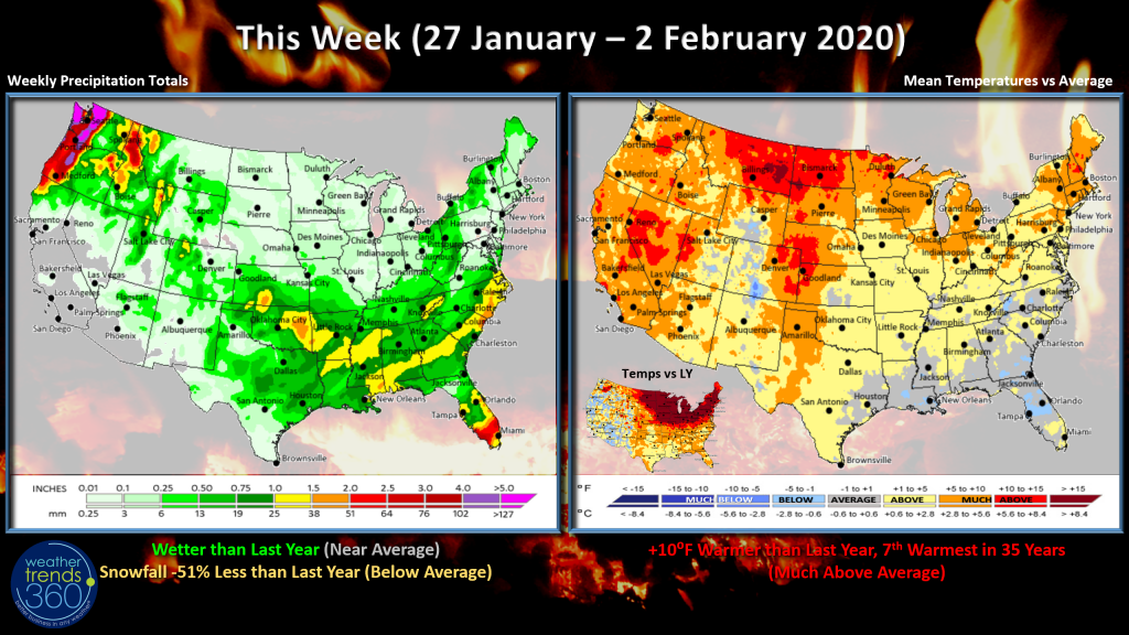 This week (27 Jan - 2 Feb) is on the toasty side, at least by late January standards, with the U.S. trending 10F warmer than last year, 7th warmest in 35 years, tad wetter than last year but snowfall trending down a whopping 51% nationally. Ironic that Florida is the one are with slightly cooler than average temperatures, probably not falling Iguanas this week.
Next week (3-9 Feb) shows some signs of hope for Winter cold/snow lovers with a small piece of the Polar Vortex bringing a glancing blow to the North Central U.S. and late in the period to the Northeast. It doesn't appear to last long but does give hope for a coastal Northeast snow storm in the 6-9th time-frame...way out there...but some hope. WTI's year-ahead outlook suggested the middle February period would bring some cold/snow to the Eastern U.S.

For 2020 we are very bullish on a lot of "in-sync" weather for retailers and seasonal suppliers through back2school with a particular favorable Q1, Q2 but then some higher risk in the October-November period. Combined with a Presidential election, the Fall period is likely to be very weak for seasonal categories!!!
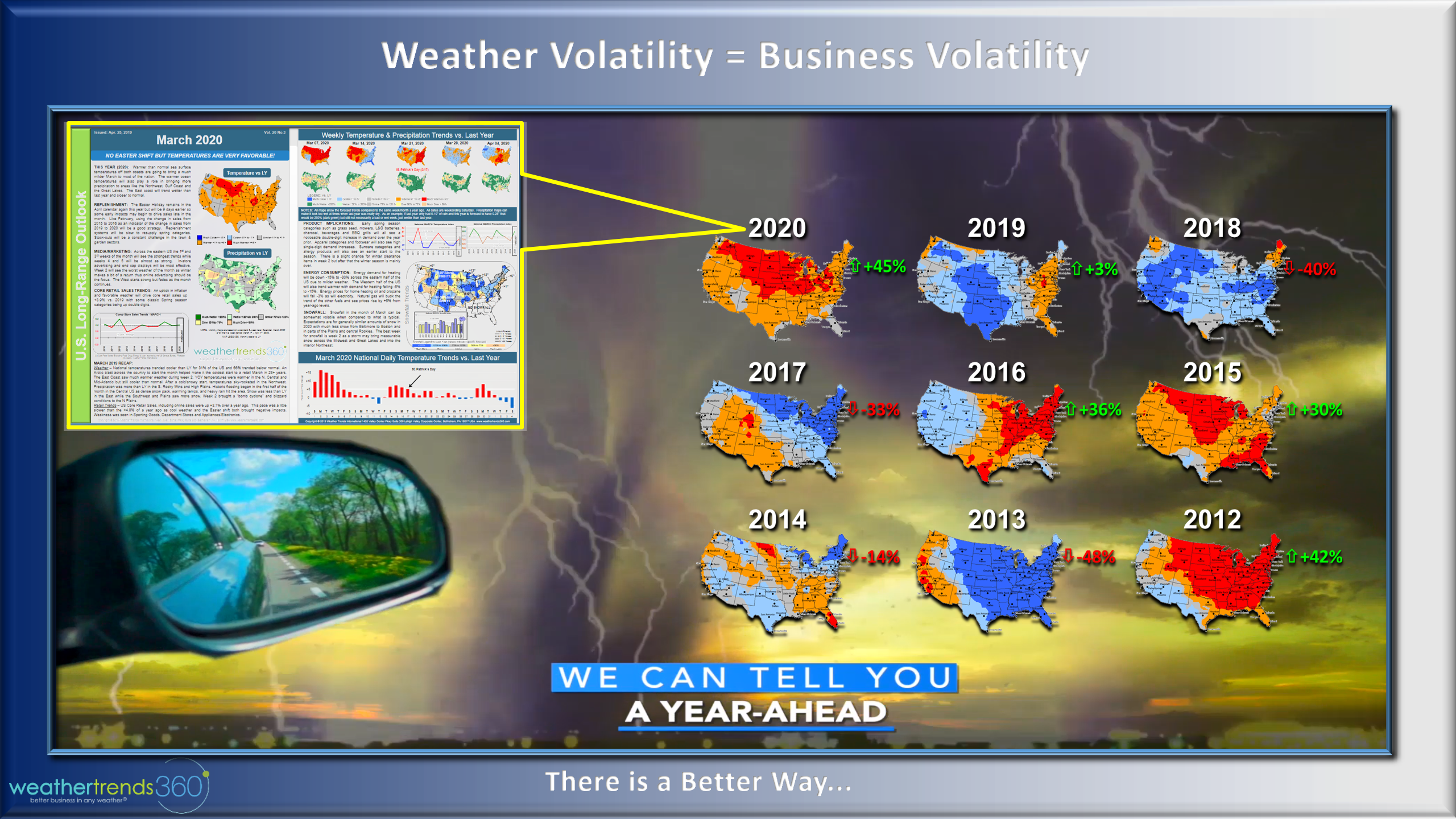
Spring looks to be a bright spot in 2020 with the best conditions in several years. The past few years have brought colder/snowier March weather for many and we don't expect it to be that way this year with conditions the best since 2016 and more similar to 2015, 2012. 2012 was record warm Winter and Spring so we don't expect conditions to be that good, but close. If you're planning off the past few Springs...you're planning through the rear view mirror and you'll miss a golden opportunity here in 2020.
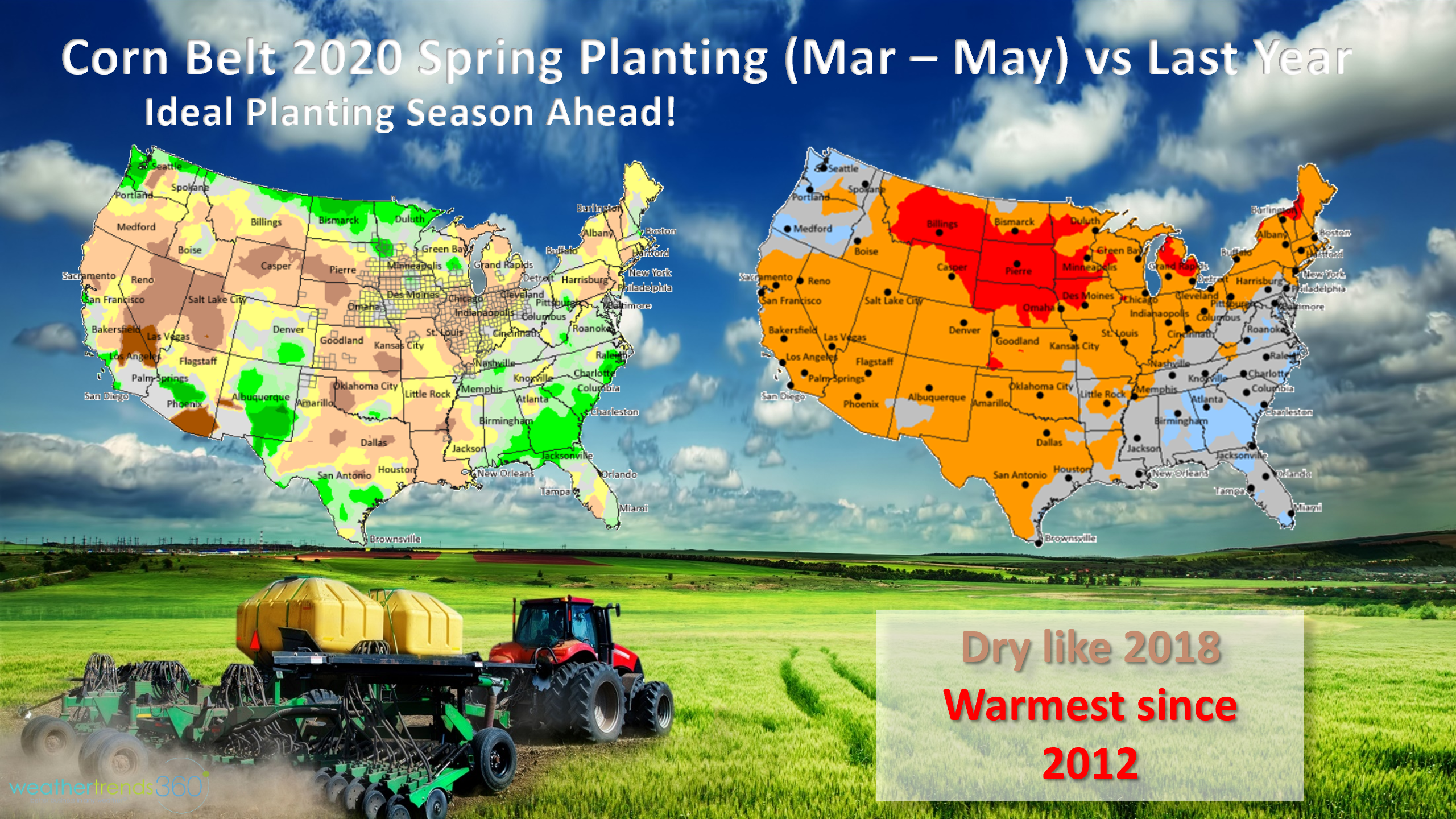
Farmers will also have a much better Spring planting season after a disastrous season last year. God Bless our farmers!
Have a great week and don't forget to follow us on social media for frequent updates. Facebook, Twitter, YouTube, Pinterest and Linkedin
- Captain Kirk out.