Captain's Log 27 Jan '24 Warm...but Pattern is Changing!
Captain's Log
27 Jan 2024: Happy Saturday! :)
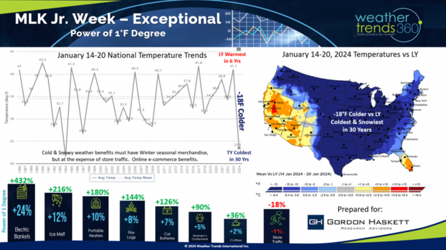
This past week we shared our 2024 outlook with long time client Chuck Grom - Gordon Haskett Research Advisors. The outlook is VERY WET and that's a big drain on the quarter ahead. Our Financial Services Updates always highlight both the weather outlook and the influence on business, sales, etc. CLICK ON IMAGES FOR A LARGER VIEW.
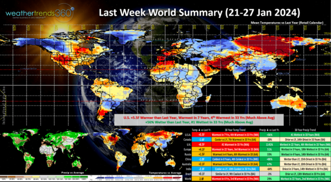
Last week (21-27 Jan) across the World shows the retreating Polar Vortex with the U.S. trending +5.5F warmer than last year, warmest in 7 years and 4th warmest of the past 33 years. Rainfall was up +56% over last year making it the #1 wettest in several decades. China was the cold spot, while the U.K. was the hot spot. The World overall was the wettest in 22 year - typical El Niño.
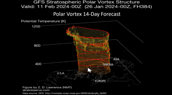
The retreating Polar Vortex is strong and symmetrical at the North Pole which pulls the Arctic air well North allowing for a warming trend in the middle latitudes. But signs of a wobble back toward the U.S. for middle February into early March so Winter is not over!
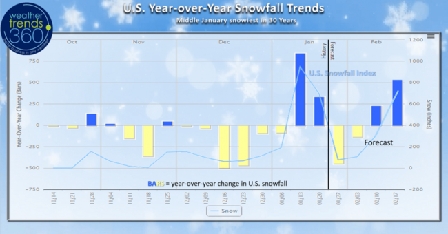
The wt360 U.S. snowfall index shows the very snowy middle January period which was the coldest/snowiest in 30 years and now a lull in the cold/snow. But by middle February those snowy trends are very likely to return, especially in the East.
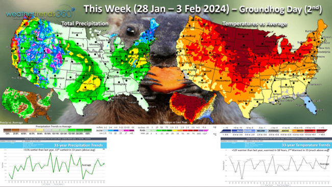
This week (28 Jan - 3 Feb) shows the mild/wet trends with the U.S. trending +12F warmer than last year, warmest in 18 years and 2nd warmest of the past 33. Rainfall up +11% over last year and 11th wettest of the past 33 years. Flooding is going to become a very big problem in the Northeast in the weeks and months ahead. Groundhog Day is 2 February (Friday)...wt360 says 6-more weeks of cold/snow returning!
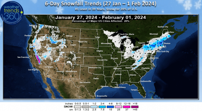
The 6-day snowfall outlook (27 Jan - 1 Feb) shows the snowy spots in New England and the Sierras of California, but only 20% of the U.S. will be impacted by snow.
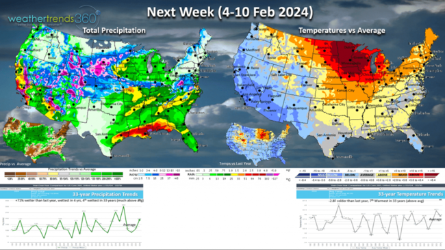
Next week (4-10 Feb) shows the evolving weather pattern with colder and snowier weather moving into the West and the retreating extreme warmth. National temperatures trend -2.8F colder than last year, but still 7th warmest of the past 33 years. Rainfall up +71% over last year, wettest in 4 years and 4th wettest in 33 years. Increasing threats for bigger snowstorms that will eventually head East.
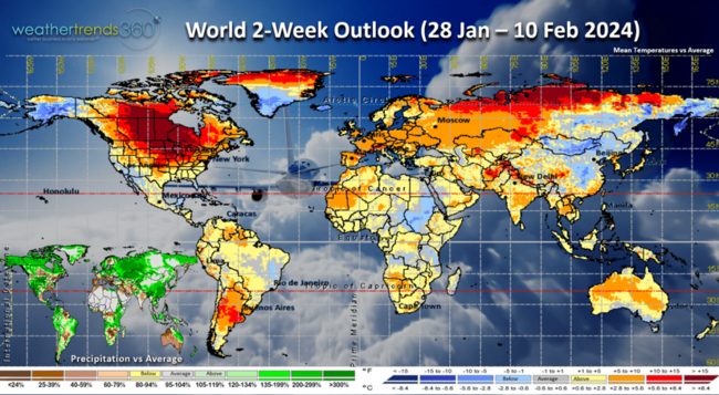
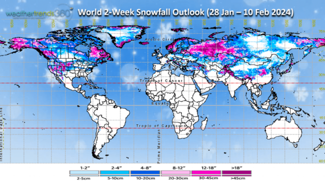
The World 2-week outlook (28 Jan - 10 Feb) is a little misleading as it combines the very warm week this week and a cooling trend next week in the U.S.
World 2-week snowfall is particularly heavy in Western Russia, Alaska, Northeast Canada and the Western U.S.
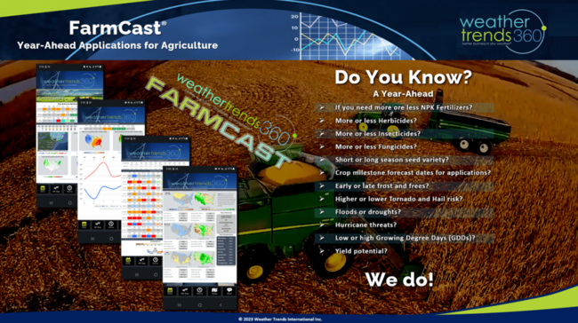
For our FarmCast customers, our 2024 annual Ag outlook video will be sent to you this week. The theme will be WET, SEVERE but a strong crop year for most. For more information on our Ag FarmCast product - watch the video.
Have a great week ahead, and don't forget to follow us on social media for frequent updates: Facebook, Twitter, YouTube, Pinterest and Linkedin.
- Captain Kirk out