Captain's Log 27 July '20 Hot & Hurricane Threat
Captain's Log
Happy Monday! :)
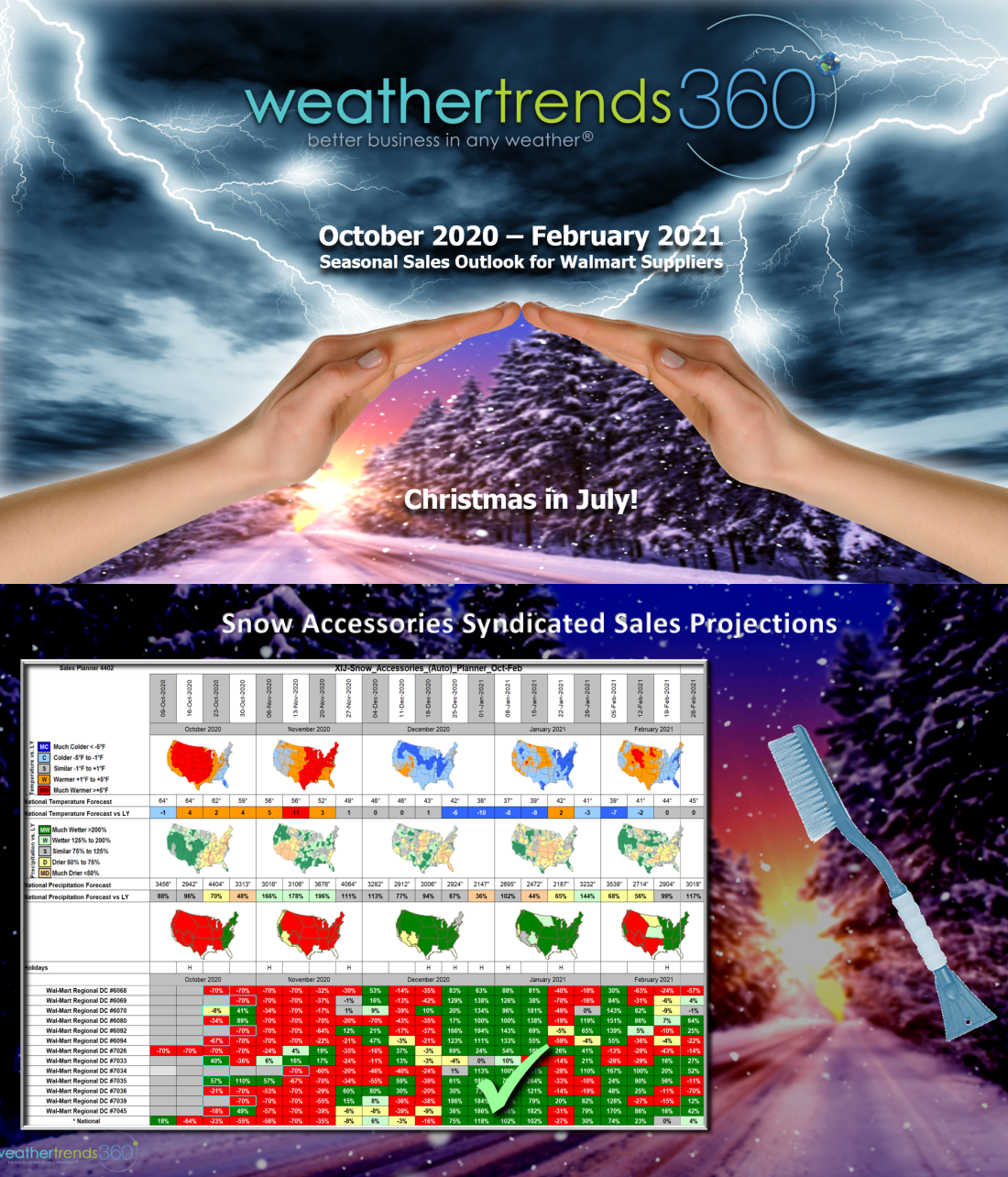
Can you believe it's already late July and only 151 days until Christmas? To celebrate early, we're providing Walmart Bentonville based suppliers a free outlook for dozens of seasonal categories for the Oct 2020 - Feb 2021 period. We're calling it Christmas in July contact sales@wt360.com to get your free category outlook for this Fall-Winter across your Walmart geographies. CLICK ON IMAGES FOR A LARGER VIEW.
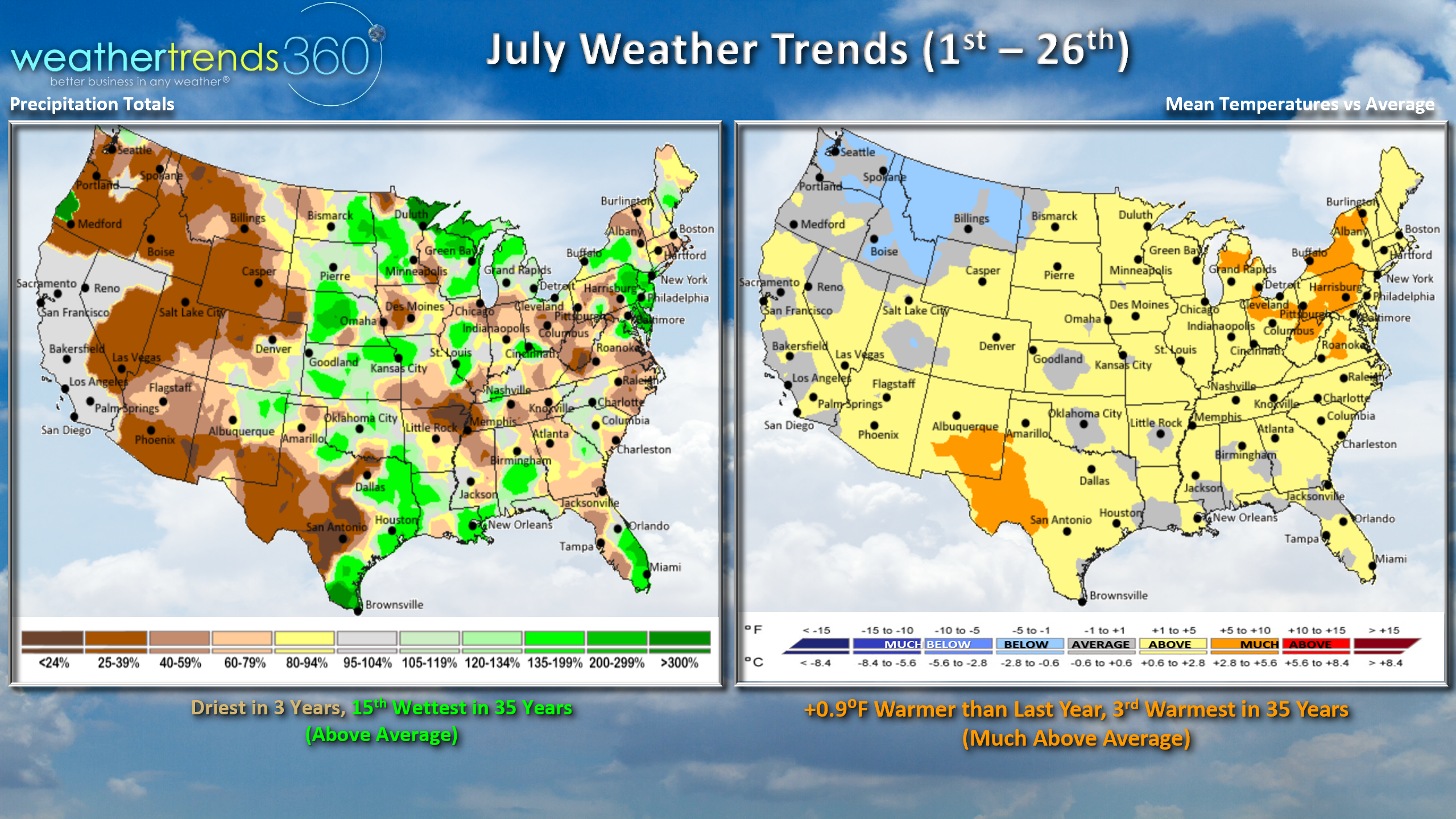
July is almost in the history books and it's been hot with a lot of tropical activity. Nationally it's been trending +0.9F warmer than last year, 3rd warmest in 35+ years with much above average national temperatures. The cool spot has been the Pacific Northwest. Rainfall is the least in 3 years and 15th wettest of the past 35 years, but drought is expanding rapidly in many areas.
 Drought now impacts about 56% of the country, up from the record lows of just 10% last year.
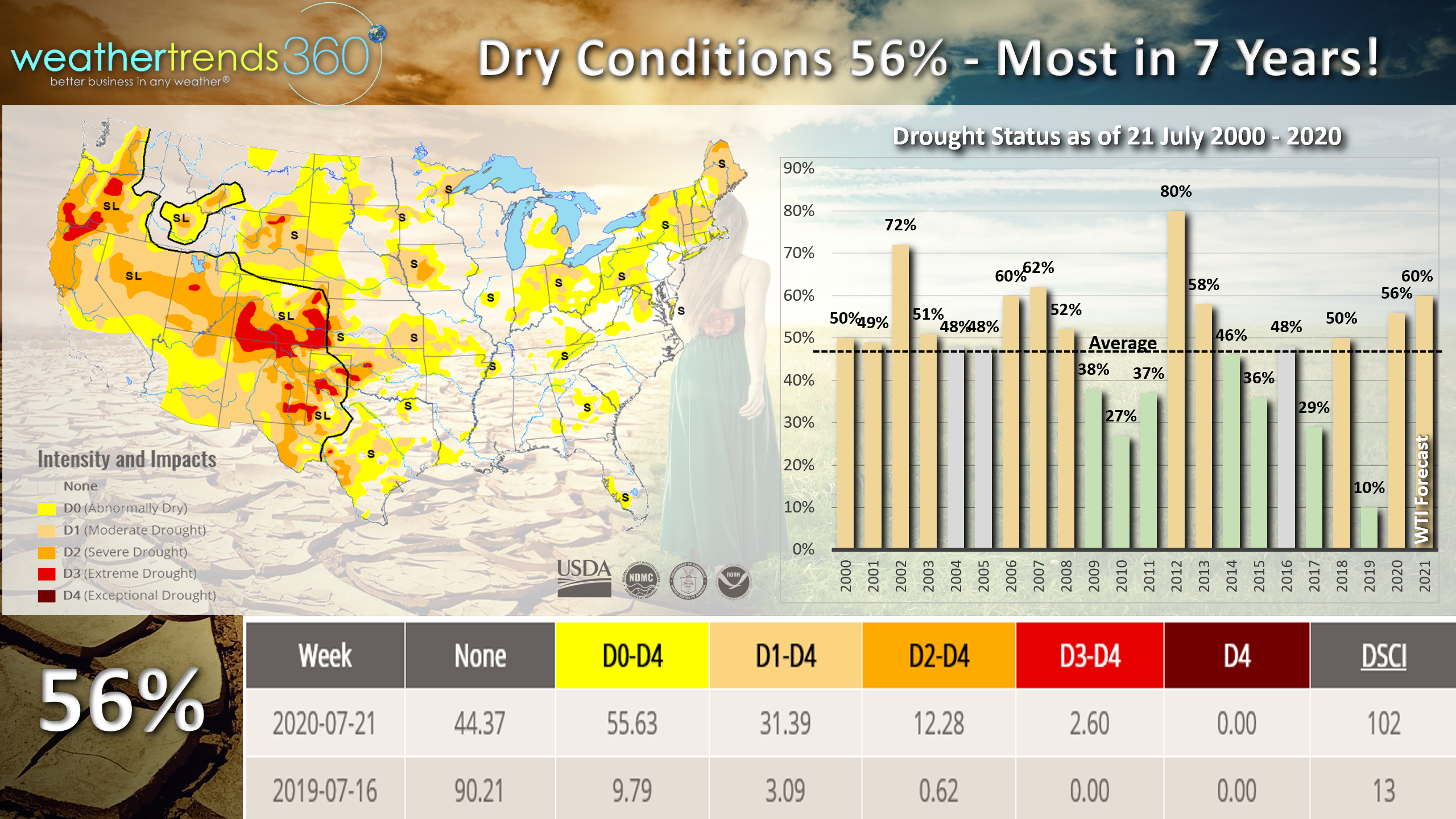
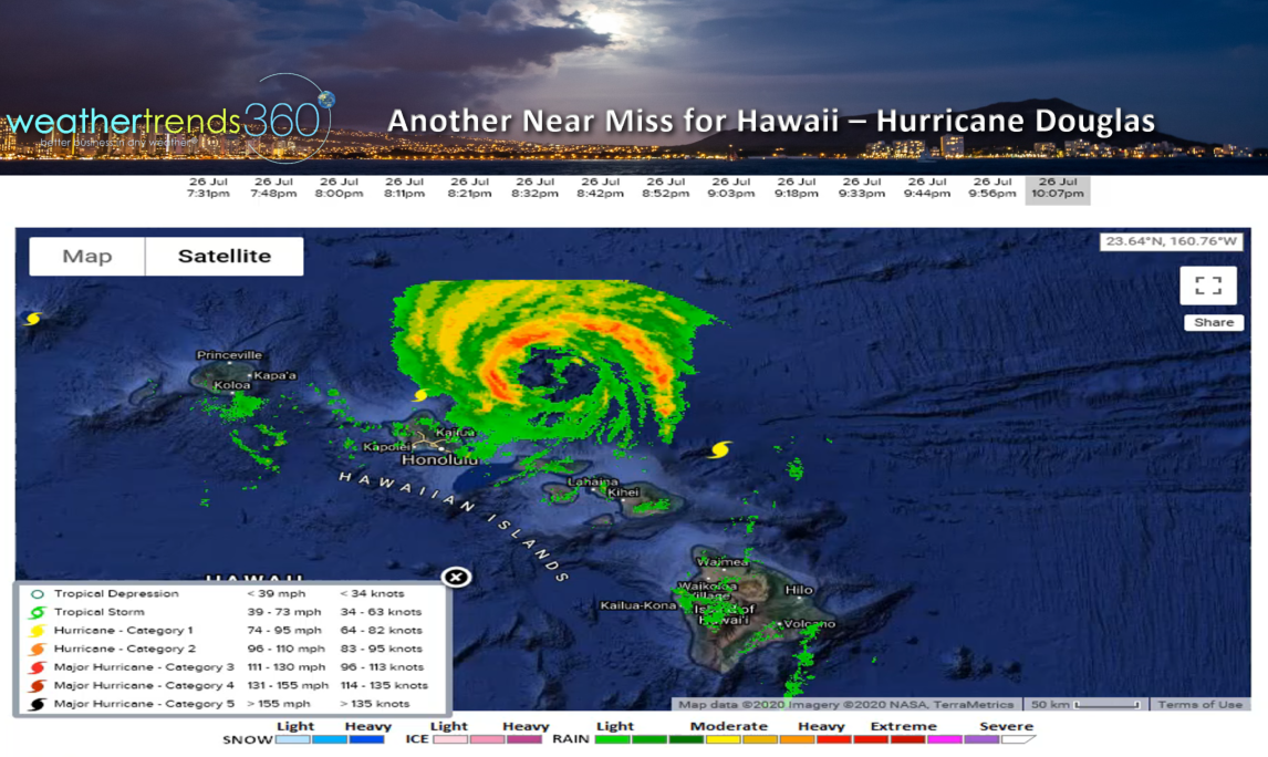
Hawaii dodged a bullet with Hurricane Douglas passing north of the Islands last night. Fortunately they were in the Southwest quadrant of the hurricane keeping the devastating right front quadrant winds and surge well away from all of the Islands.
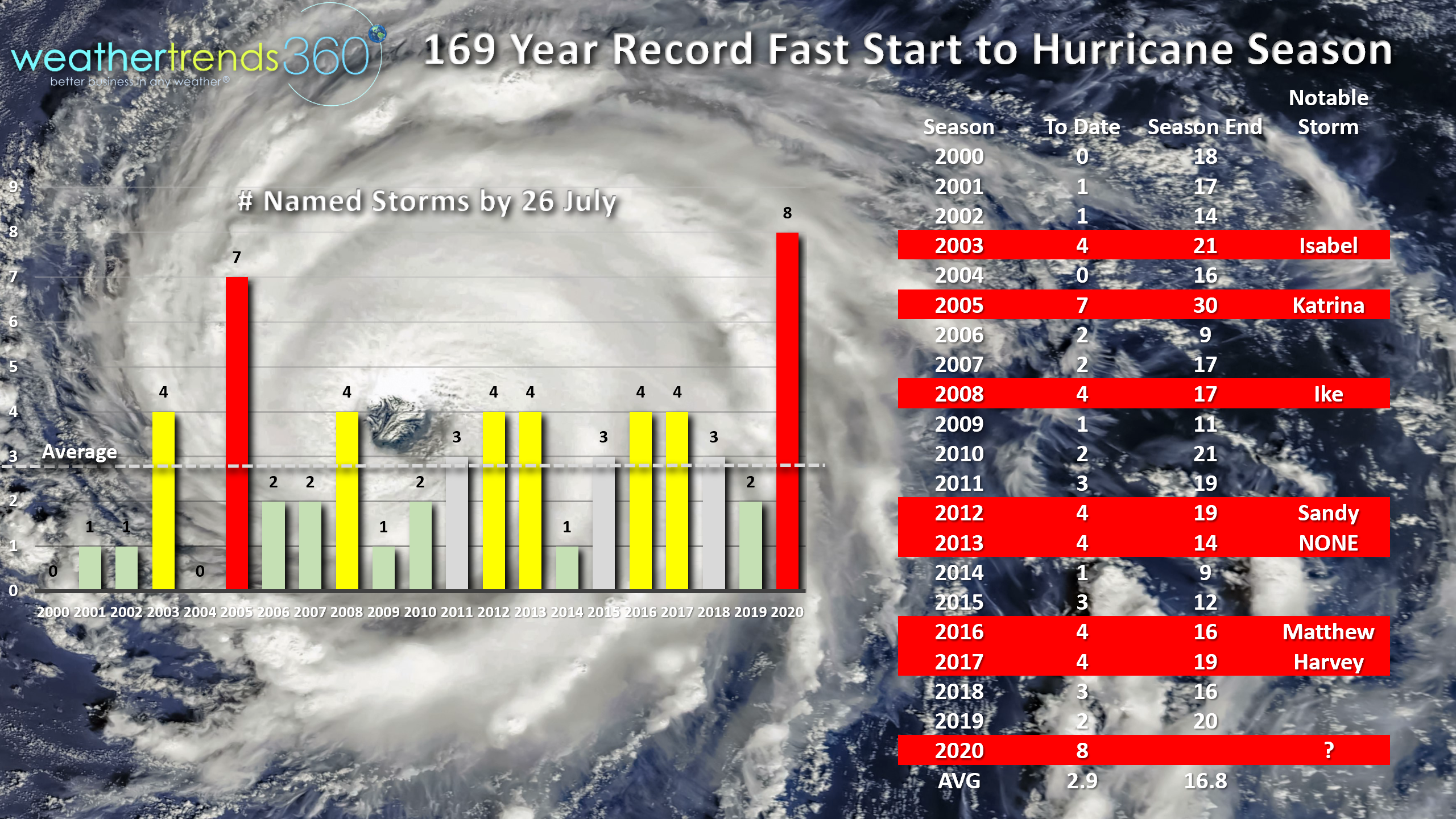
The Atlantic basin will almost certainly not be as lucky this year as the season is already off to a 169 year record fast start and very likely we get the 9th named system this week. Eight named storms season-to-date is more active than the devastating 2005 season.
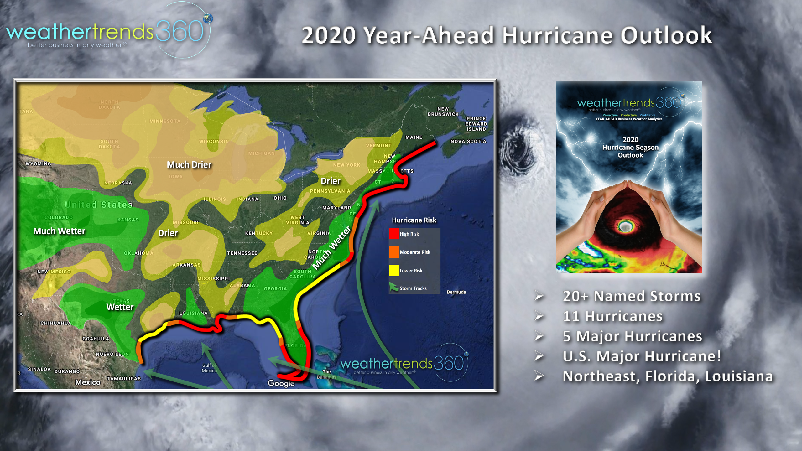
Very likely we're going to have a couple catastrophic hurricanes impacting the U.S. this year with our high risk areas in SE Florida, New England and the North Central Gulf.
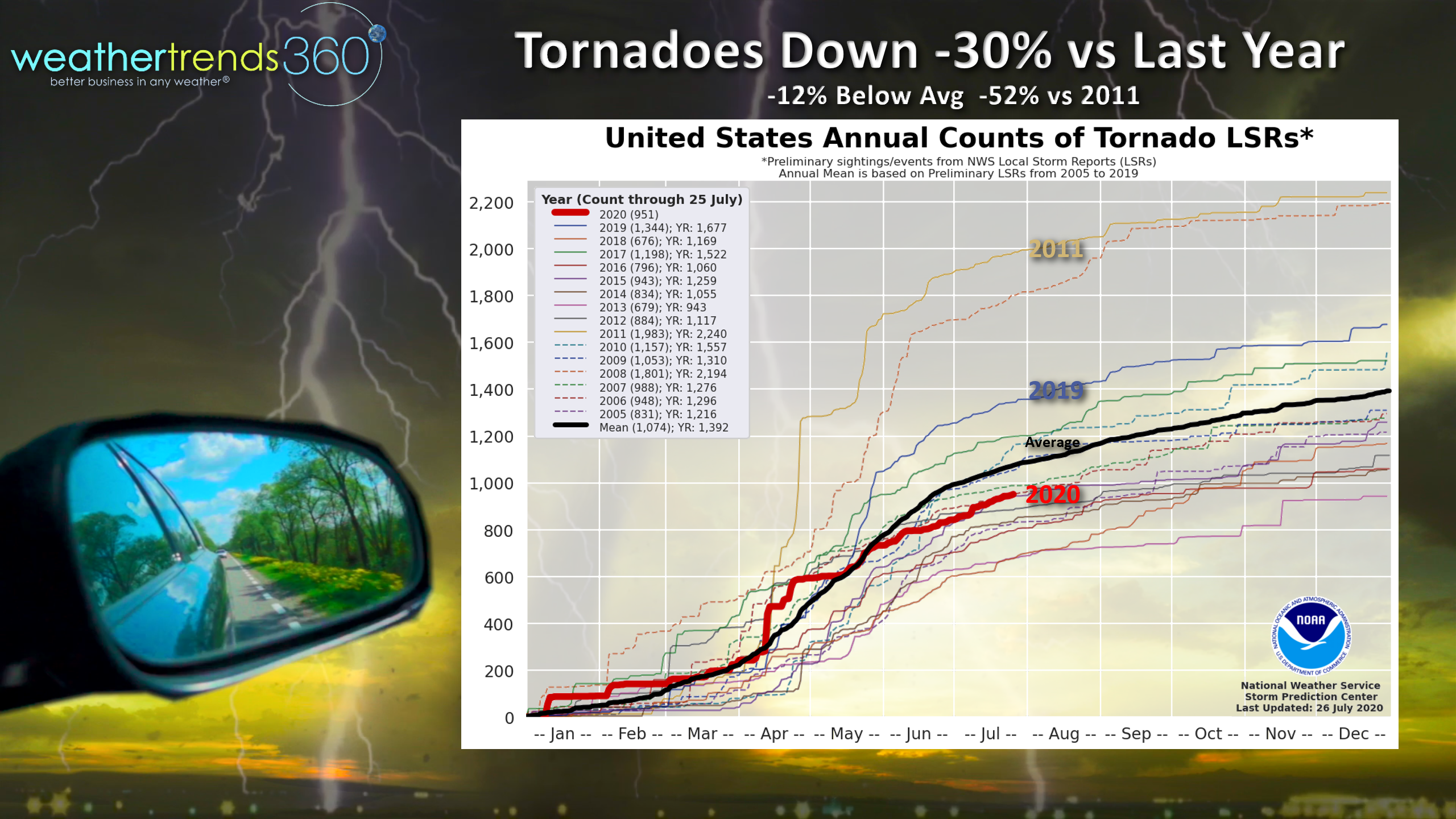
Fortunately the tornado season has been well below average as wt360 forecast a year-ahead. Tornadoes are down 30% from last year, 12% below average and way down, 52% from the hyper active 2011 season.
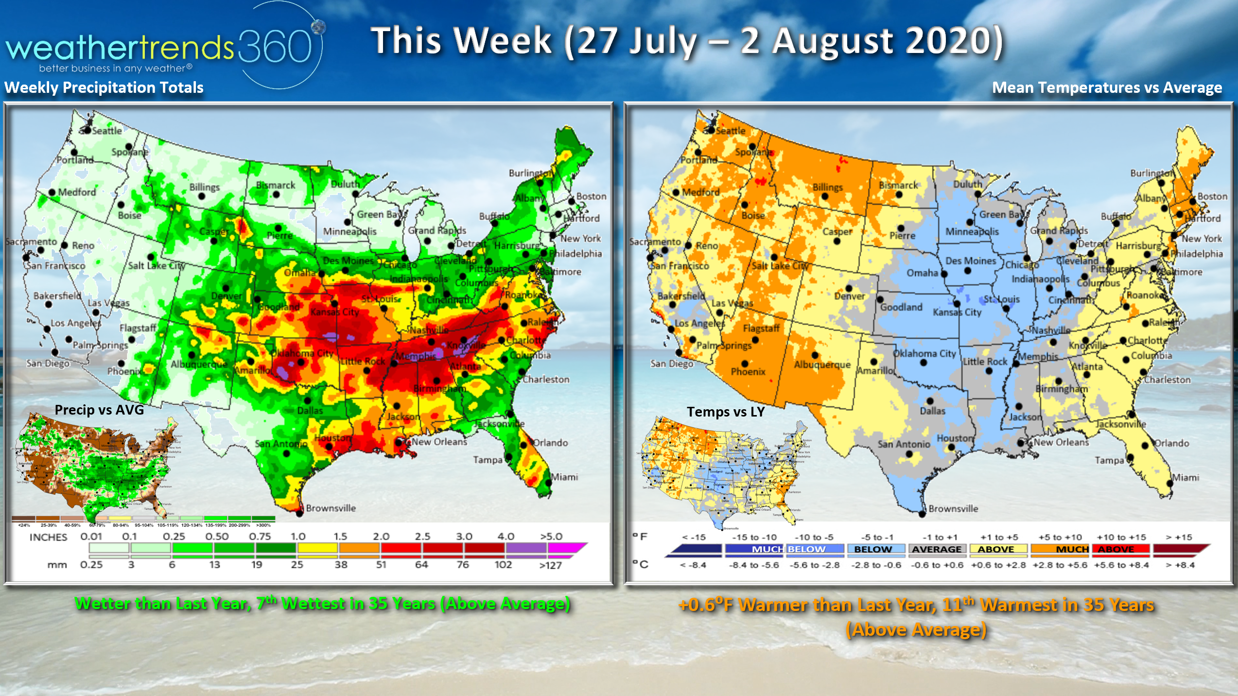
This week (27 July - 2 August) A cold front will sweep through the Midwest and the East Coast with some cooler weather and less humid conditions for a few days. Overall the week trends +0.6F warmer than last year nationally making it 11th warmest of the past 35 years. Rainfall is up over last year and 7th wettest of the past 35 years with some relieve for drought plagued areas in the Central U.S. and Middle Atlantic. Need to watch the East Coast this weekend for a potential Hurricane Isaias...TBD if it makes the right turn off the East Coast.
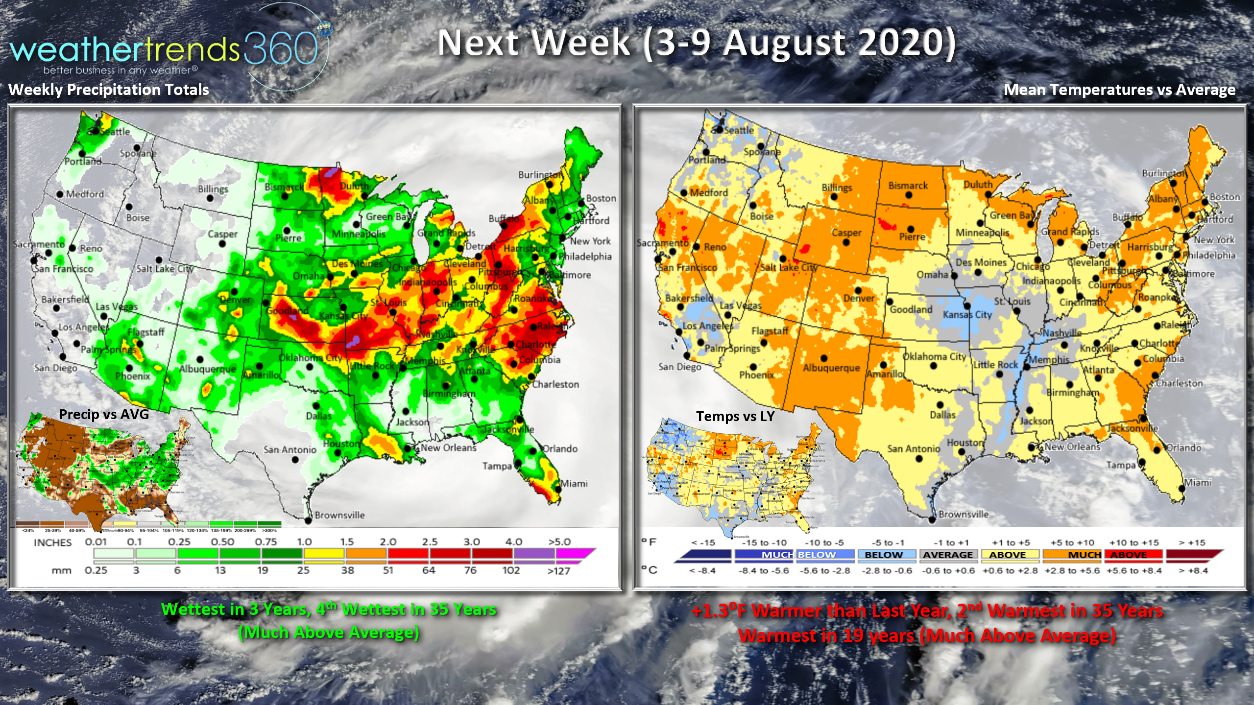
Next week (3-9 August) shows a hot and humid pattern for the dog days of Summer. National temperatures trend 1.3F warmer than last year making it the 2nd hottest early August period in 35 years. Rainfall the most in 3 years and 4th wettest of the past 35 years nationally. We're entering the peak Aug - Oct period of the hurricane season and things can flare up very quickly.
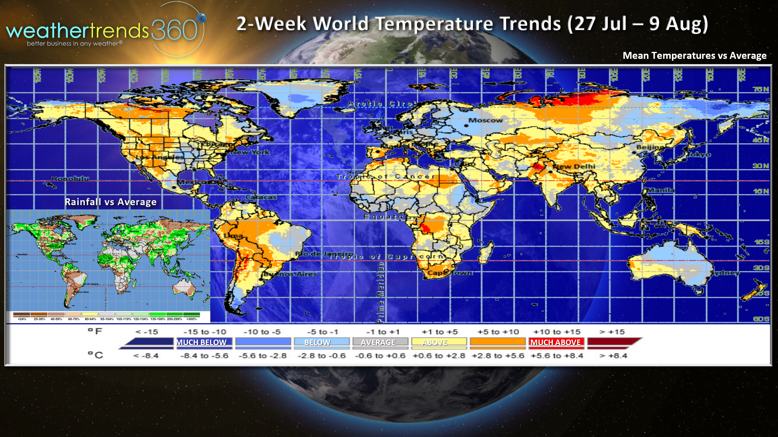
For the World overall, the next 2-weeks show hot conditions across much of North America except the Central U.S., cooler across Northern Europe and Western Russia with below average temperatures but hot in the Mediterranean coastal areas and cool down under in Australia.
Have a great week and don't forget to follow us on social media for frequent updates: Facebook, Twitter, YouTube, Pinterest and Linkedin