Captain's Log 27 March '22 Much Colder than Last Year
Captain's Log
Not so Happy Sunday...unless you like cold and snow. :(
It feels and looks like February outside wt360 HQ in Bethlehem, PA today with a very cold wind and snow showers. CLICK ON IMAGES FOR A LARGER VIEW.
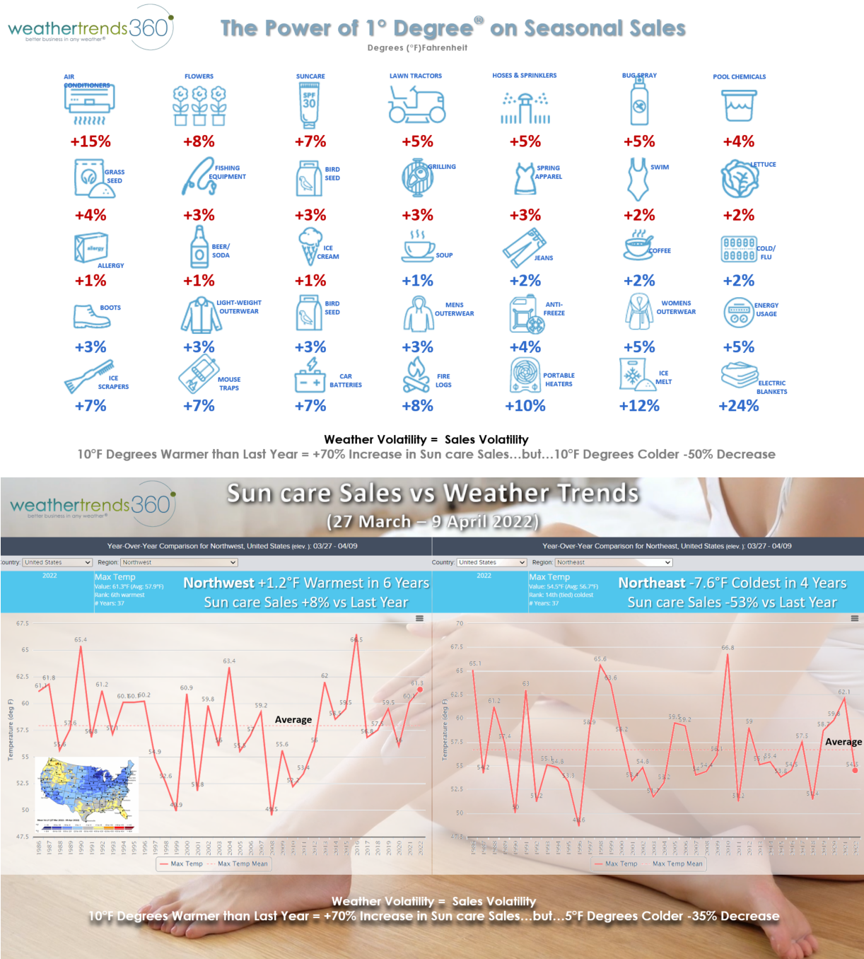
We've been featuring some of our YEAR-AHEAD forecasts in the videos each week, but today we talk more about how we convert a weather forecast into a sales forecast. It's our Power of 1 Degree® technology. As an example, every 1F warmer this time of year there is a 7% increase in sun care sales, 10 degrees warmer +70% increase. But if colder, a downside to sales. Over the next two weeks, the winner for sun care sales would be the Pacific Northwest trending up 8% while the Northeast trends down -53% (see video for details).
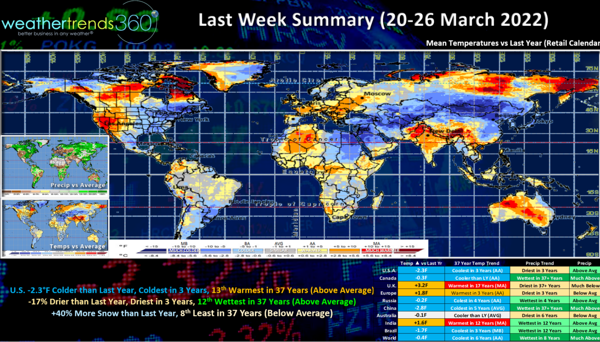
Last week (20-26 March) across the World shows the U.S. trending -2.3F colder than last year, coldest in 3 years but still the 13th warmest of the past 37 years nationally. Rainfall was 17% drier than a year ago, least in 3 years but still 12th wettest of the past 37 years. Snowfall was up +40% over last year, but still below average and 8th least of the past 37 years. Overall, a slightly negative week for Spring merchandise sales.
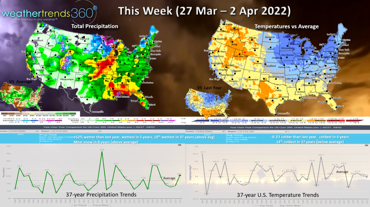
This week (27 March - 2 April) shows the cooler trends continuing for the Midwest, Great Lakes and Northeast, while the West is best. The U.S. overall trends -0.3F colder than last year, coldest in 4 years and 14th coldest of the past 37 years with below average national temperatures. Rainfall way up +52% more than last year, wettest in 5 years and 10th wettest of the past 37 years. Snowfall also way up +240% and most in 8 years. Another soft week for Spring seasonal merchandise, stronger West. Another bout of severe weather and tornadoes for the Central U.S. midweek and Deep South later in the week.
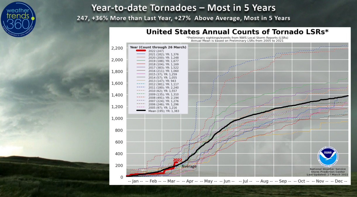
Tornadoes are way up with 247 reported so far, +36% more than last year, +27% above average and most in 5 years. These trends are likely to continue through the core April - May season ahead.
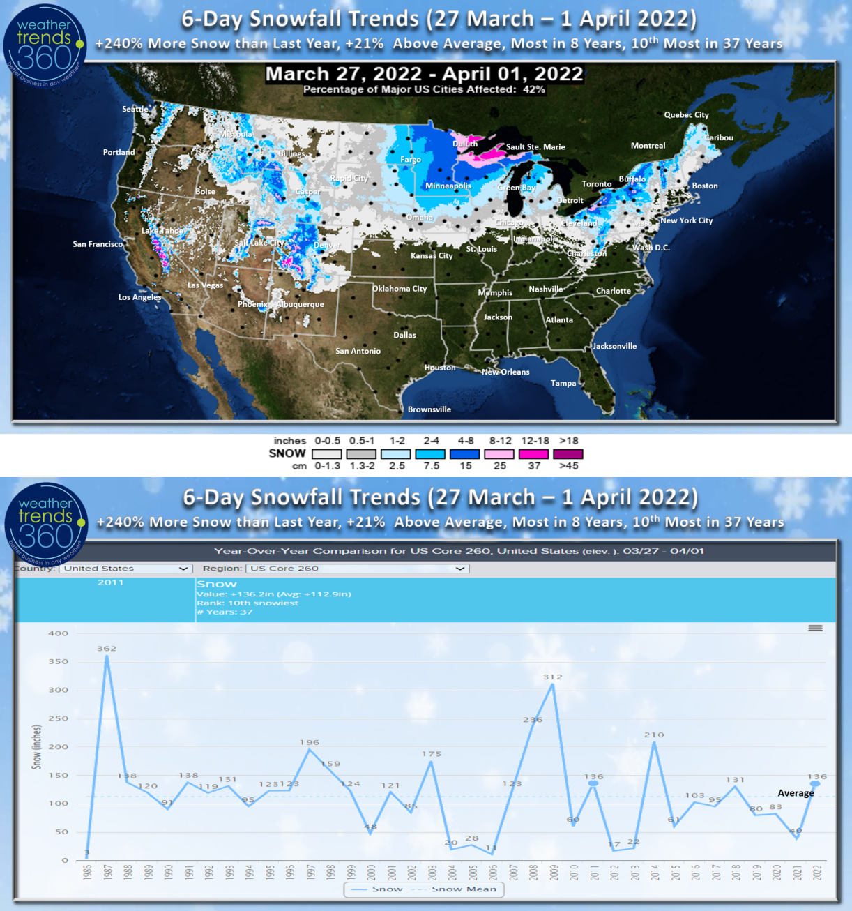
The 6-day snowfall trends show winter hanging on with +240% more snow than a year ago, +21% above average, most in 8 years and 10th most of the past 37 years.
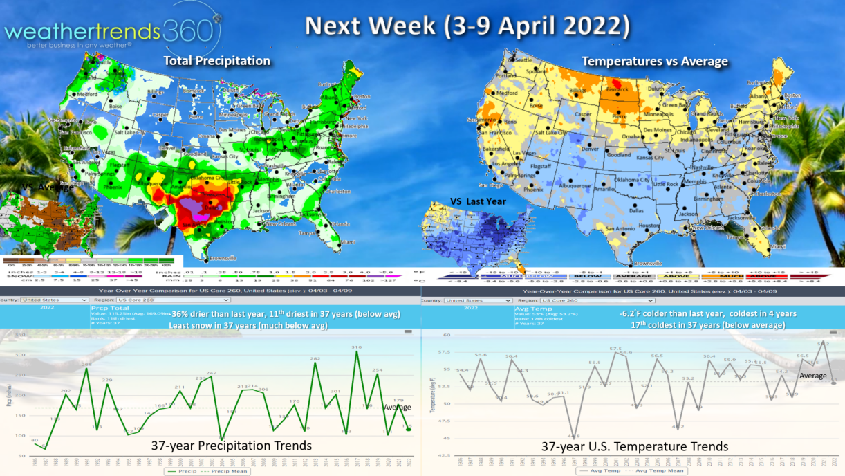
Next week (3-9 April) more of the same with the U.S. trending a significant -6.2F colder than last year, coldest in 4 years and 17th coldest of the past 37 years with below average national temperatures. Rainfall trends down -36% vs last year and 11th driest of the past 37 years. Snowfall likely to be way down and below average. The severe weather threat likely to shift to the South Central - Texas area while wildfires continue to plague the Southwest and Rocky Mountains.
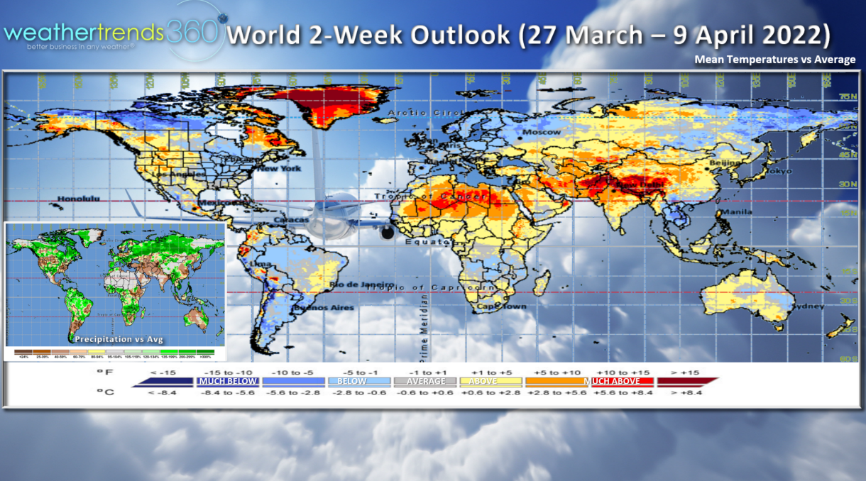
The 2-week World outlook shows cooler conditions in the Eastern half of the country, warmer out West. Europe also looks to be on the cool side while very hot conditions dominate China, Middle East and Africa.
We hope you have a great week, and don't forget to follow us on social media for frequent updates: Facebook, Twitter, YouTube, Pinterest and Linkedin.
- Captain Kirk out.