Captain's Log 9 December 2019 Monday
Captain's Log
Happy Monday! :)
You have 15 days...13 hours...40 minutes and 6 seconds until Christmas! Sorry for the panic breaking news. CLICK ON IMAGES FOR A LARGER VIEW
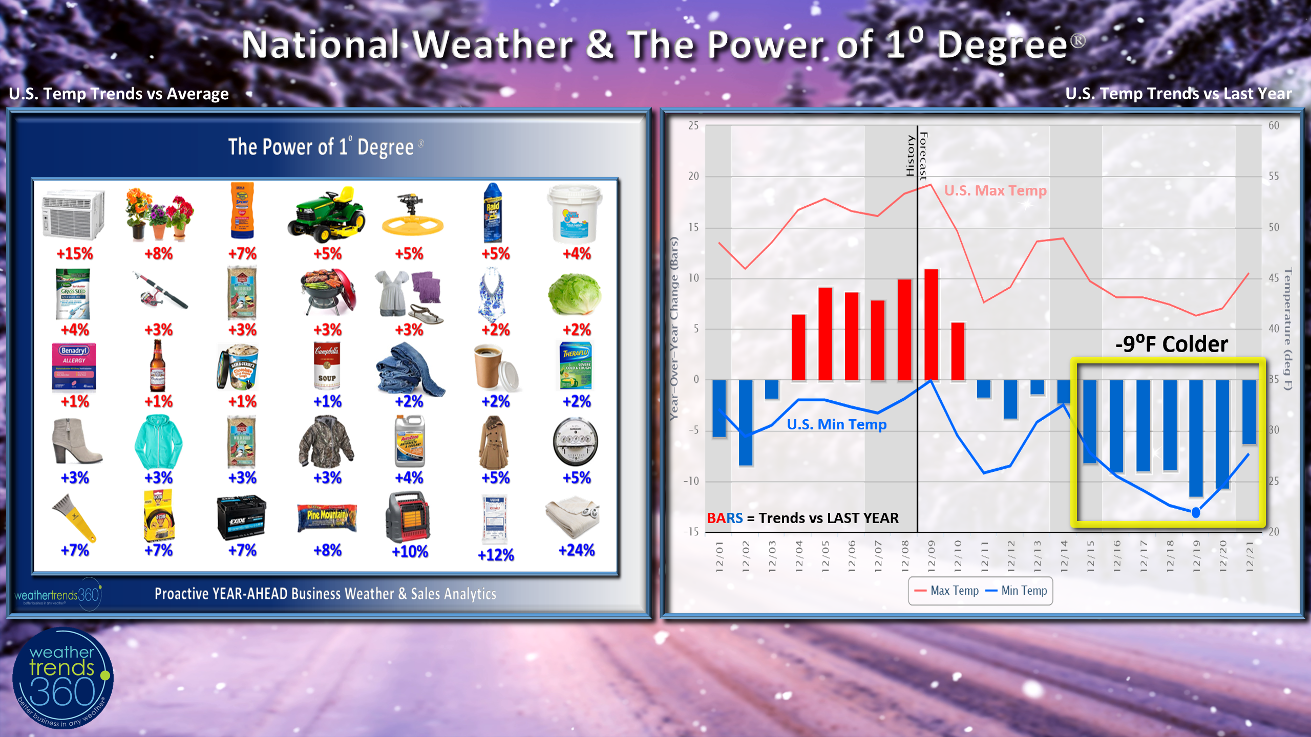
The 2-week outlook shows a much colder and stormier pattern than last year leading up to Christmas across much of North America which is good news...bad news for both shoppers and retailers. First the good news. With national temperatures expected to trend 9F colder than last year for the last full week before Christmas, seasonal sales gains will be very strong at the expense of store traffic. Applying our Power of 1 Degree technology we expect very strong sales gains for everything from Coffee to Electric Blankets. Every 1F colder than last year there is an 7% increase in Ice Scraper sales x 9 degrees colder and we have a huge uptick in sales of 63%.
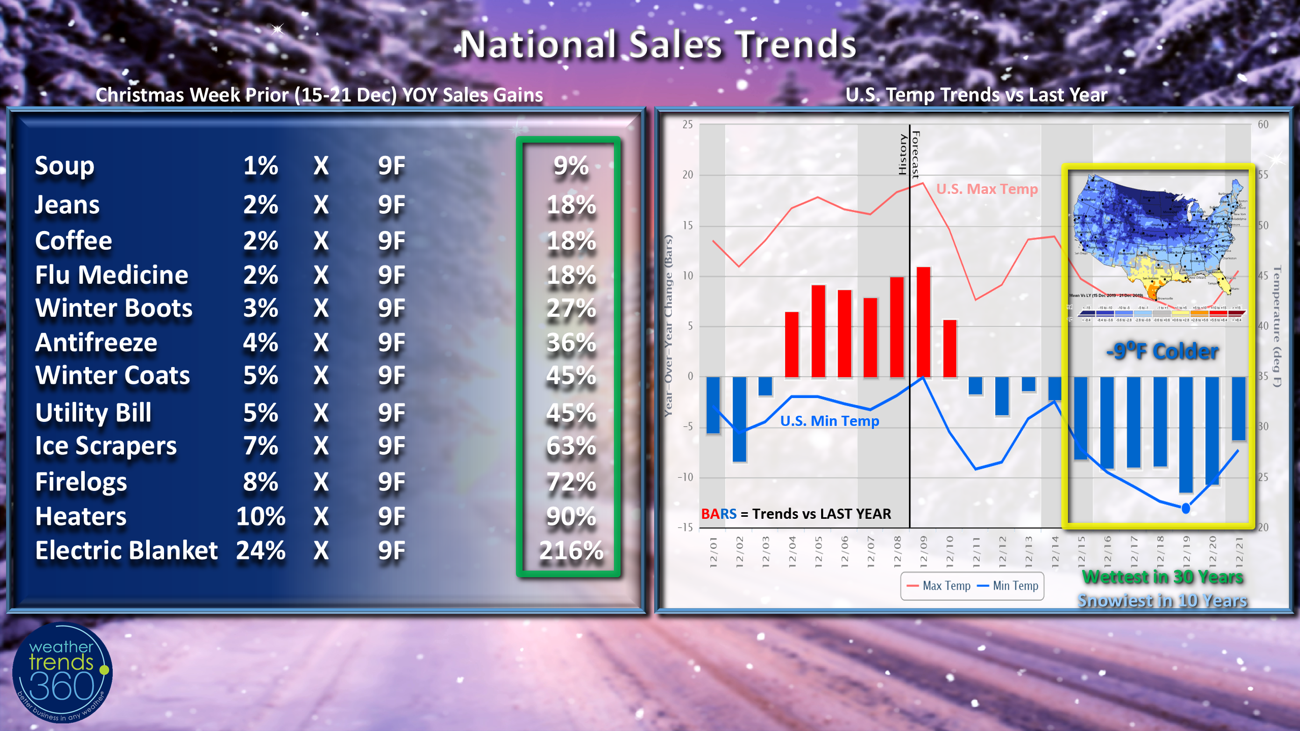
Now the bad news...the wettest in 30 years and snowiest in 10 years will certainly create challenges for shoppers to get out so that will be to the benefit of e-commerce and on-line shopping. On-line sales always go way up when the weather is challenging so retailers with both brick and mortar stores and a great on-line platform will do well (Amazon, Wal-Mart).
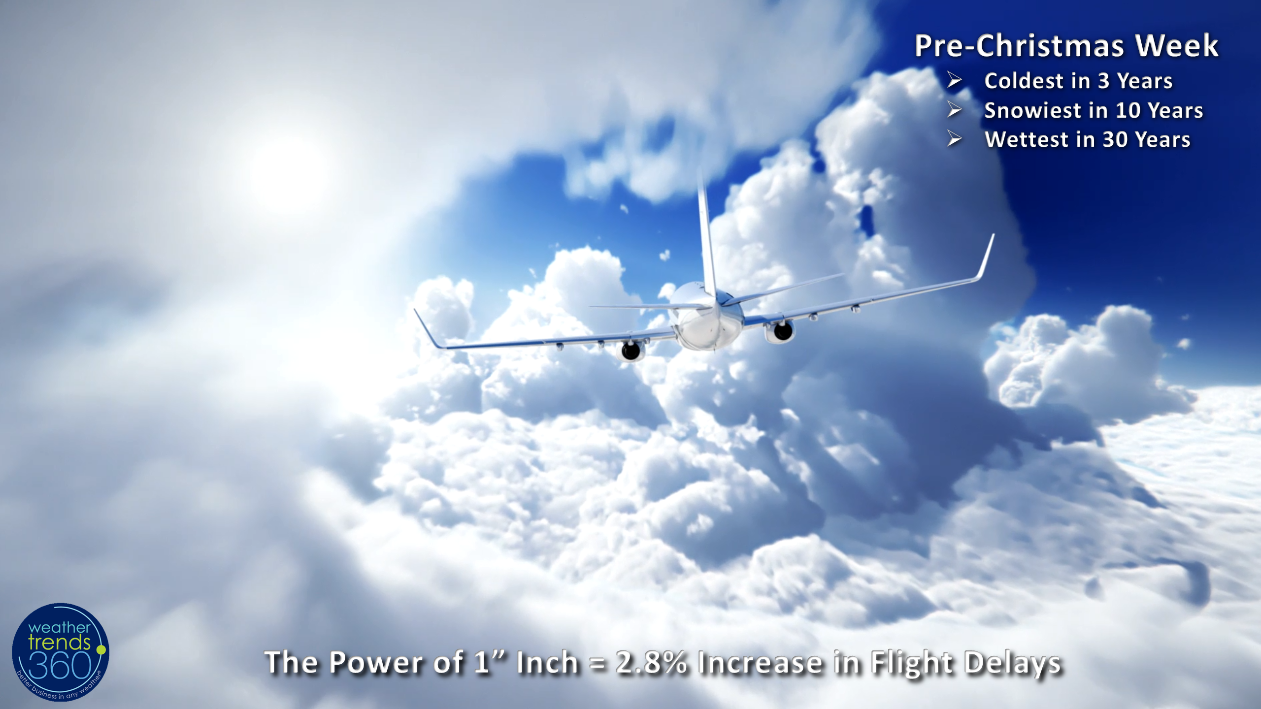
Unfortunately FedEx, UPS and Amazon will have their challenges cut out for them navigating the skies to get your packages to their destination on-time. Every 1" more rainfall can create a 2.8% increase in flight delays so there will certainly be delays and cancellations whether you're carrying packages or people over the next couple weeks.
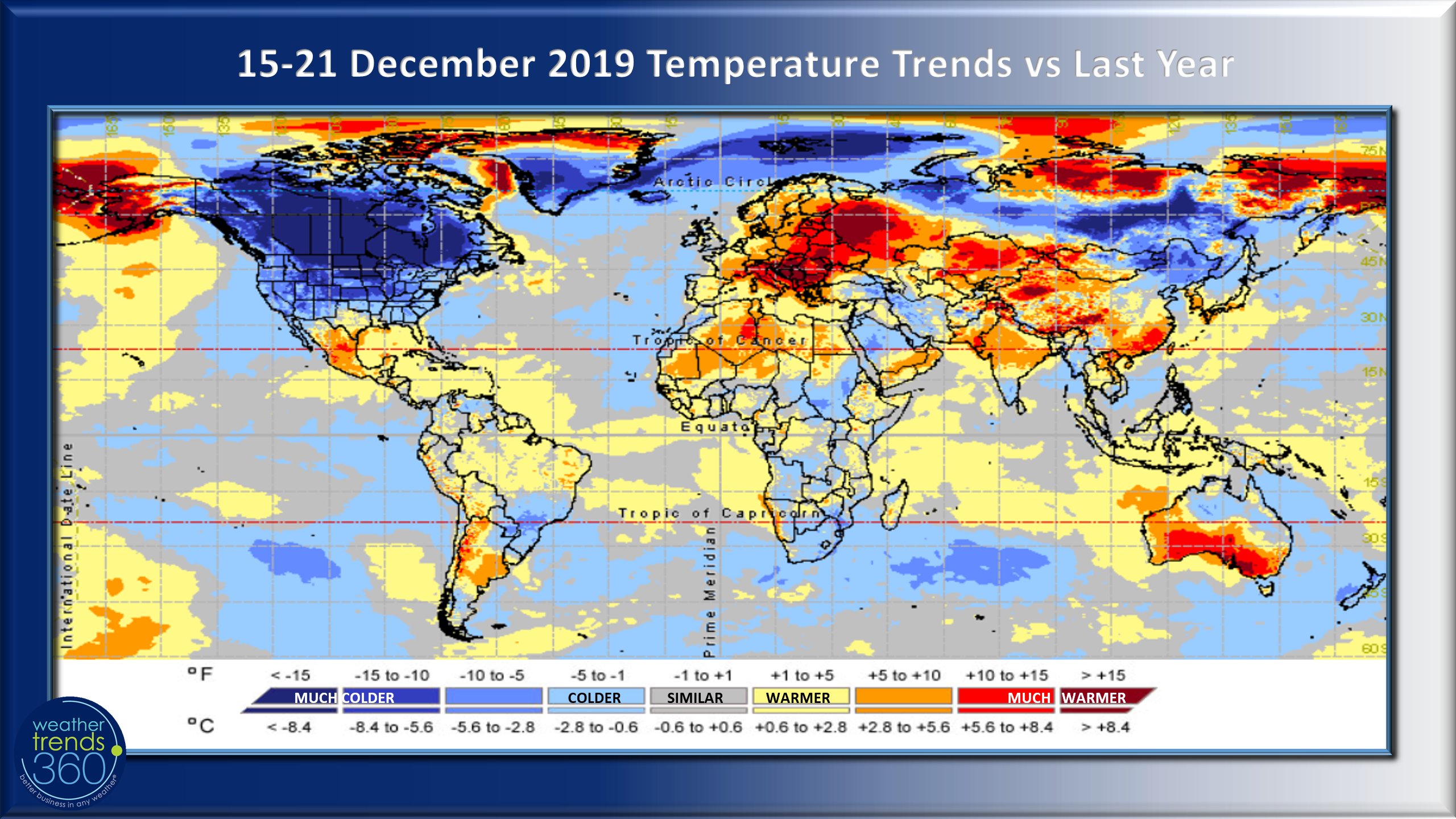
Around the world the last full week before Christmas looks much warmer than a year ago across Europe and Southeast China while North America is the colder spot. Milder and drier weather is better for store traffic at the expense of seasonal merchandise sales.
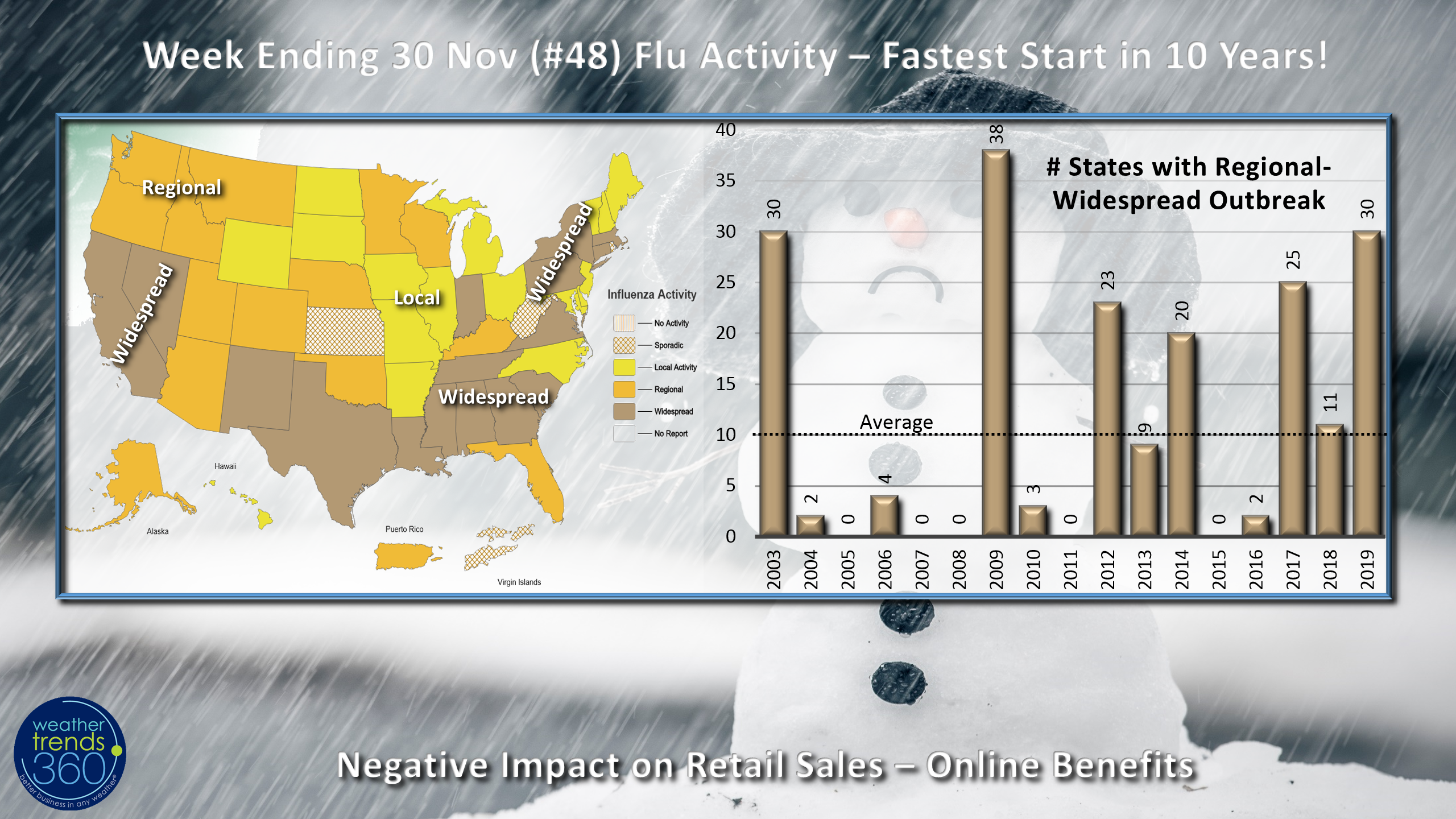
The other big negative is a rapidly increasing bout of illness across the U.S. with Flu now trending the most widespread in 10 years. 30 states now have regional or widespread outbreaks so this is a much faster start than last year when Flu peaked much later in the January and February timeframe. The good news is spike years tend to see a quick drop off in Flu later in the Winter.
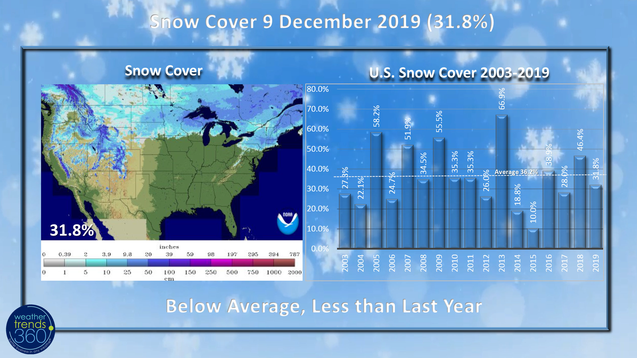
Snow Cover this morning is below average across the U.S. with only 31% of the country blanketed in snow, down from last year and below average for the date. But, we have at least 4 storm systems to contend with over the next couple weeks so this will increase into the Christmas period.
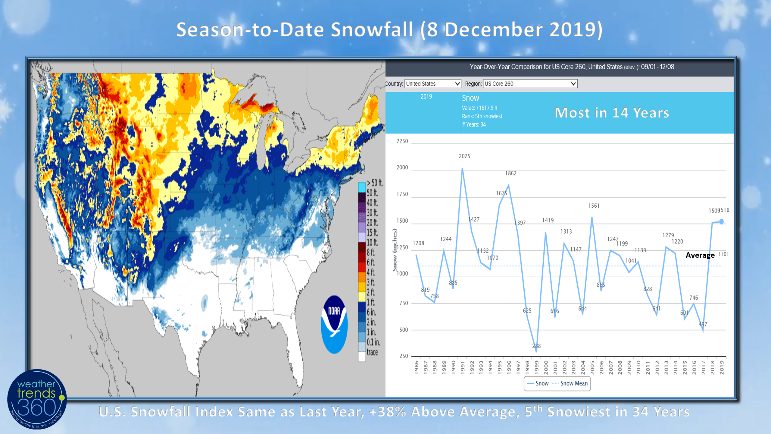
Snowfall season to date is still running a tad higher than last year, 18% above average and the 5th most in 34 years.
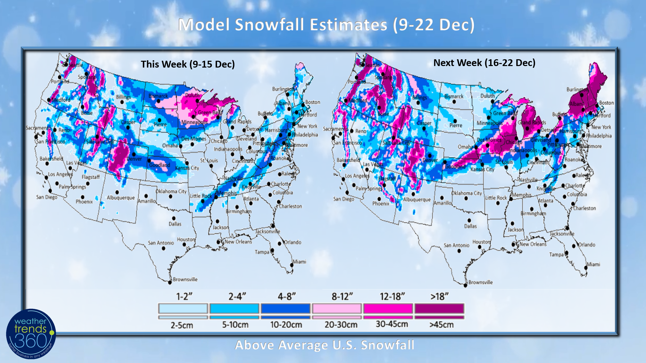
The modeled snow outlook shows a big system for the Upper Midwest-Great Lakes early in the week with moderate snow possible midweek for the Northeast as much colder air moves in. Next week shows a couple bigger snow threats - TBD on exact amounts but it looks stormy.
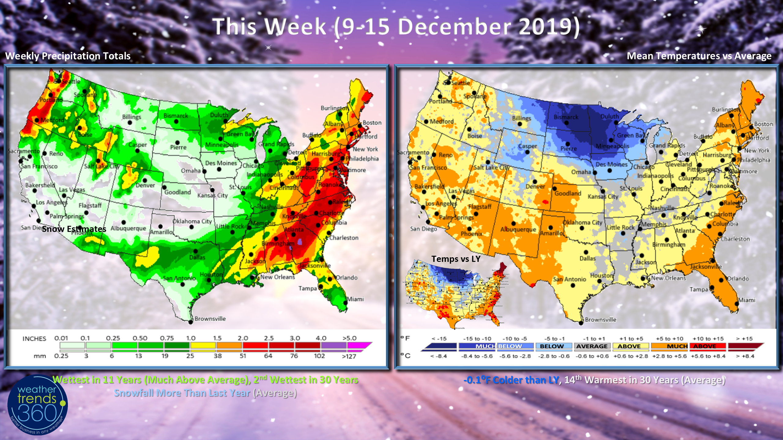
This week (9-15 December) trends similar to last year, tad cooler but still 14th warmest of the past 30 years while precipitation is the most in 11 years with more snow than last year.
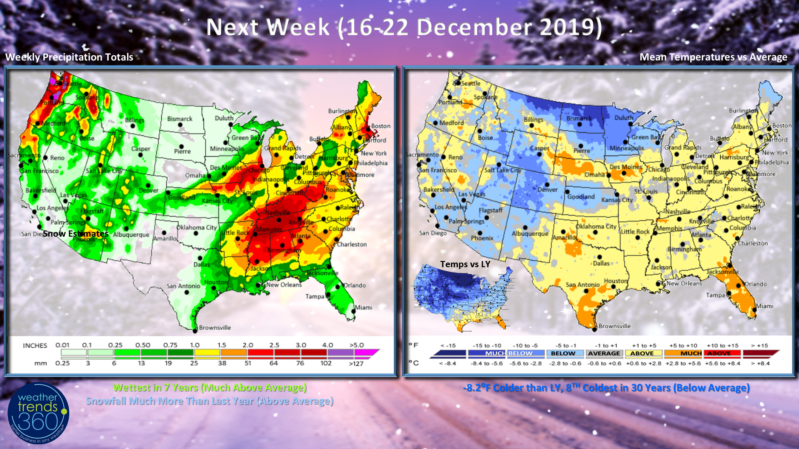
Next week (16-22 December) shows a much colder YOY trend with the U.S. 8.2F colder and 8th coldest of the past 30 years. Precipitation is again excessive with the wettest conditions in 7 years and much above average nationally. Snowfall looks to be well above average.
The Philadelphia Inquirer ran a fair story on Weather Trends on the regional section front page today on how weather trends approaches the science of long range weather forecasting. Don't forget to follow us on social media for frequent updates: Facebook, Twitter, YouTube, Pinterest and Linkedin
- Kirk out.