Captain's Log Start Date 28 October 2019
Captain's Log
Happy Monday! :)
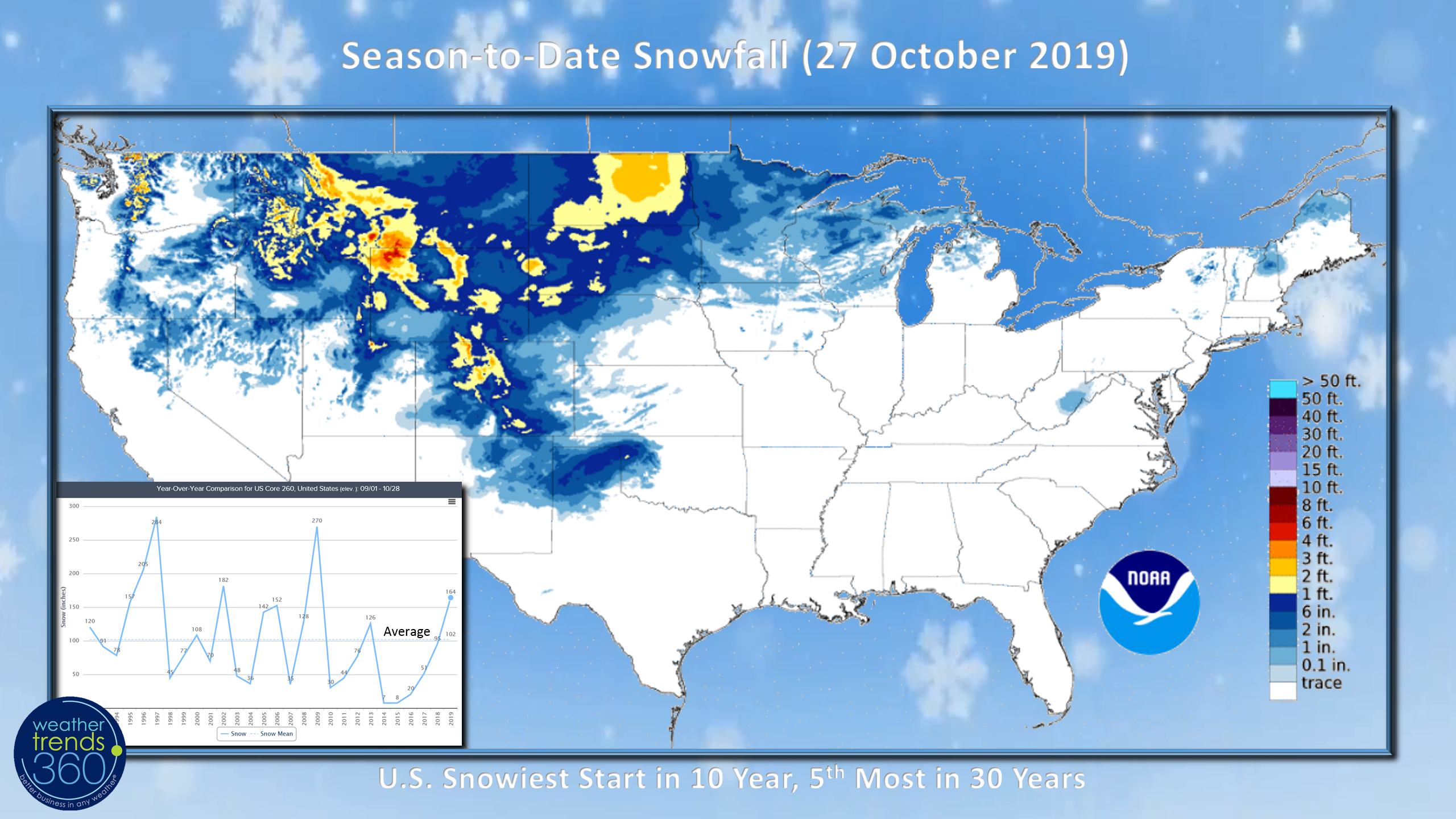
Season-t0-date snowfall continues to favor the Rocky Mountain states where yet another storm is developing. This has the U.S. off to the snowiest start in 10 years and 5th most in 30 years. CLICK ON IMAGES FOR A LARGER VIEW.
 Snow Cover this morning is at 8.4% with most of that in the Rocky Mountains. Last year was 2.3% and an average for today is 5%.
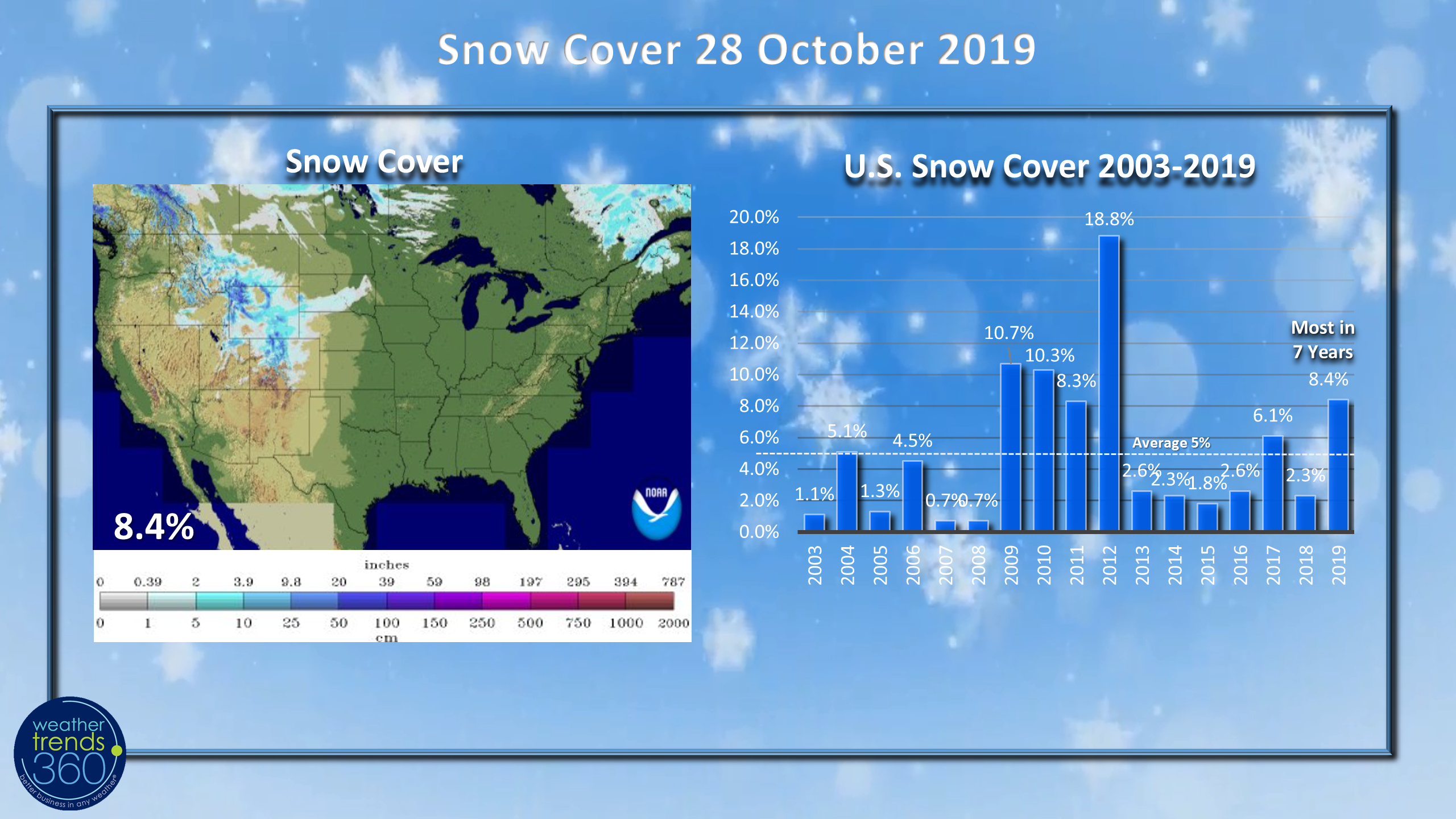 With "The Blob" of warm North Pacific Ocean Temperatures displaced further to the West, that in part explains why the persistent snows in the Rocky Mountains and Plains. Assuming this holds through Winter with a LaNada event, the Rockies and Upper Plains likely to be the coldest spot of Winter with the snow storm track through the Central U.S. Midwest.
 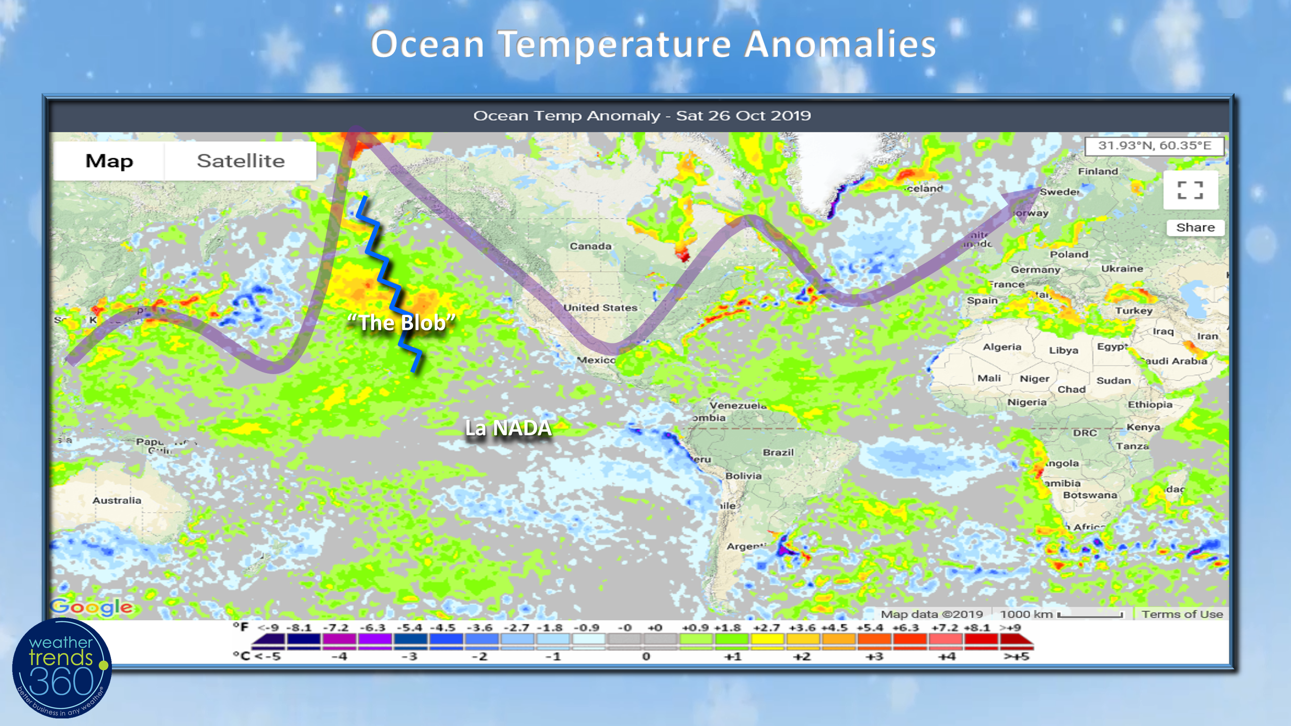 Last Week (20-26 October) world temperature trends vs a year ago show much warmer YOY conditions in the Eastern U.S., colder West with the U.S. +2.7F warmer than a year ago, a negative for seasonal merchandise sales. Europe is very warm trending 2.2F warmer than last year and warmest in 30 years, while China is also warmer than a year ago. Negatives for retail sales.
 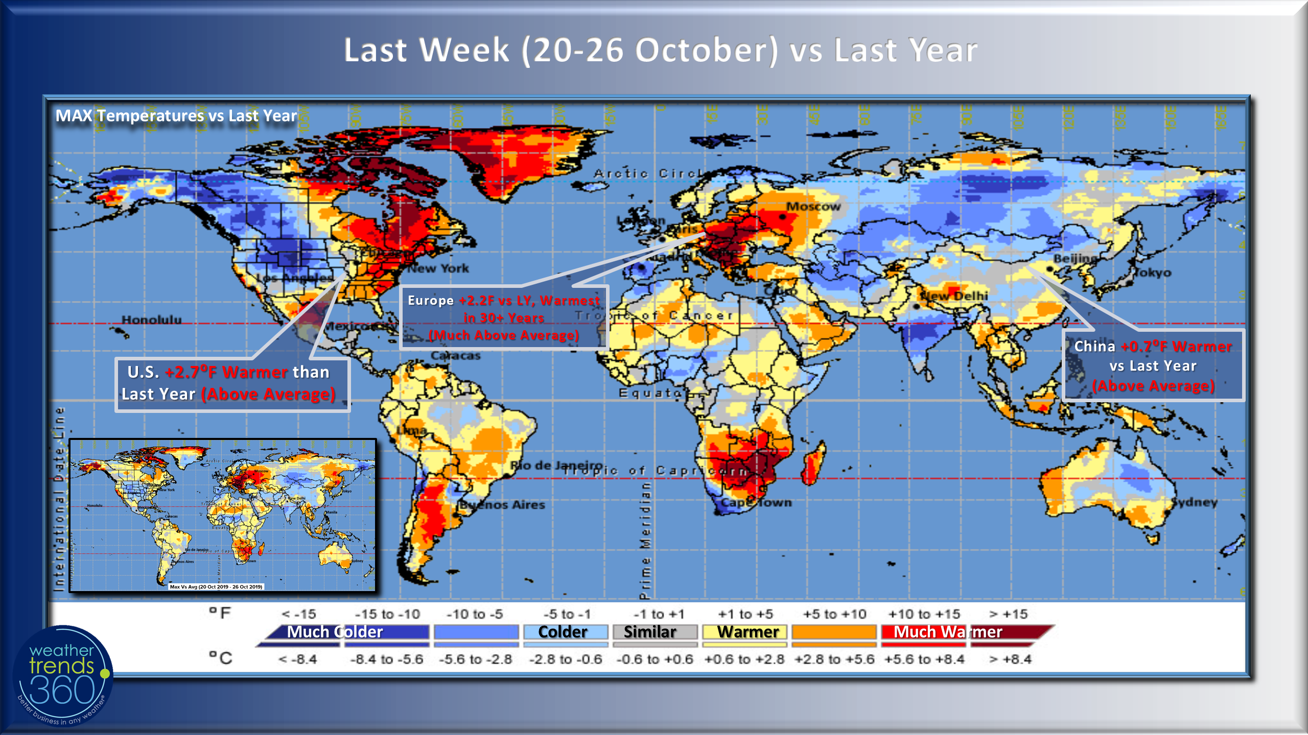 Fall to date across the U.S. has been the warmest in 3 years, 6th warmest in 30 years and 26% drier than last year.
 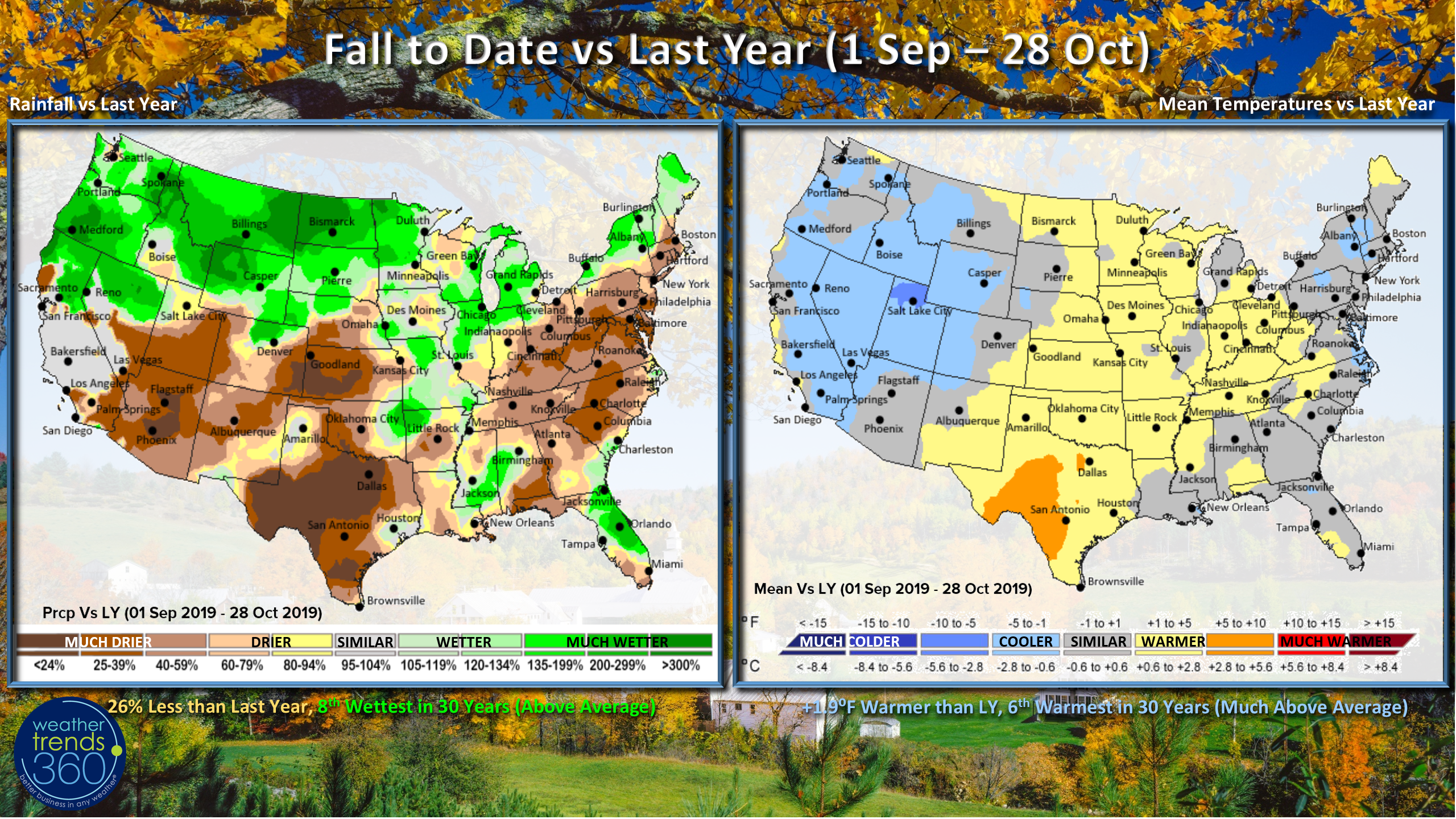 But, good news on the horizon as the U.S. enters a very favorable 10 day stretch of colder YOY conditions which will bring the biggest surge in seasonal sales this Fall. Recall that our Power of 1 Degree technology shows every 1F colder brings a 2% increase in coffee, soup sales; 3% increase in apparel sales, 7% increase in coat sales, 10% increase in heater sales and a whopping 24% increase in electric bedding sales. With the period trending 5F colder we're looking at very strong double digit sales gains for most of these categories.
 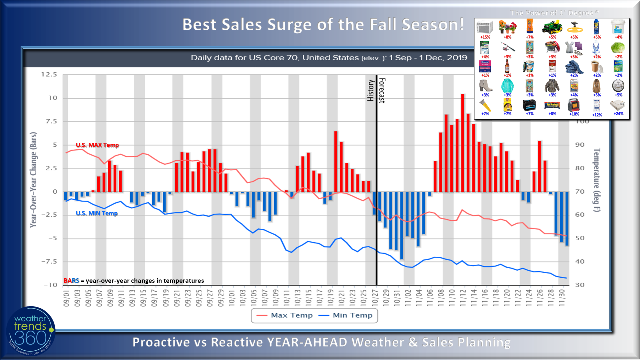 The other good news is that the hurricane season is quickly winding down. While there have been 16 named storms in the Atlantic Basin the damage to the U.S. has been significantly less than the past few years. Of these named storms, 7 lasted less than one day and 2 lasted less than 6 hours. In years past many of these would never been named. Major hurricane's Dorian and Humberto had the biggest impact on the Bahamas and Bermuda, right in the middle of Weather Trends highest risk areas. We expect 2020 to be a much more devastating season for the U.S. and even in New England!
 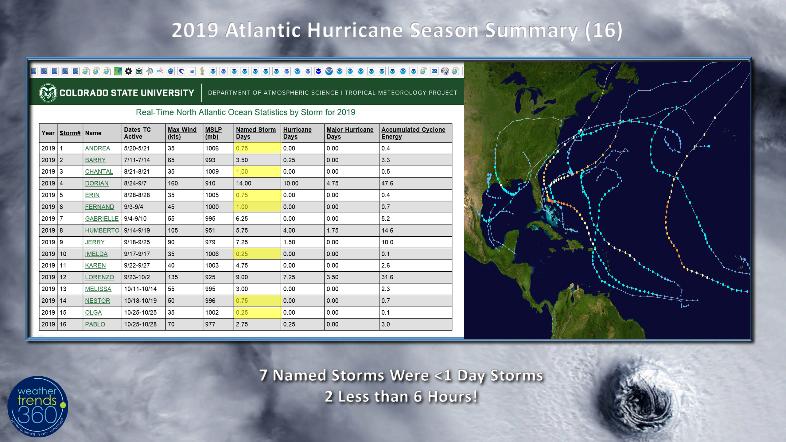 Drought is also up to 37% of the U.S. with dry to drought conditions compared to only 8% back in middle May. Weather Trends expects dry to drought-like conditions to expand this Winter into 2002 with upwards of 56% of the U.S. making it the most in 7 years.
 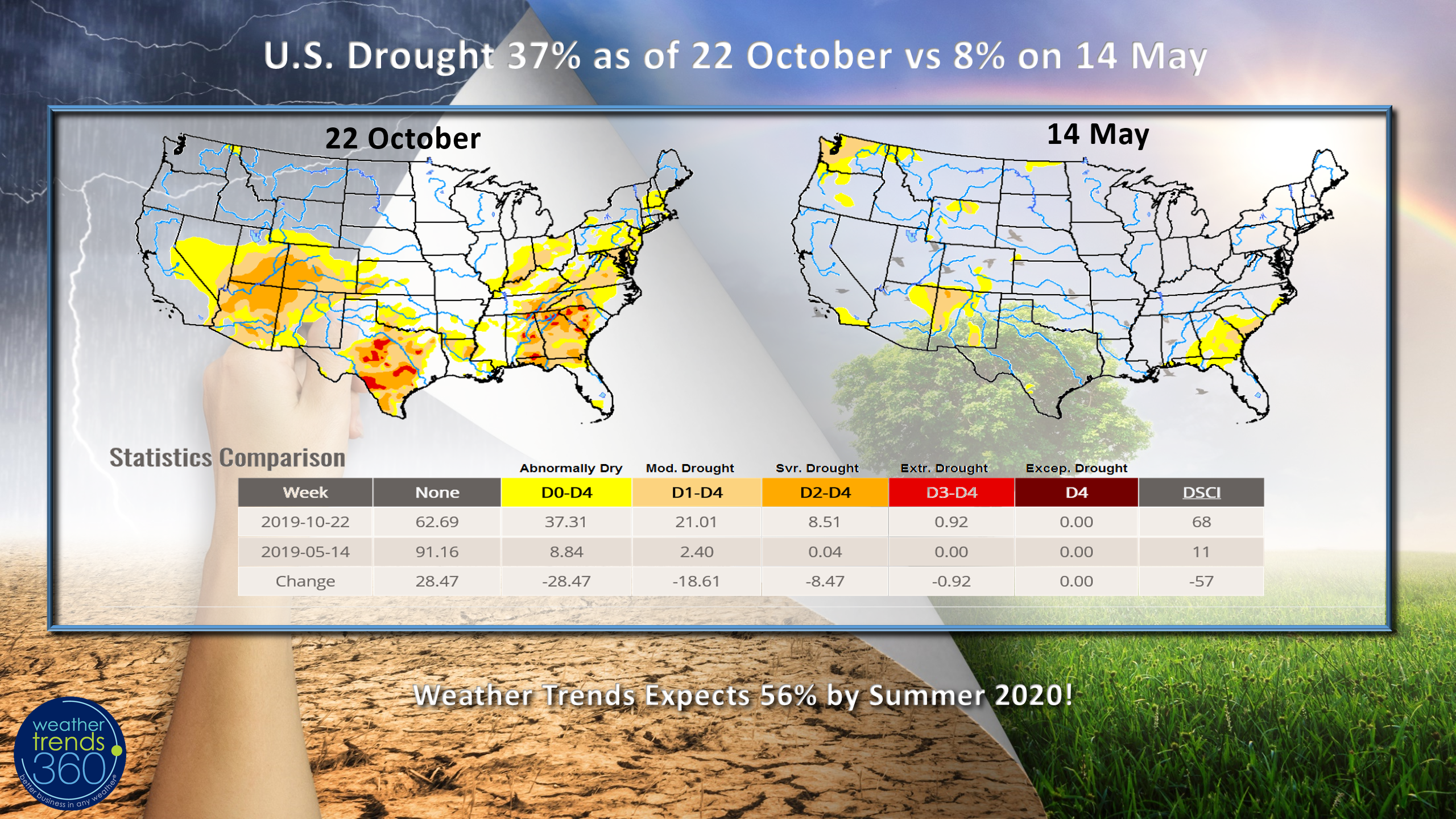 There is no drought in California but recent wet seasons have made for a lot of under brush which is fuel for these bigger fires to the North of San Francisco.
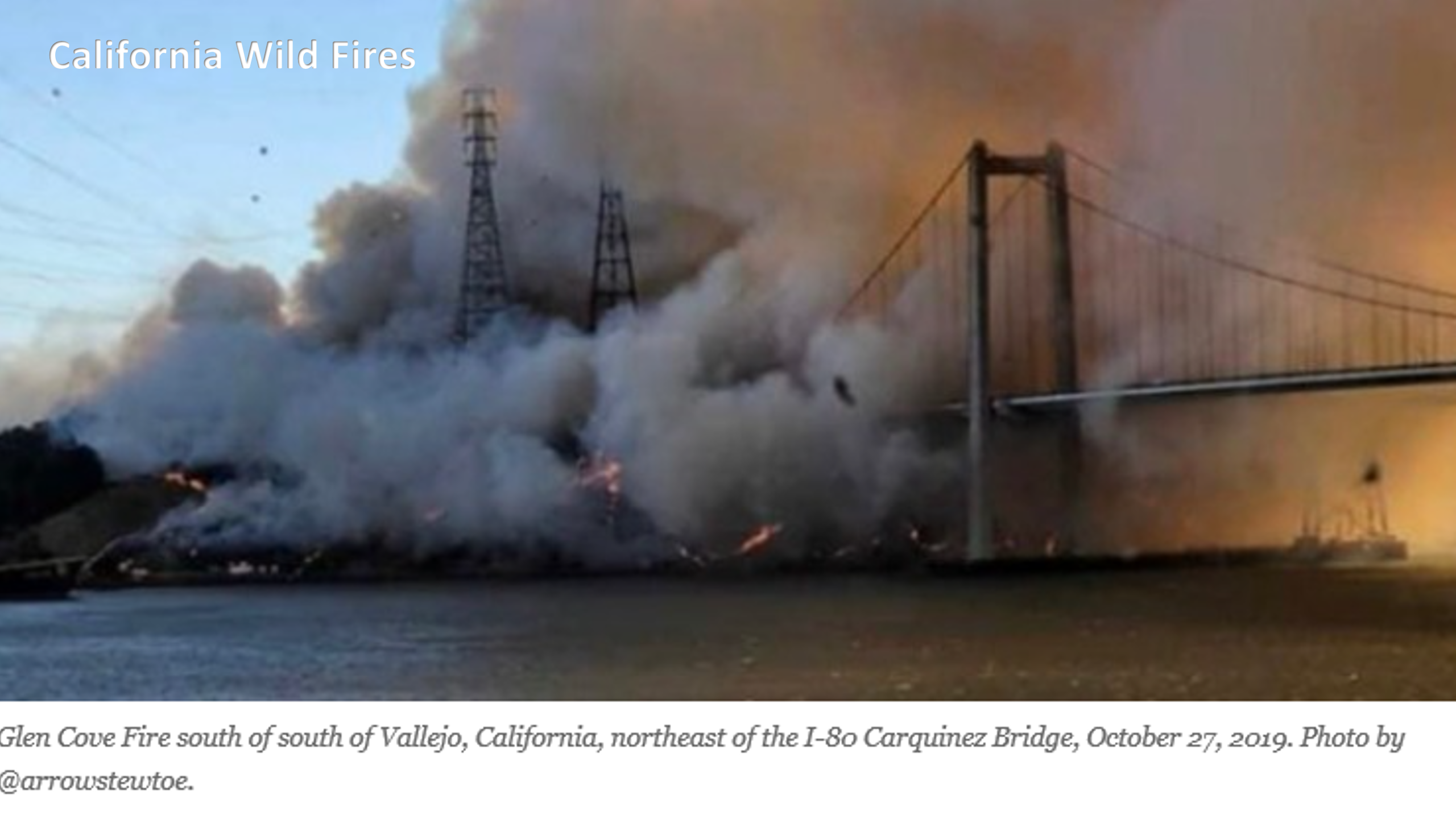
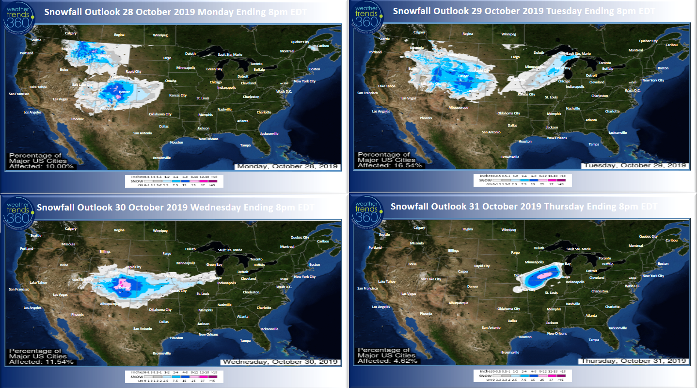 Yet another snow storm will plague the Rocky Mountains and head into the Midwest later this week with a narrow band of heavier snow later in the week. New England might get in on the act the 2nd week of November.
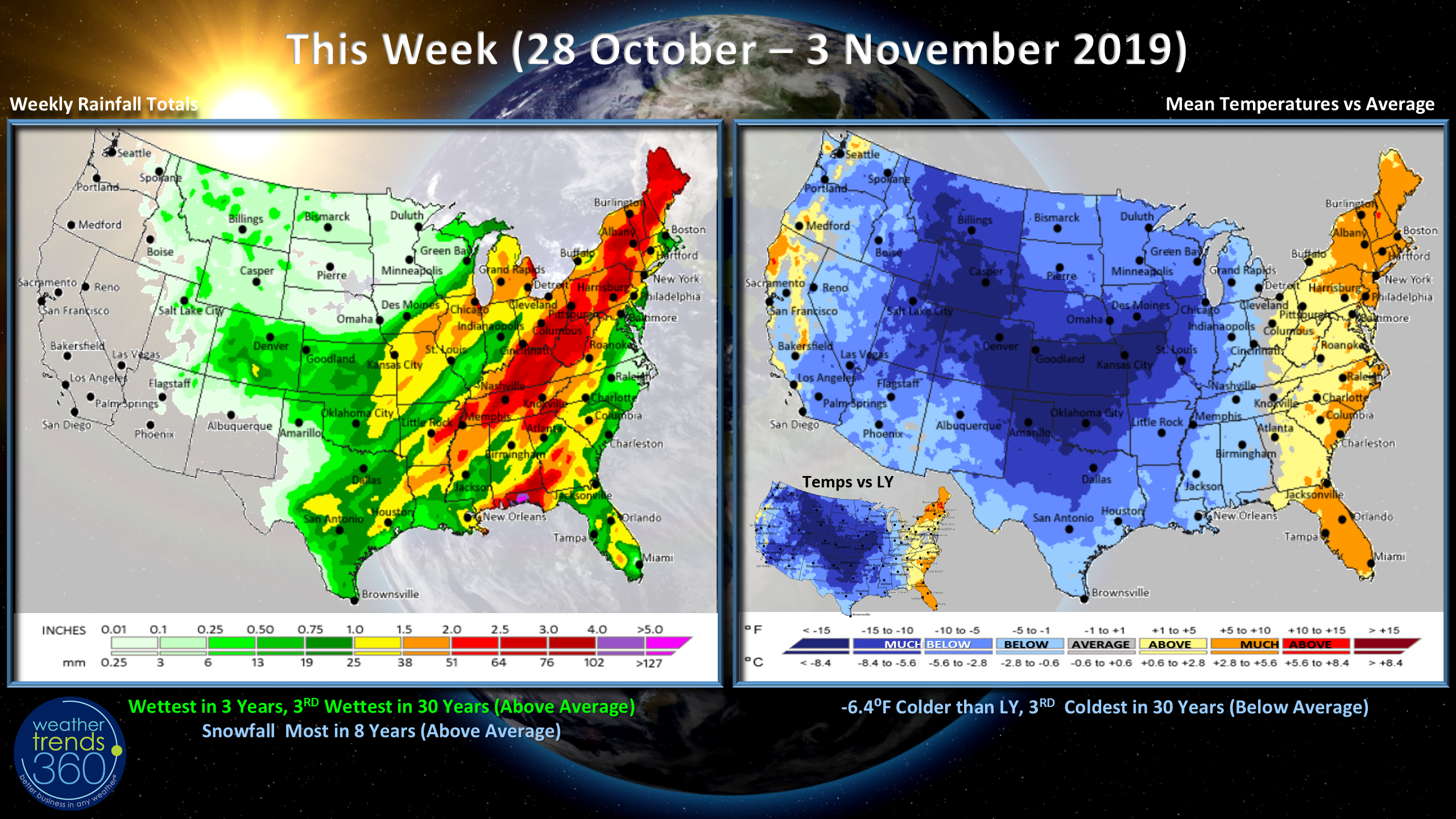
This week (28 Oct - 3 Nov) A nation-wide blast of cold weather will encompass all but the East Coast. Overall the U.S. will trend 6.4F colder than last year making it the 3rd coldest in 30 years, a great week for seasonal merchandise sales. Precipitation the most in 3 years, 3rd wettest in 30 years with snowfall the most in 8 years nationally.
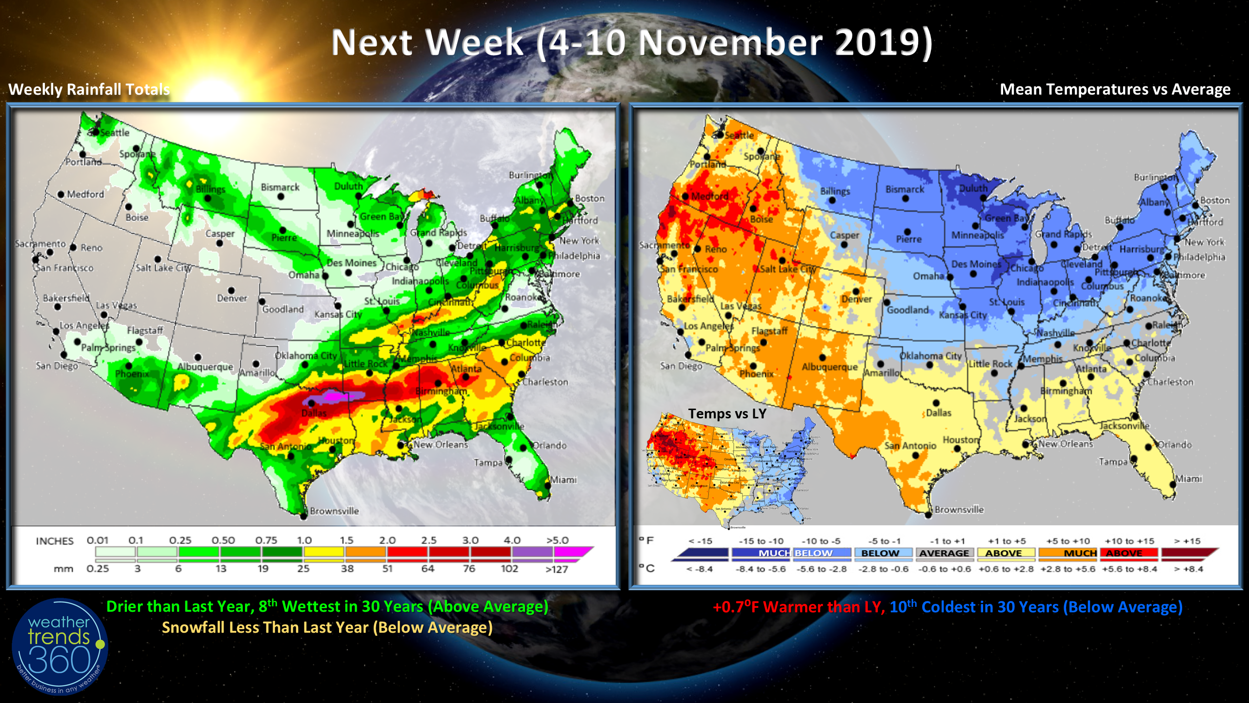
Next week (4-10 Nov) The cold air will finally invade the Northeast but already signs of a warm up in the South and West so a milder trend likely going into the later half of the month. For the U.S. overall the week trends warmest in 3 years but still 10th coldest of the past 30 years. Precipitation is drier than last year with below average snowfall. Some snow in New England possible late in the period.
Follow us on social media for frequent updates. Facebook, Twitter, YouTube, Pinterest and Linkedin
- Kirk out.