Star Date 1 October 2018 Monday
Captain's Log
Happy 1st day of October! :)
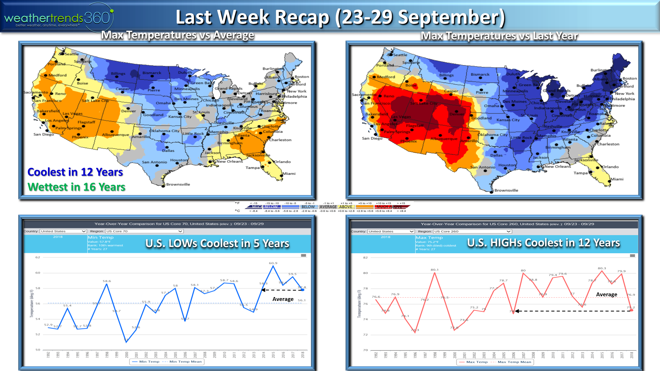
This LAST WEEK of September(23-29 Sept) was on the chilly, snowy and frost side for some with the week overall trending the coolest in 12 years and wettest in 16 years for the U.S. overall.CLICK ON IMAGES FOR LARGER VIEW
The Southeast and West were the hot spots. Map left shows trends vs average and map right trends vs last year. Much colder end to September in the Great Lakes and Northeast than last year.
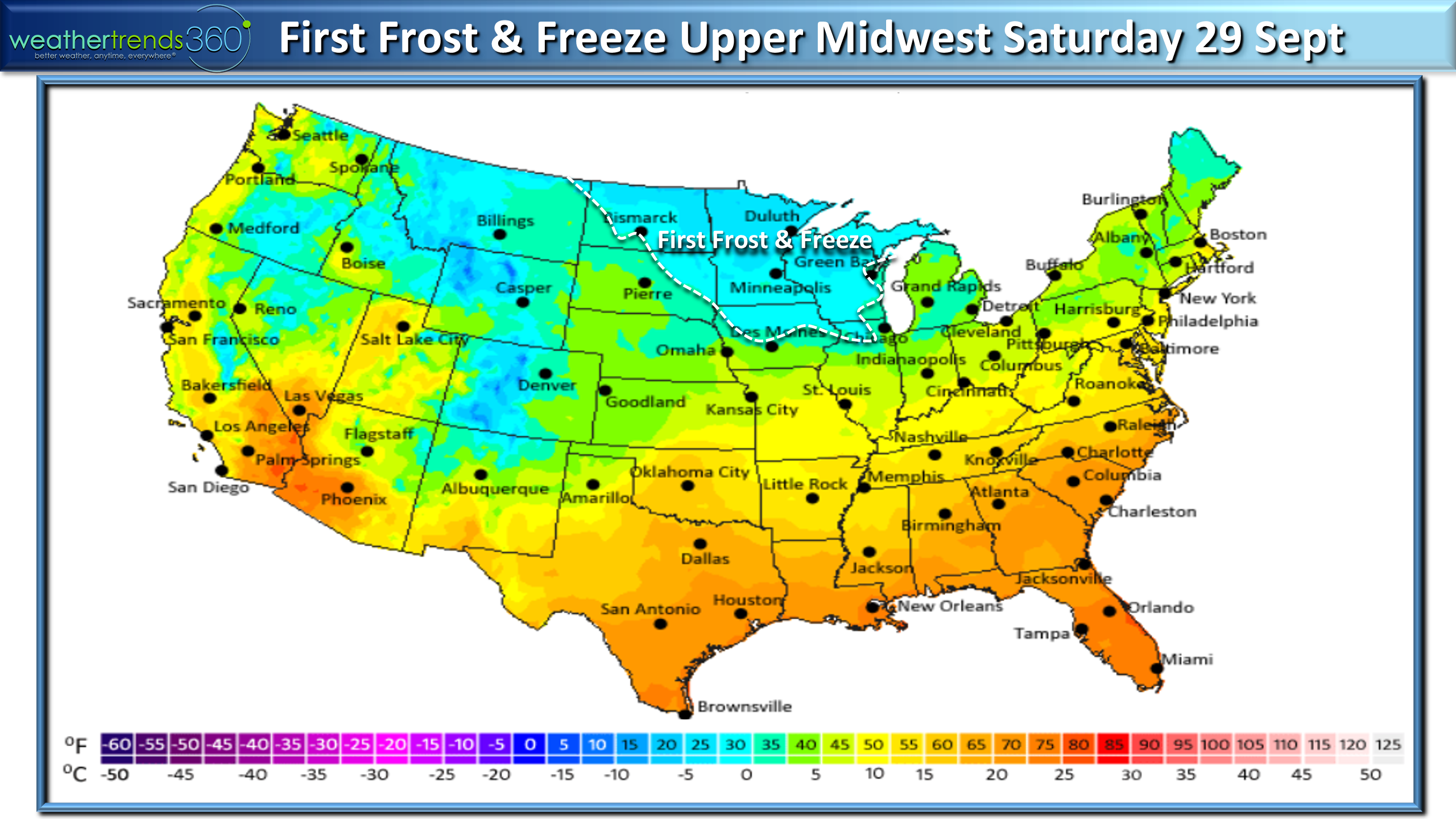
The season's first frost and freezes arrived Saturday, about on time for the Upper Midwest and Plains, but about 2 weeks early for Northern Iowa and Northern Illinois.
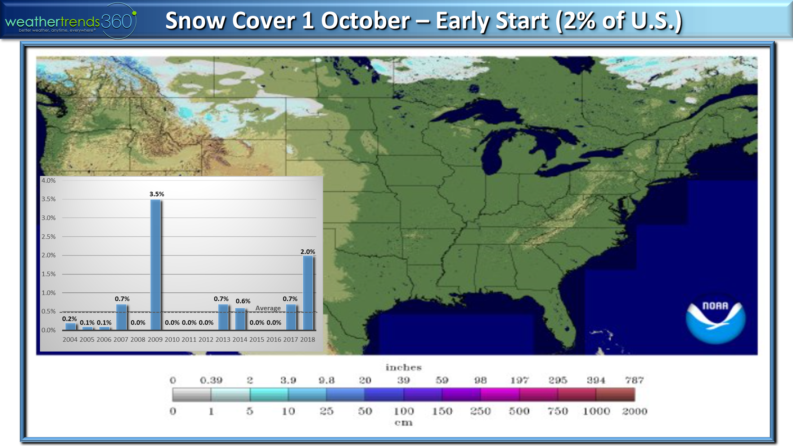
Snow Cover this morning showed 2% of the U.S. blanketed in snow which is above the 0.5% average and the most since 2009. We'll add to this in the Rockies over the next couple weeks with a fast and early start to Winter here.
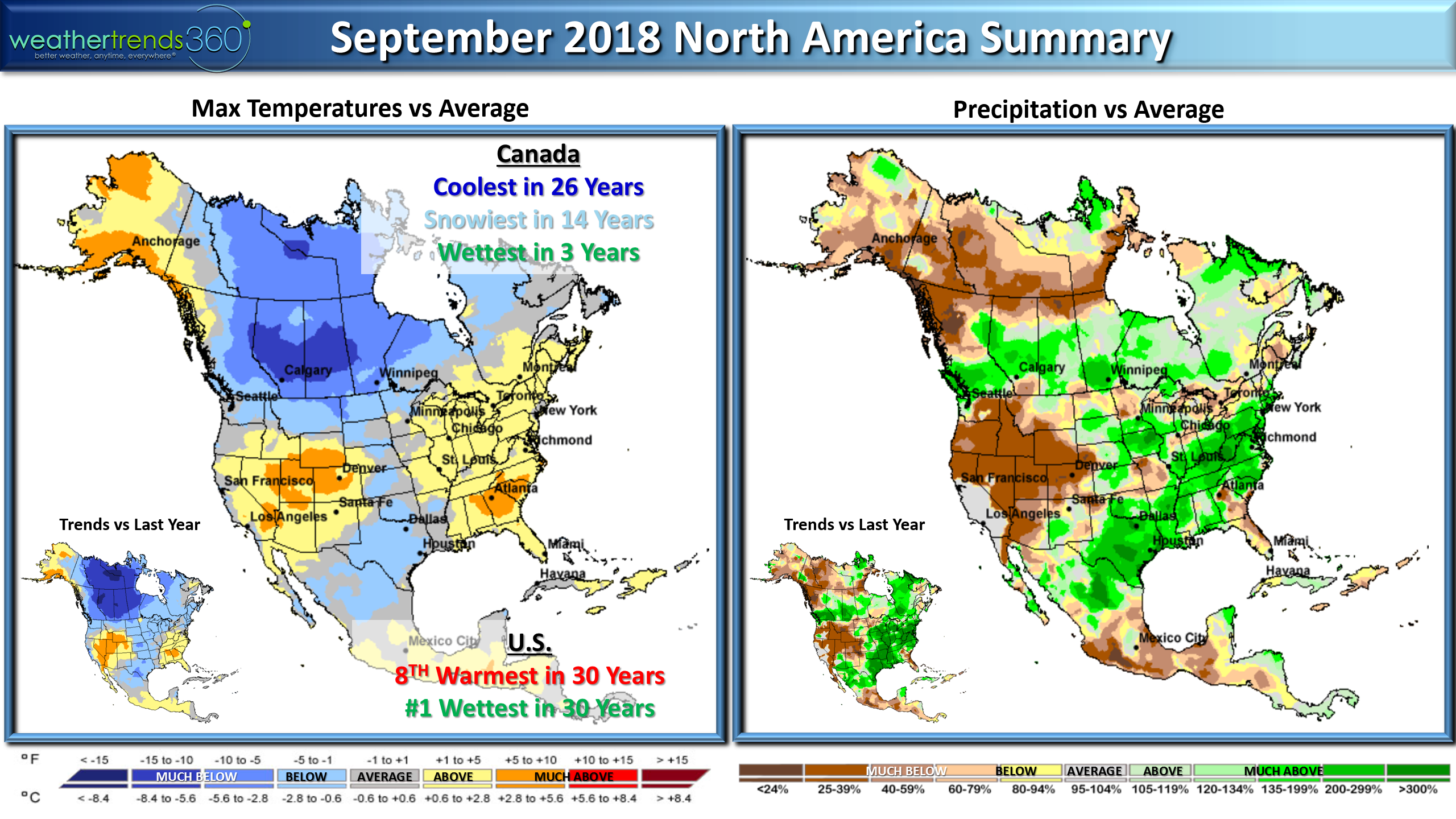
The calendar September ended up being frigid across Canada with the month trending the coldest in 26 years, snowiest in 14 years and wettest in 3 years. In the States it was the 8th warmest of the past 30 years but #1 wettest for the U.S. overall.
We saw a lot of farmers out harvesting here in Eastern PA this past weekend, be safe and have a great harvest season! It was our first dry weekend here in PA in over a month so it was nice to finally see the sun. Rainfall YTD has been off the charts from Arkansas to Pennsylvania and especially North Carolina where Wilmington is a whopping 86.38" for a record wet year. Dry spots are in the Rockies and West but some relief on the way for them.

The 2-week outlook (1-14 Oct) shows the cold weather invades the West and North and gradually spills East later next week. The remnants of once major hurricane Rosa likely to bring flash flooding rains to the Desert Southwest and parts of the Central Rocky Mountains - they need the rain! We might even get the remnants of Hurricane Sergio later next week with rains possible for California - a tad early and unusual but they'll take it. Still need to watch the East Coast as the tropics likely to back to life in October, we don't think the season is over just yet so be prepared for another tropical threat along the East Coast.
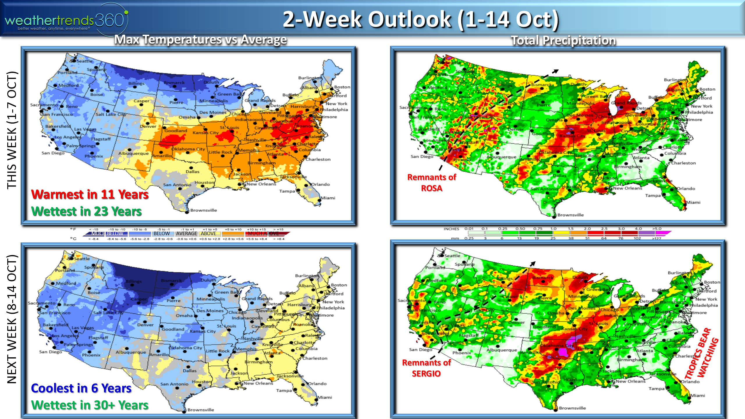
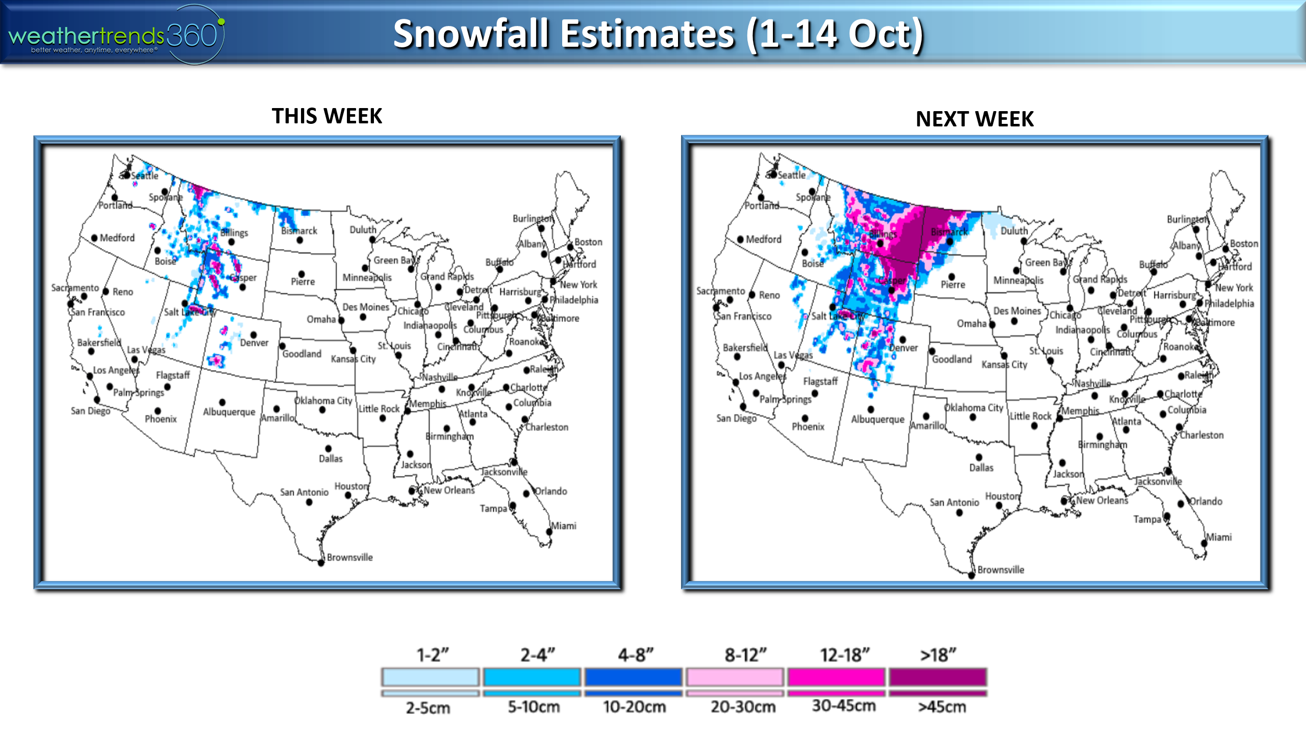
Snow will continue to expand in the Rockies and Upper Plains, probably not this much but certainly a wintry pattern over the next couple weeks.
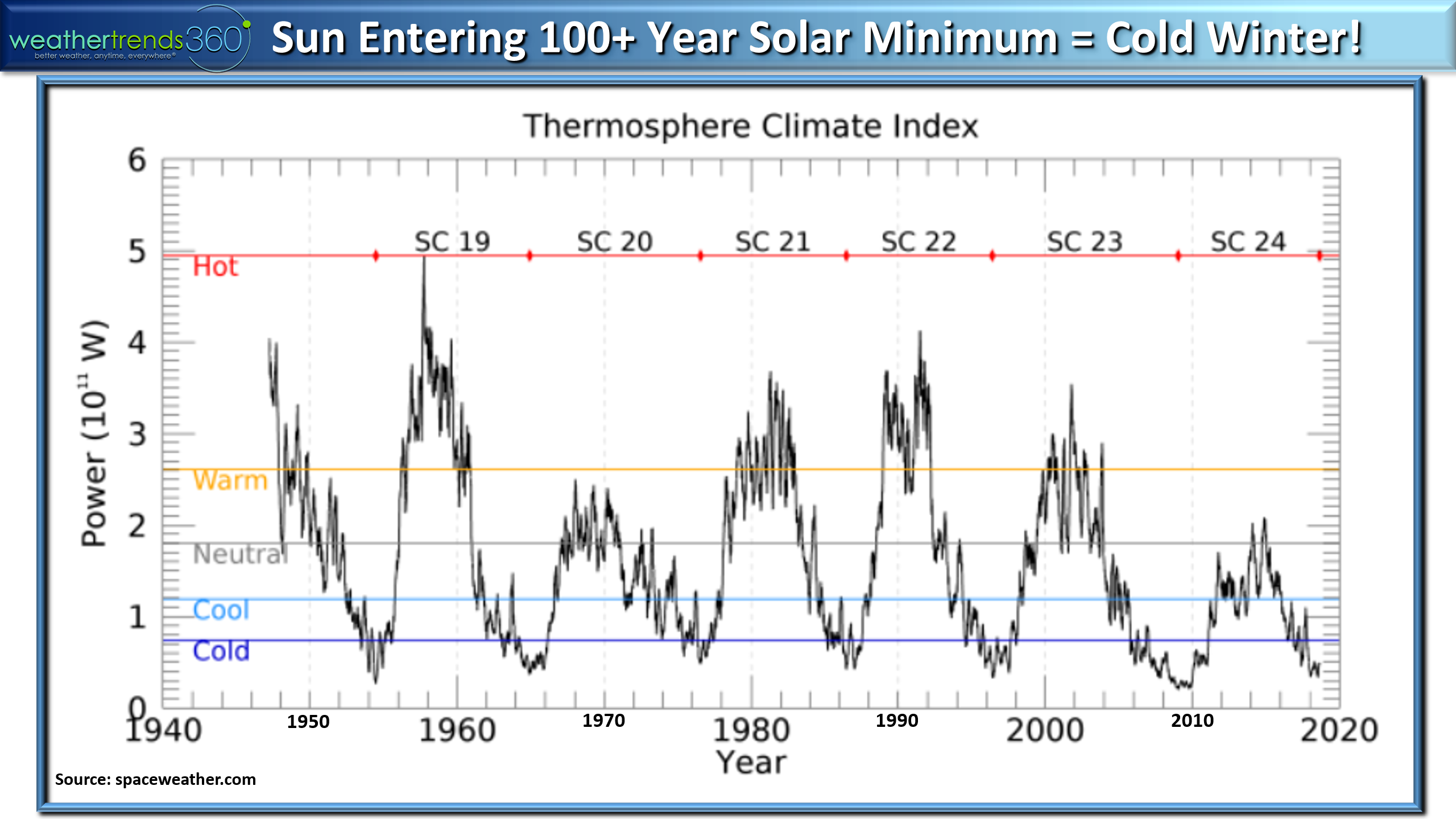
The early cold across Canada and snow in the U.S. is in part related to the Sun entering a 100 to 30o year solar minimum. When the Sun's output is weak like this, we tend of have a very cold winter across the Northern Hemisphere and in part why we're projecting the coldest and snowiest U.S. Winter in 5 years.
Have a great week folks and don't forget to follow us on social media.Facebook,Twitter,YouTube,PinterestandLinkedin

- Captain Kirk out (USAF Gulf War Veteran 1989-1999)