Star Date 10 April 2017 Monday
Captain's Log
Happy Monday!
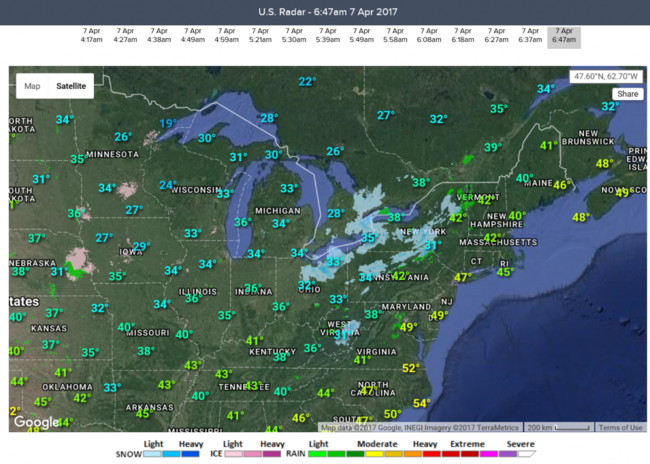
Late last week a hard frost and freeze swept from the Midwest to the Middle Atlantic with snow in the Great Lakes, Appalachians and even some flurries as far East as wt360 headquarters in Eastern PA. This may not be the last frost either as there's still a decent chance of more frost/freezes in later April into the first week of May for these same locations. For the near term we're headed for an early Summer-like week for the Eastern half of the U.S. and we'll take it!
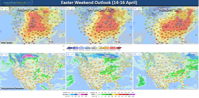
With a fast progressive weather pattern still in place the cold snaps are short lived and the warm ups are tad longer in duration. This week will end up being the warmest in 11 years and driest in 7 for the U.S. overall with most having a warm Easter weekend, except in the West. The exceptionally warm weather early in the week will moderate some 10 to 15 degrees by the weekend in the East but still nice by middle April standards.
CLICK ON IMAGES FOR LARGER VIEW.
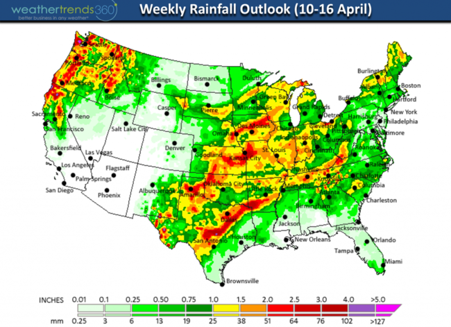
Rainfall this week is heaviest in Northern California and the Northwest with 1-3" and bands of heavier thunderstormsin the Central U.S. It remains relatively dry for the Gulf Coast and Florida. For the U.S. overall, April 1st - 10th is off to the wettest start in over 26 years with national rainfall +59% above average and +87% more than last year. This wetter pattern also has the severe weather tornado season off to a near record fast start.
Next week turns much wetter again for the U.S. overall with the wettest middle April period in over 26 years and more severe weather possible in the Central U.S.

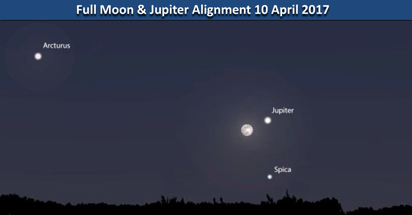
For those of you that like Full Moon's with a twist...you'll like the "Pink Moon" tonight as it aligns with Jupiter and Spica shortly after sunset. It's called the Pink Moon in the US and Canada with the blooming of pink phlox flowers. Enjoy!
Follow us on Facebook and Twitter for daily updates. We hope you have a great week folks!
- Capt Kirk out
Late last week a hard frost and freeze swept from the Midwest to the Middle Atlantic with snow in the Great Lakes, Appalachians and even some flurries as far East as wt360 headquarters in Eastern PA. This may not be the last frost either as there's still a decent chance of more frost/freezes in later April into the first week of May for these same locations. For the near term we're headed for an early Summer-like week for the Eastern half of the U.S. and we'll take it!
With a fast progressive weather pattern still in place the cold snaps are short lived and the warm ups are tad longer in duration. This week will end up being the warmest in 11 years and driest in 7 for the U.S. overall with most having a warm Easter weekend, except in the West. The exceptionally warm weather early in the week will moderate some 10 to 15 degrees by the weekend in the East but still nice by middle April standards.
CLICK ON IMAGES FOR LARGER VIEW.

Rainfall this week is heaviest in Northern California and the Northwest with 1-3" and bands of heavier thunderstormsin the Central U.S. It remains relatively dry for the Gulf Coast and Florida. For the U.S. overall, April 1st - 10th is off to the wettest start in over 26 years with national rainfall +59% above average and +87% more than last year. This wetter pattern also has the severe weather tornado season off to a near record fast start.

Next week turns much wetter again for the U.S. overall with the wettest middle April period in over 26 years and more severe weather possible in the Central U.S.
For those of you that like Full Moon's with a twist...you'll like the "Pink Moon" tonight as it aligns with Jupiter and Spica shortly after sunset. It's called the Pink Moon in the US and Canada with the blooming of pink phlox flowers. Enjoy!
Follow us on Facebook and Twitter for daily updates. We hope you have a great week folks!
- Capt Kirk out