Star Date 11 June 2018 Monday
Happy Monday! :)
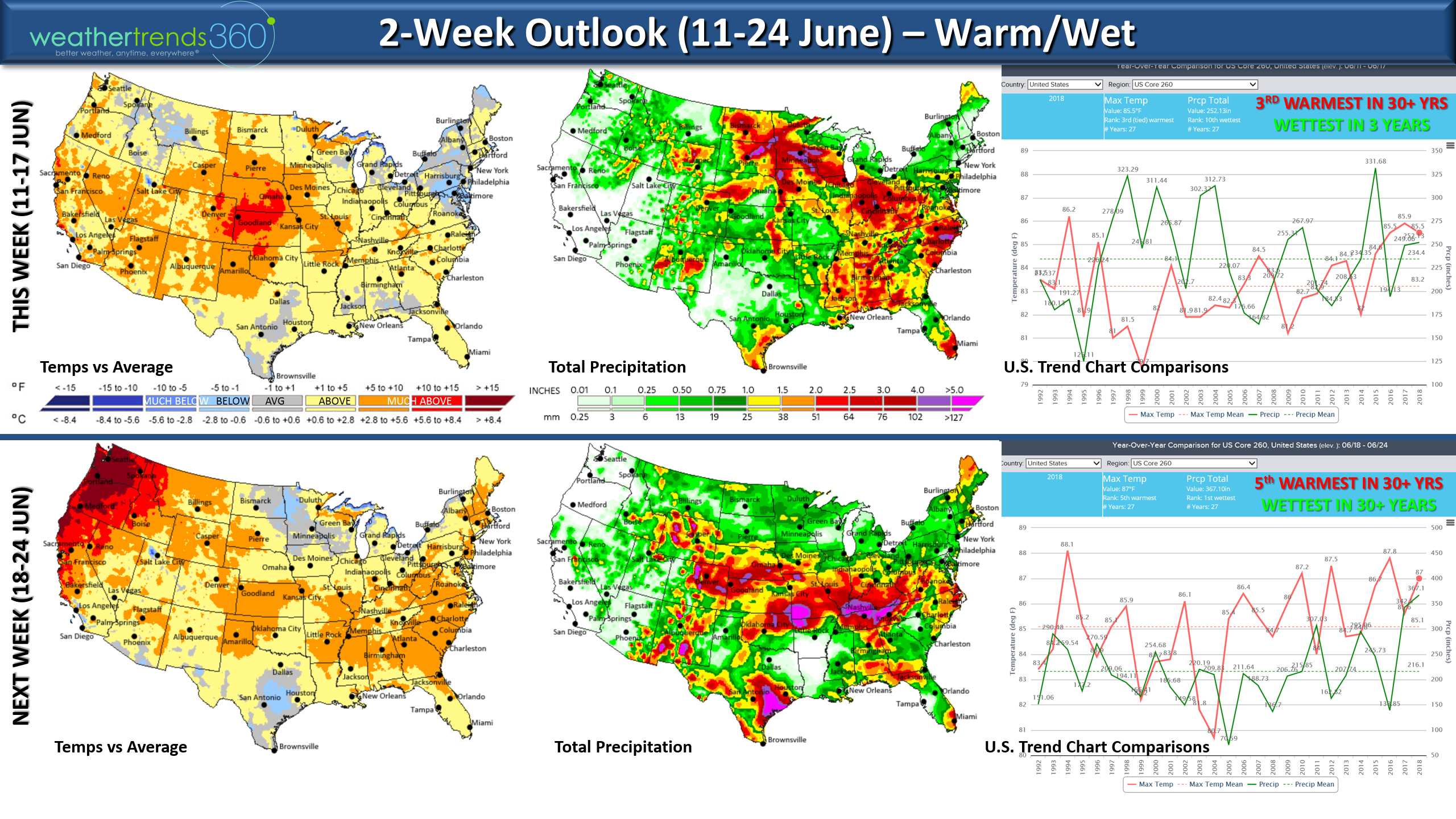
Meteorological Summer is 1 June - 31 August and it's off to a warm start here in the U.S. To date it's trending 3rd warmest of the past 30 years and 5th driest for the U.S. overall. The warm trends likely to continue but more likely to get wetter vs drier for the later half of them month. The 2-week outlook shows a warm/wet pattern for the U.S. overall. CLICK ON IMAGES FOR LARGER VIEW
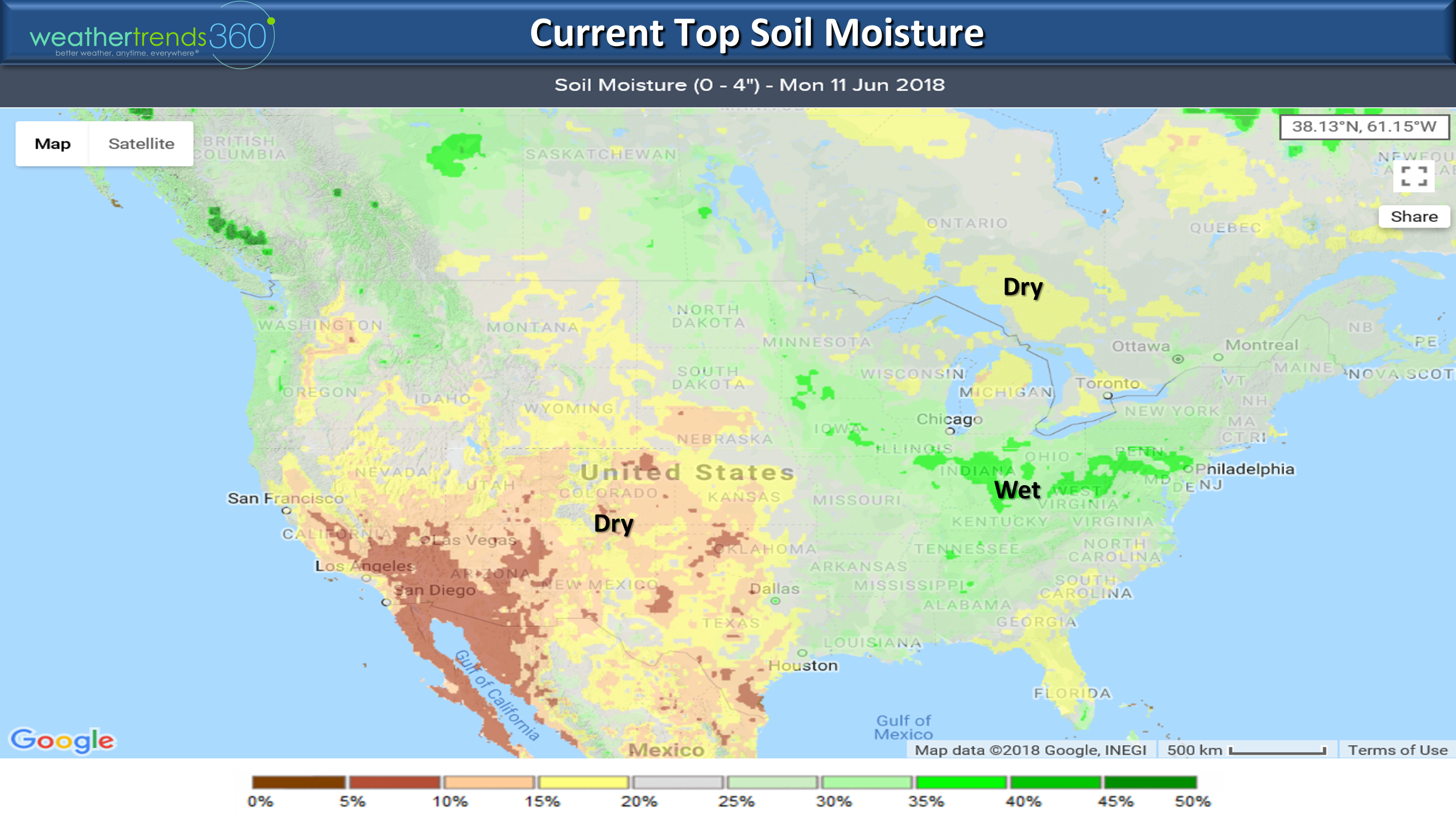
Soil moisture levels are very moist across the Midwest to Middle Atlantic with drier soils in the Southwest U.S. and Southeast Canada. This suggests crops in the main Corn Belt will have another strong year with some challenges in the SW areas.
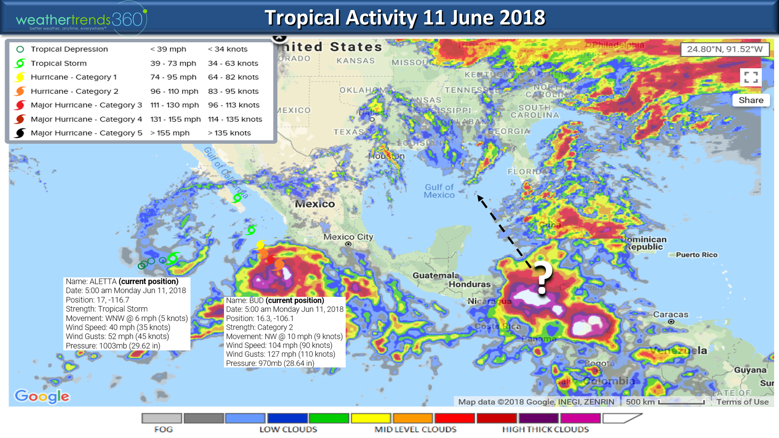
The tropics are also alive with two systems in the Eastern Pacific with Cat 2 Hurricane Bud likely to have some impact on the Baja Peninsula of California/Mexico. A system in the SW Caribbean also bears watching as it moves into the Gulf of Mexico.
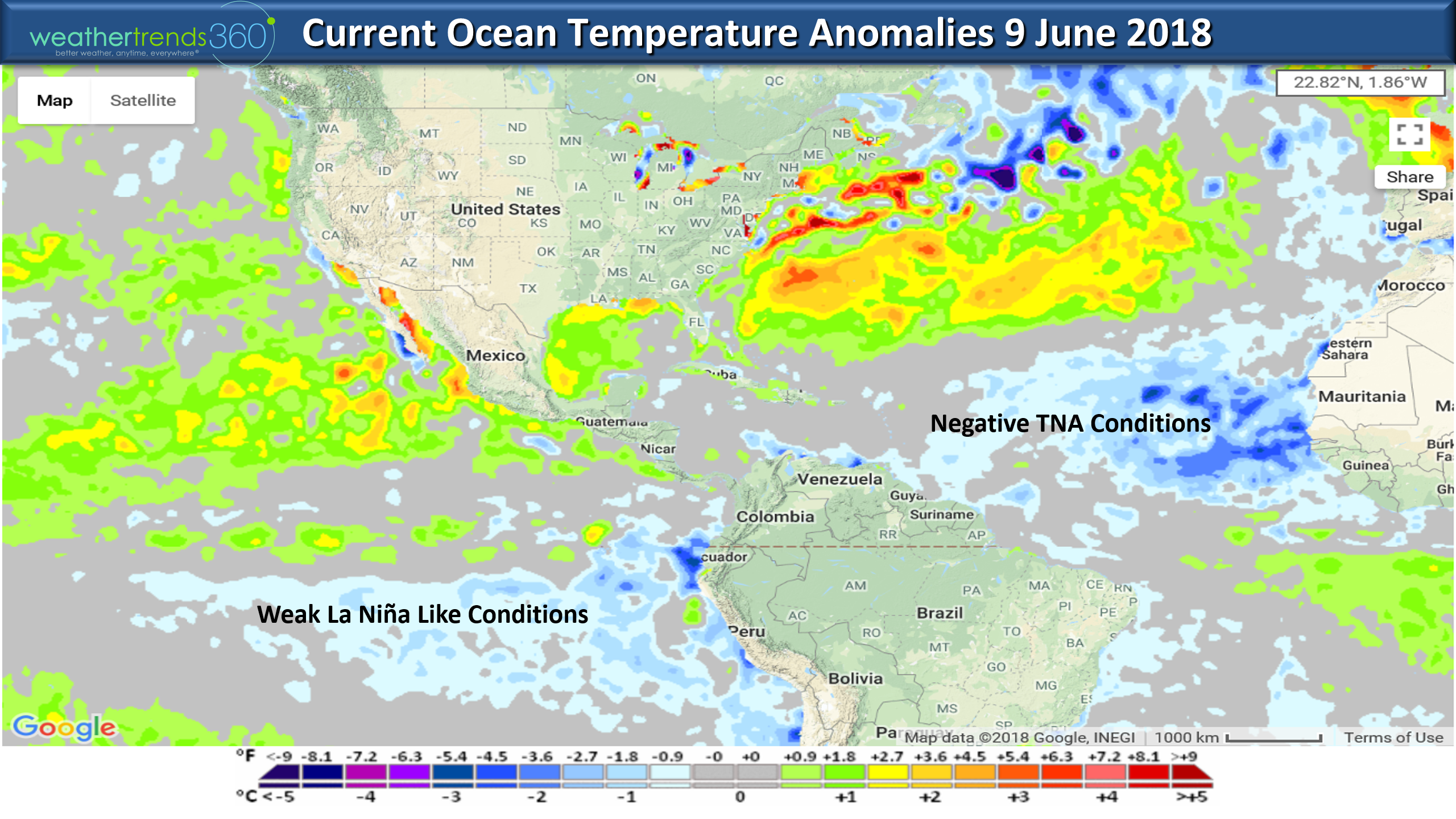
The ocean temperatures remain cooler than average in the Equatorial Tropical Pacific with La Nina like conditions although technically the Pacific is now in a neutral phase. The Eastern Atlantic Ocean off Africa is also showing much colder than average water temperatures. This is a plus for diminishing the late season hurricane activity that comes off Africa but that doesn't mean the U.S. is out of the woods. The waters around the U.S. are much warmer than average and that suggests moderate to high risk for a hurricane closer to home this season.
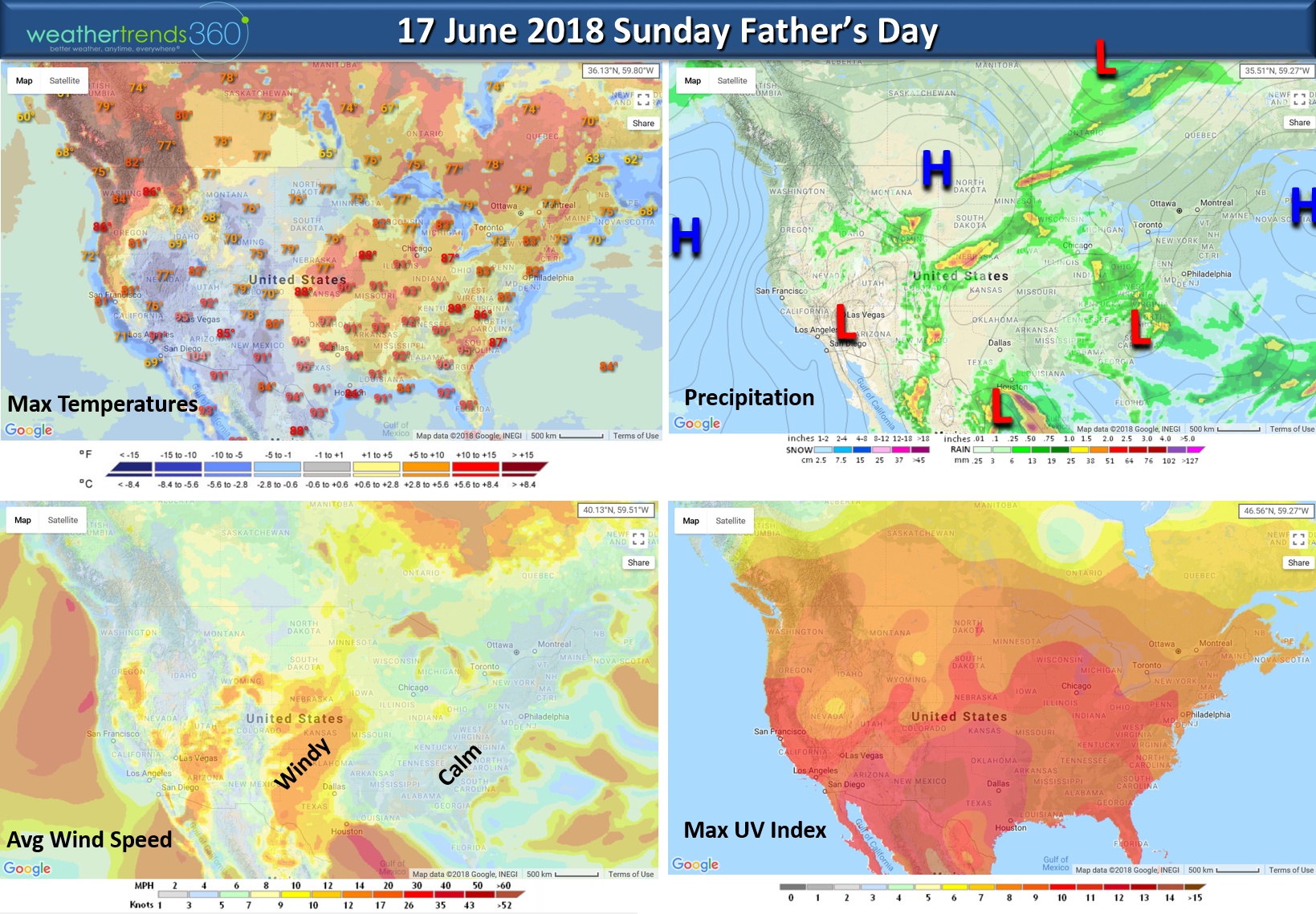
We hope you have a great week and don't forget about Dad this weekend - Father's Day Sunday 17 June. Right now it doesn't look too bad but a band of heavier storms from the Upper Midwest, Ohio Valley and Middle Atlantic...same areas that have been getting rain will get more. For the U.S. overall Dad's day looks to trend 4th warmest of the past 30 years but 1st wettest.
Follow us on social media for frequent updates.Facebook,Twitter,YouTube,PinterestandLinkedin
- Captain Kirk out