Star Date 12 Nov 2018 Monday
Captain's Log
It's Monday...hard to say happy in light of California wild fires.
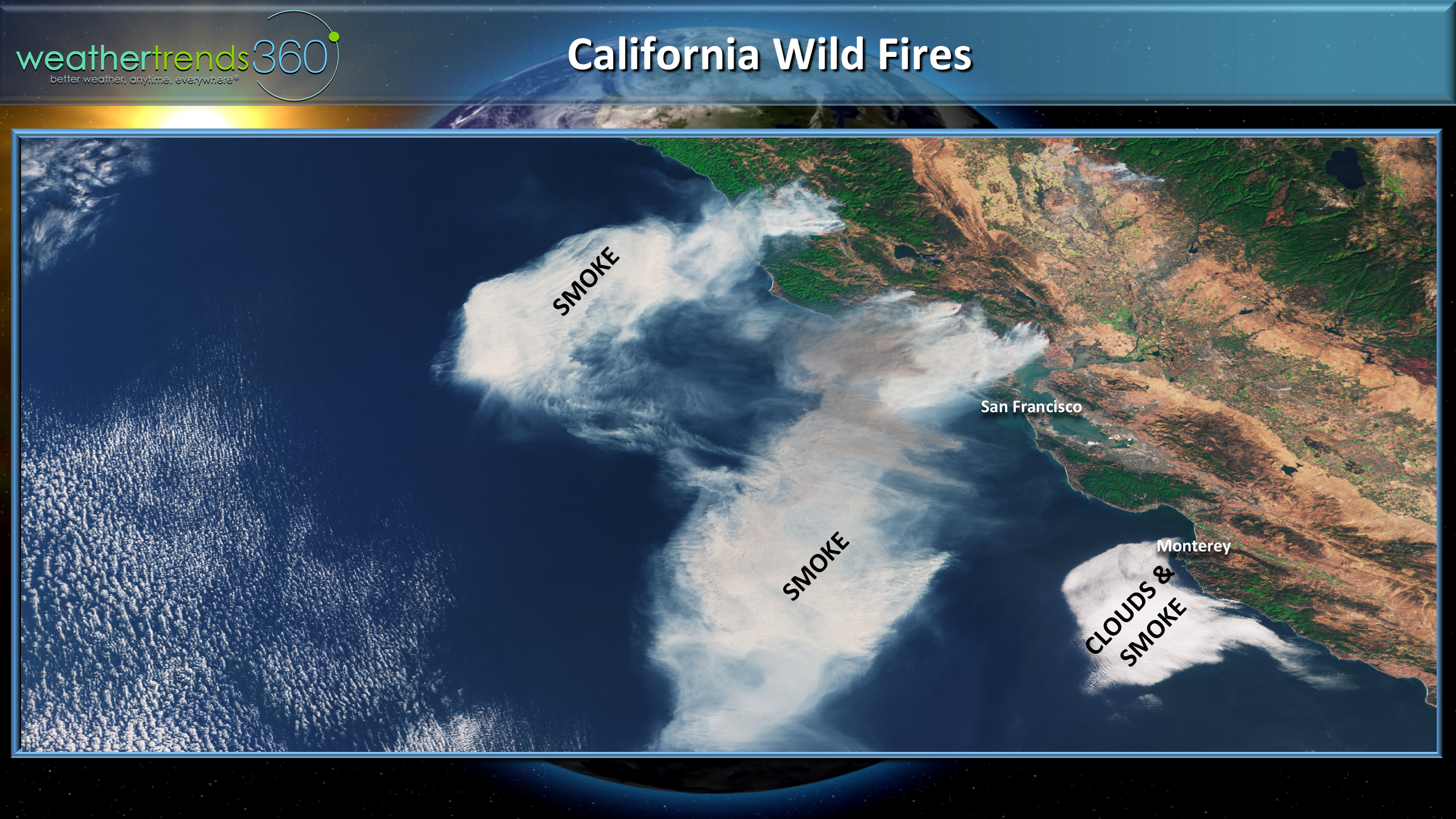
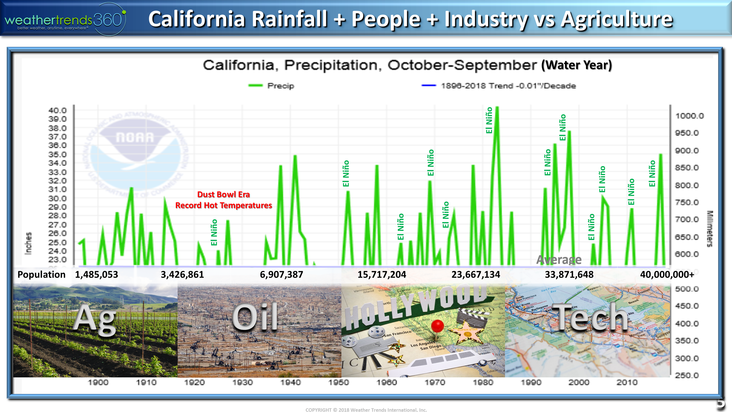
The smoke from the big wild fires to the North of San Francisco is impressive on satellite. Prayers for the brave firefighters battling these fires. After big rainy seasons in California it's common to get a lot of vegetative growth and underbrush that in turn become tinder for these big fires during the typical hot/dry Summer season. And then with 40+ million folks in the State you simply have more people in harms way when these bigger fires get started. Over the past 123 years, California has shown an overall wetter pattern since the drier years of the 1920-1940s. We will be speaking at an Ag4.0 conference this week in San Francisco.
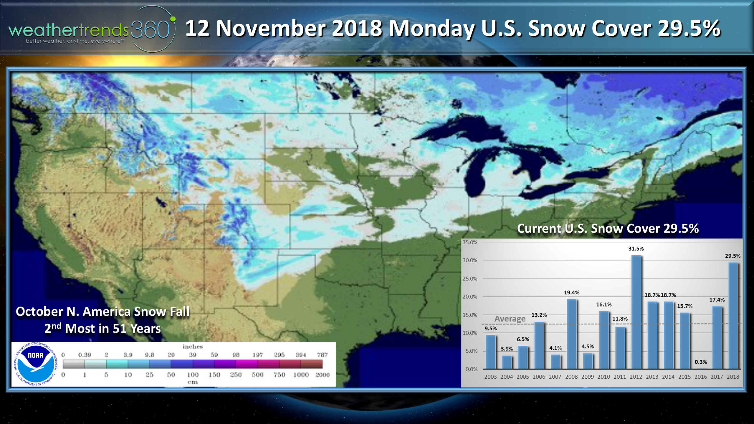
Snow cover this morning across the U.S. is again widespread with nearly 30% of the U.S. blanketed in snow. Typical is closer to 13% for this time of year. The snowy Fall continues for North America with the 2nd most snow cover in 51 years, and #1 snowiest in Canada on record. Lays the foundation for the coldest/snowiest Winter in 5 years per Weather Trends...don't say we didn't warn you.
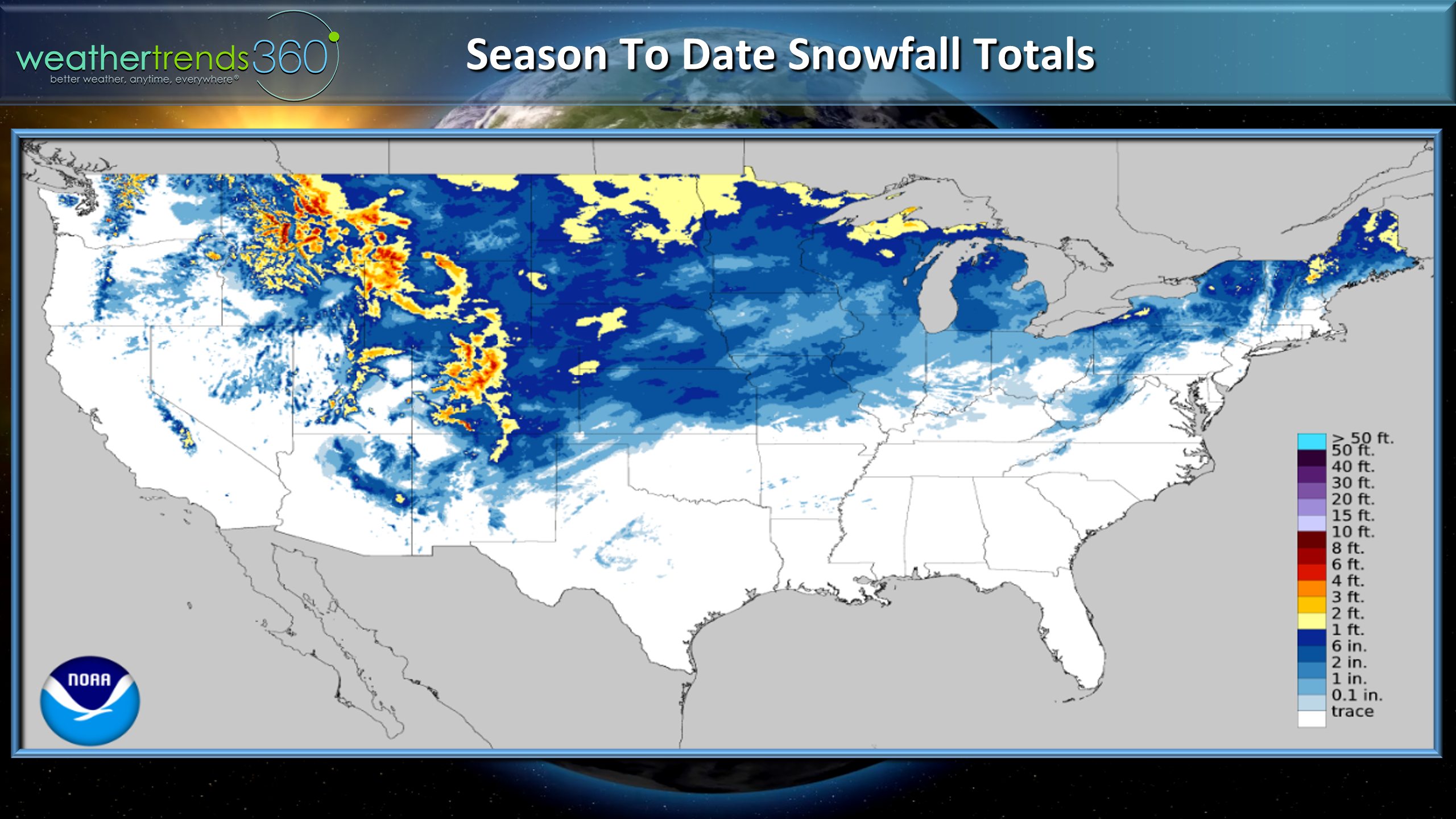
The NOAA map below shows season to datesnowfall with an unusual amount of early snowfall for about 50% of the country. The heaviest snows have been in the Rockies and Plains but now adding to that for the interior Northeast.
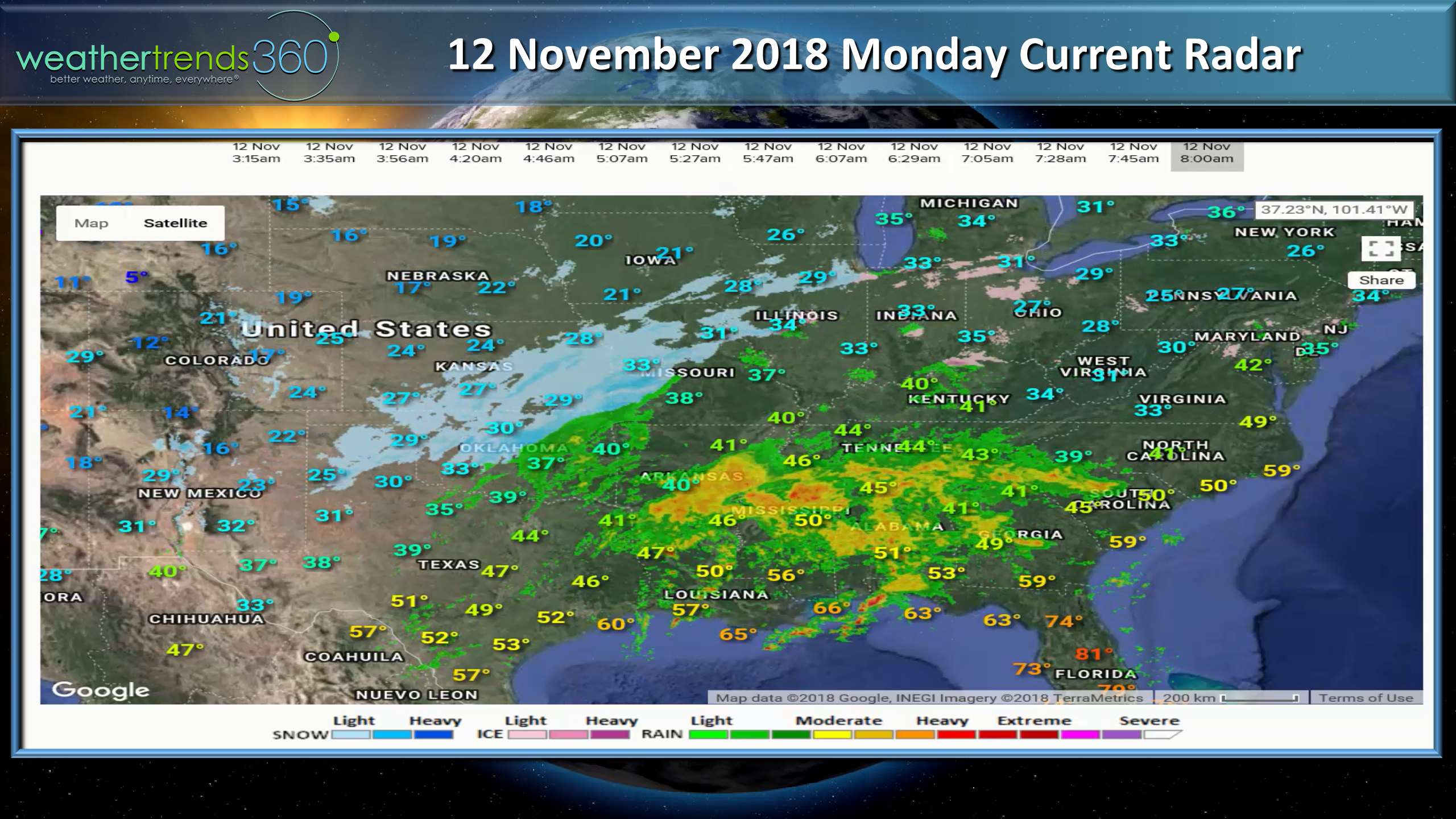
We're adding to this again this week with a couple more systems traversing the Central U.S., Great Lakes and interior Northeast. Current radar shows the snow well into the South from North Texas into the Southern Plains and Midwest.
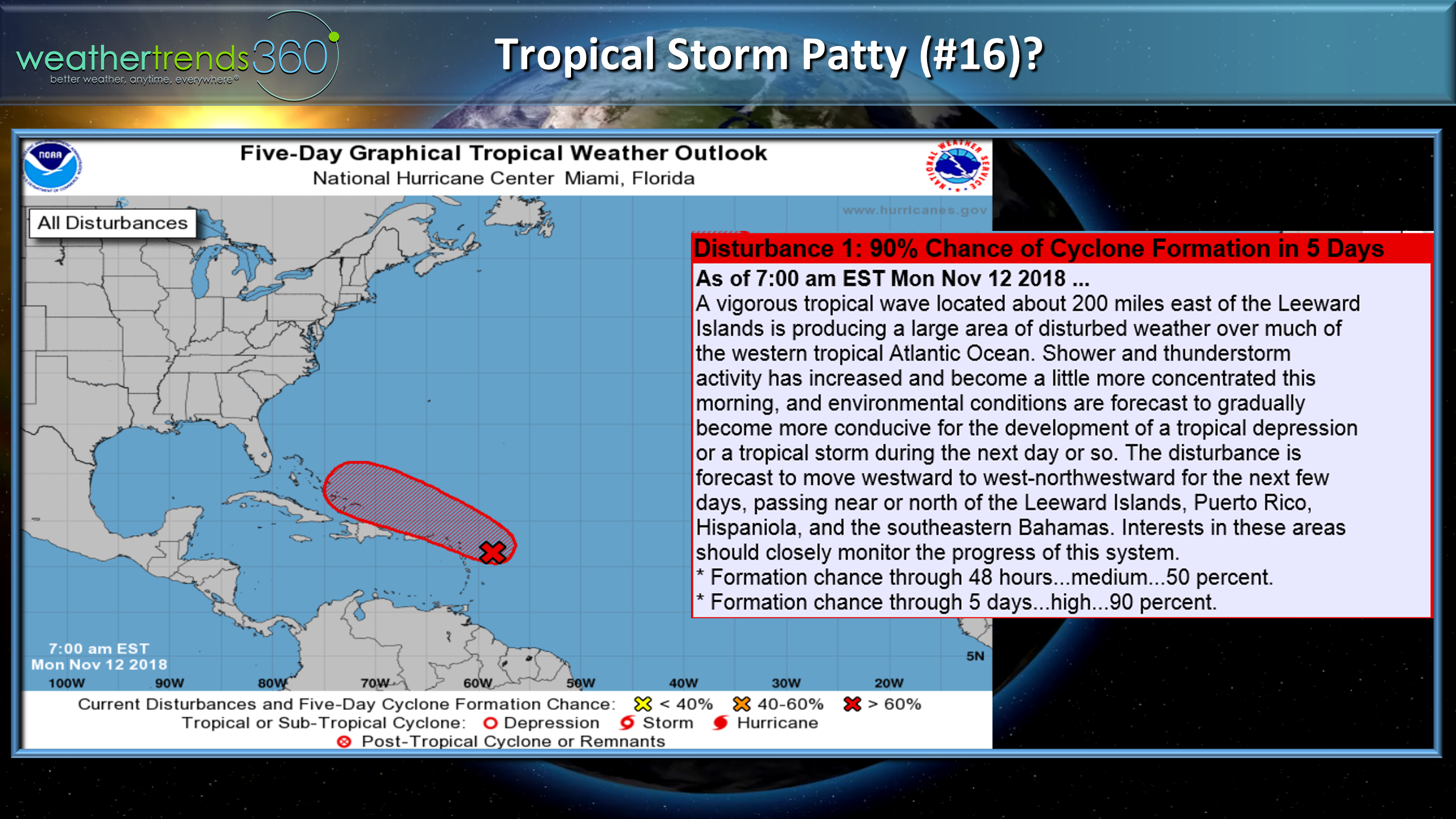
While the weather pattern for much of the U.S. has been very cold, we still have a couple weeks left of the 2018 Hurricane Season. Appears we'll get system #17 or 16th named storm of the season Patty this week. Patty will likely remain weak and head toward Turks & Caicos then toward Bermuda - not a big deal.
The week ahead (12-18 November) is again down right cold in the Eastern half of the U.S. The week overall trends coldest in 4 years, 4th coldest in 30+ years and wettest in 3 years and snowiest in 4 years. Many cities along the East Coast and Northeast are having their wettest year on record; two systems this week will add to the lofty totals.

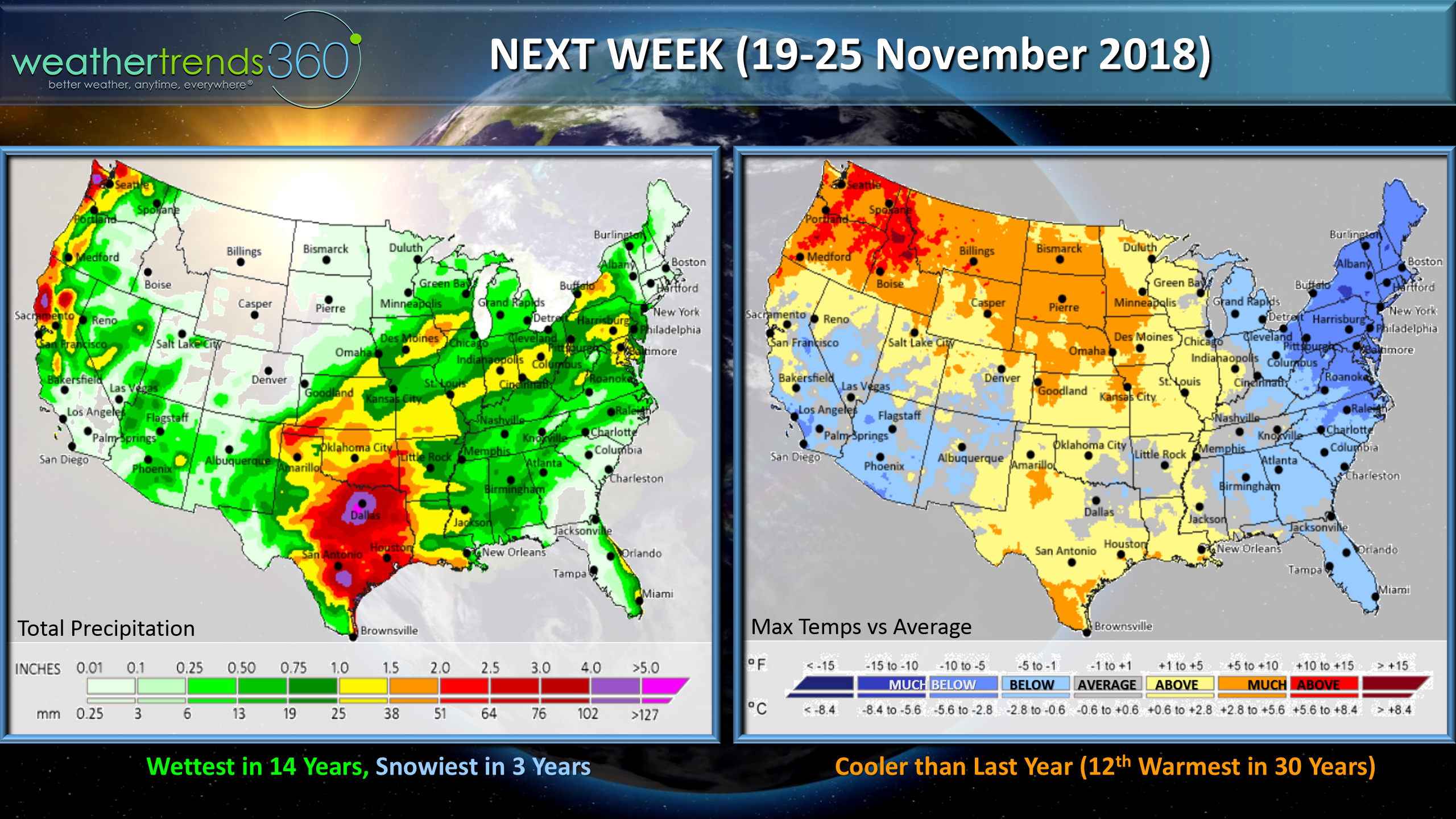
Next week (19-25) which includes the Thanksgiving holiday weekend shows moderating temperatures except along the East Coast where it remains cold. Hopefully some rain for California to assist in putting out these fires.
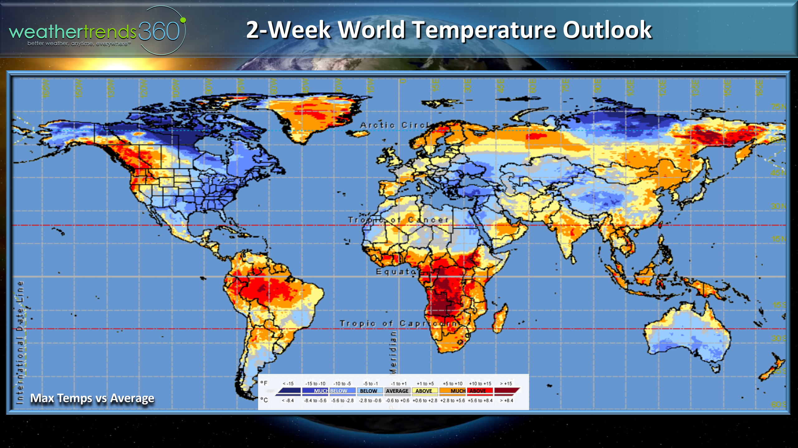
For the world overall the coldest temperatures relative to averages are in Eastern North America, warmer in W. Europe but cold E. Europe.
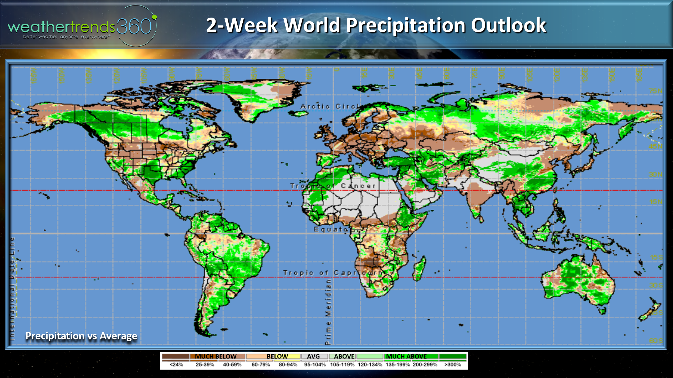
World precipitation over the next couple weeks shows the wettest conditions along the South and Eastern U.S., dry in the Northwest U.S. Snowy across Canada but very dry across Europe.
We'll end with this video of a starling murmuration observed Saturday here in Eastern PA showing thousands of the little birds doing their acrobatic displays. Turn up the volume and then at the 5 second mark it goes silent...
Have a great week and don't forget to follow us on social media for frequent updates.Facebook,Twitter,YouTube,PinterestandLinkedin
- Captain Kirk out.