Star Date 13 August 2018 Monday
Captain's Log
Happy Monday! :)
Captain's Log video for those that would rather watch than read. Readers continue below.
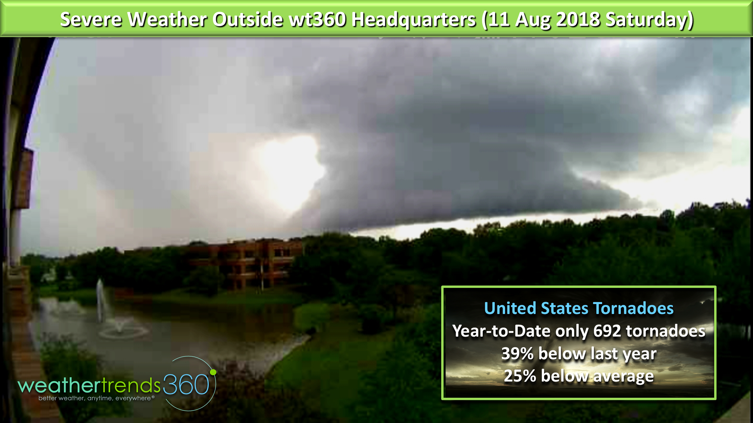
In addition to all the flooding making headline news here in the tri-state (PA-NJ-NY) area, we had a close call with a severe thunderstorm that was rotating outside wt360 headquarters on Saturday! Fortunately nothing touched down. Speaking of tornadoes, the numbers are quite low for the U.S. this season trending 39% less than last year's active season and 25% below average. CLICK ON IMAGES FOR LARGER VIEW.
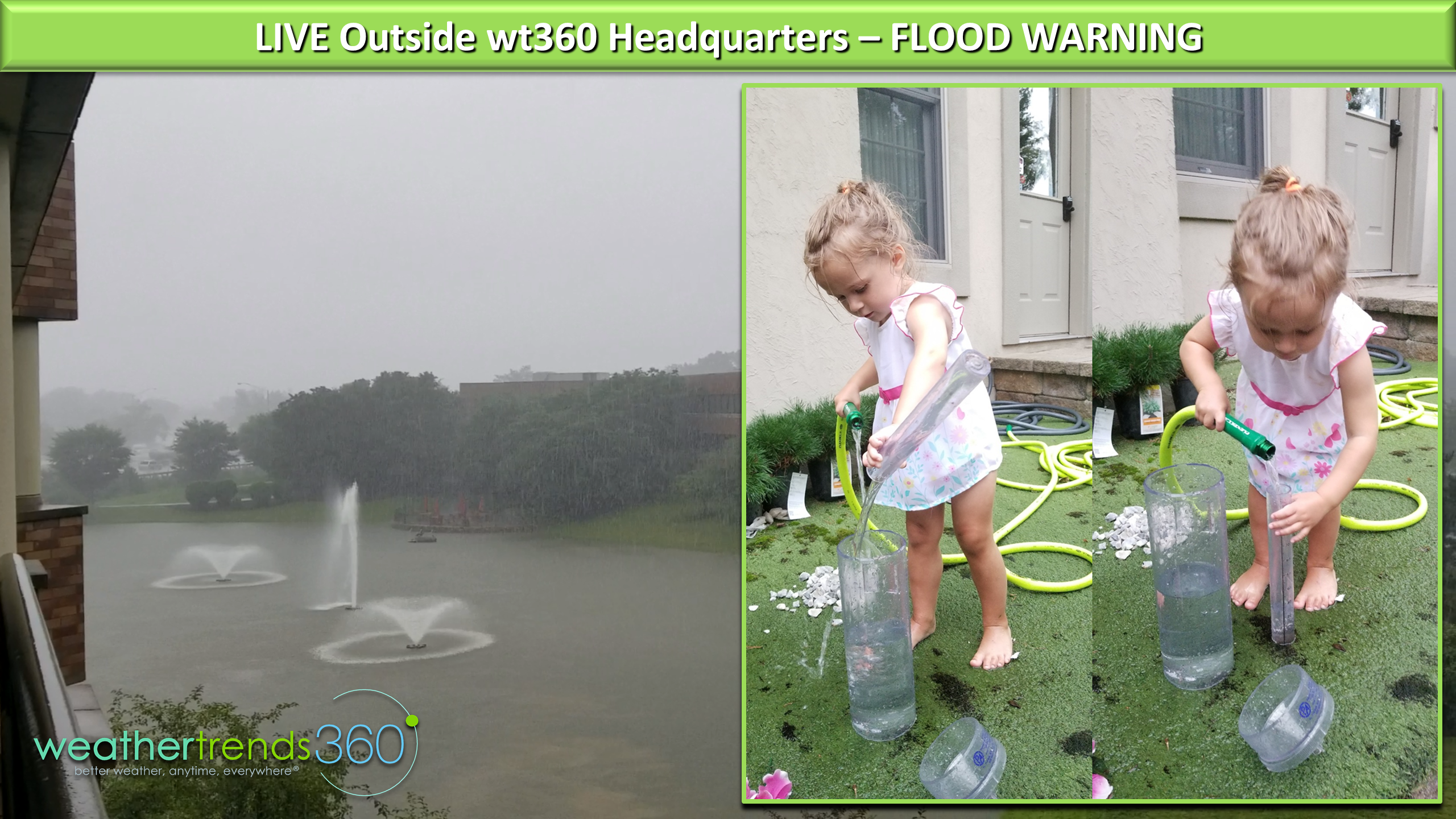
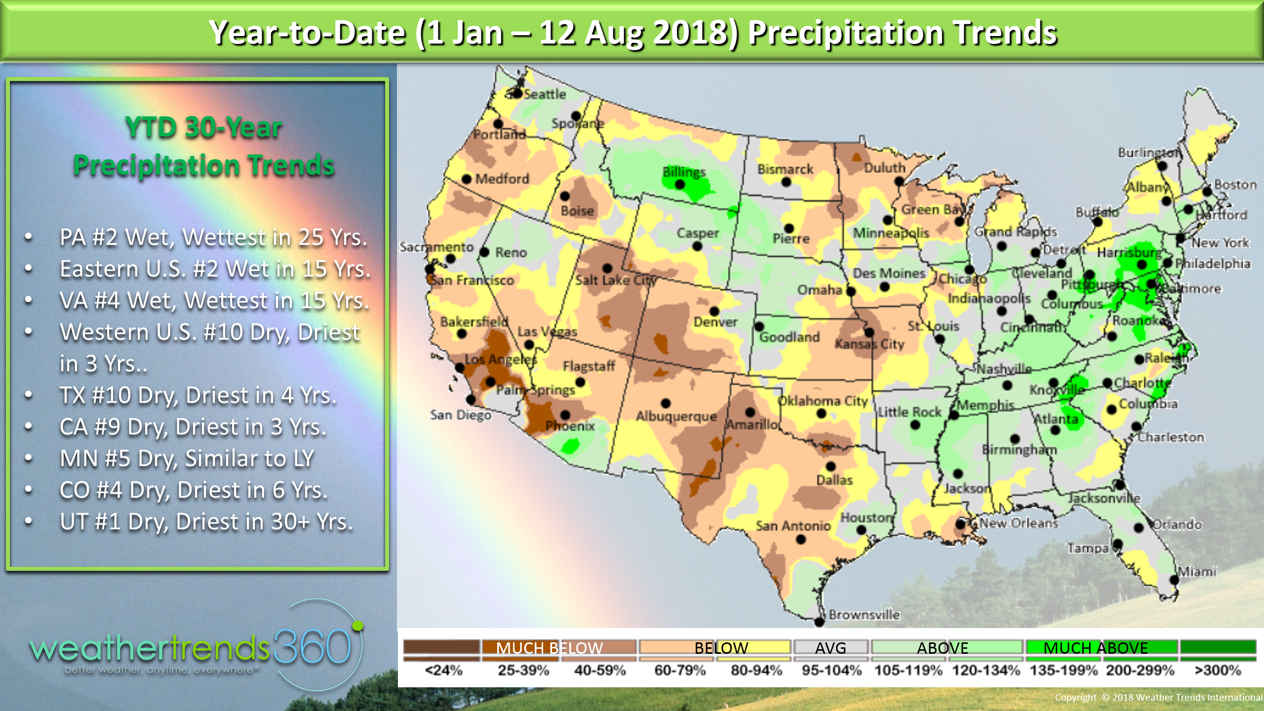
Rainfall has been off the charts in parts of the Middle Atlantic, southern Northeast while many areas in the West are quite dry. Prior to today's deluges again in Eastern
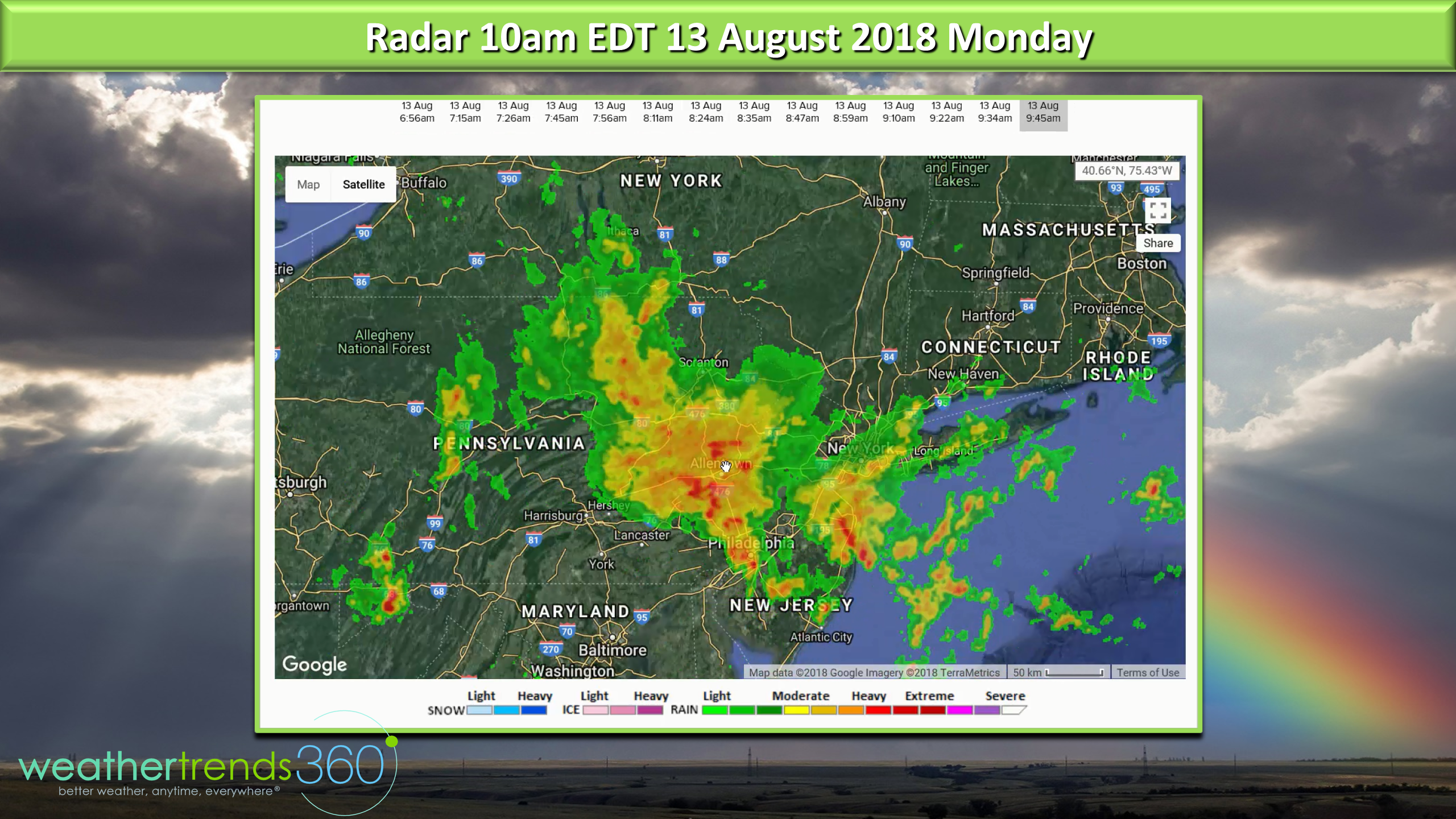
Pennsylvania we were having the 2nd wettest season to date in over 30 years. I've asked Angelina Kirk to stop filling up the rain gauge in hopes of making it dry out. ;)
The rain the past 30 days here in PA and the East is an amazing flip flop after such a hot/dry period in June and July. Utah is at the other end of the scale trending driest in over 30 years for the state as a whole.
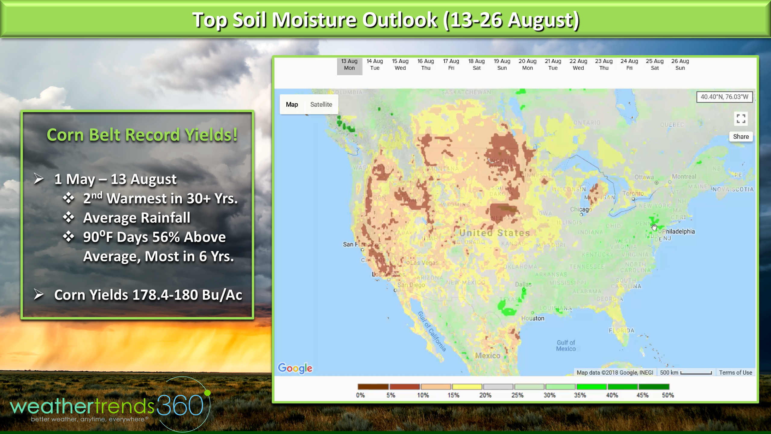
The soil moisture levels remain downright soggy in the East and especially the Middle Atlantic up into Eastern PA and there was much needed rainfall in TX and MO helping to boost moisture levels. The latest from the USDA suggest that Corn yields are going to be off the charts with 178.4 to as high as 180 bu/ac this season - a record. This despite the 2nd hottest growing season across the Corn Belt in over 30 years. The number of 90F days was 56% above average, the most since 2012 but rainfall was very close to average for the Corn Belt as a whole. Again proves that hybrids can trump high temperatures.
There will be more much needed rainfall in the Heartland around Kansas, maybe too much of a good thing over the next couple weeks.
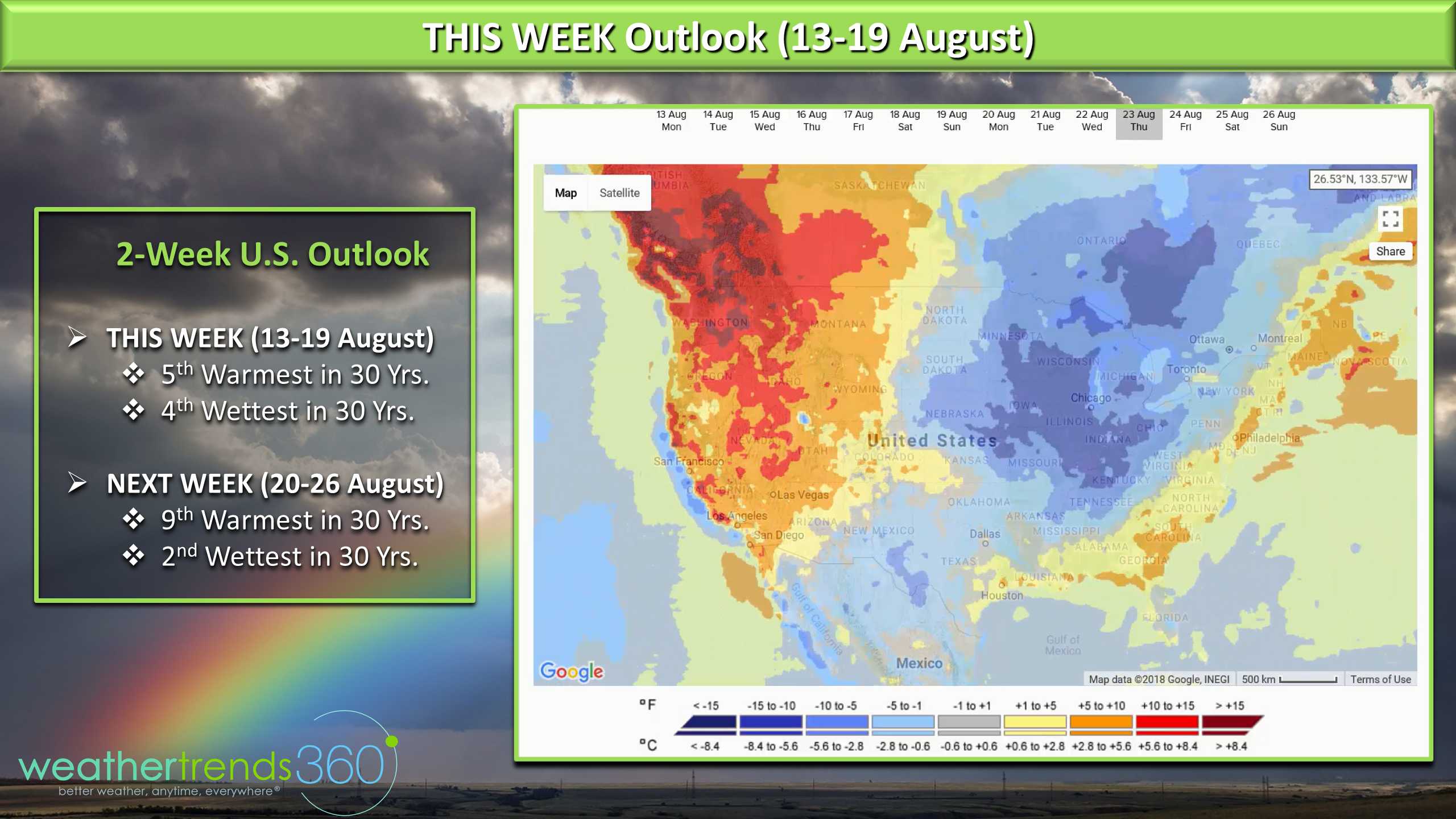
The 2-week outlook shows the heat will again build out West while a couple cold fronts will invade the Midwest and East next week. Could see the first 40s of the season in the Upper Midwest which will feel downright cold after the recent heat. For the U.S. overall this week is still the 5th warmest of the past 30 years and 4th wettest. Next week is a tad cooler trending 9th warmest of the past 30 years but #2 wettest for the U.S. as a whole.
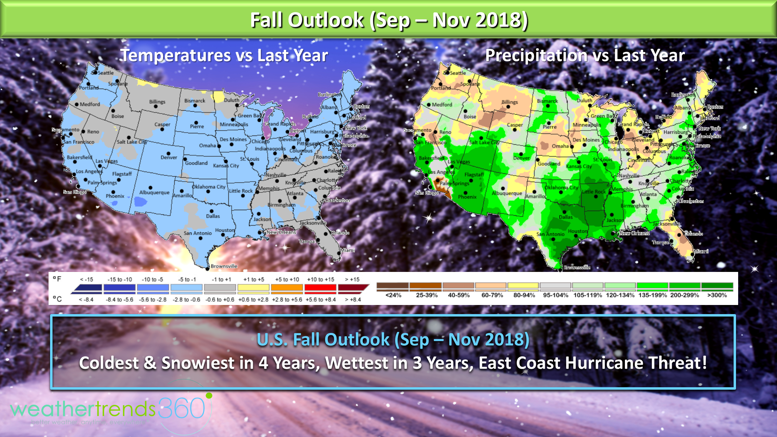
Our Fall outlook would suggest to enjoy the heat as we do expect it to be the coolest and snowiest in 4 years, yes we said the snow word in August, and the wettest in 3 years. We remain very concerned about land falling hurricane threat for the East Coast and Northeast Gulf of Mexico.
On the business front, Weather Trends won its 15th business/technology award with a SILVER in the International Business Awards for Innovator of the Year. We lost to CISCO a $48 billion dollar company so we'll take it. :)

Have a great week and check our social media pages for frequent updates.Facebook,Twitter,YouTube,PinterestandLinkedin
- Captain Kirk out.