Star Date 13 December 2017 Wednesday
Captain's Log
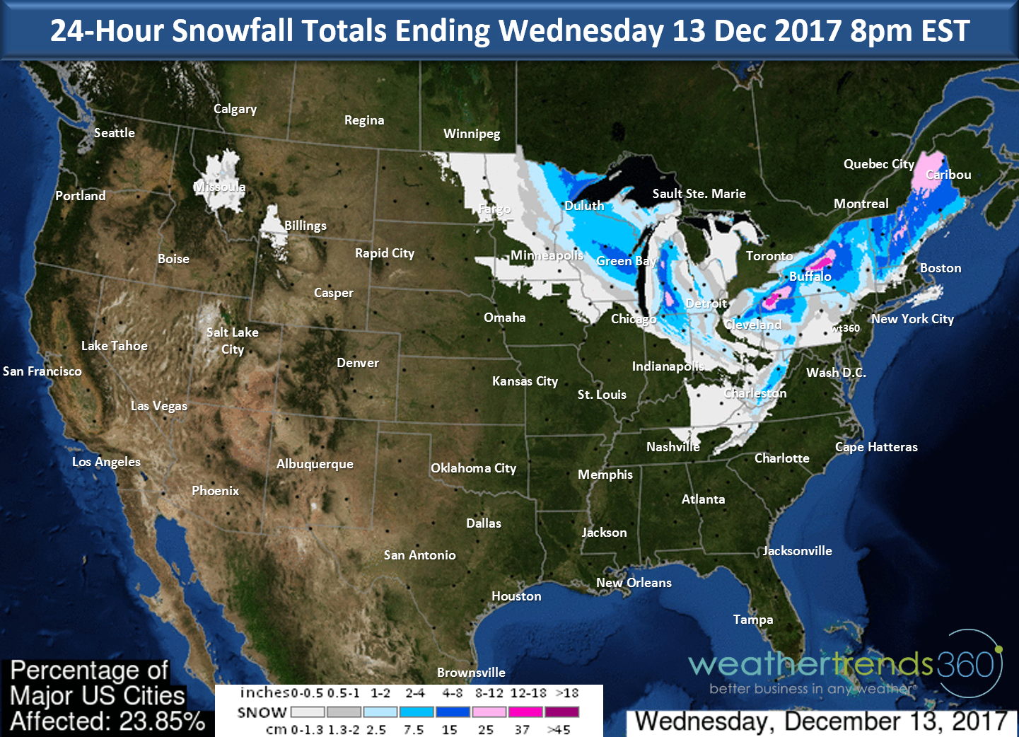
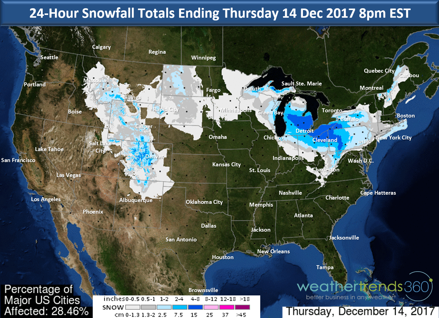
13 Dec 2017 Wednesday Update:
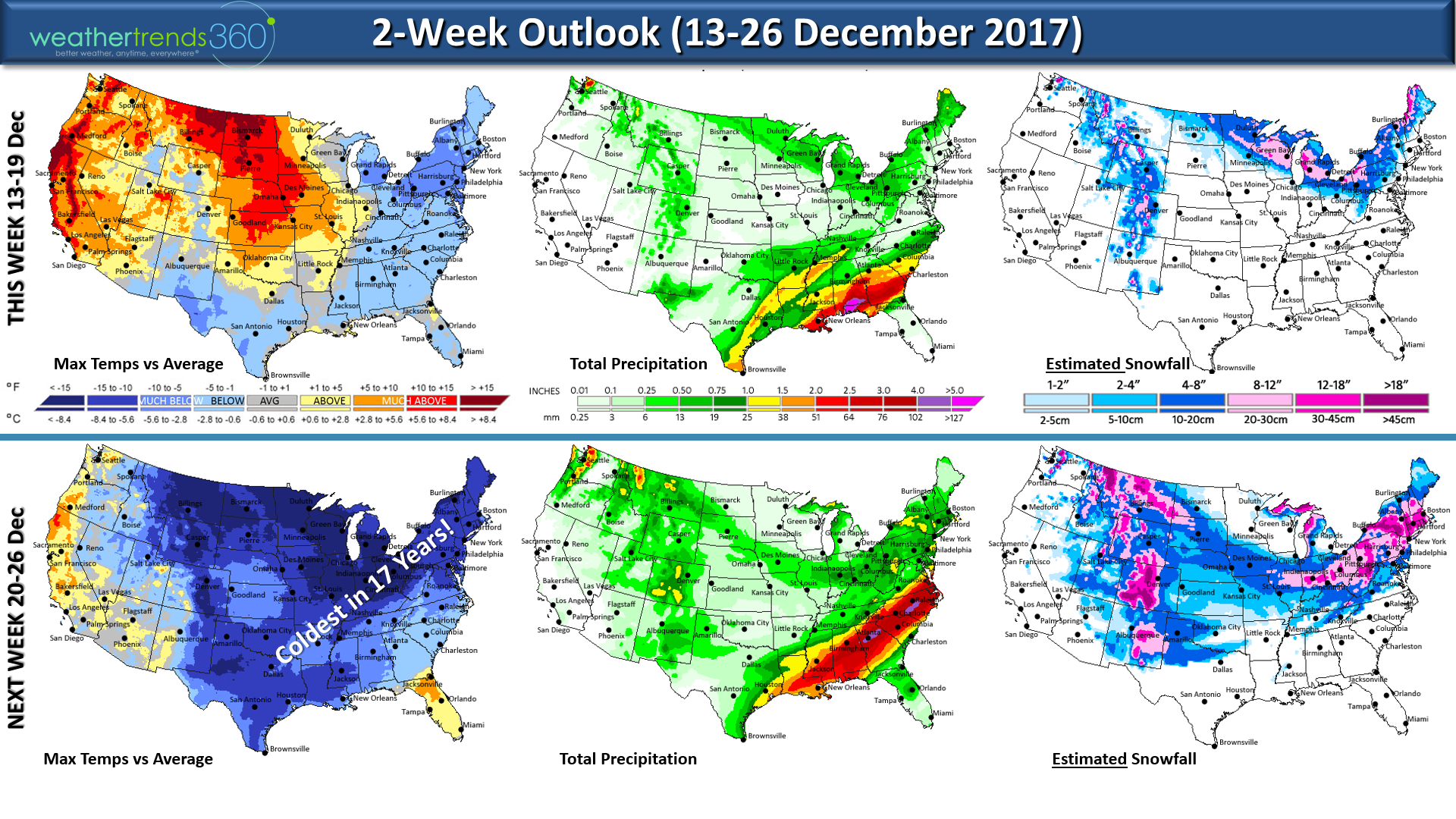
Does anyone remember the 60s in the East Christmas last year? We'll forget about it as this year all signs point to epic cold moving in before, during and after Christmas with more bigger snow threats well into the Deep South but also the Rockies, Midwest and Northeast. In fact the Christmas Eve - Christmas Day period likely to be the coldest in 30+ years for many locations in the Central and Eastern U.S. The entire week of Christmas looks to be the coldest in 17 years for the Eastern half of the U.S. with heavy snow in the Lakes and Northeast. CLICK ON MAPS FOR LARGER VIEW.

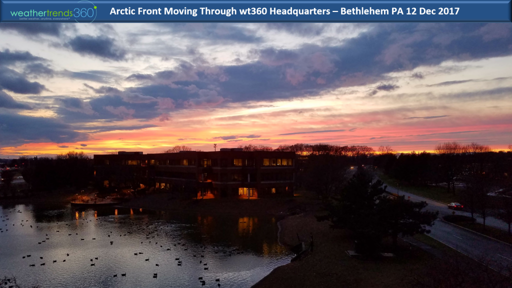
The first in a series of Arctic cold fronts brought a beautiful sunset here at wt360 headquarters yesterday ushering in frigid conditions today.
Now the next reinforcing shot with an Alberta Clipper type system will also bring another round of light snow tomorrow.

It's Monday 11 Dec 2017...hard to say happy with devastating fires in California. Prayers for those in harms way.
The Thomas Fire to the East of Santa Barbara exploded in size over the weekend and continues to threaten bigger cities near Montecito, Carpenteria and Santa Barbara. CLICK ON IMAGES FOR LARGER VIEW
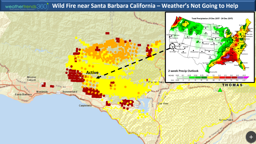
The fire is burning in an areas that really hasn't had a major fire in decades with very old growth brush fueling the fire. Humidity levels remain very low (<15%) with a northerly wind flow causing down sloping winds that get very dry as it descends down through these canyons. The humidity bumps up a bit on Saturday but no major relief until later next week (higher humidity and onshore winds later next week) but still no rain in sight. A lot of big homes in this area are at risk including celebrities like Oprah, Ellen DeGeneres, Rob Lowe, Jeff Bridges, etc. Sadly 800 homes have already been destroyed since these fires started 11 days ago but amazing only 1 death. The good news is the Ventura County fire has improved dramatically.

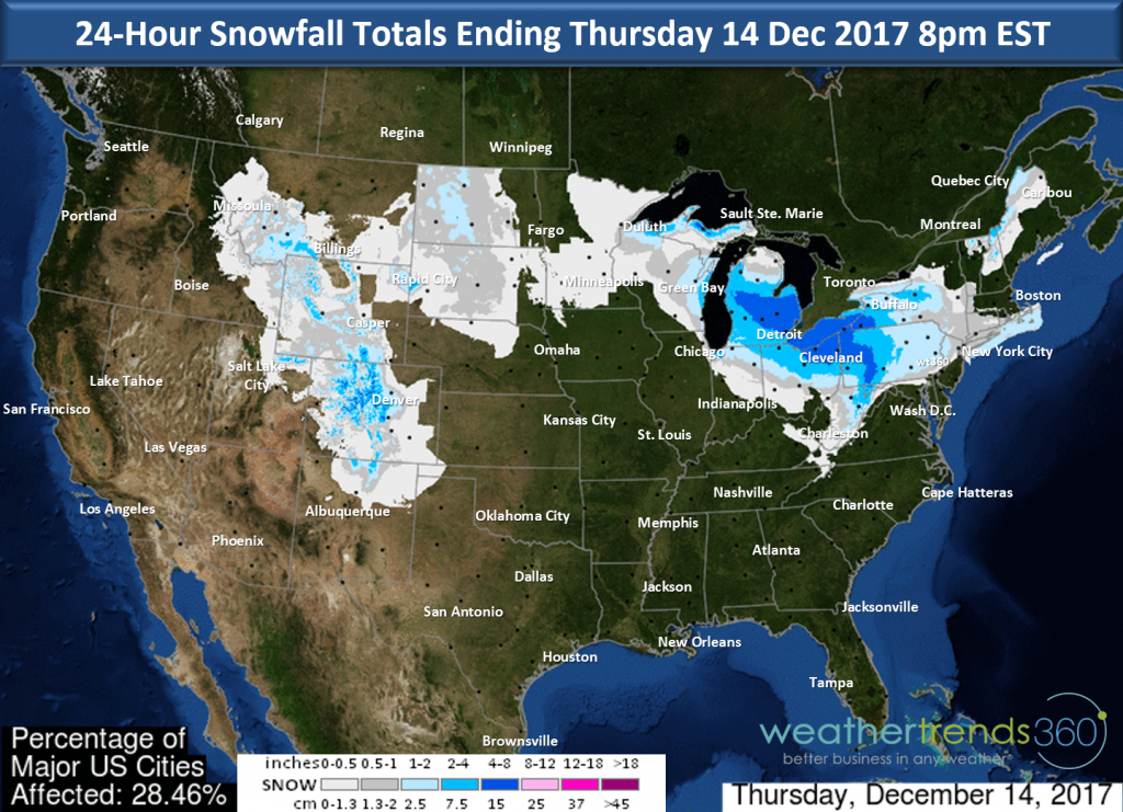
The other big event was the record setting snow storm this past weekend that brought snow from southern TX to north Florida, throughout the Southeast and up the East Coast. This brought record shattering early snow to the Deep South. Snow totals above.
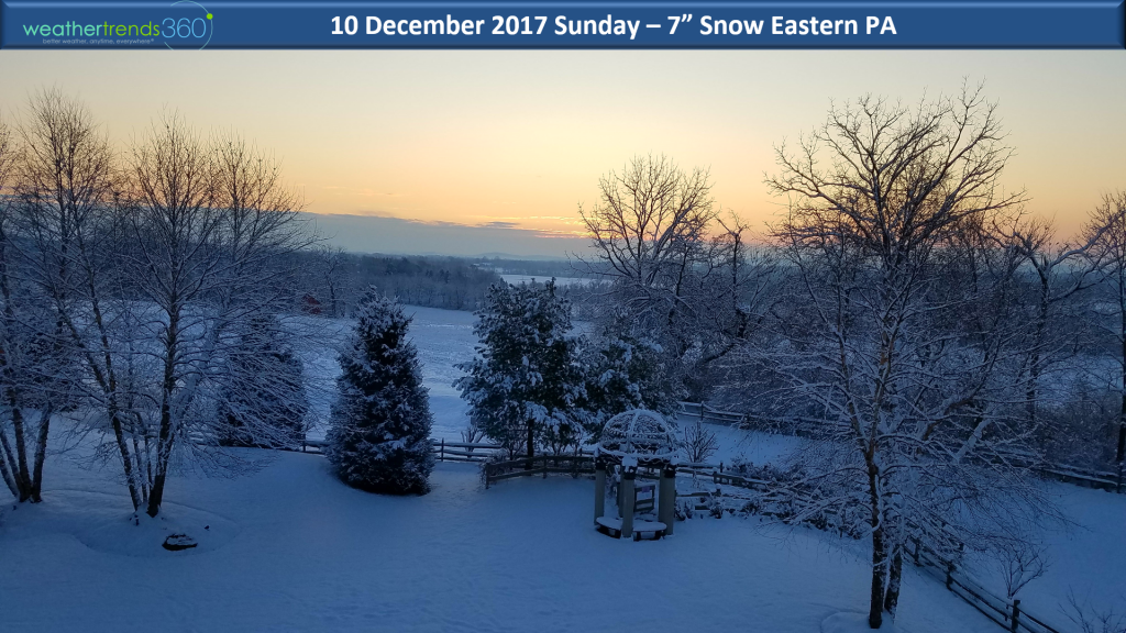
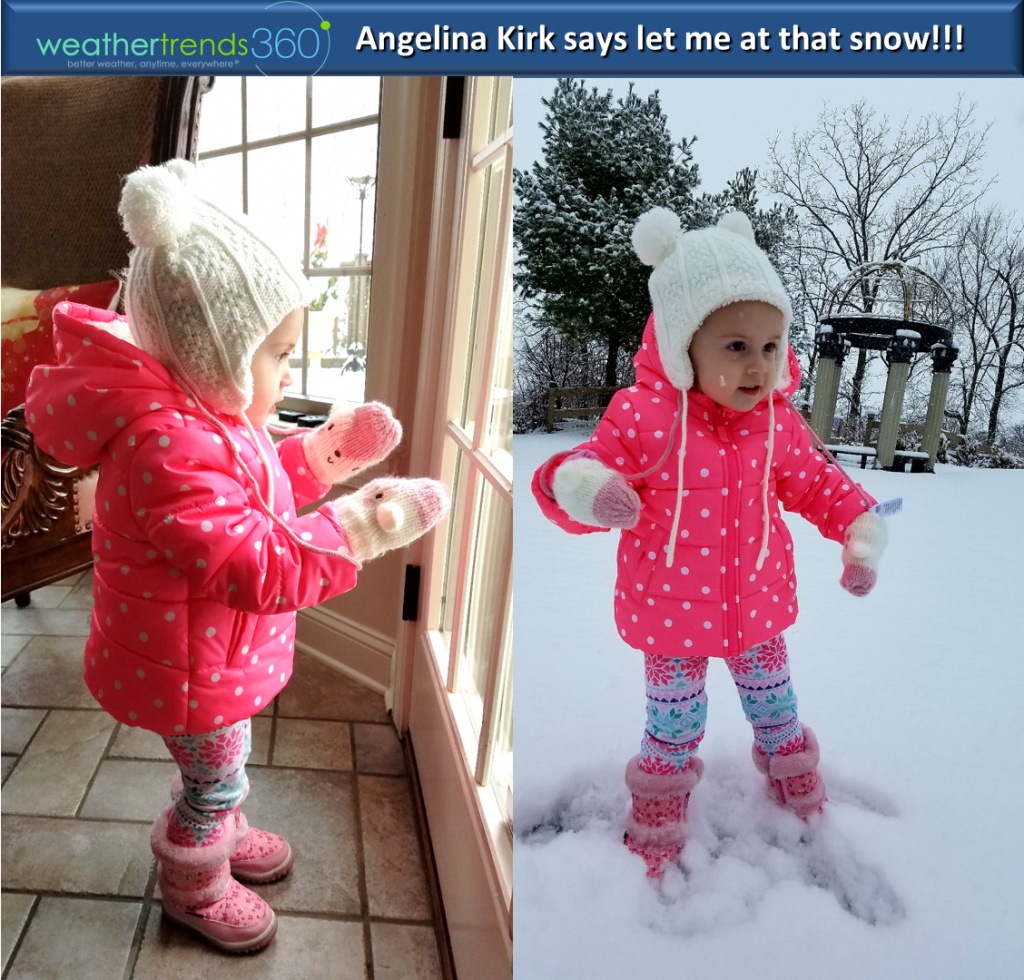
Near wt360 headquarters we had 7" in Eastern PA making for a cold wintry scene. For those wanting an Angelina photo - here you go! :) A future meteorologist in the making. Ask any meteorologist how they got interested in weather and most will tell you it was an early childhood weather event.
This past weekend was the 3rd coldest in 30 years, coldest in 7 years for the Eastern U.S. and the 2nd snowiest of the past 30 years, snowiest in 12 years. The West was obviously warm and dry.
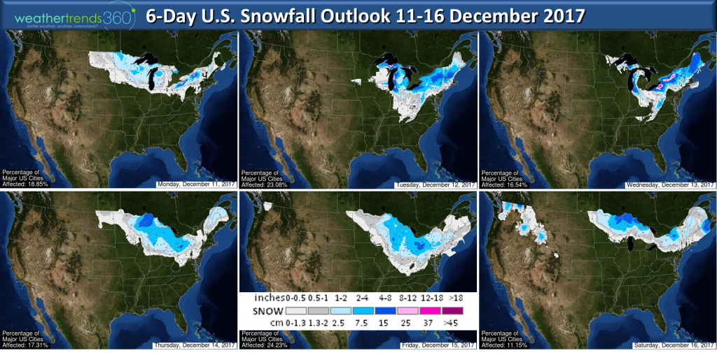
More snowfall likely over the next 6-days with several Alberta Clipper type storms to watch between now and Christmas. The Great Lakes and Northeast look to remain the snowiest and coldest regions overall for the balance of the month with more cold days than warm days. Probably not looking at 60s like last Christmas in the Northeast. This Christmas looks to be the coldest in 4 years for the Eastern half of the U.S. with some stormy wintry weather the last week of December.
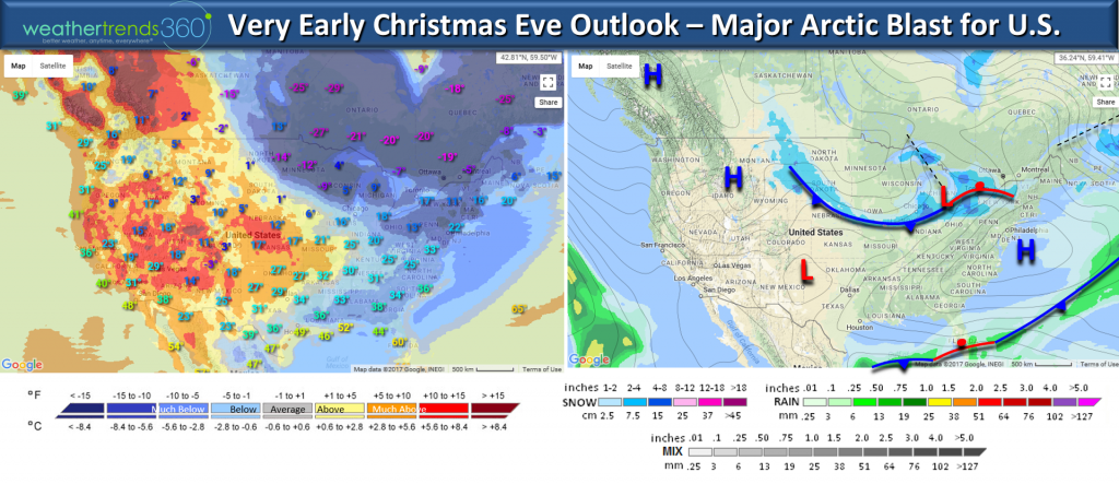
The very early Christmas Eve outlook above shows cold and snow in the Midwest to Northeast while it remains warm and dry in the West.
Follow us on Facebook and Twitter for daily updates. We had some cool drone footage of the snow storm - worth checking out! Have a good week.
- Captain Kirk out.
Does anyone remember the 60s in the East Christmas last year? We'll forget about it as this year all signs point to epic cold moving in before, during and after Christmas with more bigger snow threats well into the Deep South but also the Rockies, Midwest and Northeast. In fact the Christmas Eve - Christmas Day period likely to be the coldest in 30+ years for many locations in the Central and Eastern U.S. The entire week of Christmas looks to be the coldest in 17 years for the Eastern half of the U.S. with heavy snow in the Lakes and Northeast. CLICK ON MAPS FOR LARGER VIEW.
The first in a series of Arctic cold fronts brought a beautiful sunset here at wt360 headquarters yesterday ushering in frigid conditions today.

Now the next reinforcing shot with an Alberta Clipper type system will also bring another round of light snow tomorrow.
It's Monday 11 Dec 2017...hard to say happy with devastating fires in California. Prayers for those in harms way.
The Thomas Fire to the East of Santa Barbara exploded in size over the weekend and continues to threaten bigger cities near Montecito, Carpenteria and Santa Barbara. CLICK ON IMAGES FOR LARGER VIEW

The fire is burning in an areas that really hasn't had a major fire in decades with very old growth brush fueling the fire. Humidity levels remain very low (<15%) with a northerly wind flow causing down sloping winds that get very dry as it descends down through these canyons. The humidity bumps up a bit on Saturday but no major relief until later next week (higher humidity and onshore winds later next week) but still no rain in sight. A lot of big homes in this area are at risk including celebrities like Oprah, Ellen DeGeneres, Rob Lowe, Jeff Bridges, etc. Sadly 800 homes have already been destroyed since these fires started 11 days ago but amazing only 1 death. The good news is the Ventura County fire has improved dramatically.
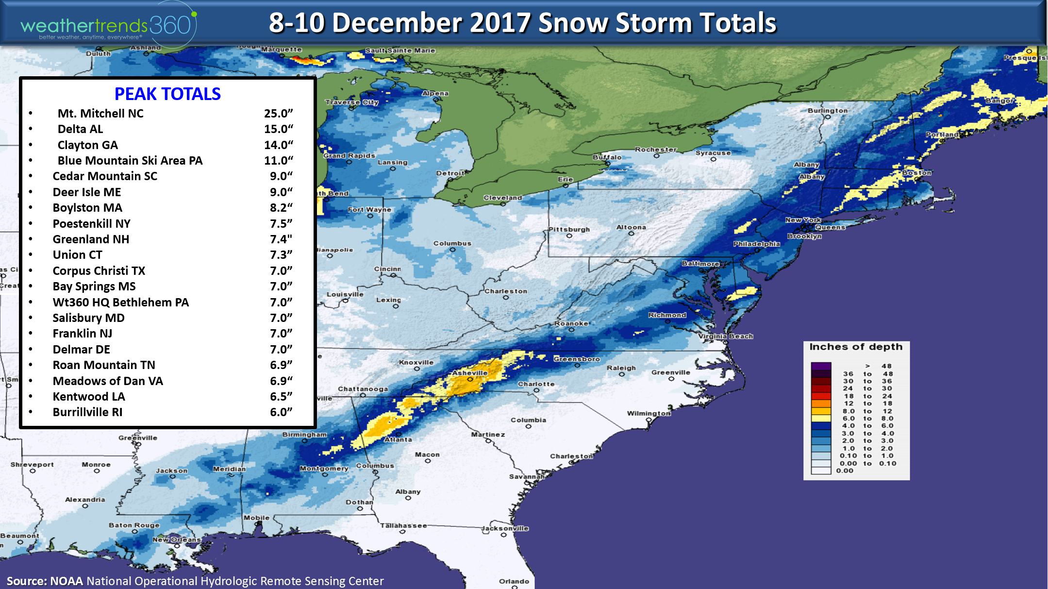
The other big event was the record setting snow storm this past weekend that brought snow from southern TX to north Florida, throughout the Southeast and up the East Coast. This brought record shattering early snow to the Deep South. Snow totals above.

Near wt360 headquarters we had 7" in Eastern PA making for a cold wintry scene. For those wanting an Angelina photo - here you go! :) A future meteorologist in the making. Ask any meteorologist how they got interested in weather and most will tell you it was an early childhood weather event.

This past weekend was the 3rd coldest in 30 years, coldest in 7 years for the Eastern U.S. and the 2nd snowiest of the past 30 years, snowiest in 12 years. The West was obviously warm and dry.
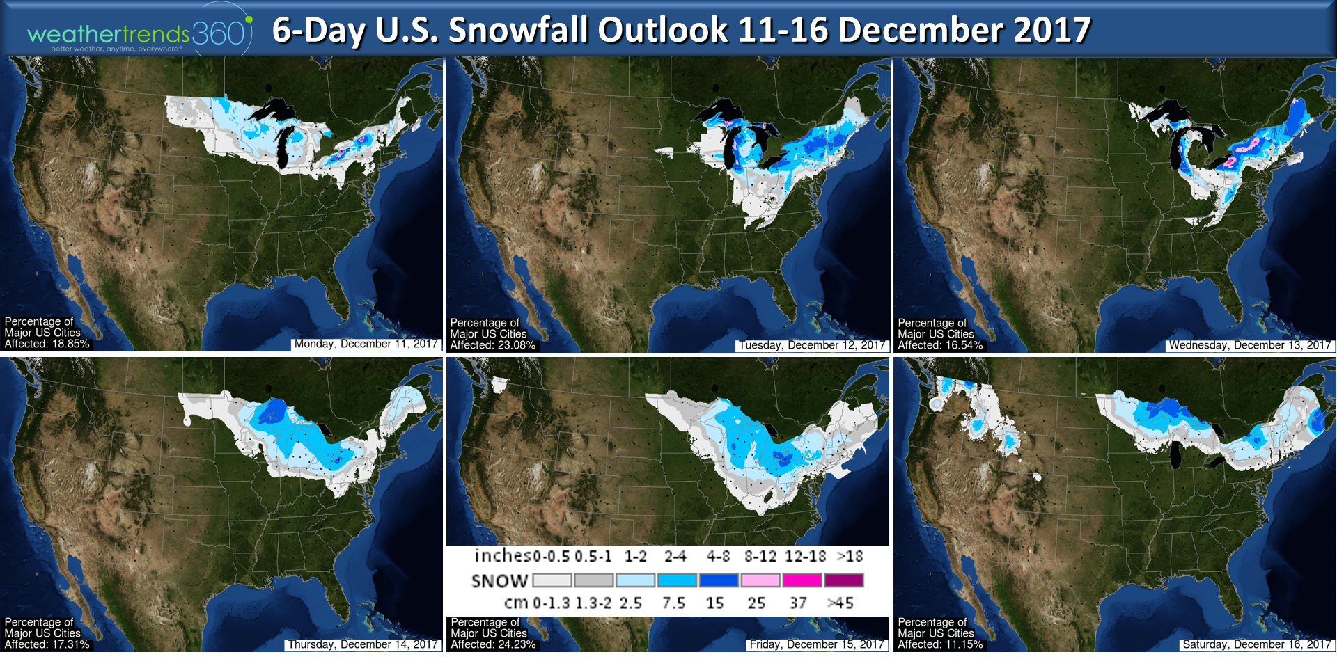
More snowfall likely over the next 6-days with several Alberta Clipper type storms to watch between now and Christmas. The Great Lakes and Northeast look to remain the snowiest and coldest regions overall for the balance of the month with more cold days than warm days. Probably not looking at 60s like last Christmas in the Northeast. This Christmas looks to be the coldest in 4 years for the Eastern half of the U.S. with some stormy wintry weather the last week of December.

The very early Christmas Eve outlook above shows cold and snow in the Midwest to Northeast while it remains warm and dry in the West.
Follow us on Facebook and Twitter for daily updates. We had some cool drone footage of the snow storm - worth checking out! Have a good week.
- Captain Kirk out.