Star Date 13 September 2018 Thursday
Captain's Log
THURSDAY 13 SEP 2018 11AM EDT HURRICANE FLORENCE UPDATE VIDEO:
WEDNESDAY 12 SEP 2018 10AM EDT HURRICANE FLORENCE UPDATE VIDEO:
MONDAY UPDATE: Hard to say Happy Monday in light of 3 tropical systems making landfall this week.
Obviously all eyes are on Major Hurricane Florence that will almost certainly make landfall Thursday in the North Carolina area from Wilmington to Morehead City.
The other land-falling systems will be Cat 1 Hurricane Isaac going through the middle of the Leeward/Windward Islands also on Thursday and weakening Hurricane Olivia will be a strong Tropical Storm going through the Hawaiian Islands Tuesday into Wednesday. CLICK ON IMAGES FOR LARGER VIEW.
This morning's satellite image shows the 3 hurricanes in the Atlantic with a rapidly intensifying Florence.
The overnight models have tightened up with almost all showing a high probability of land fall in Southeast North Carolina Thursday into pre-dawn Friday as a major hurricane.
One model shows it could briefly become a Cat 5 and if so it would be the furthest north Cat 5 in U.S. history, Camille in 1969 currently is the farthest north in the coastal Louisiana area.
Normally most Atlantic Hurricanes like to recurve to the North and East but this go around we have a huge blocking high pressure to the North combined with a blocking Bermuda High pressure ridge that is forcing Florence West into the U.S. This morning the Northeasterly winds here in PA made for a downright cold morning with middle to upper 40s, so it felt like Fall.
The big concern with any hurricane is always the right front quadrant to the right of the eyewall where the storm surge is biggest. In this case the storm surge could be 10-14 feet in the concave coast line configuration (most devastating coastline configuration as water piles up with nowhere to escape) from Wilmington NC to Morehead City NC. Just south on the left side of the hurricane the storm surge is only 3-4 feet. But, 3-days out the exact location of the eye is difficult to say exactly so any minor wobble will adjust this a bit.
On top of that surge of water will be 20-30 foot seas so this will be a devastating hurricane on the order of Hugo back in 1989.
Then Florence appears to get stuck which will result in major flooding inland from very heavy rainfall. The ground is already wet with the heavy rain this Spring-Summer in the Middle Atlantic so the model predictions of 30-55" of rain will be catastrophic.
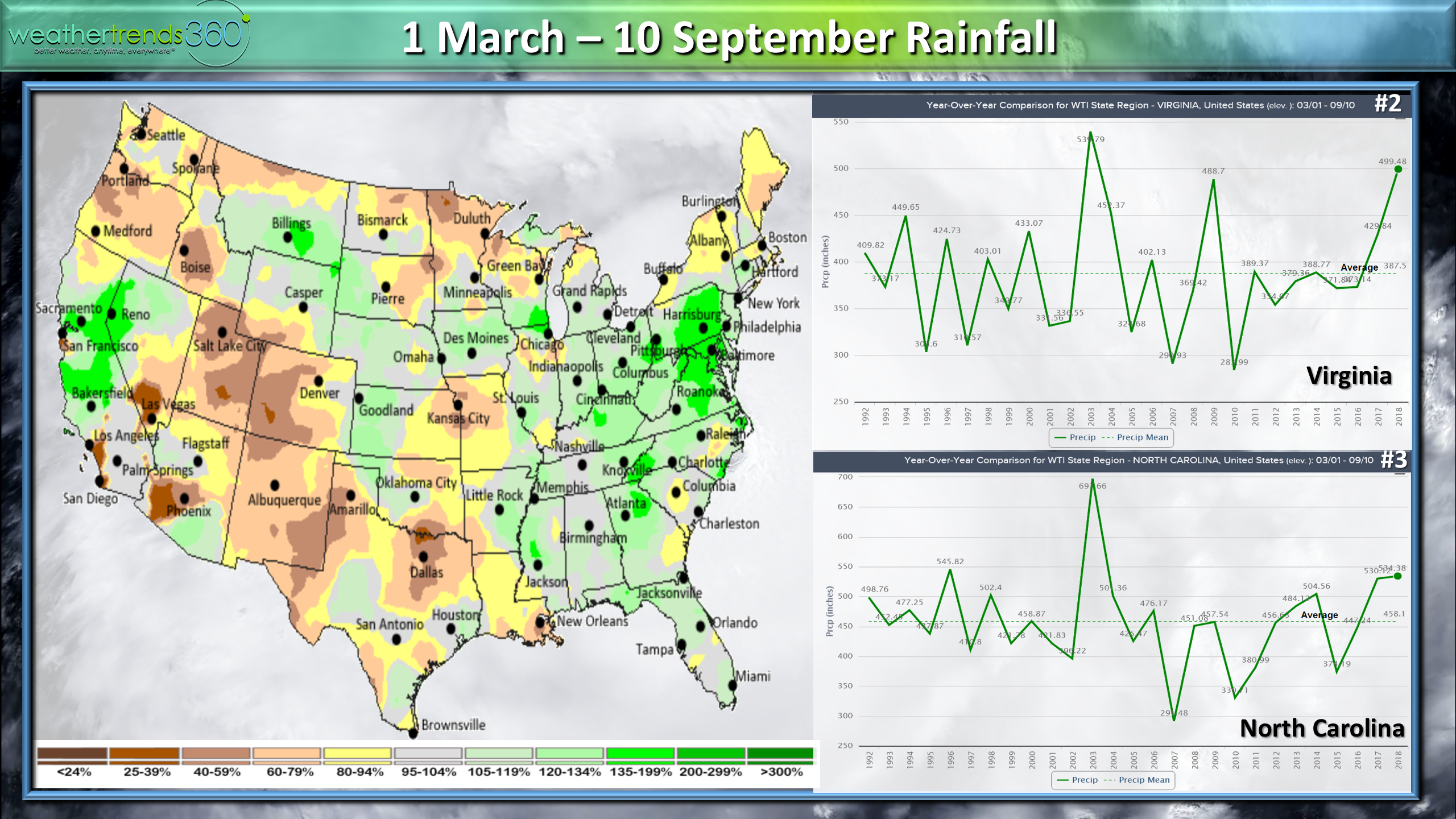
Spring to date rainfall in NC is the 3rd most in 30 years and 2nd most in 30 years for Virginia. The water will have nowhere to go so flooding is a major concern.
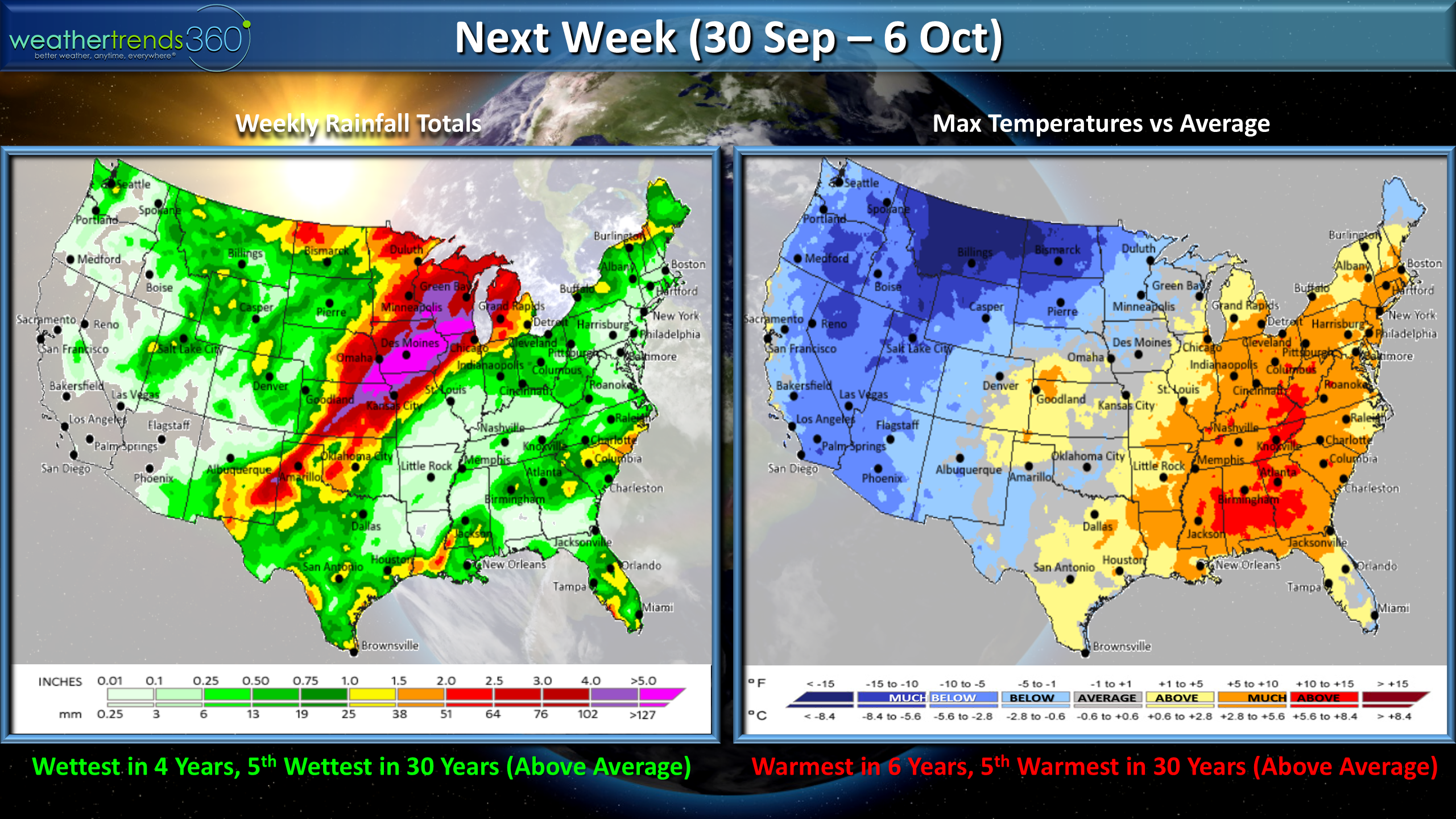
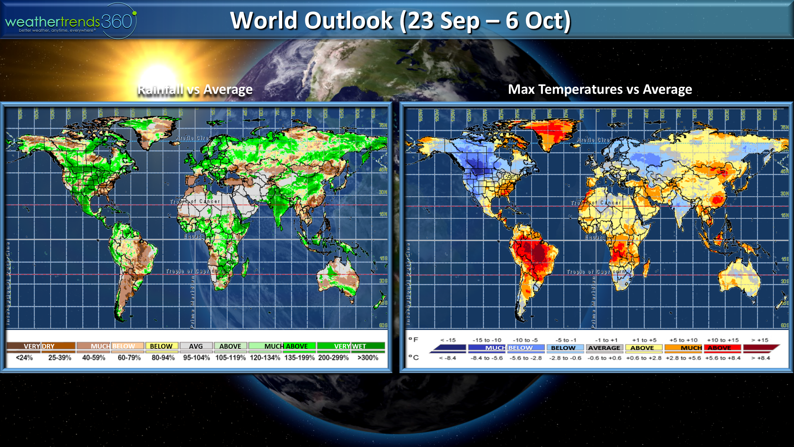
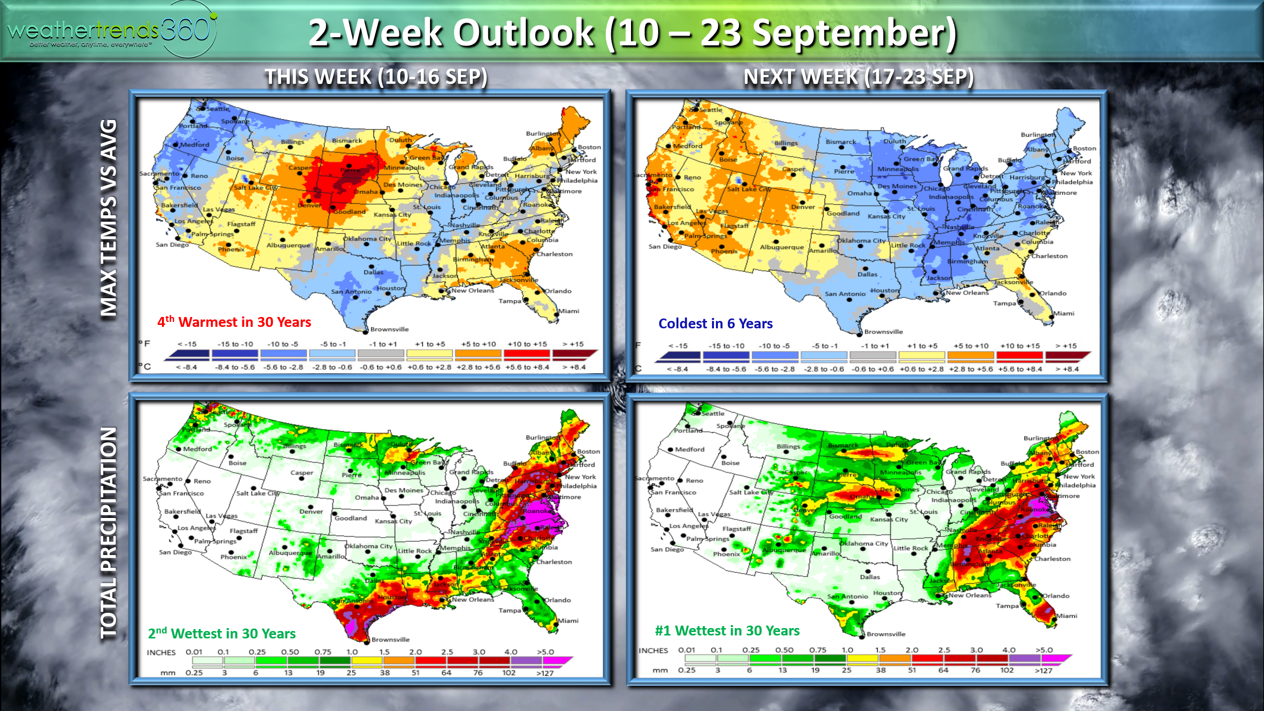
The 2-week outlook shows a couple blasts of cold weather sweeping the U.S. so Fall is in the air. This week for the U.S. overall trends 4th warmest in 30 years and 2nd wettest in 30 years (mainly East Coast), while next week looks to be the coldest in 6 years and #1 wettest in 30 years.
Be safe and please heed all warnings from local officials. Follow us on social media for frequent updates.Facebook,Twitter,YouTube,PinterestandLinkedin
- Captain Kirk out.