Star Date 16 July 2018 Monday
Happy Monday! :)
Can you believe July is half over already? Seems like the cold/snowy Spring lasted forever but now the hot/dry Summer is moving at warp speed. Things are changing here in July with a flip flop in the weather pattern for the later half of the month. CLICK ON IMAGES FOR LARGER VIEW.
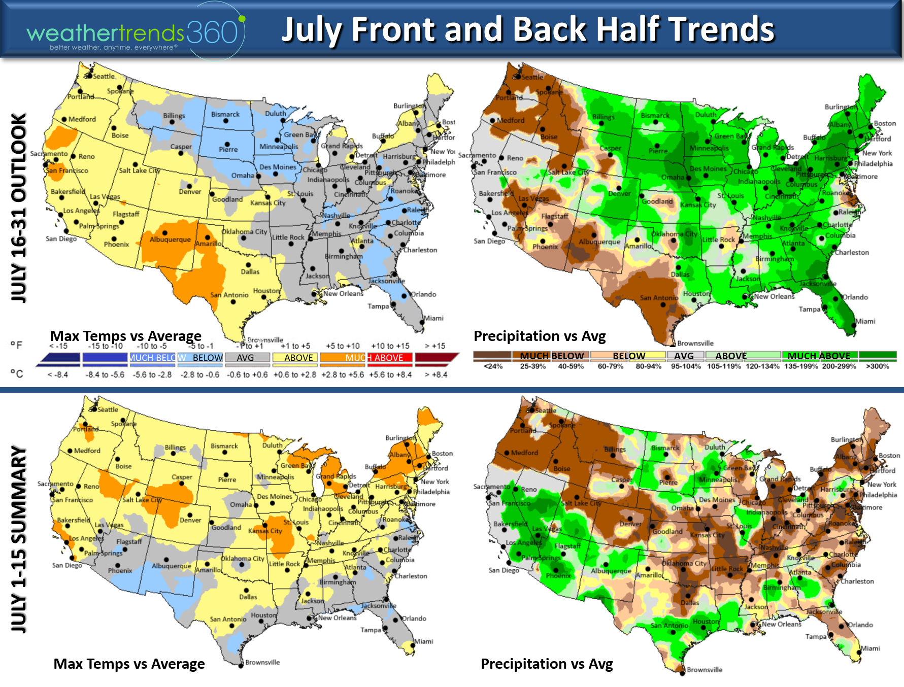
The front half of July was hot and dry for many areas with the U.S. overall the warmest in 6 years but driest in 23 years. For the later half of the month it's more seasonable in the East, hot West while rainfall appears to get very heavy for many areas in the Central and Eastern U.S. The U.S. overall shows similar temps to last year but off the charts wet, #1 wettest in 30 years for the later half of July. The wet pattern is in part because the Southwest Monsoon is cranking and cold front diving into the U.S. clashing with a Bermuda High closer to the Central Atlantic will bring a conveyor belt of tropical moisture to the Midwest and East.
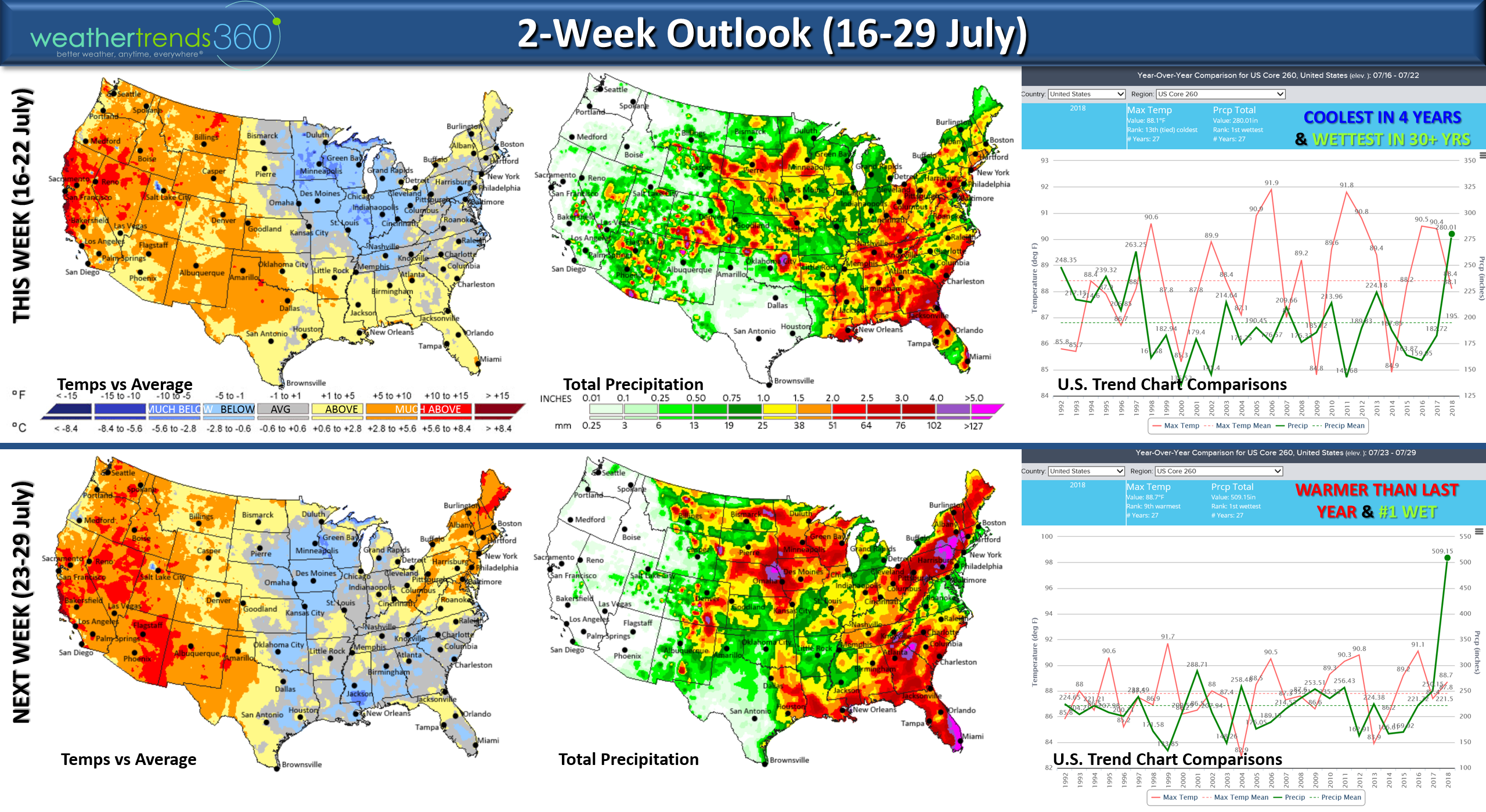
The 2-week outlook shows the conveyor belt of moisture invading much of the Eastern U.S. so a warm, humid and stormy pattern setting up for many.
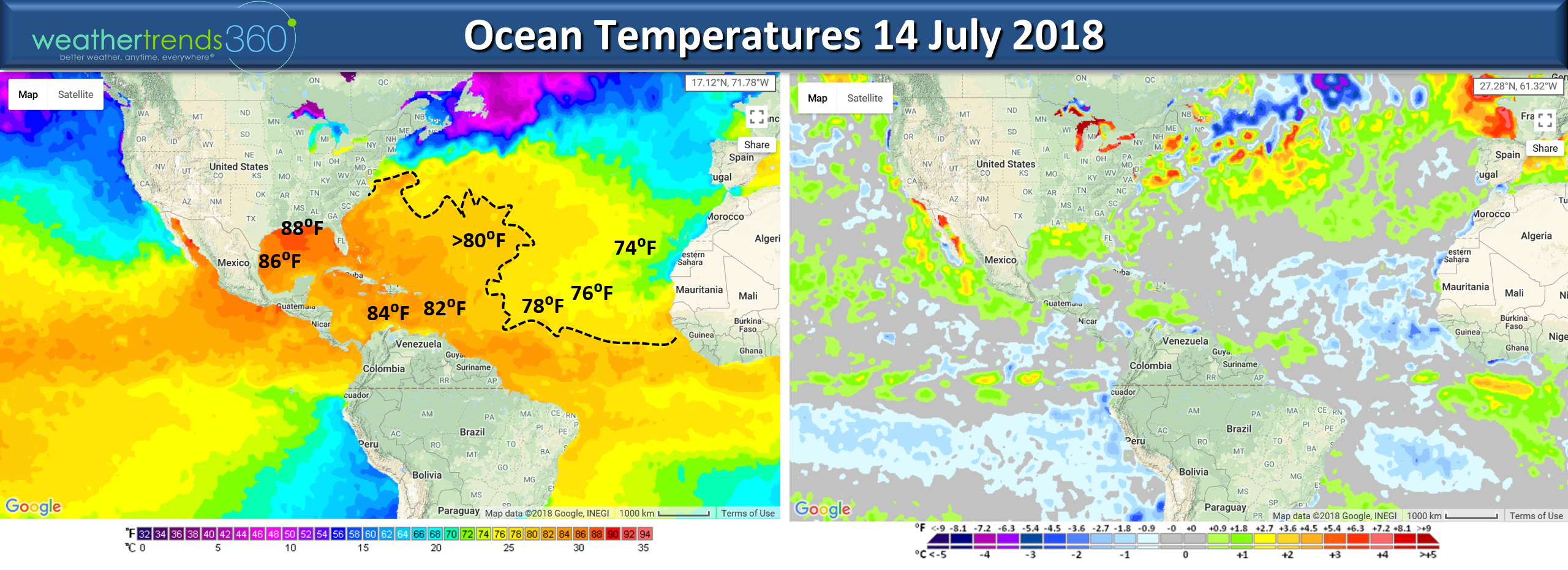
Need to watch a potential sub-tropical low development off the East Coast late this weekend, too early to say if it will become Debby but waters off the U.S. are plenty warm enough (above 80F) to support tropical development.
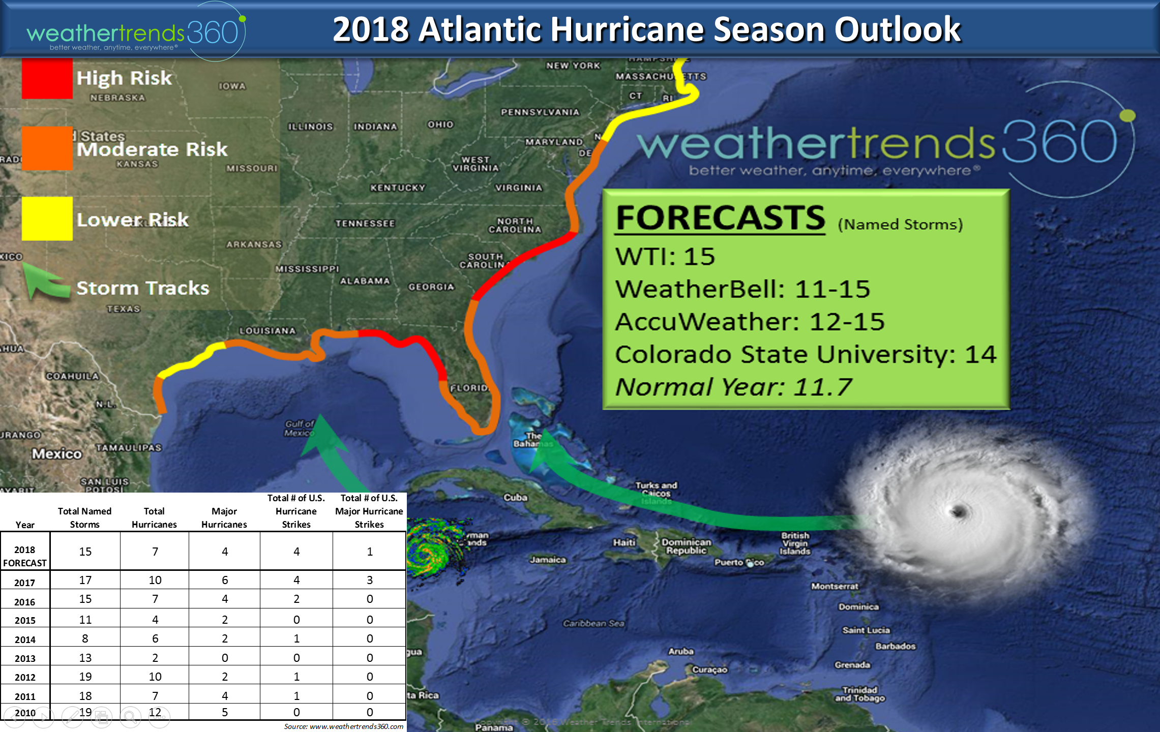
Recall that our long range hurricane season outlook called for Florida and the East Coast as our high threat areas for a land falling hurricane this season. We're still a month or so away from the start of the peak season (middle August - late September) but the season is off to a fast start with 3 named systems already.
We hope you have a great week ahead!Follow us on social media for frequent updates. Facebook,Twitter,YouTube,PinterestandLinkedin
- Captain Kirk out.