Star Date 18 August 2017 Friday
Captain's Log
Happy TGIF!
A quick update on the weekend weather and the all important outlook for the eclipse Monday afternoon. Click on images for larger view.
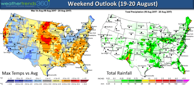
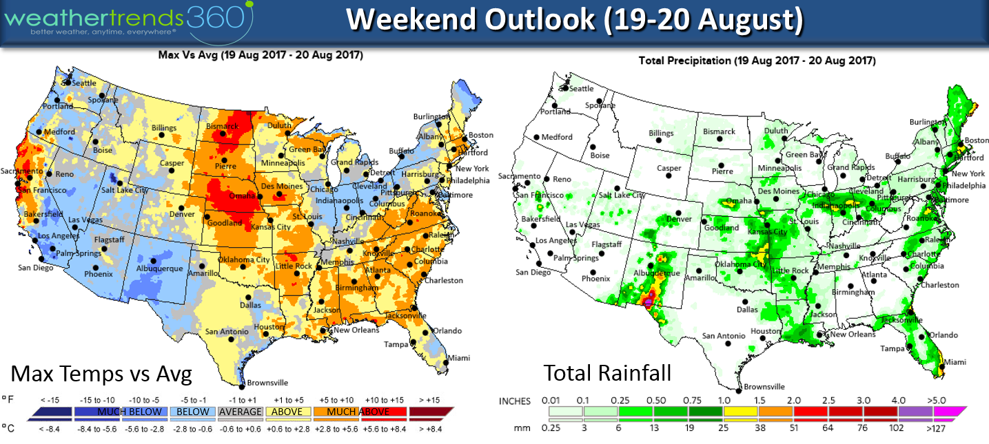
The weekend is Hot in the central U.S. and Southeast but cooler in much of the West and Ohio Valley. Scattered Summer-time thunderstorms in the Central and Eastern U.S. but nothing too severe.
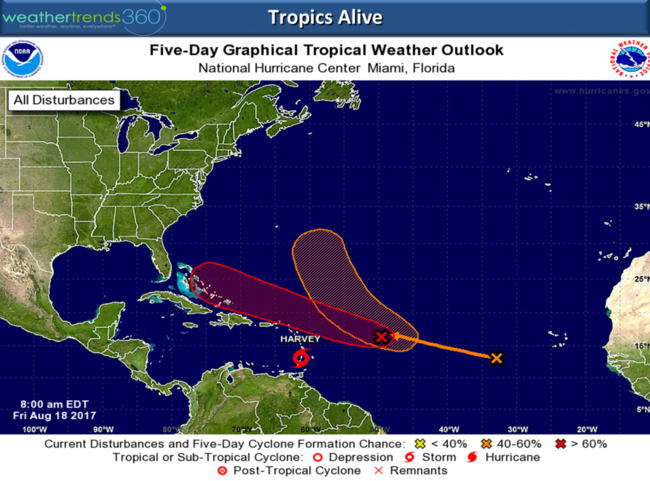
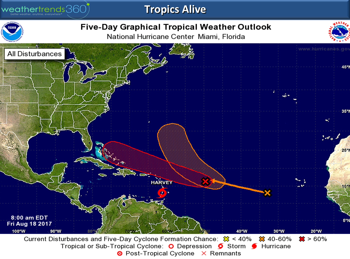
The Tropics are alive with T.S. Harvey headed toward Mexico again. There are two other systems that could develop this weekend but any impact to U.S. will be ify at best late next week. Cold fronts and some shear for now could spare the U.S. but worth watching next week if you live in the Southeast.
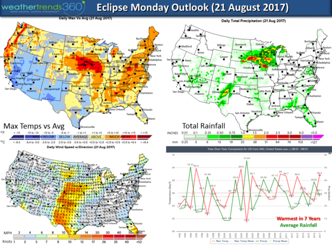
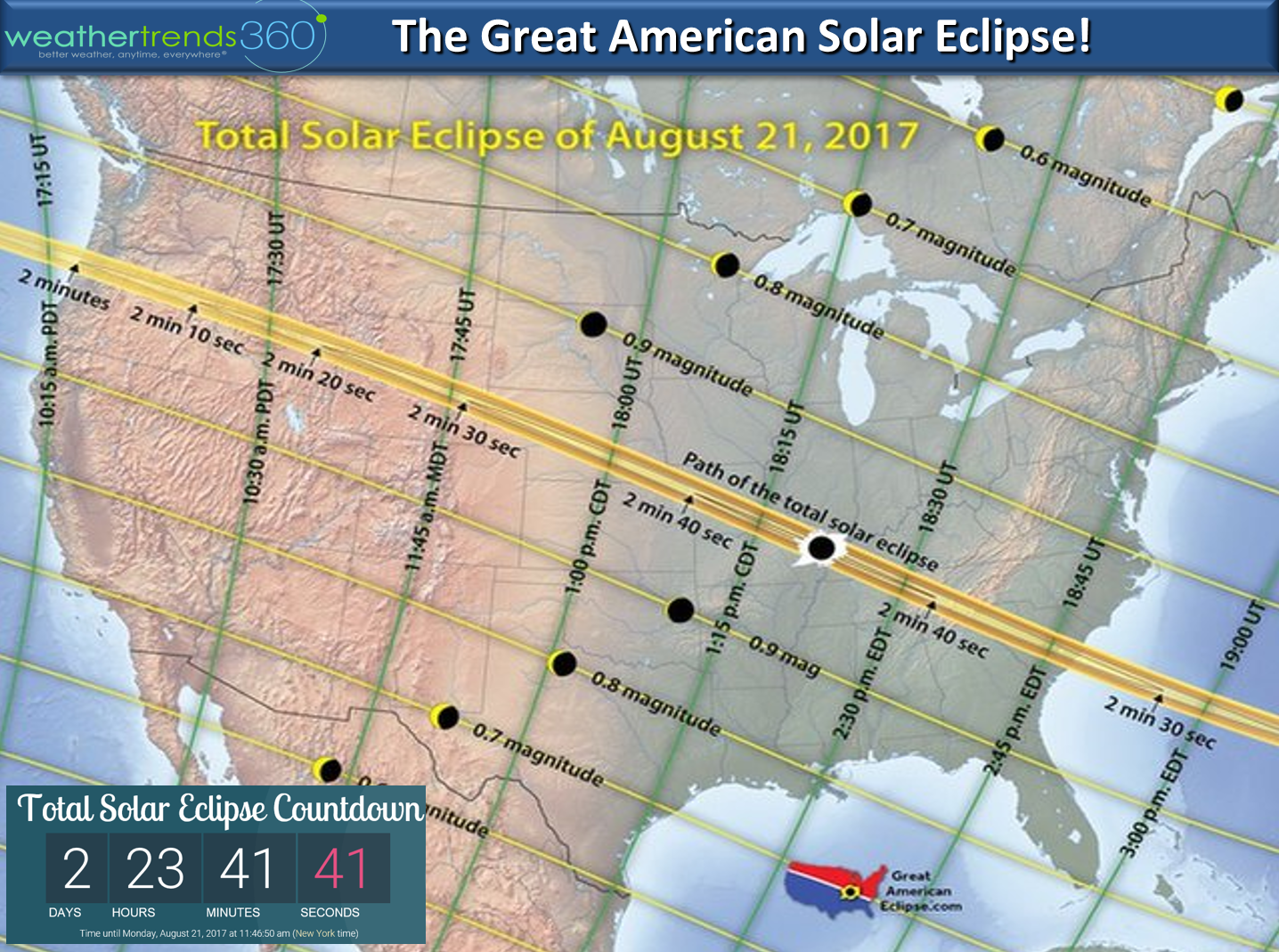
The Eclipse is less than 3-days away. A storm in the center of the country brings the risk for some clouds with scattered thunderstorms in the path of totality. The Pacific Northwest and Northeast look to have ideal conditions while the Central U.S. and Southeast have the most risk for more cloud cover. A strong southerly wind will dominate the Central U.S. Plains on Monday while much of the rest of the U.S. has calm winds. In low humidity areas along the path of totality the temps could drop some 10-18 degrees, while more humid areas maybe drop 10 degrees. Noticeable either way.
Have a great weekend folks! Follow us on Facebook and Twitter for weekend updates
- Capt Kirk out.
A quick update on the weekend weather and the all important outlook for the eclipse Monday afternoon. Click on images for larger view.
The weekend is Hot in the central U.S. and Southeast but cooler in much of the West and Ohio Valley. Scattered Summer-time thunderstorms in the Central and Eastern U.S. but nothing too severe.
The Tropics are alive with T.S. Harvey headed toward Mexico again. There are two other systems that could develop this weekend but any impact to U.S. will be ify at best late next week. Cold fronts and some shear for now could spare the U.S. but worth watching next week if you live in the Southeast.
The Eclipse is less than 3-days away. A storm in the center of the country brings the risk for some clouds with scattered thunderstorms in the path of totality. The Pacific Northwest and Northeast look to have ideal conditions while the Central U.S. and Southeast have the most risk for more cloud cover. A strong southerly wind will dominate the Central U.S. Plains on Monday while much of the rest of the U.S. has calm winds. In low humidity areas along the path of totality the temps could drop some 10-18 degrees, while more humid areas maybe drop 10 degrees. Noticeable either way.

Have a great weekend folks! Follow us on Facebook and Twitter for weekend updates
- Capt Kirk out.