Star Date 2 April 2018 Monday
Happy Monday! :)
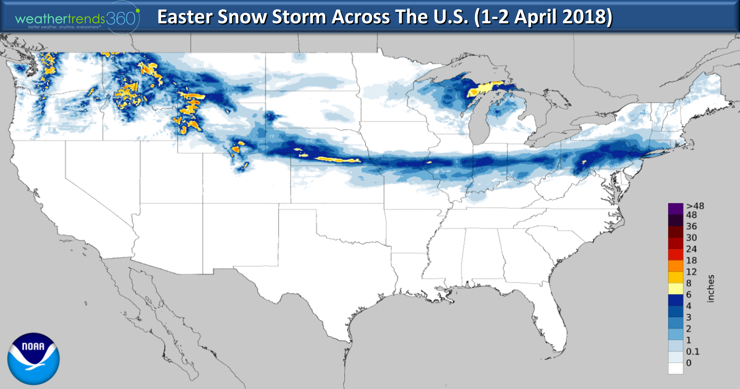
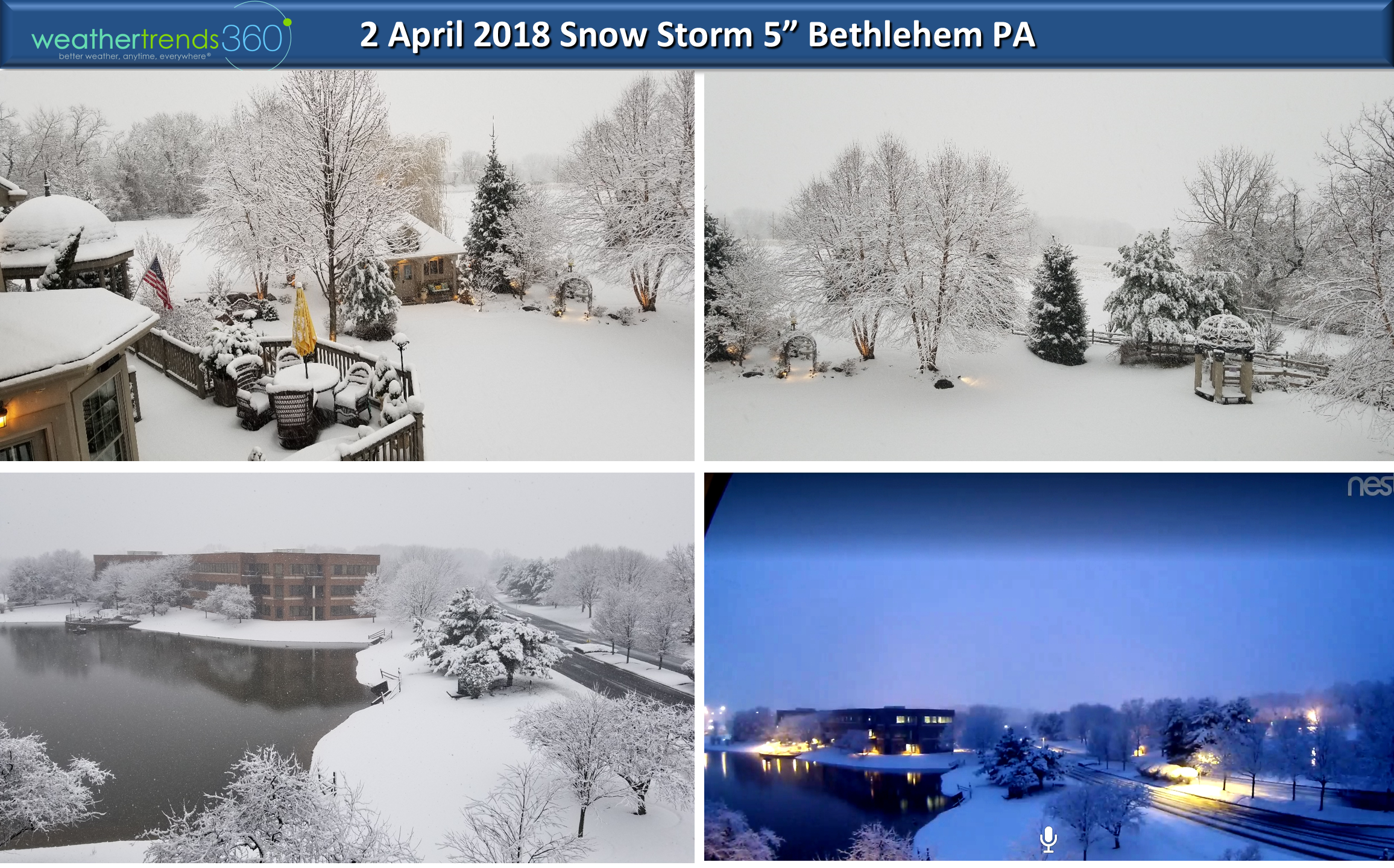
It's not so happy if you don't like near record breaking April snowfall! Over the past 48 hours a swath of heavy snow stretched from the Rockies through the HeartLand into the Northeast. Outside wt360 headquarters we've had 5" of snow today which is the most in at least 32 years! CLICK ON IMAGES FOR LARGER VIEW.
Outside wt360 headquarters in Bethlehem, PA it's quite the Winter Wonderland this morning. 5" of snow is the most April snow we've seen in decades.
Angelina was not at all happy about the snow and was doing her best to THINK SPRING...didn't work. :(

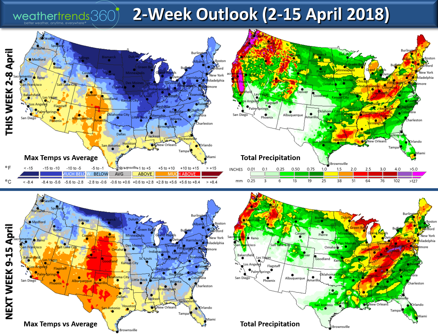
The 2-week outlook won't make you very happy either if you're expecting another hot April like last year. This year is making a wholesale change toward much colder, wetter and snowier weather with the first 15 days trending the coldest in 9 years, wettest in 27+ years and snowiest in 5 years for the U.S. overall. Last year Easter temps surged into the upper 80s and low 90s, not this year.
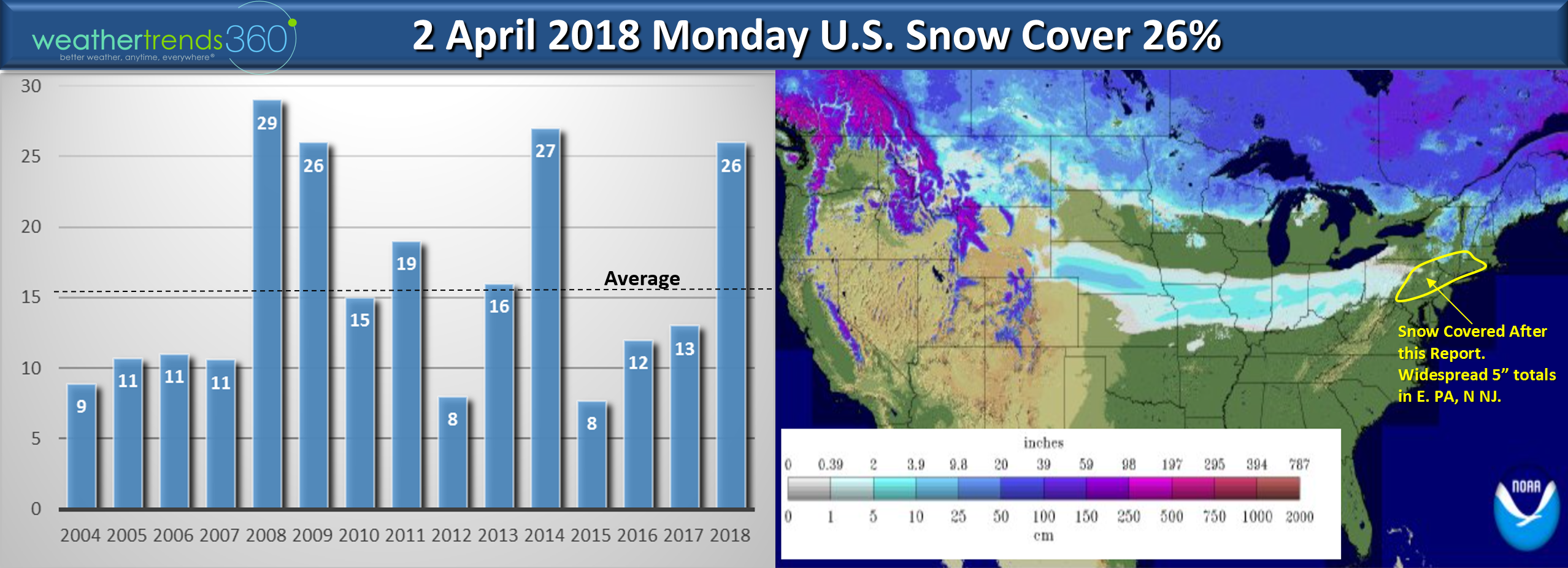
Snow cover this morning was higher than the 26% of the U.S. as most of PA, NJ and southern New England had snow on the ground making this the snowiest 2 April since at least 2008.
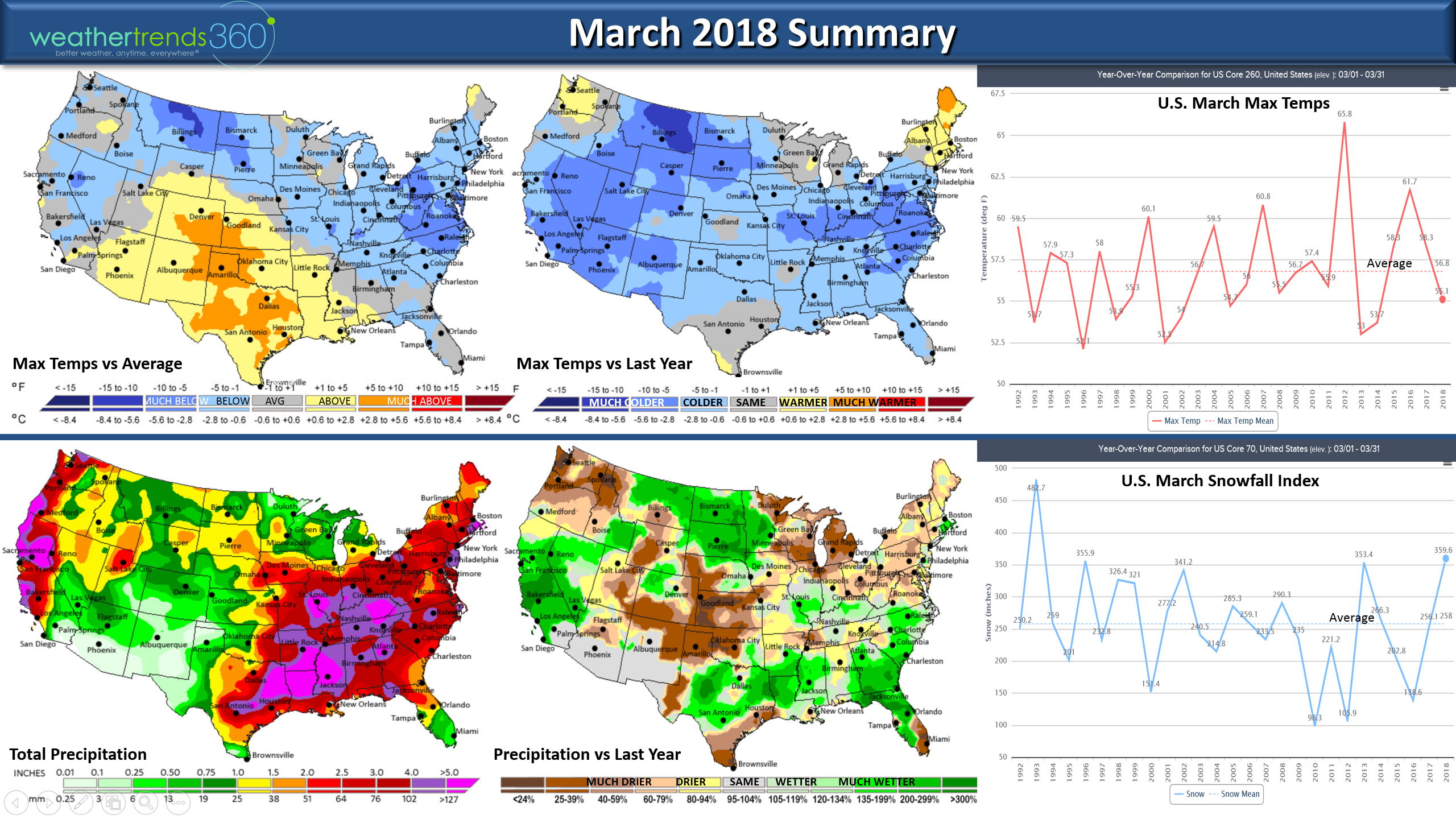
March overall ended up the coldest in 4 years (below average national temperatures), snowiest in 25+ years but driest in 3 years for the U.S. overall. The predominantly cold pattern kept tornadoes to a minimum with only 41 reported for the month, down from 191 last year and well below the average of 96.
We hope you have a great week and don't forget to follow us on Facebook and Twitter for daily updates. - Captain Kirk out.