Star Date 21 January 2019 Monday
Captain's Log
Happy Monday...especially happy if you're off for the Martin Luther King Jr Holiday! :)
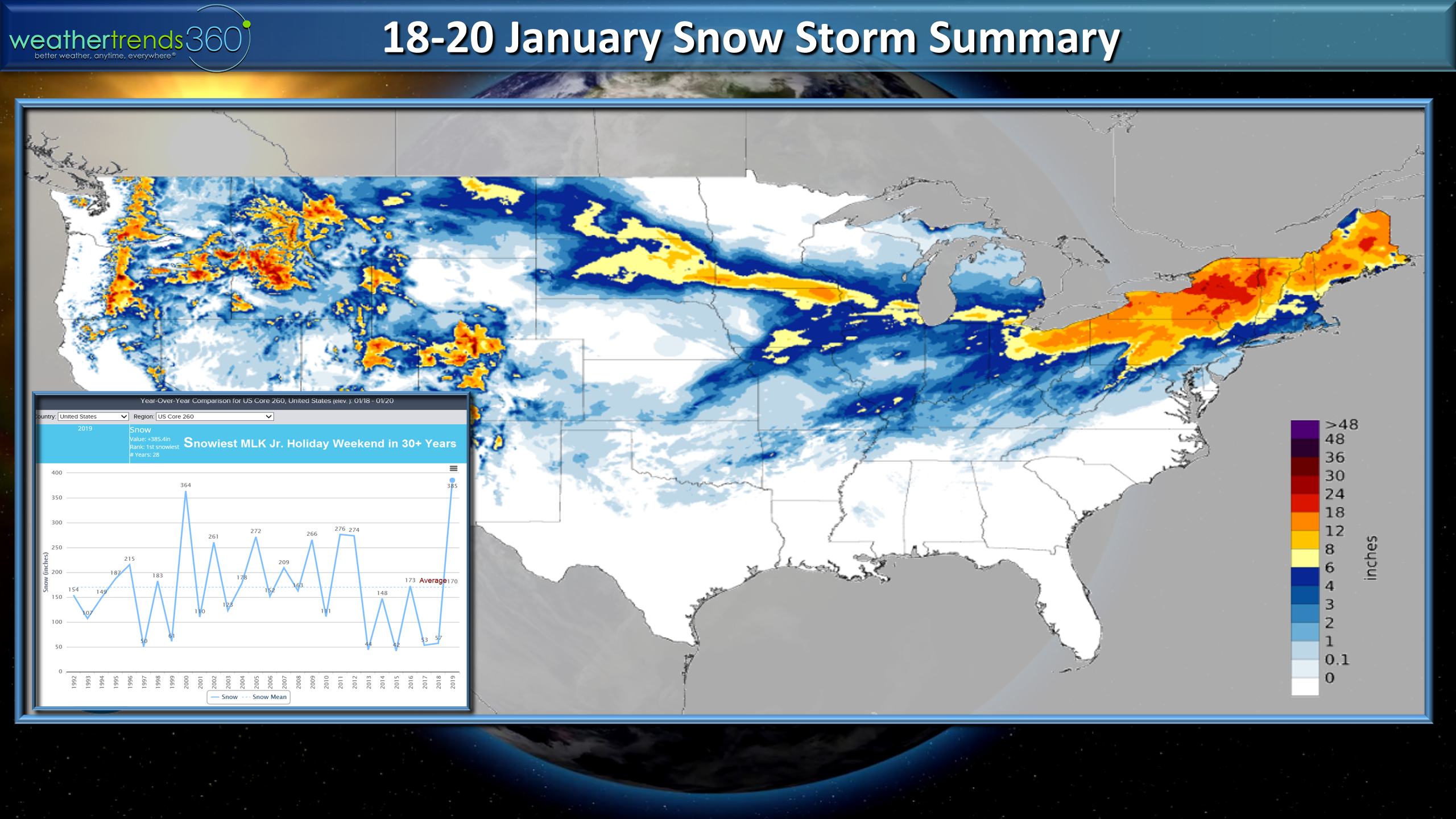
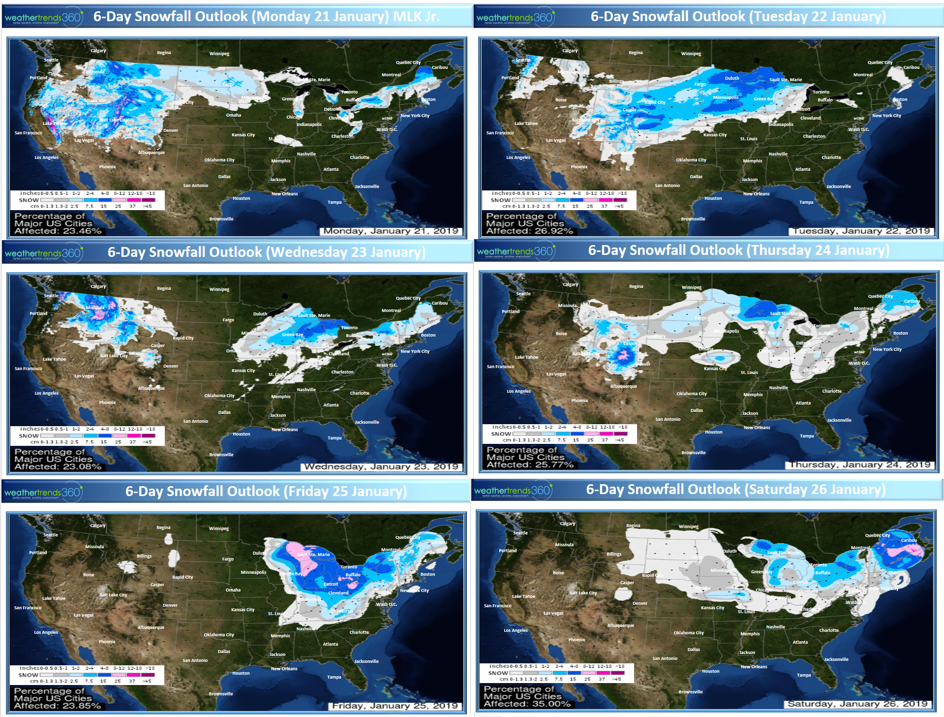
The MLK Jr. holiday weekend snow storm that traversed the U.S. this weekend was a prolific snow producer with total snowfall the most in over 30 years for any MLK Jr. weekend in the past 30 years. CLICK ON IMAGES FOR LARGER VIEW
 Snow cover this morning shows over 50% of the U.S. has some snow on the ground which is the most in 3 years, last year only 36% coverage for the date. Average is about 40% for the MLK Jr. holiday.
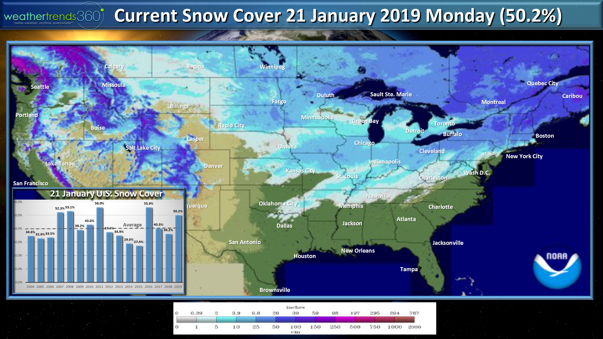
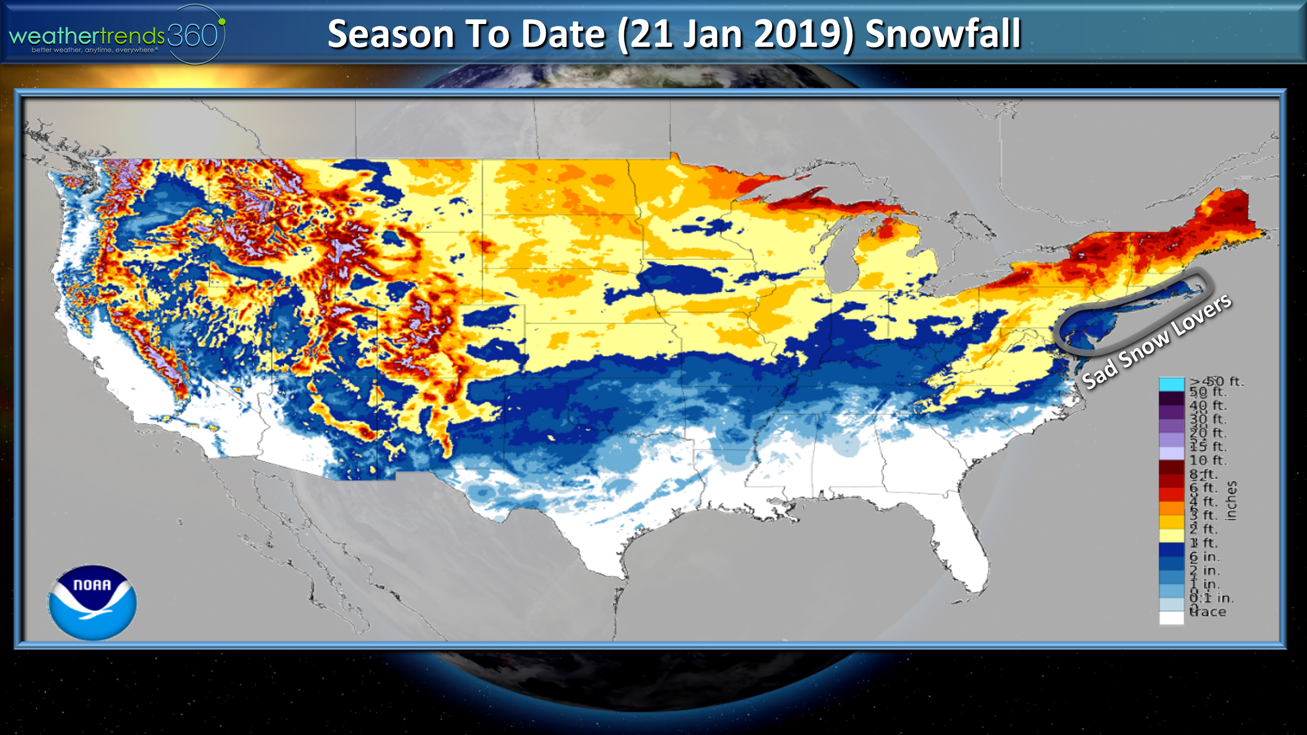
Snowfall season to date still shows some areas missing the heavier snow, especially from Philadelphia to Boston and points toward the coast.
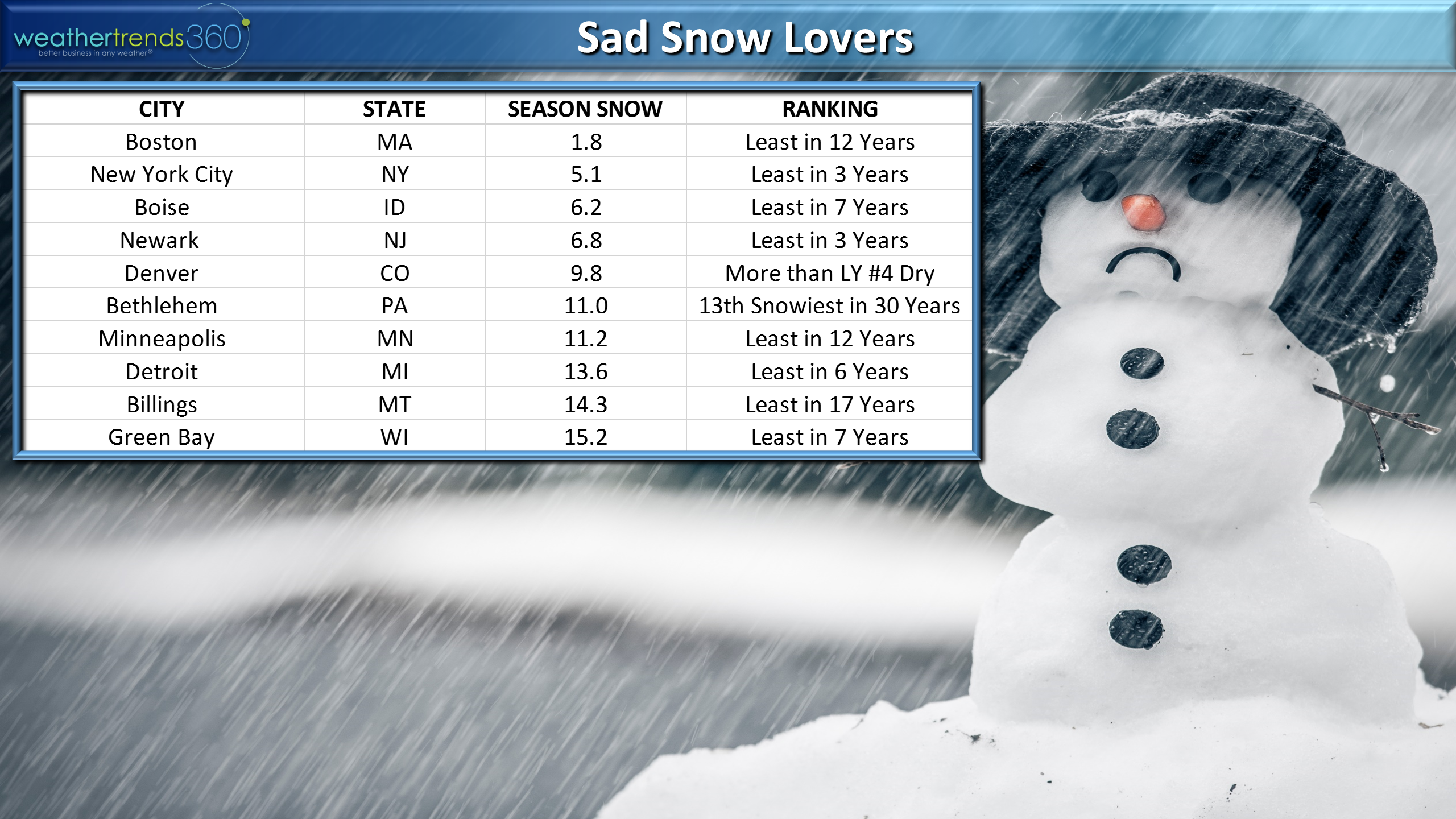
Looking at the specifics Boston takes the top spot for lack of snow so far this season with only 1.8" to date. This is the least in 12 years and 3rd least in 124 years. New York City isn't too far behind Boston for the least snow with only 5.1", the least in 3 years.
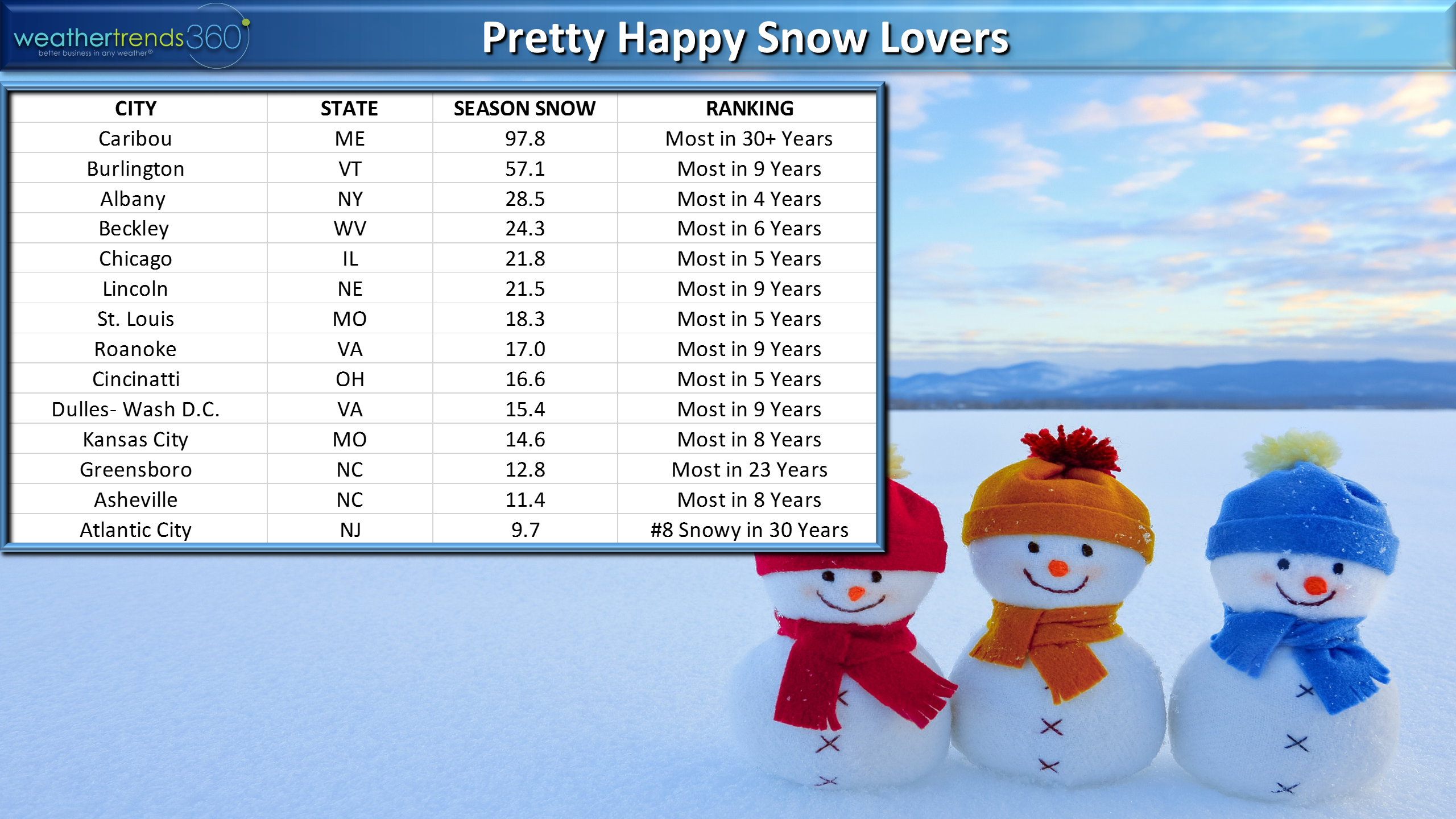
The bigger snow winners are ironically in the East where some have missed out. Caribou Maine takes the top spot with a whopping 97.8", the most in over 30 years. Some of the fringe areas in the Middle Atlantic around the D.C. area are doing well - most in 9 years. The Heartland in Missouri is doing well with the most snow in 5 to 8 years up into the Chicago area - most in 5 years.
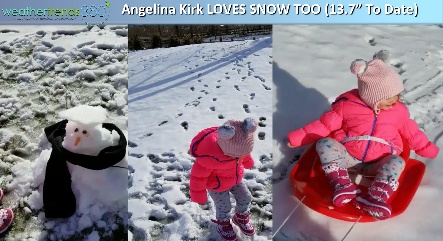
Outside wt360's office we've had 13.7" which is about average but 9" of that came way back in middle November with the big Nor'easter event. Still enough snow this weekend for the little Captain Kirk to enjoy a SMALL snowman and some sledding.
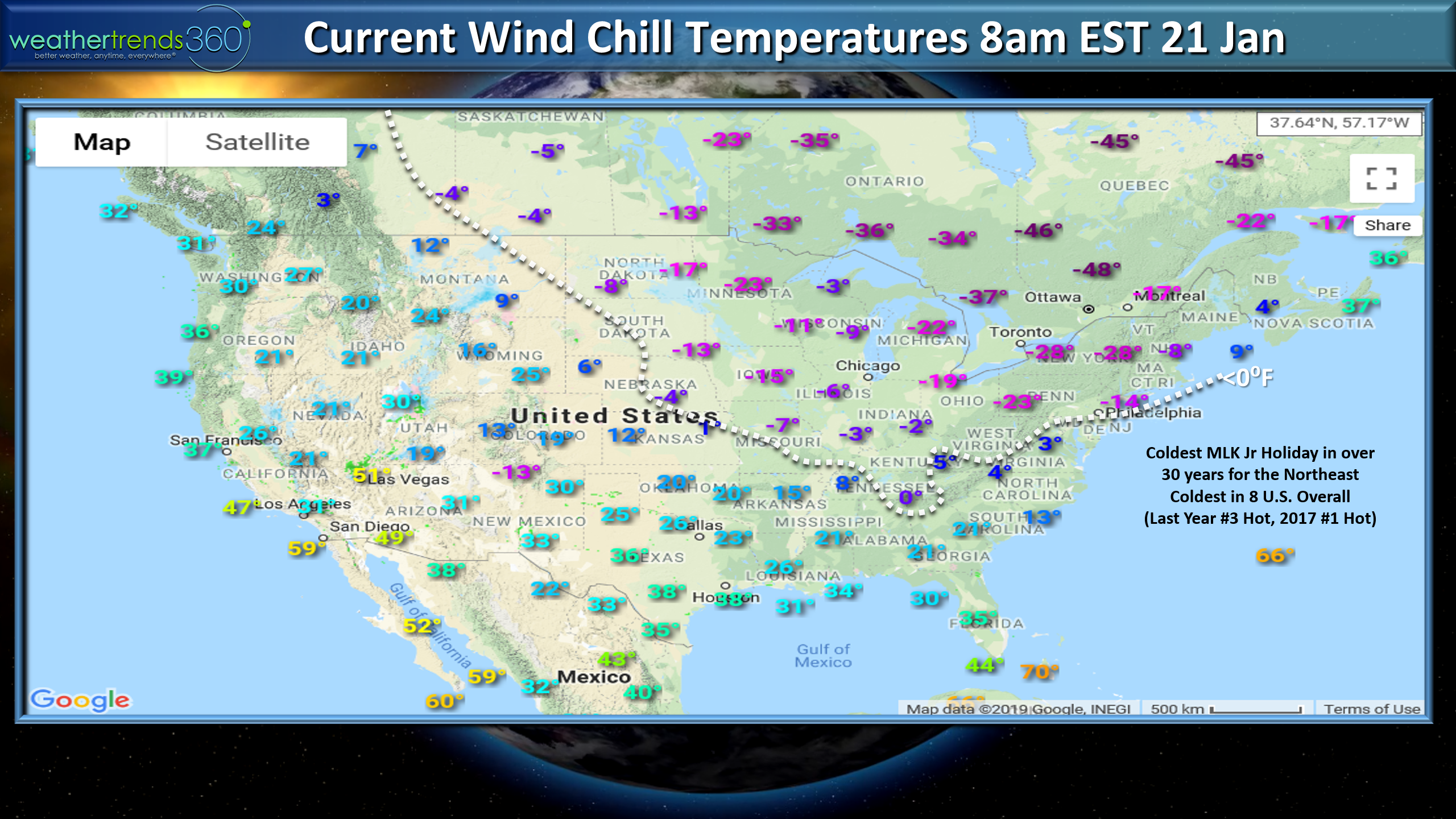
Enough on snow...it's the coldest MLK Jr. holiday in over 30 years in the Northeast with brutal -15 to -40F wind chill temperatures. For the U.S. overall the holiday is the coldest in 8 years, a wholesale change from the past two years that were near record warm.
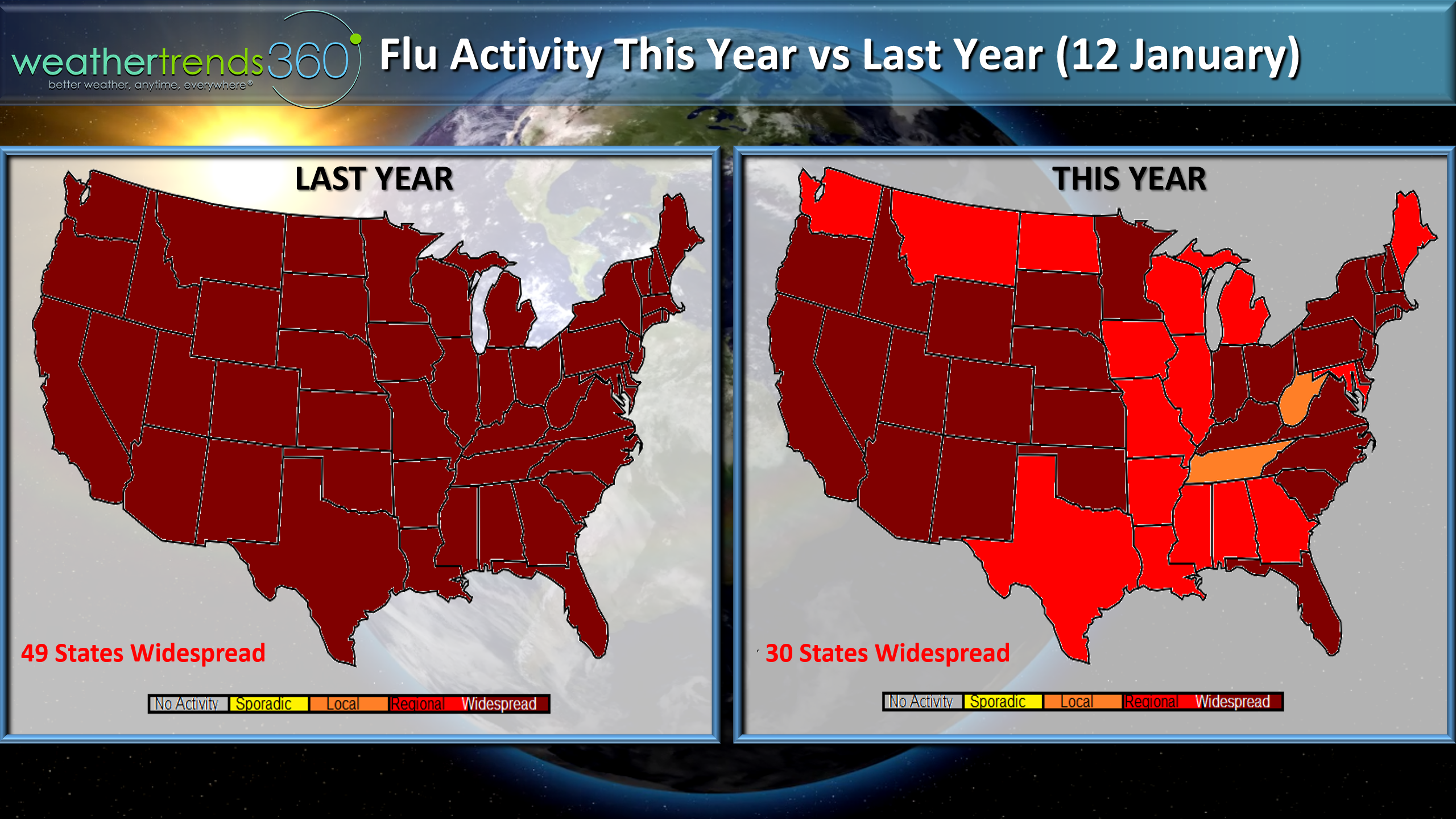
The Flu season showed some signs of improvement so we may be peaking for the season, well below last year's epic nationwide outbreak.
OK OK snow lovers...more on snow. Here's the 6-day outlook and fingers crossed the Euro is right on another coastal storm threat for the snow deprived coastal Northeast this time next week. Still very uncertain, but there's a chance.
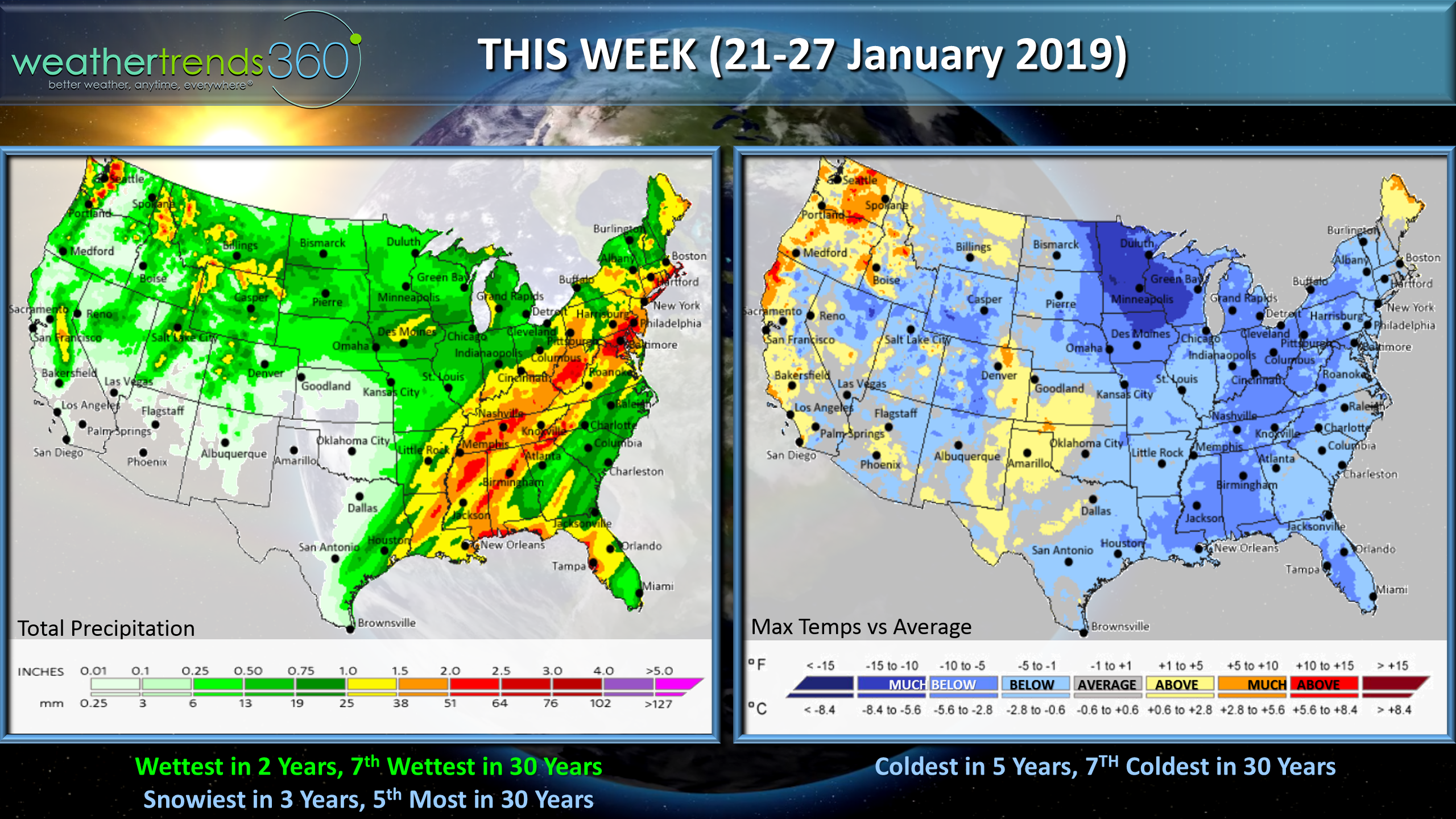
This week (21-27 January) the U.S. overall trends the coldest in 5 years, 7th coldest in 30 years, wettest in 2 years, 7th wettest in 30 years and snowiest in 3 years, 5th most in 30 years.
Next week (28 Jan - 3 Feb) the U.S. is likely to again trend the coldest in 5 years, 9th coldest in 30 years, wettest in 30 years, snowiest in 4 years and 8th snowiest in 30 years. Some conflicting cycles with an MJO cycle phase that may allow some milder Pacific air to invade the U.S. but there is still major blocking in the Arctic so the cold air will still make appearances with bigger storm threats. Cycles should go back into a brutal cold/snowy phase in February which is likely to be a pretty epic month for cold/snow so Winter is by no means over.
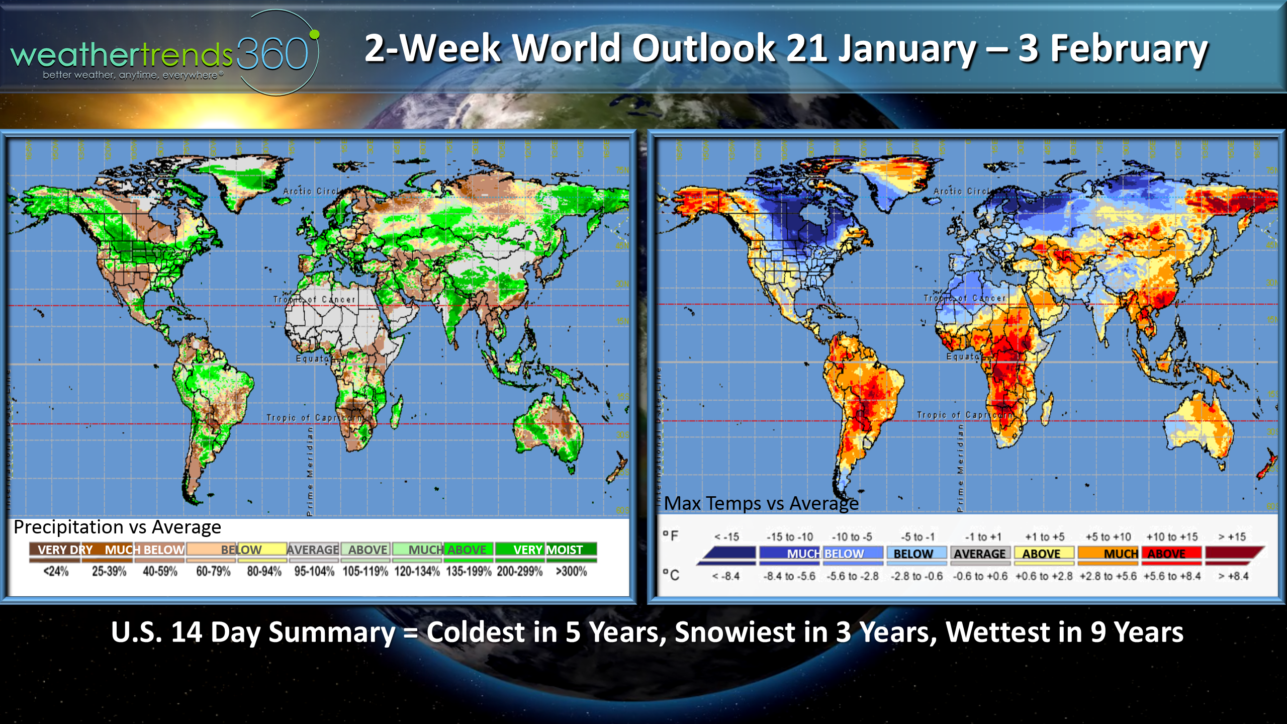
For the 2-week aggregate (21 Jan - 3 Feb) the U.S., Canada, Europe, NW Africa and Western Russia are the cold spots.
We hope you have a great week and don't forget to follow us on social media for daily updates.Facebook,Twitter,YouTube,PinterestandLinkedin
- Captain Kirk out