Star Date 22 October 2018 Monday
Captain's Log
Happy Monday folks! :)
We covered a lot in today's video with an explanation as to why we think NOAA will be wrong on their warm winter outlook - we completely disagree!
In the near-termTHIS WEEK (22-28 OCT) is the coldest in 13 years for the Eastern U.S. and 4th coldest of the past 30 years. The Pacific Northwest remains the warm spot. CLICK ON IMAGES FOR LARGER VIEW.
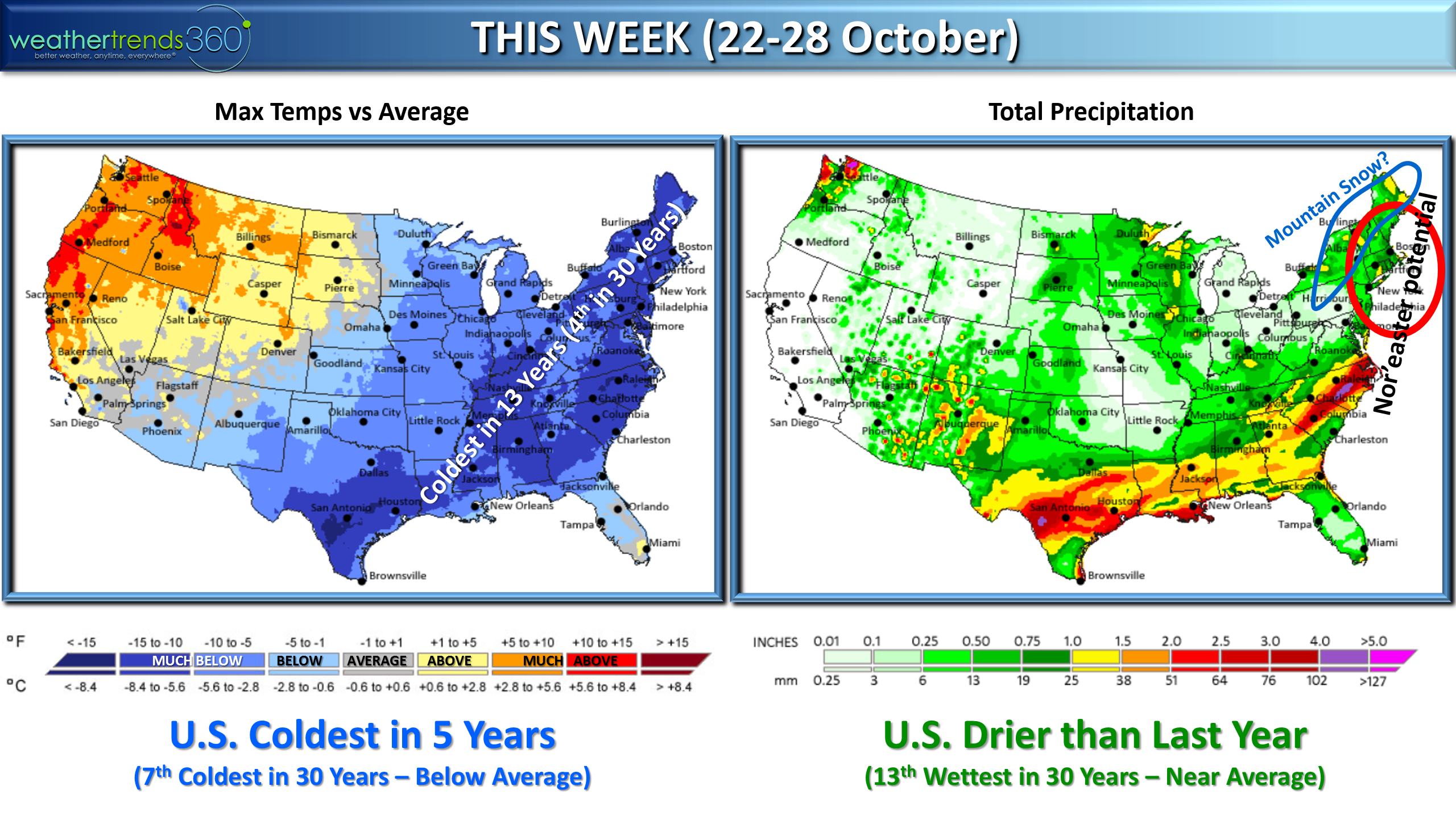
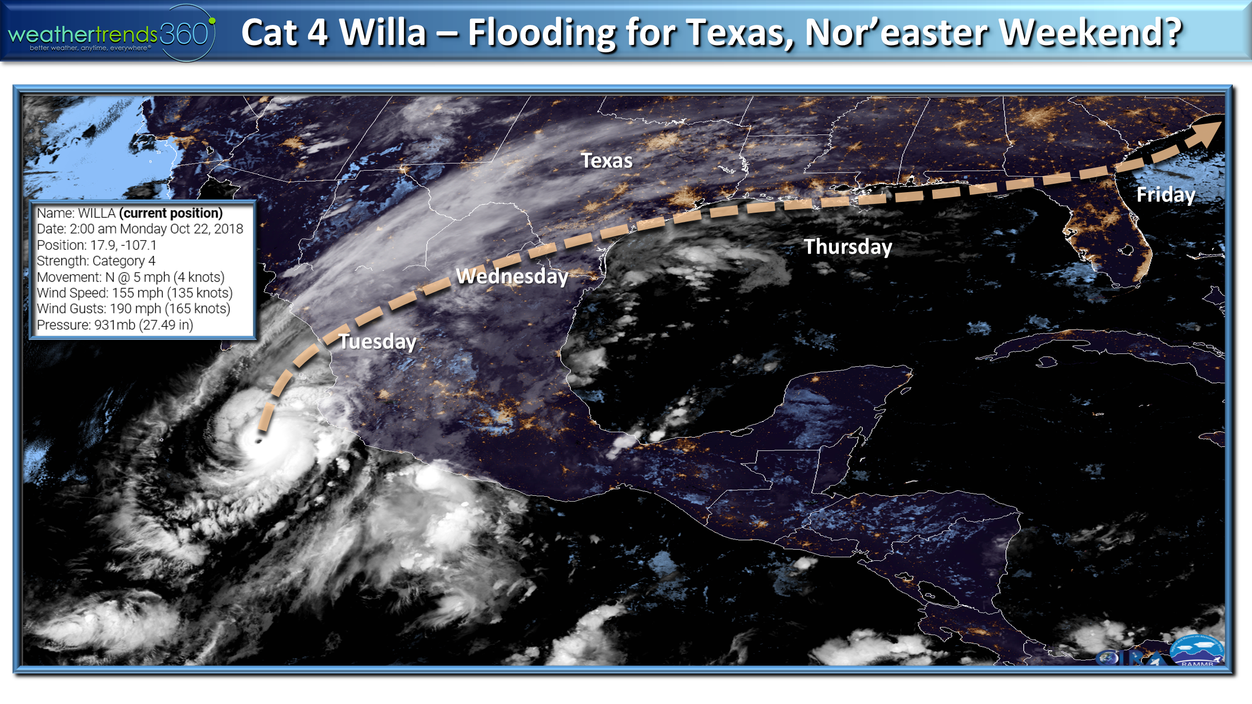
The remnants of cat 4 Hurricane Willa will bring heavier rain across Texas midweek with the potential some of this energy/moisture results in a Nor'easter by the weekend. For the U.S. overall the week is the coldest in 5 years, 7th coldest in 30 years and slightly drier than last year ranking 13th wettest of the past 30 years.
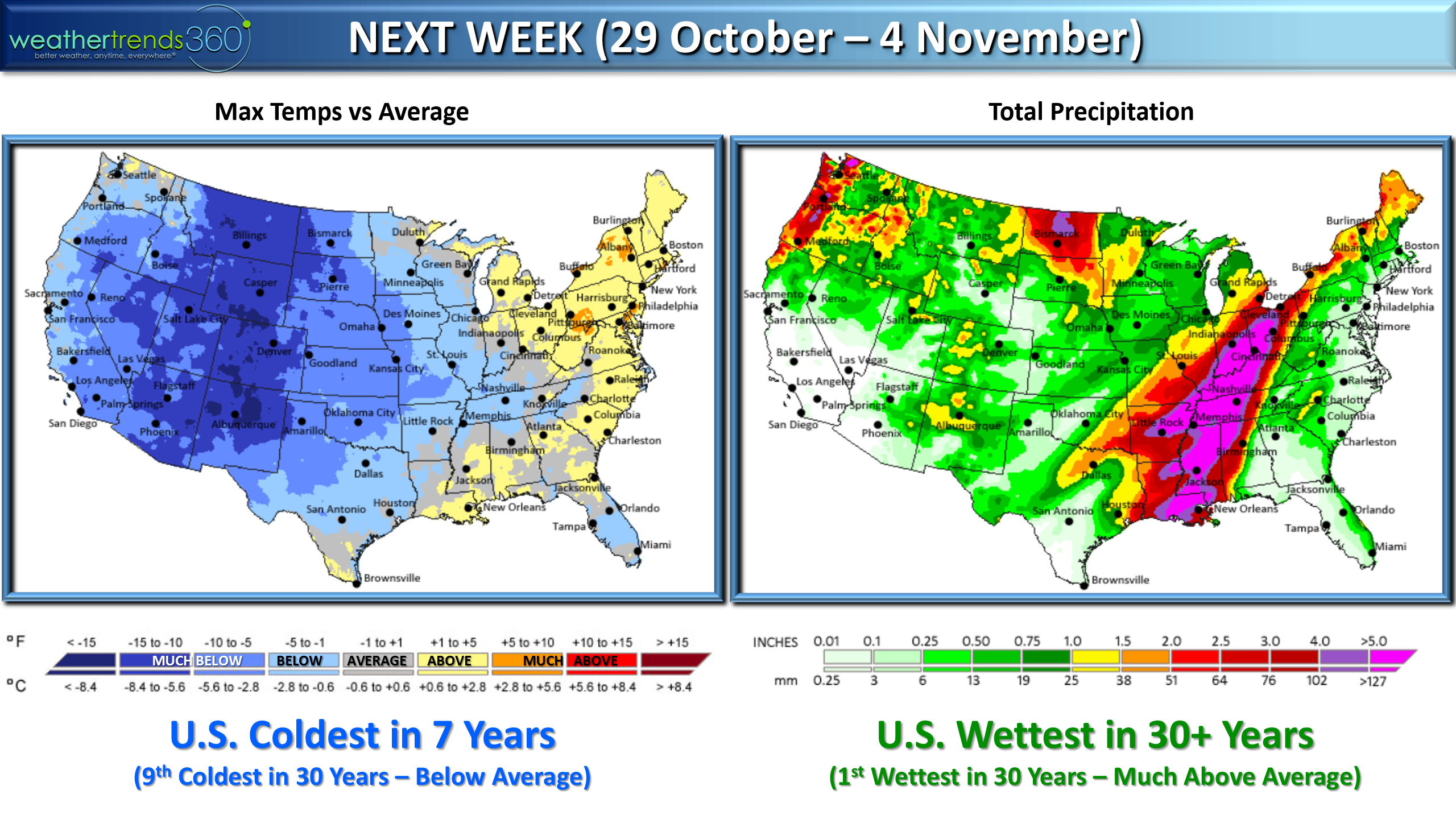
NEXT WEEK (29 OCT - 4 NOV) a very strong surge of cold weather invades the Western 2/3rds of the country with a warm up finally returning to the East. This strong cold front will sweep off the East Coast by 5 November ushering a return to much colder weather in the East. For the U.S. overall the week looks to trend coldest in 7 years and #1 wettest.
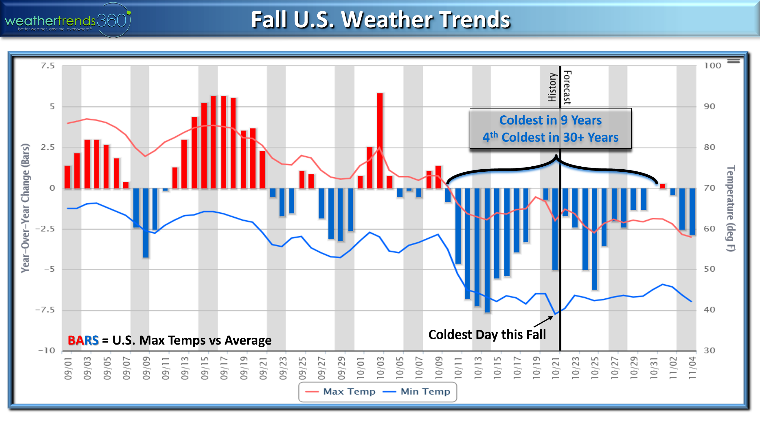
Since meteorological Fall started 1 September the pattern has made a big flip flop going from a warm September to a very cold October. Since 10 October the U.S. overall has been the coldest in 9 years and 4th coldest of the past 30 years.
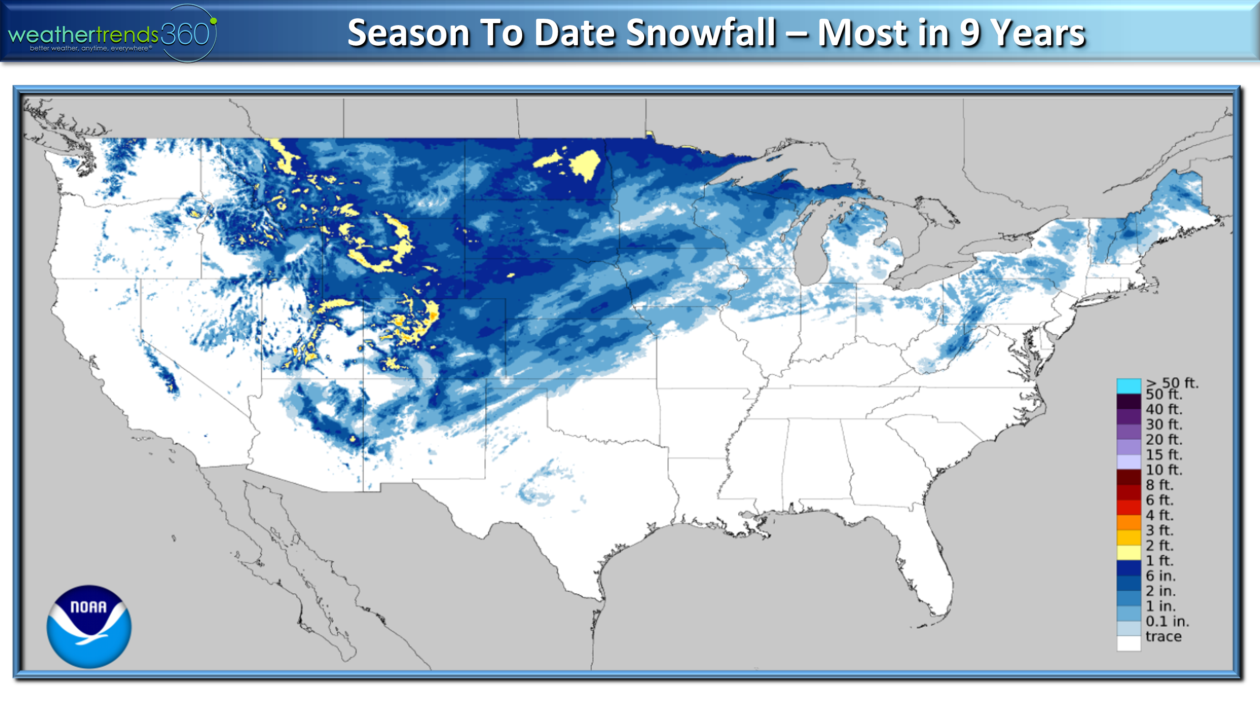
Seasonal snowfall to date is the most in 9 years for the U.S. overall with many areas from the Rockies to New England already having their first snows of the season.
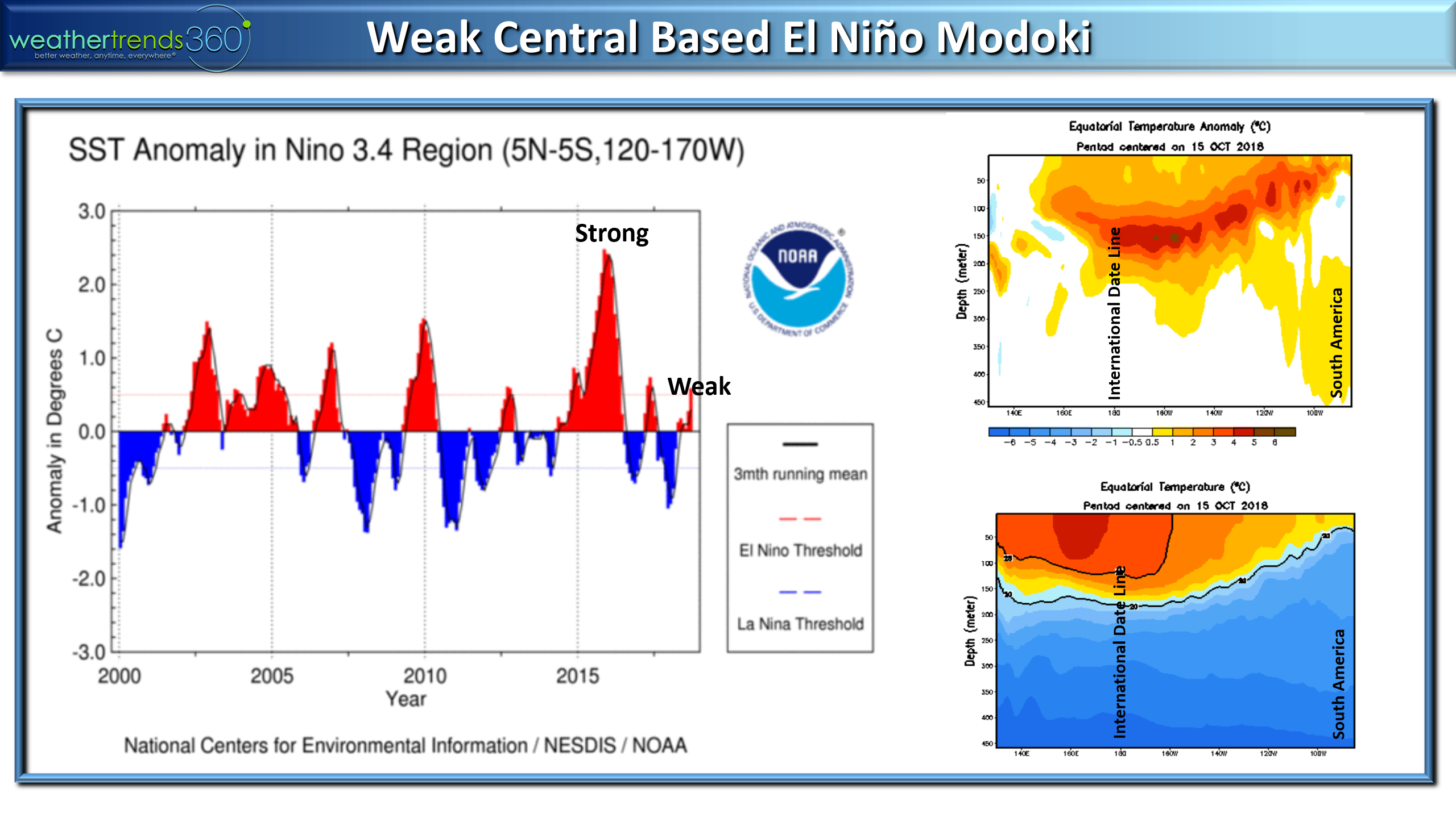
So why do we strongly disagree with the warm Winter outlook from NOAA? Many reason and many cycles. The one cycle most key in on is El Niño and this is a weak central Modoki based event, very different than a full-fledged strong El Niño like that a few years ago.
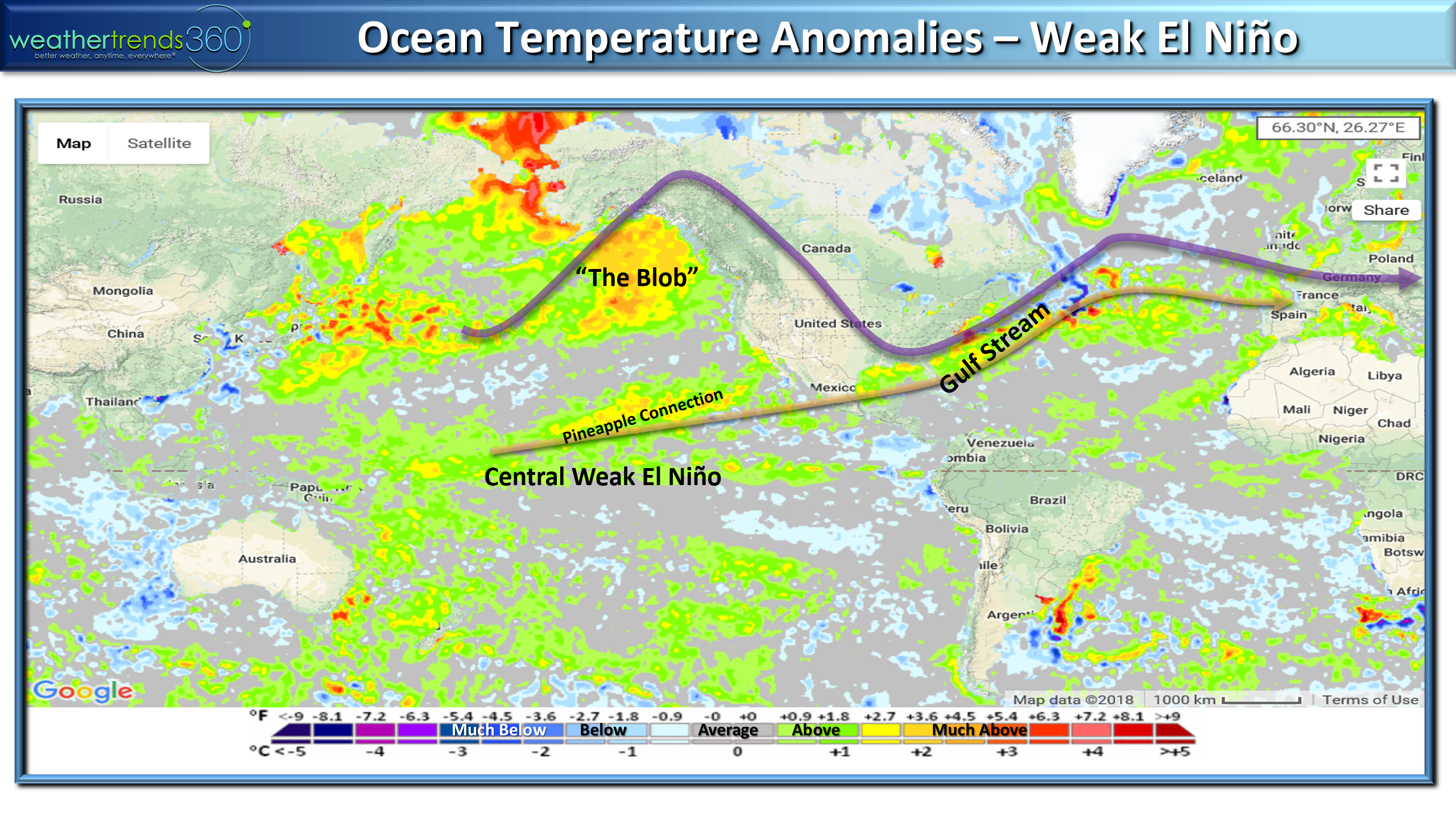
The other factor is "The Blob" of really warm water off Alaska and British Colombia. This typically allows for a big high pressure to build in this region causing the jet stream to go much further north into Canada (warm) but then results in a downstream buckle in the Eastern part of North America (cold).
This creates a negative AO pattern which are very conducive to cold/snowy weather for the Eastern half of the U.S. Combined with a sub-tropical Jet Stream and a very warm Gulf Stream off the U.S. East Coast, the threat for bigger Nor'easters are also likely. Combined with the solar minimum cycle - weakest in 100 to 300 years you have a lot of climate factors and statistics teamed up for an exciting Winter assuming you enjoy cold/snow.
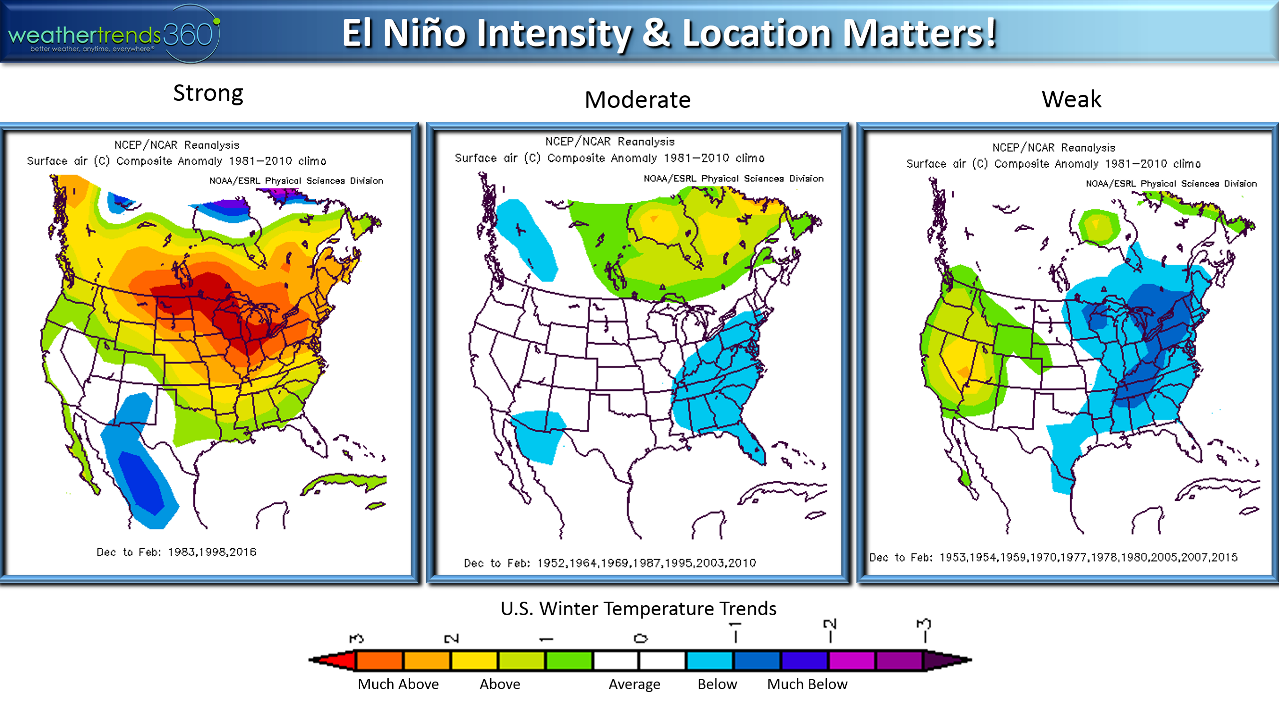
NOAA's data shows a very big difference between a strong El Niño and a weak one.
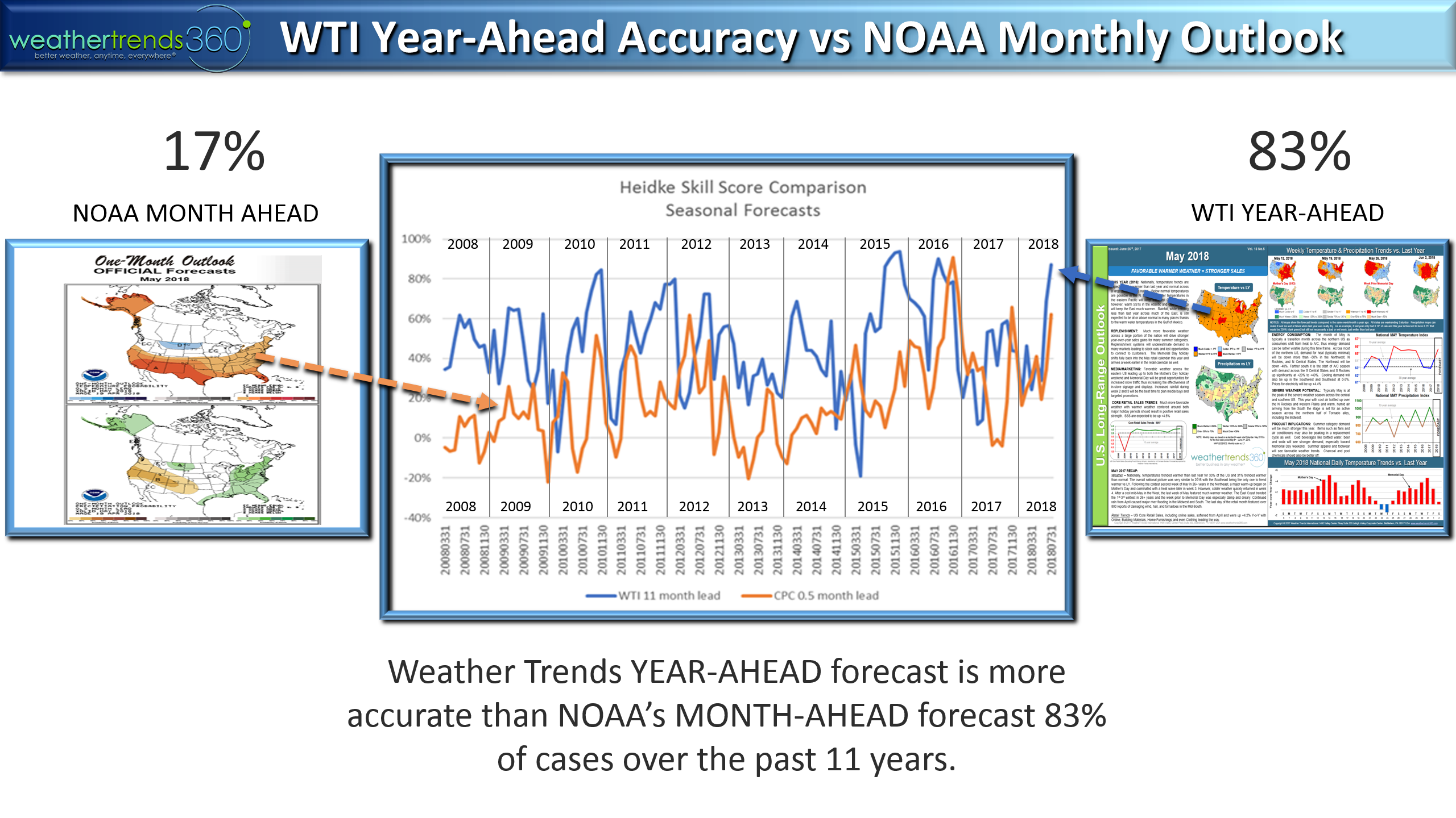
Audits from academics at the University of Miami have proven over the past 11 years that WTI's year-ahead forecast is much more accurate (83% of the time) than NOAAs month ahead outlooks, let alone their seasonal Winter outlooks.
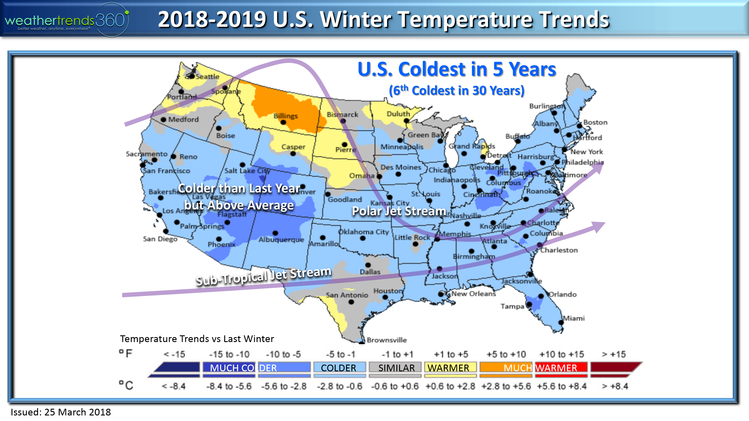
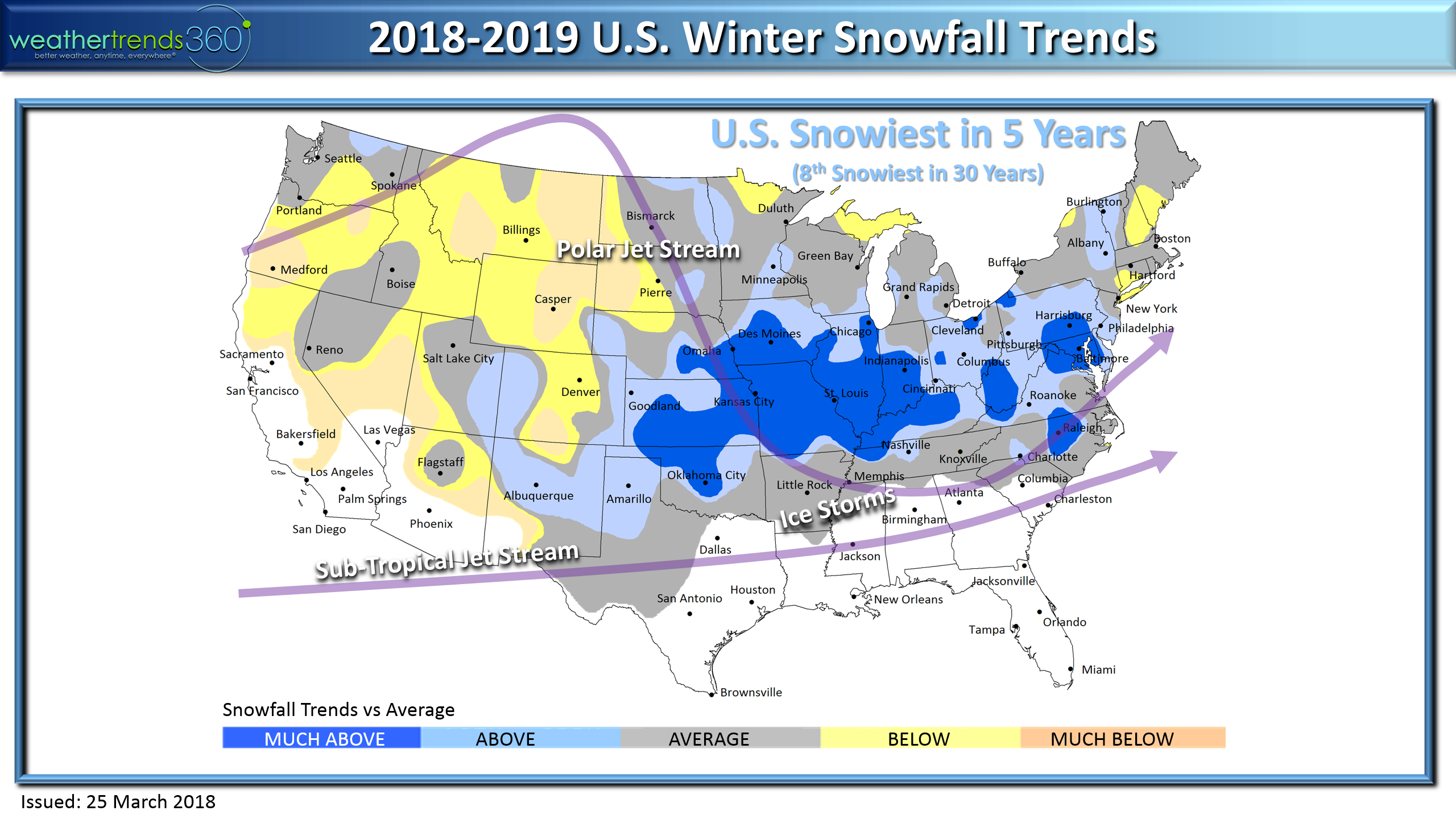
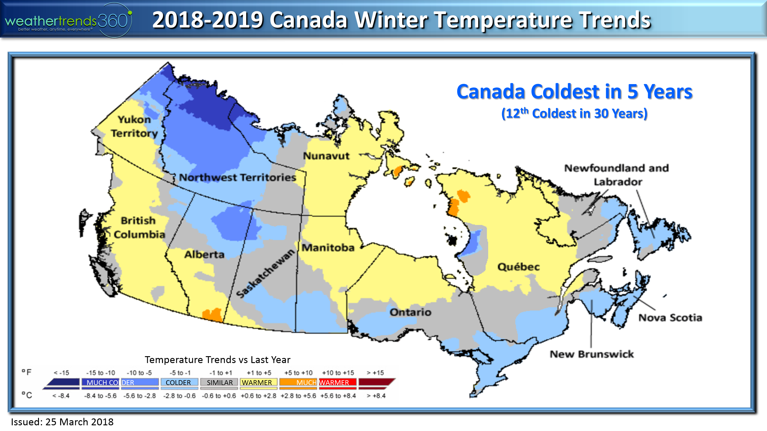
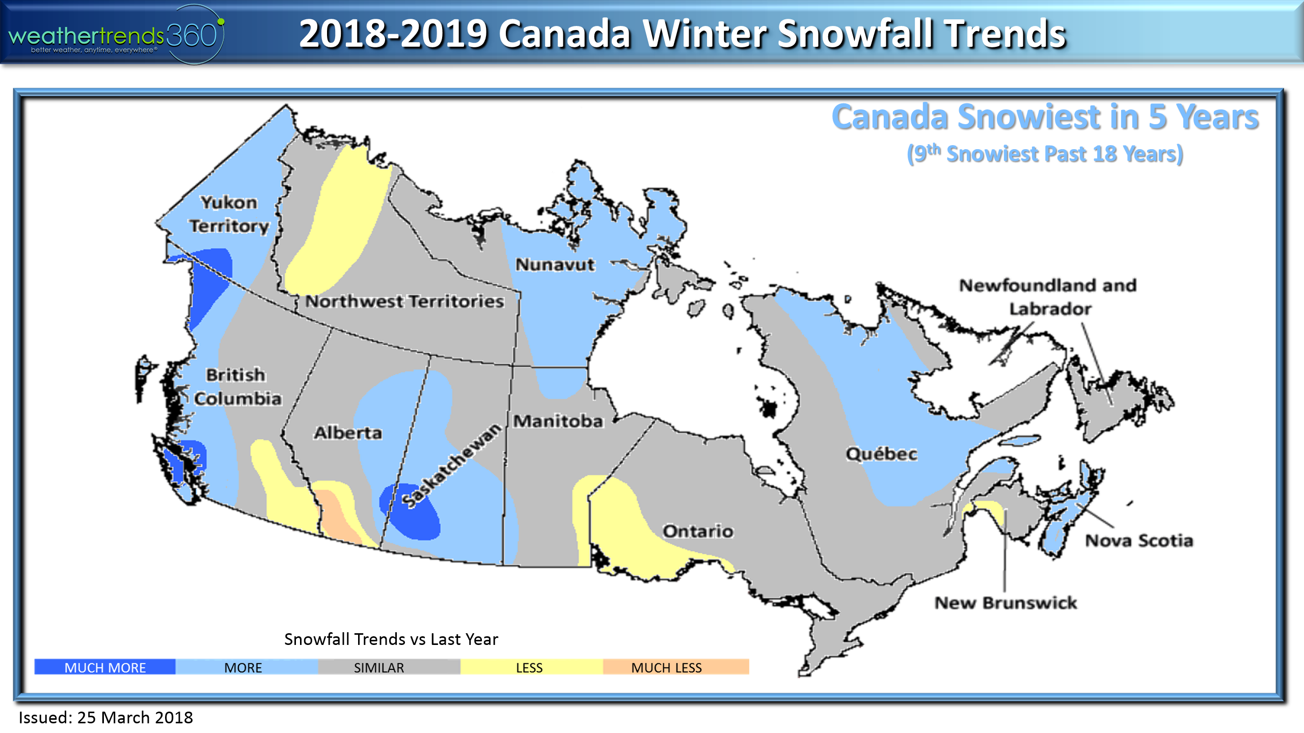
For both the U.S. and Canada we have the Winter the coldest and snowiest in 5 yearswith a potentially very cold January and especially February when we think you'll hear the Polar Vortex has shifted from Northern Canada to the Great Lakes of Southern Canada.
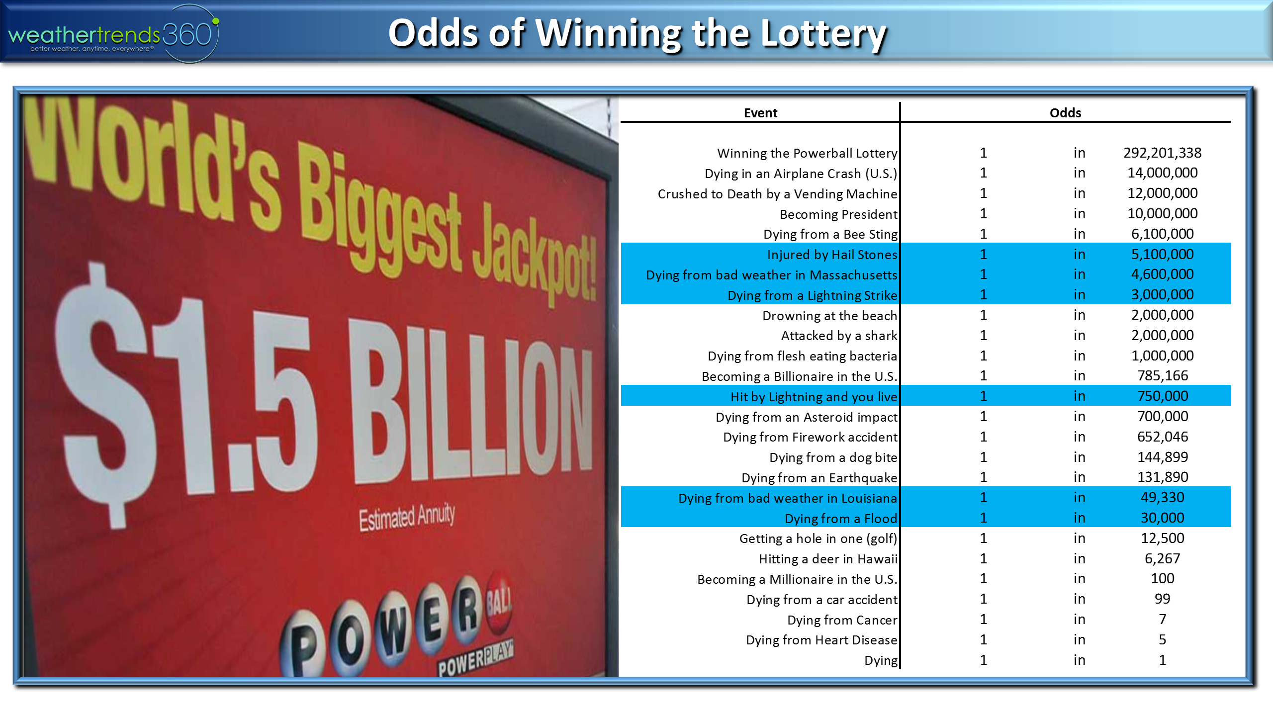
Finally, we thought we'd put your odds of winning the billion dollar lottery into perspective. You actually have a much better chance of earning a billion dollars on your own efforts (1 in 750,000) vs the 1 in 292,201,338 odds with the lottery. You have a much better chance of being injured by a hail stone (1 in 5.1 million), being hit by lightning and surviving (1 in 750,000), being killed in a flood (1 in 30,000) and of course dying (1 in 1). :) But if you win, remember your friends at wt360. ;)
Have a great week and don't forget to follow us on social media for daily updates.Facebook,Twitter,YouTube,PinterestandLinkedin
- Captain Kirk out.