Star Date 23 July 2018 Monday
Happy Monday! :)
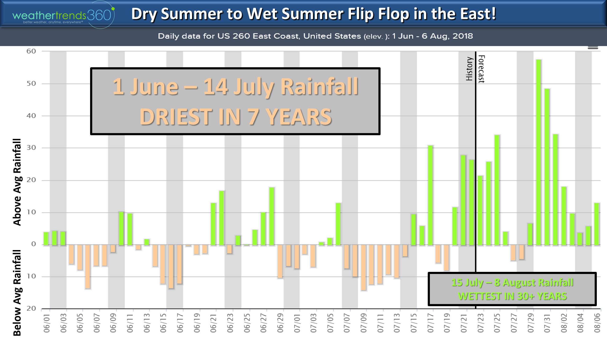
"RAIN RAIN GO AWAY..." That's the tune we'll be singing in the East with a very soggy pattern into early August. It's an amazing flip flop going from the driest front half of Summer (1 June - 14 July) in 7 years for the Eastern U.S. as a whole to now the wettest in 30+ years over the next couple weeks. CLICK ON IMAGES FOR LARGER VIEW
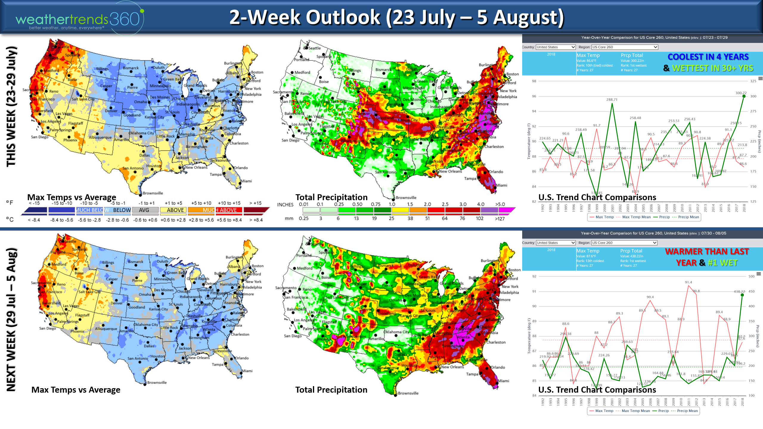
The 2-week outlook shows why it will be so wet in the Eastern U.S. as a large Bermuda High Pressure system well off the East Coast remains anchored while cold air from the Midwest clashes right along the East Coast. The clash of warm/moist air around the Western edge of the high with the cold air will create widespread heavy thunderstorms for much of the next couple weeks. The Middle Atlantic region looks to get 10-16"+, 6-10" in the PA-NJ-NYC areas and lesser 2-3" amounts in New England. The dry spots will remain in TX-OK and much of the Pacific Northwest and Central Rocky Mountains.
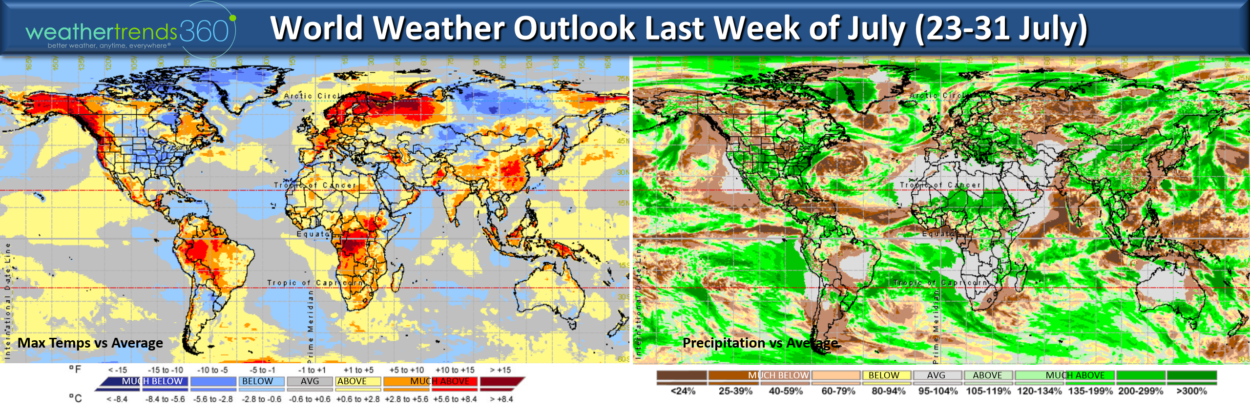
Around the world the cool spots relative to this time of year for the balance of July are in the Eastern U.S., Siberia and the Arctic regions while much of the rest of the Earth is on the warm side. Notice the dry weather in the middle of the Bermuda high off the East Coast with a conveyor belt of 3x the normal rainfall for much of the Eastern U.S.
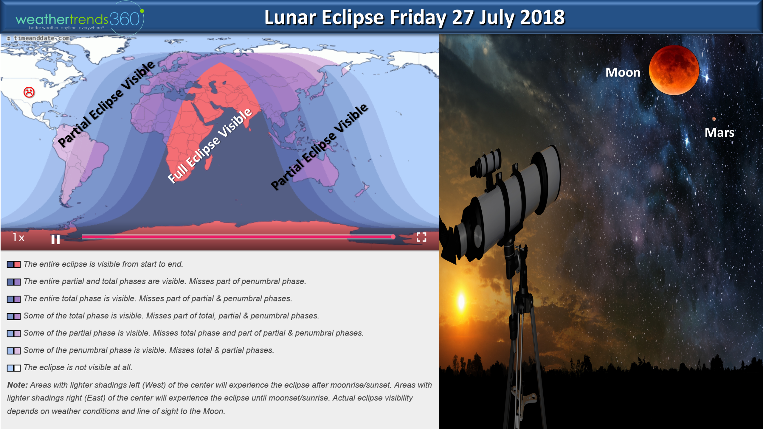
On Friday this week we'll have the longest lunar eclipse this century(1 hour 42 mins and 57 seconds) but unfortunately it won't be visible in the U.S. Peak totality will be in Africa, the Middle East and far Eastern Europe. And there's a twist with Mars very near the moon during the eclipse and Mars will be the brightest in 15 years despite the big planet wide dust storm.
We hope you have a great week ahead and don't forget to follow us on social media for daily updates.Facebook,Twitter,YouTube,PinterestandLinkedin
- Captain Kirk out.