Star Date 24 August 2017 Thursday
Captain's Log
Thursday 2pm EDT update.
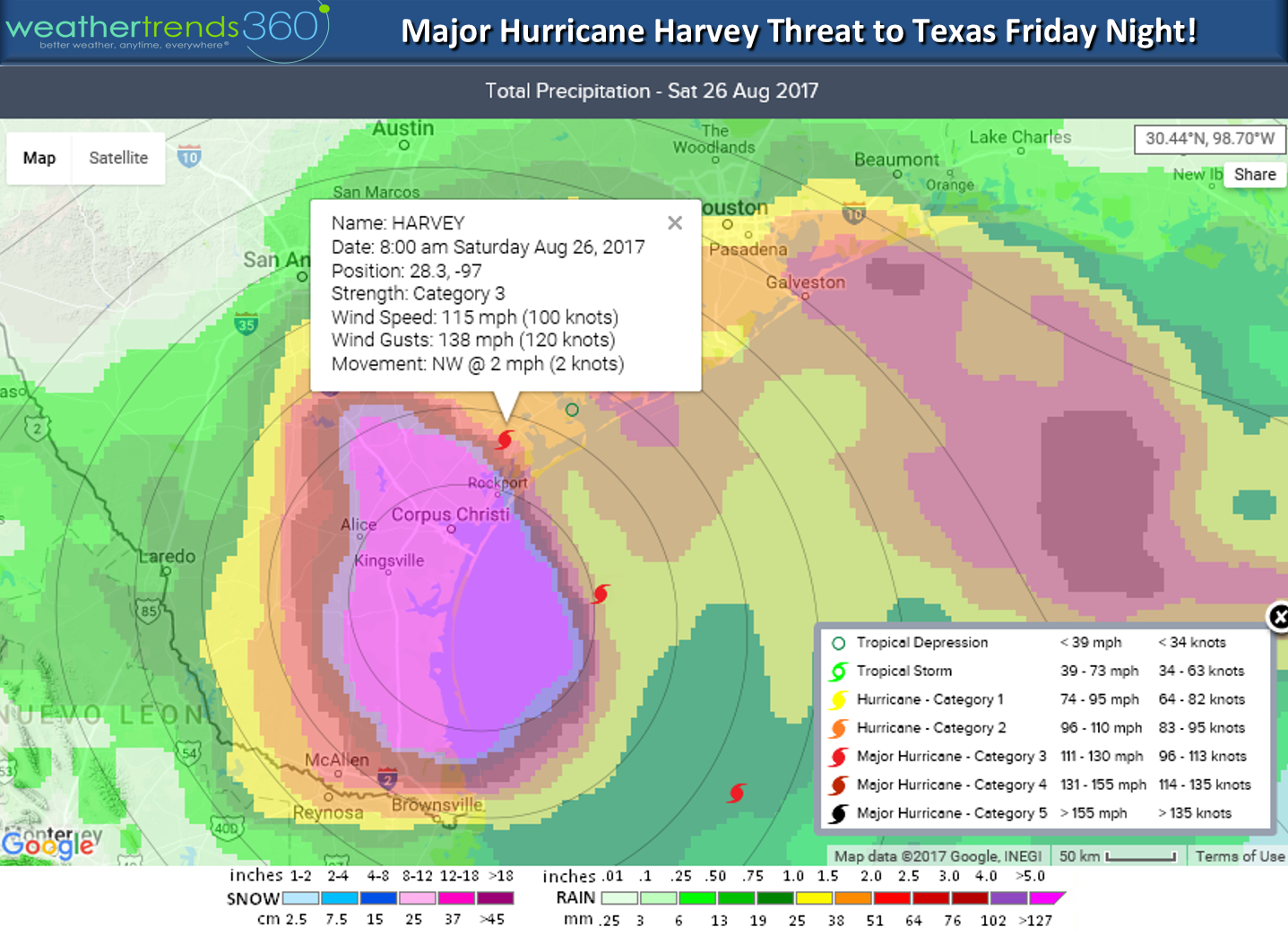
Hurricane Harvey is exploding in the SW Gulf of Mexico and it will make landfall in Texas late tomorrow night into pre-dawn Saturday. At this time it could be a major cat 3 hurricane at landfall which appears to be just Northeast of Corpus Christi. Anyone to the right of this storm could have a devastating tidal surge and right now that appears to be Port O'Connor area. PLEASE KEEP IN MIND THE ERROR JUST 1-2 DAYS OUT CAN STILL BE 50-100 MILES so anyone from Port Mansfield to Houston needs to prepare and heed local officials about evacuating. This COULD break the almost 12 year drought with out a major land-falling hurricane in the U.S. (165 year record). PLEASE BE SAFE!!!

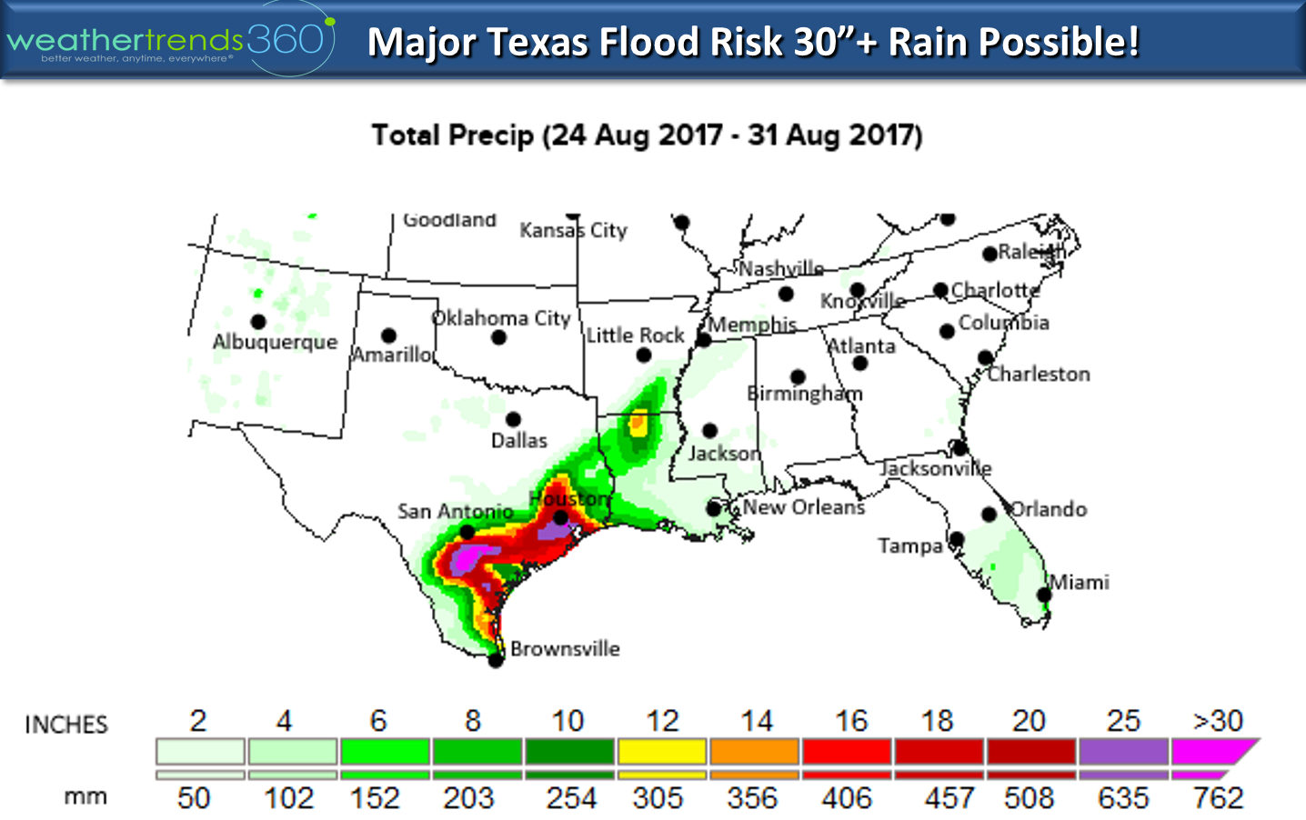
The biggest impact after landfall is major flooding. Some models are hinting at 15-30" of rain in spots from San Antonio to near Houston over the week ahead. This is a big deal as the ground is already pretty saturated in Eastern Texas with Houston having the 4th wettest Summer in decades. West Texas has been drier but still major risk for serious flood damage.

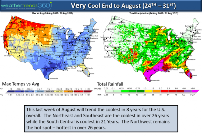
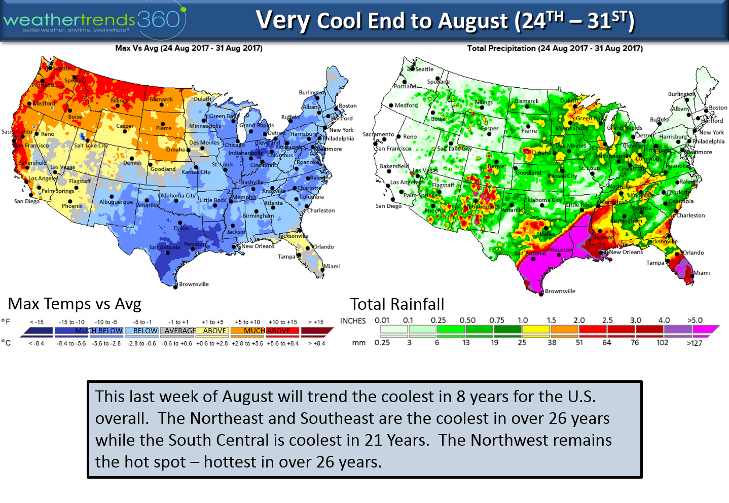
August is going out like September in the East with the Northeast and Southeast having the coolest end to August in over 26 years. Rain cooled air in the South Central will be the coolest end to August in 21 years while the Pacific Northwest continues to be the hot spot - hottest in 26 years.
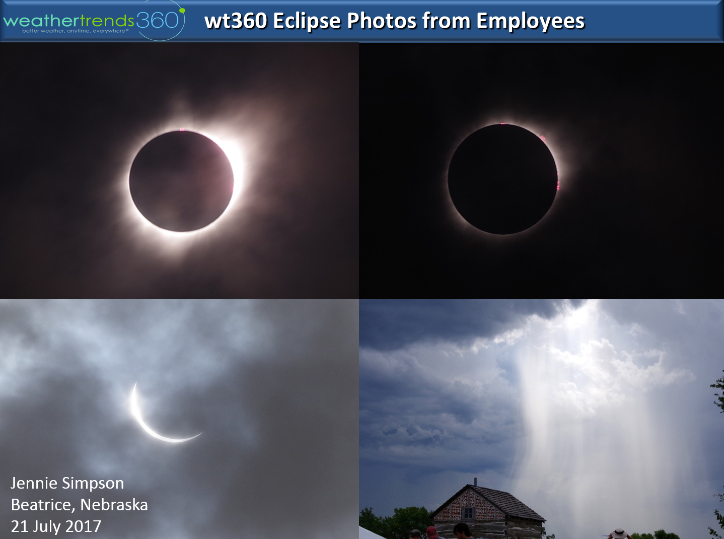
The eclipse is over but wt360's Jennie Simpson captured these amazing photos from Beatrice Nebraska!

Follow us on Facebook and Twitter for daily updates.
Have a great weekend folks! - Kirk out.
Hurricane Harvey is exploding in the SW Gulf of Mexico and it will make landfall in Texas late tomorrow night into pre-dawn Saturday. At this time it could be a major cat 3 hurricane at landfall which appears to be just Northeast of Corpus Christi. Anyone to the right of this storm could have a devastating tidal surge and right now that appears to be Port O'Connor area. PLEASE KEEP IN MIND THE ERROR JUST 1-2 DAYS OUT CAN STILL BE 50-100 MILES so anyone from Port Mansfield to Houston needs to prepare and heed local officials about evacuating. This COULD break the almost 12 year drought with out a major land-falling hurricane in the U.S. (165 year record). PLEASE BE SAFE!!!
The biggest impact after landfall is major flooding. Some models are hinting at 15-30" of rain in spots from San Antonio to near Houston over the week ahead. This is a big deal as the ground is already pretty saturated in Eastern Texas with Houston having the 4th wettest Summer in decades. West Texas has been drier but still major risk for serious flood damage.
August is going out like September in the East with the Northeast and Southeast having the coolest end to August in over 26 years. Rain cooled air in the South Central will be the coolest end to August in 21 years while the Pacific Northwest continues to be the hot spot - hottest in 26 years.
The eclipse is over but wt360's Jennie Simpson captured these amazing photos from Beatrice Nebraska!
Follow us on Facebook and Twitter for daily updates.
Have a great weekend folks! - Kirk out.