Star Date 24 September 2018 Monday
Captain's Log
Happy Monday and welcome to Fall! Fall officially arrived Saturday at 9:54 pm EDT.
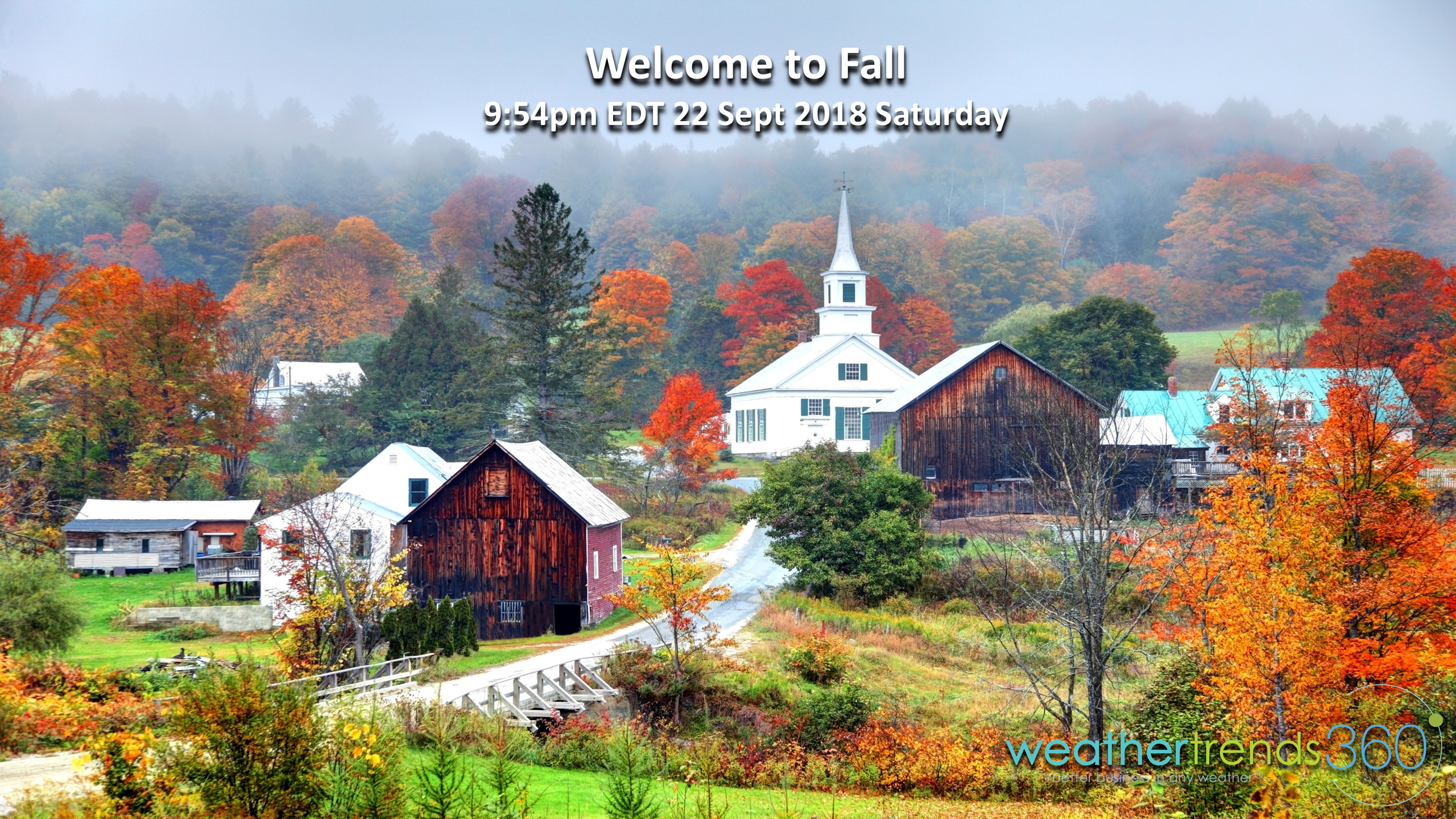
Fall isn't this pretty yet here in Eastern PA but we're starting to see signs of color which will develop quickly over the next few weeks in the Northeast and northern tier of the U.S. CLICK ON IMAGES FOR LARGER VIEW
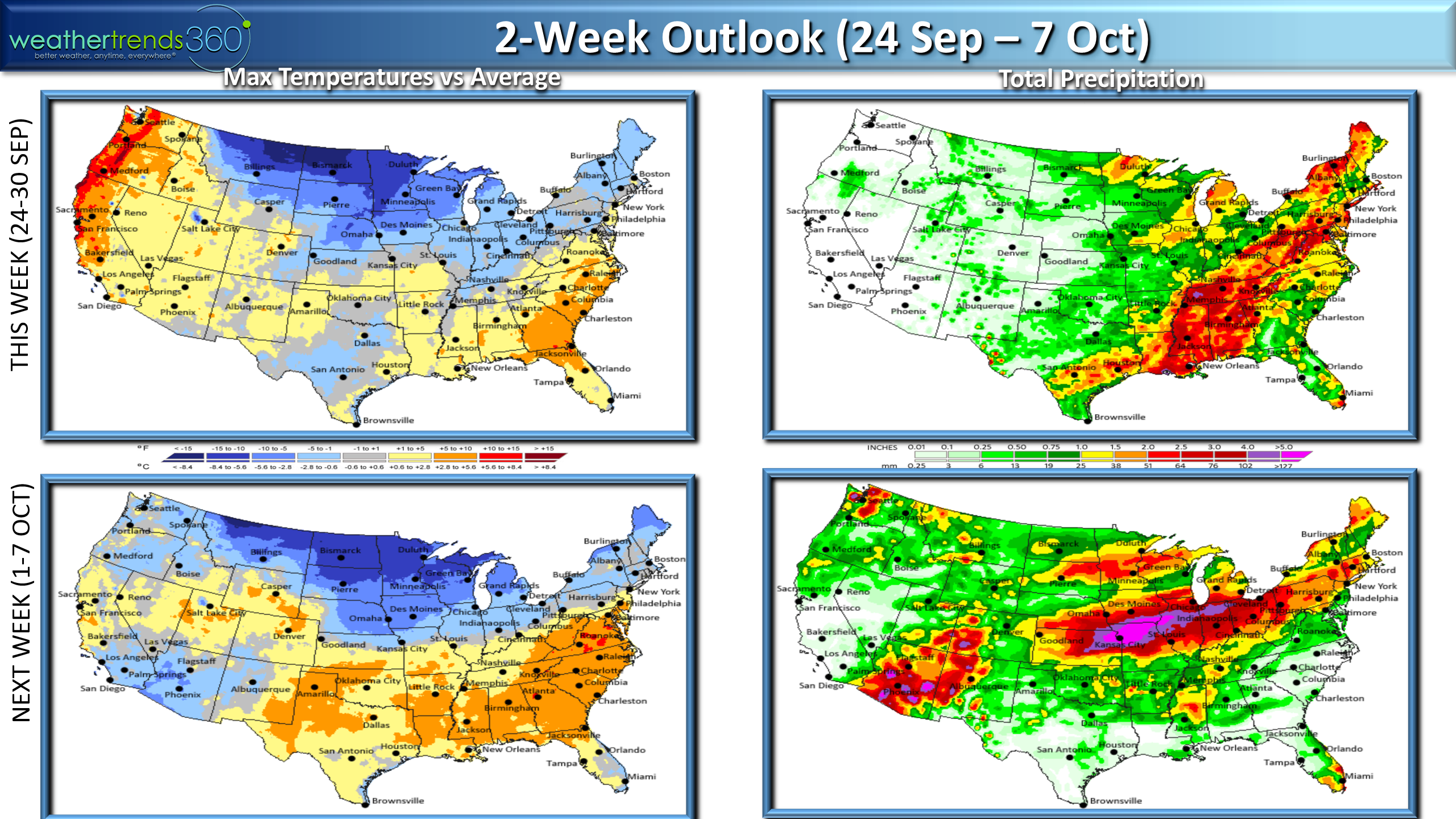
The two week outlook shows a general north-south orientation with much below normal high temperatures across the northern tier and still summer across the South, especially the Southeast. Its harvest season and we certainly don't need a conveyor belt of moisture going right through the heart of the Corn Belt this time of year.

Since the start of meteorological fall we've now had two cold snaps nationally with this past weekend actually being the coldest in 5 years, wettest in 7 years for the U.S. overall, a big change from the warm surge last week. The pattern going forward looks to show a cooler/wetter trend for the U.S. overall with this last week of September trending the coldest in 9 years and wettest in 30+ years and next week into early October trending the coolest in 3 years and wettest in 23 years. Great for Fall merchandise sales.
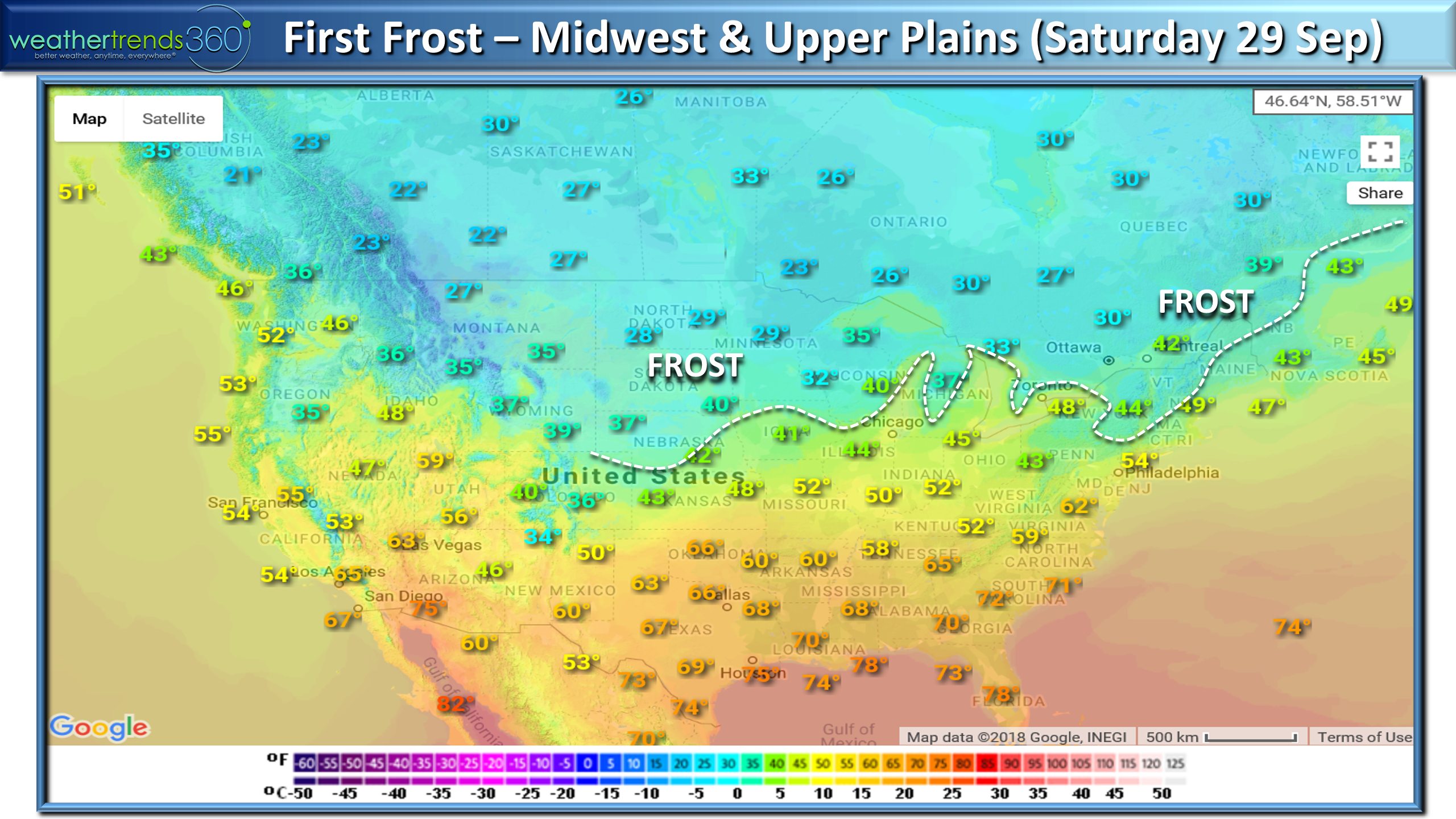
The first frost and freezes are likely over the next week in the Plains and Upper Midwest and parts of the interior Northeast.
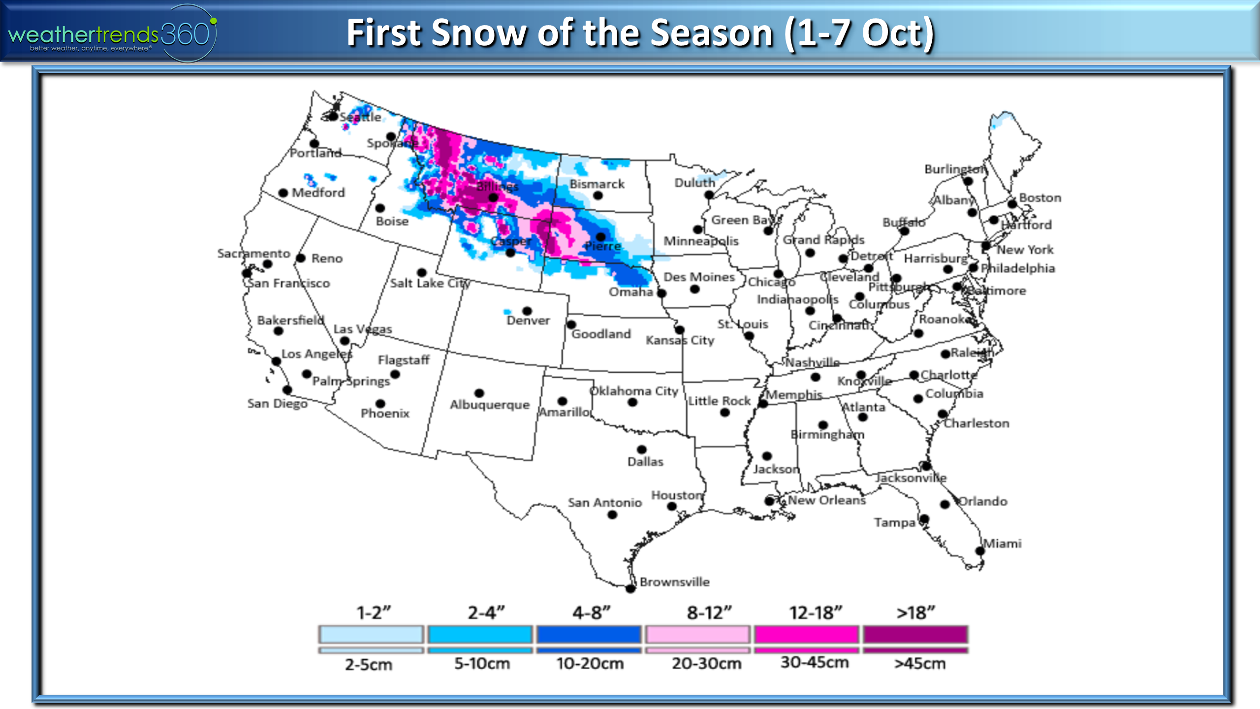
And dare we say it, SNOW, is in the forecast for the Northern Rocky Mountains. As we've noted in early Captain's Log we do expect Winter 2018-2019 to be the coldest and snowiest in 5 years and yes we expect the media to jump on the Polar Vortex term again as we get into later January and February...it's coming!
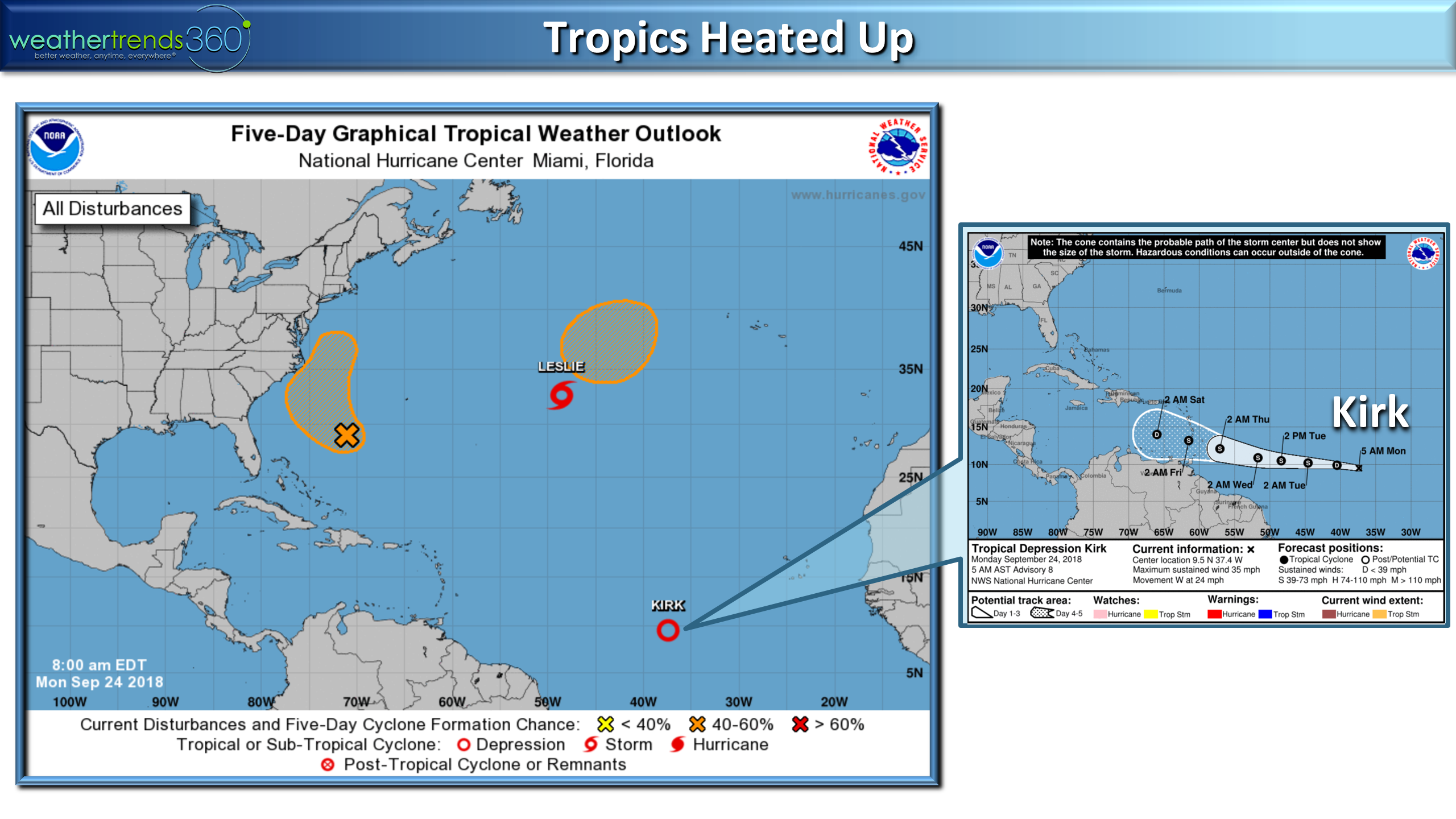
In the Atlantic it's still very much summer and the tropics did get a bit active with some weaker systems developing over the weekend. We added Kirk and Leslie to the list with Kirk likely to have some minimal impact on the Leeward Islands and then needs to be watched as it enters the Caribbean next week.
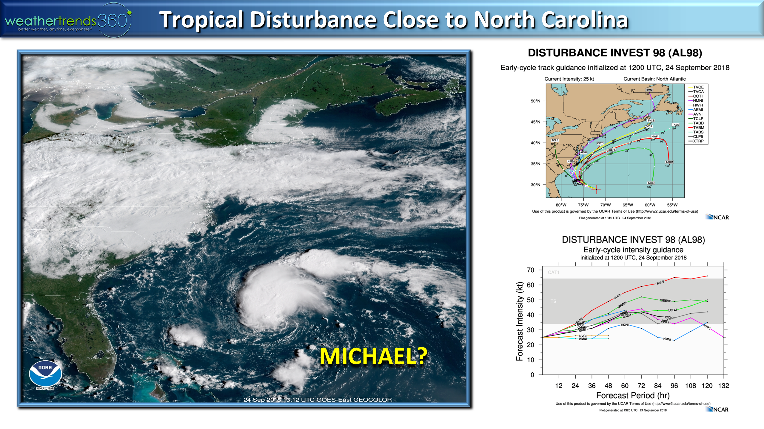
Of bigger concern is the system off the Middle Atlantic that has a chance to become Tropical Storm Michael with some rainfall impacts and bigger waves to North Carolina midweek. They don't need a drop of rain but looks like 1-3" midweek.
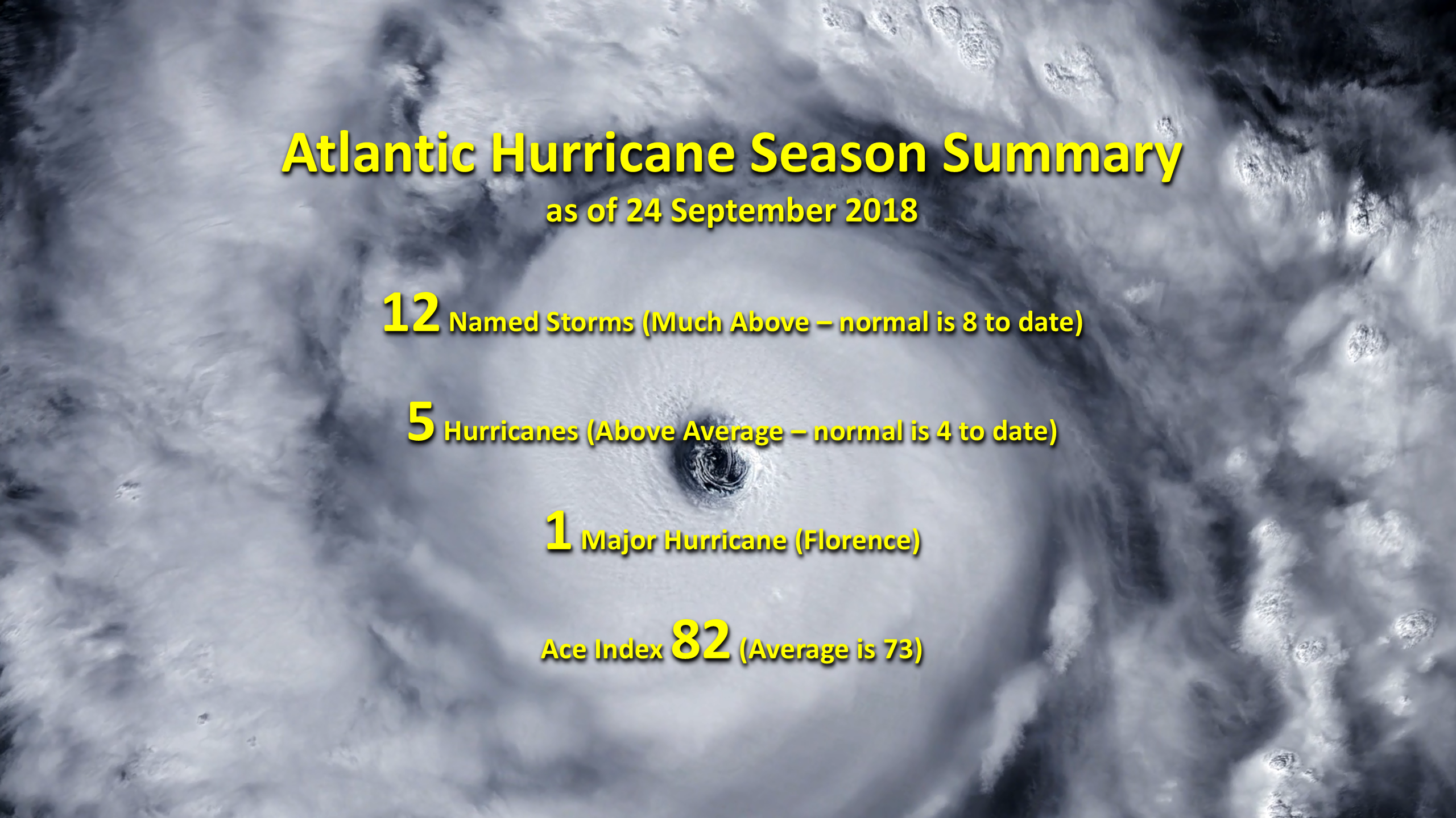
The hurricane season to date is above average with 12 named storms, 5 of which became hurricanes and 1 became a major hurricane with an ACE (Accumulated Cyclone Energy) index of 82. All above average for this point in the season with 2 months and a week to go. We like our chance to hit our robust early Spring forecast of 15 named storms, and yes we still think the U.S. will get hit by one or two more tropical storms or hurricanes this season.
Have a great weeks folks and don't forget to follow us on social media for frequent updates.Facebook,Twitter,YouTube,PinterestandLinkedin
- Captain Kirk out.