Star Date 28 Nov 2016 Monday
Captain's Log
Happy Monday folks! Are you ready for Winter??? It's coming!!!
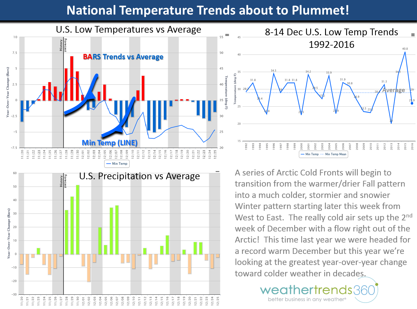
The short range Physics-based computer models (US GFS, Euro, Canadian) are agreeing with our year-ahead Math-based statistical climate cycle models showing a major pattern change from a warm/dry Fall to a cold/stormy December and beyond. There are at least 3 surges of Arctic air heading right out of Eastern Siberia into Alaska, Western Canada/US and eventually across much of the U.S. over the next few weeks.
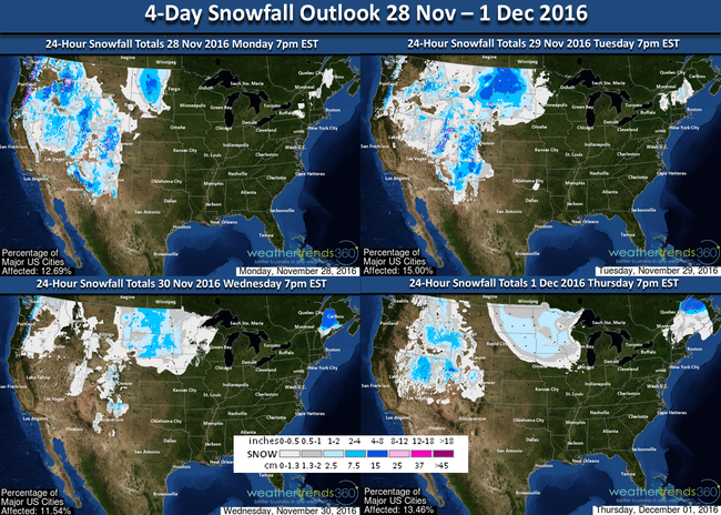
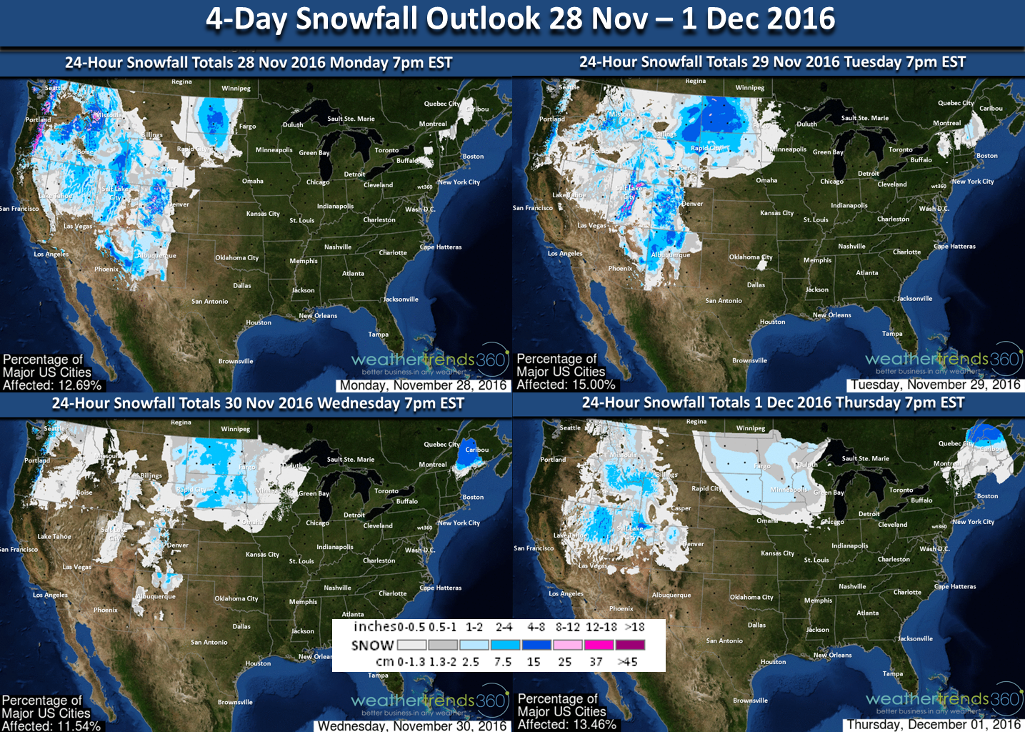
The Western U.S. gets the first moderate wave this week with 15 degree below average temperatures in the heart of the Rockies while Alaska is brutally cold with 20 degree below average temperatures in the -25F to -45F range. This air originated from Eastern Siberia taking a track through Alaska this week and then down into Western Canada and the Western U.S. early next week.
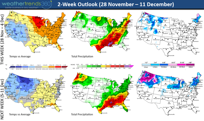
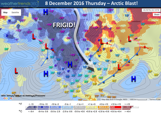
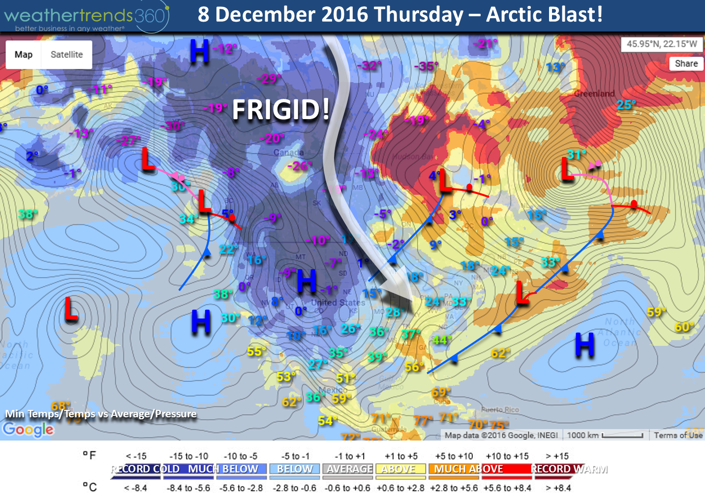
By the middle of next week much of the U.S. will have below to much below average temperatures with several systems of snow and ice to contend with. The map below is centered on 8 December with a series of cold fronts impacting much of North America. Notice the trajectory of airflow is right out of the Arctic (originally Eastern Siberia). Week 2 in December was record warm the past couple years, but not this year as we experience one of the greatest year-over-year changes toward colder weather in decades.
The outlook up until Christmas looks good if you like colder and snowier weather so kids may get their wish for a white Christmas this year! :)

In the near term, we'll be laying down a fresh snow pack across the West and N. Central U.S. which allows cold air to stay cold as it heads South and East in the weeks ahead. And we'll finally get some rain for the parched and drought stricken Southeast.
Have a great week folks! Follow us on Facebook and Twitter for daily updates.
- Capt Kirk out.
The short range Physics-based computer models (US GFS, Euro, Canadian) are agreeing with our year-ahead Math-based statistical climate cycle models showing a major pattern change from a warm/dry Fall to a cold/stormy December and beyond. There are at least 3 surges of Arctic air heading right out of Eastern Siberia into Alaska, Western Canada/US and eventually across much of the U.S. over the next few weeks.
The Western U.S. gets the first moderate wave this week with 15 degree below average temperatures in the heart of the Rockies while Alaska is brutally cold with 20 degree below average temperatures in the -25F to -45F range. This air originated from Eastern Siberia taking a track through Alaska this week and then down into Western Canada and the Western U.S. early next week.

By the middle of next week much of the U.S. will have below to much below average temperatures with several systems of snow and ice to contend with. The map below is centered on 8 December with a series of cold fronts impacting much of North America. Notice the trajectory of airflow is right out of the Arctic (originally Eastern Siberia). Week 2 in December was record warm the past couple years, but not this year as we experience one of the greatest year-over-year changes toward colder weather in decades.
The outlook up until Christmas looks good if you like colder and snowier weather so kids may get their wish for a white Christmas this year! :)
In the near term, we'll be laying down a fresh snow pack across the West and N. Central U.S. which allows cold air to stay cold as it heads South and East in the weeks ahead. And we'll finally get some rain for the parched and drought stricken Southeast.
Have a great week folks! Follow us on Facebook and Twitter for daily updates.
- Capt Kirk out.