Star Date 29 July 2019 Monday
Captain's Log
Happy Monday. :)
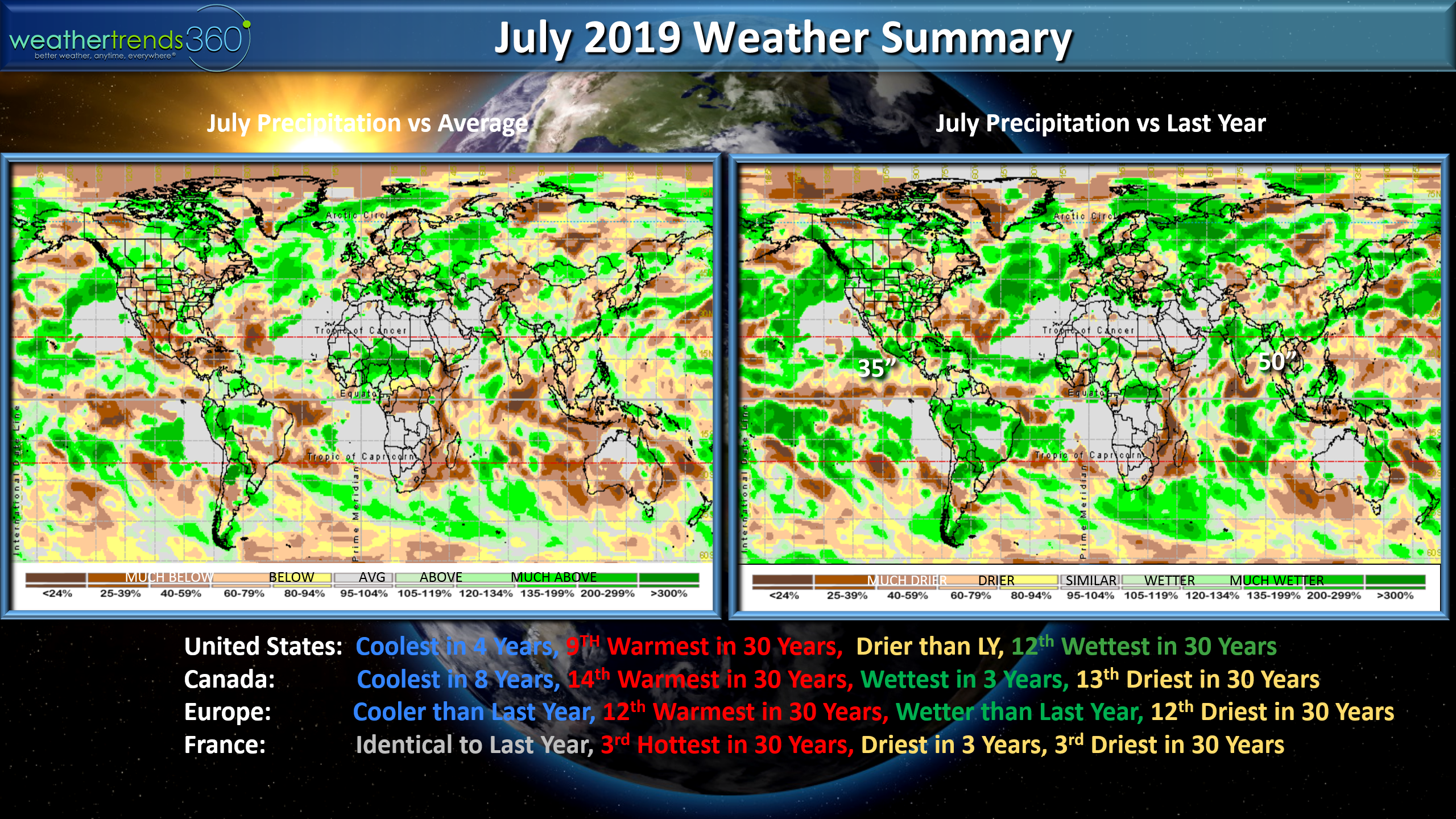
July 2019 is almost in the history books and for the U.S. weather it was the coolest in 4 years but still above average trending 9th warmest of the past 30 years, drier than last year but 12th wettest of the past 30 years. CLICK ON IMAGES FOR LARGER VIEW
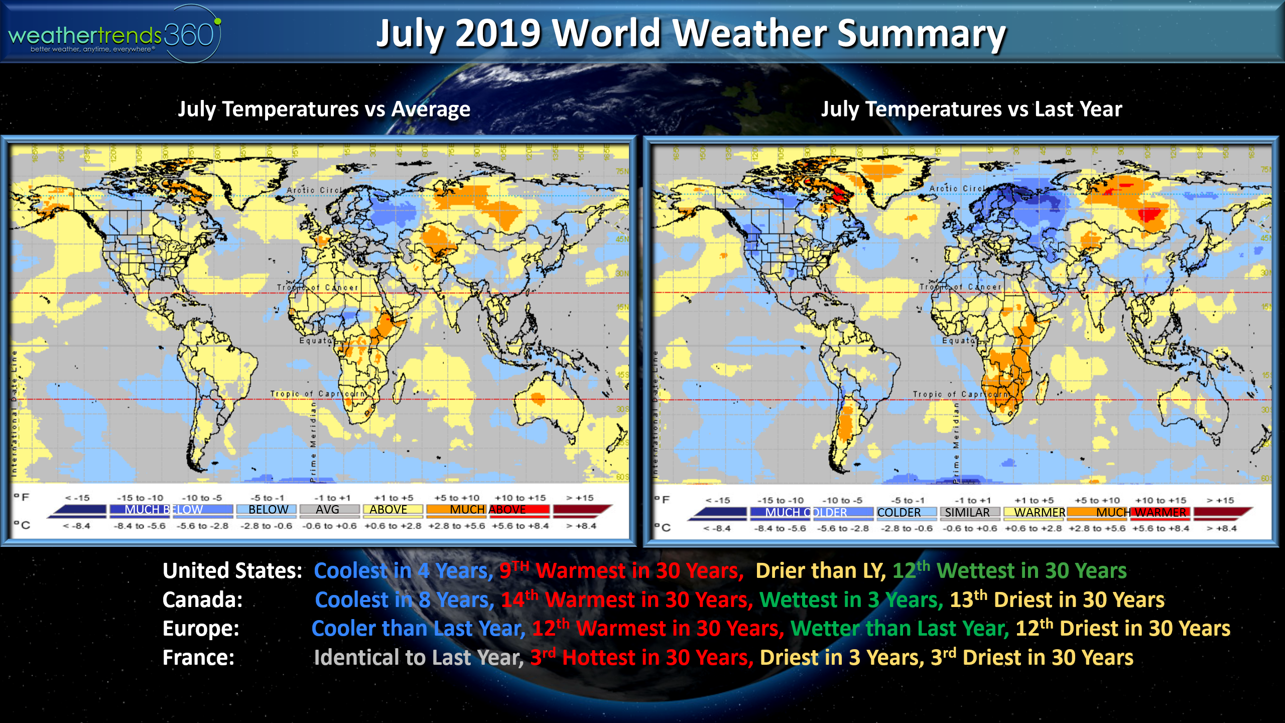
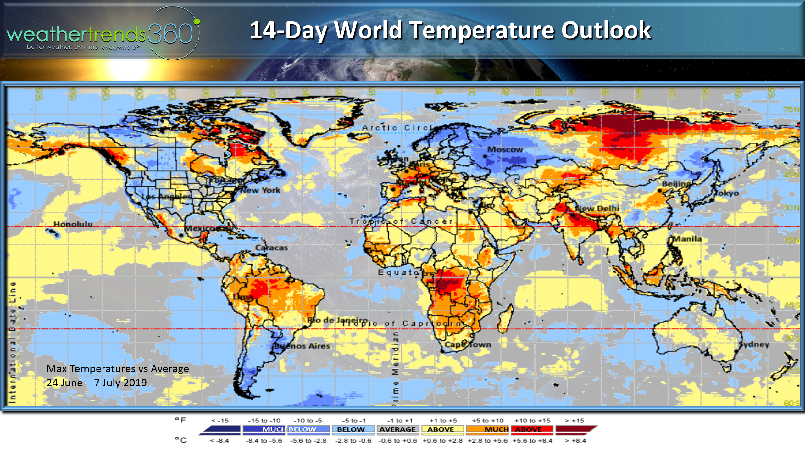
France made headline news with the heat-wave but it was still 3rd hottest in 30 years, similar to last year while Europe overall was cooler than last year and 12th warmest of the past 30 years. Canada was coolest in 8 years and 14th warmest of the past 30 years. There was a spot in the Northeast Bay of Bengal that had 50" of rain for the month.
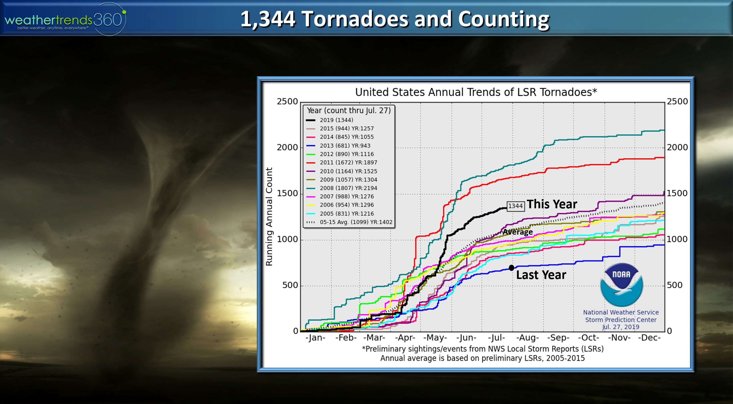
U.S. tornado count is at 1,344 which is well above average and way above last year's anemic season that was trending the fewest in 69 years. The season has peaked but still likely to see more tornadoes in August with a cooler/wetter pattern.
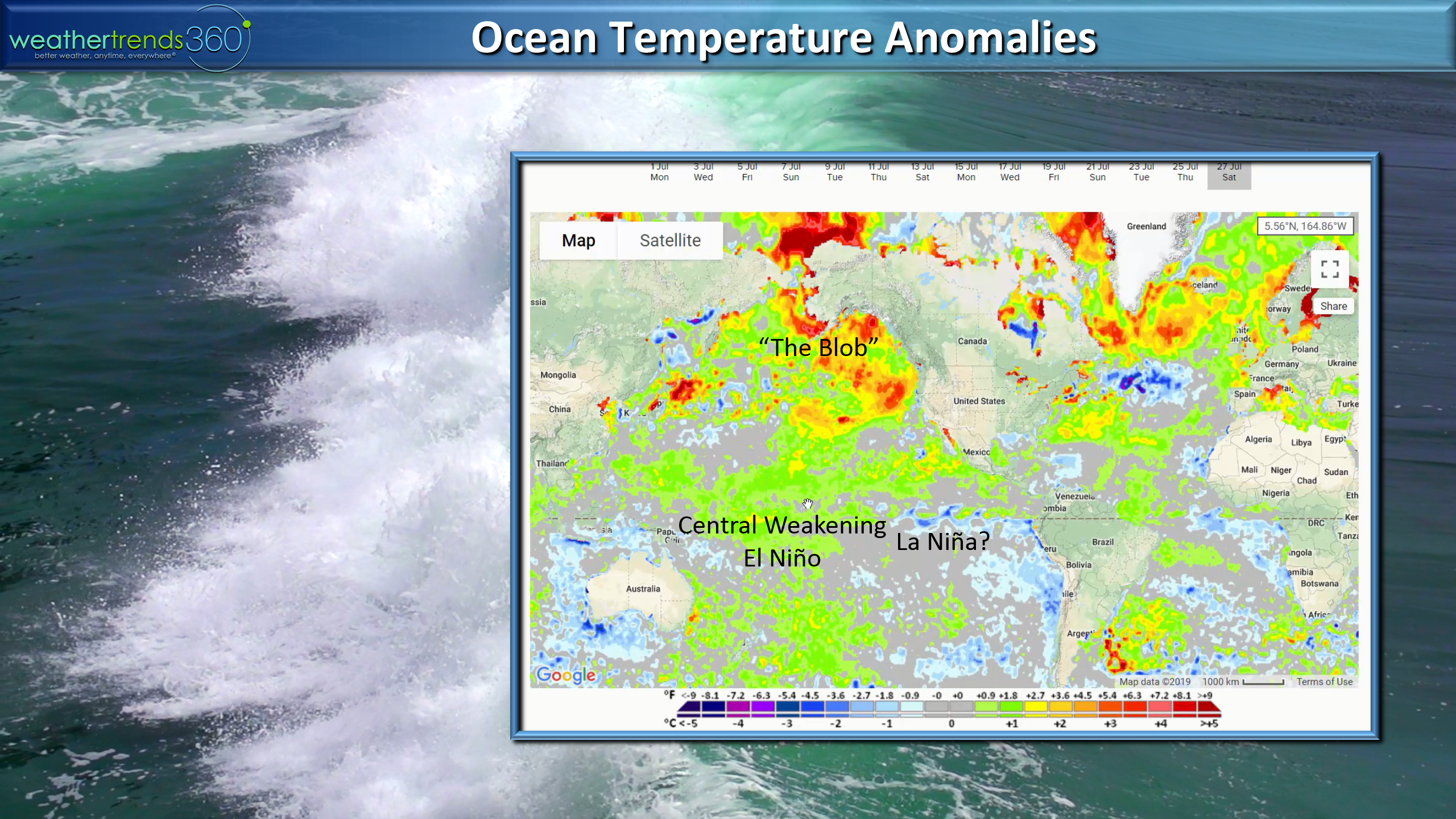
The Ocean temperaturesare a bit odd with what appears to be a weak La Nina like pattern trying to set up while we still have the weak central based El Nino with a very warm North Pacific...aka "The Blob". Most likely headed for La Nada this Winter but with the Blob we will likely have some very cold days this Winter in the U.S.
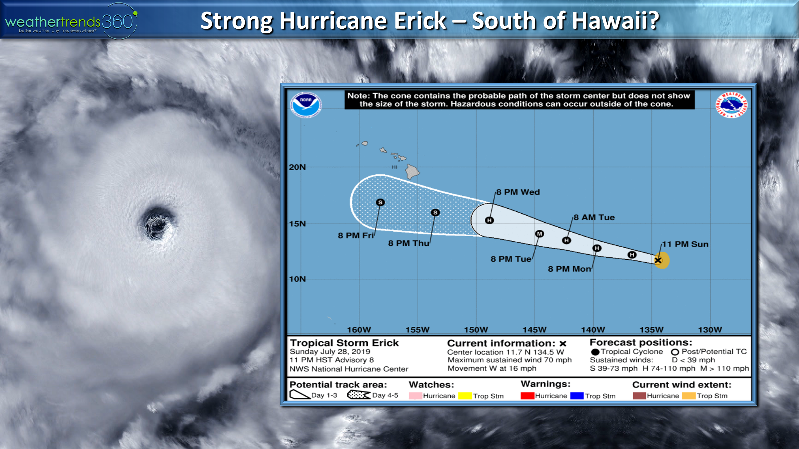
Hawaii will dodge a couple tropical systems this week and again next week so some risk to the Islands.
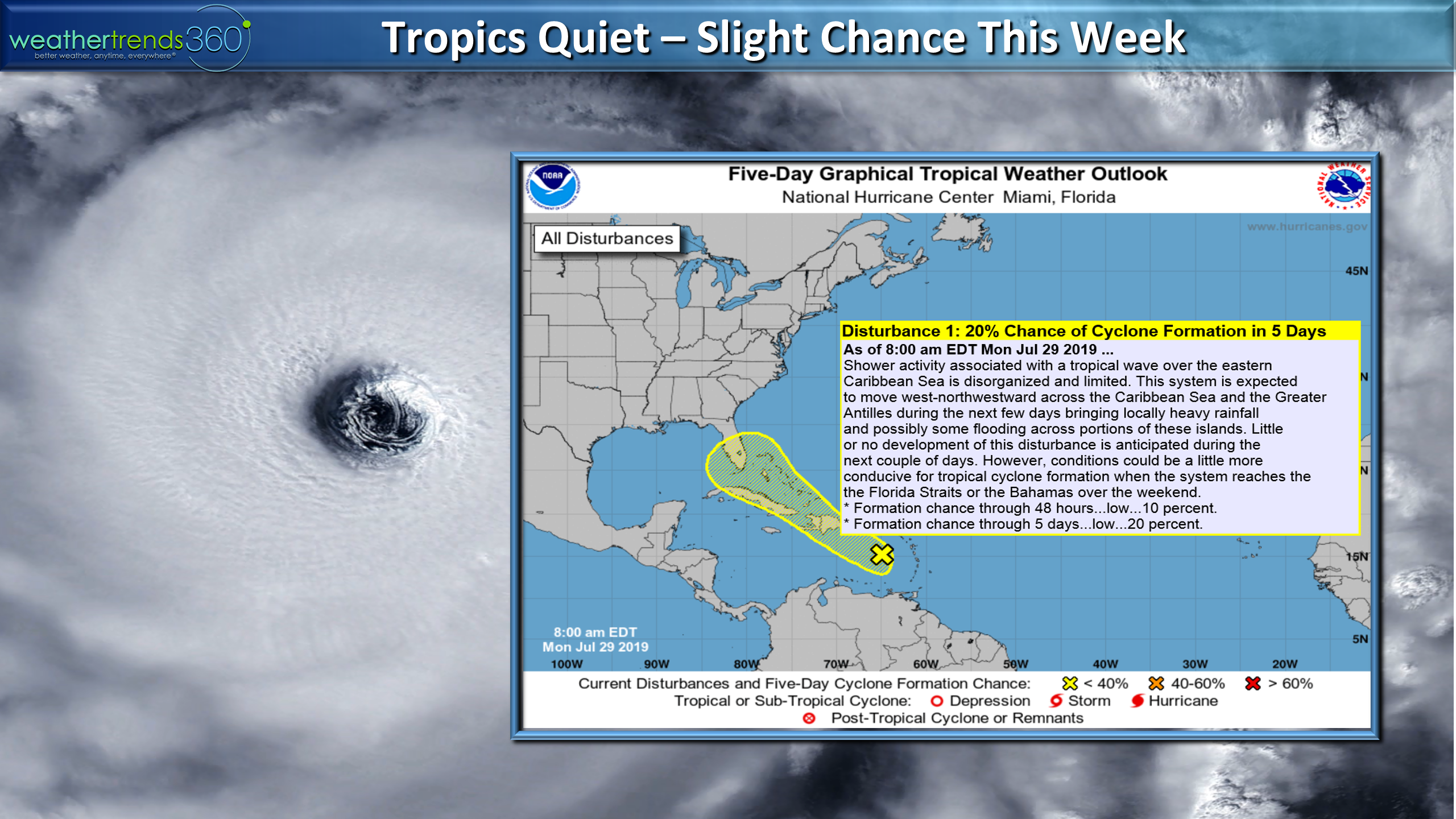
The Atlantic has all sorts of headwinds but the National Hurricane Center is watching a potential system heading in the general direction of SE Florida this week. Again, very weak at best.
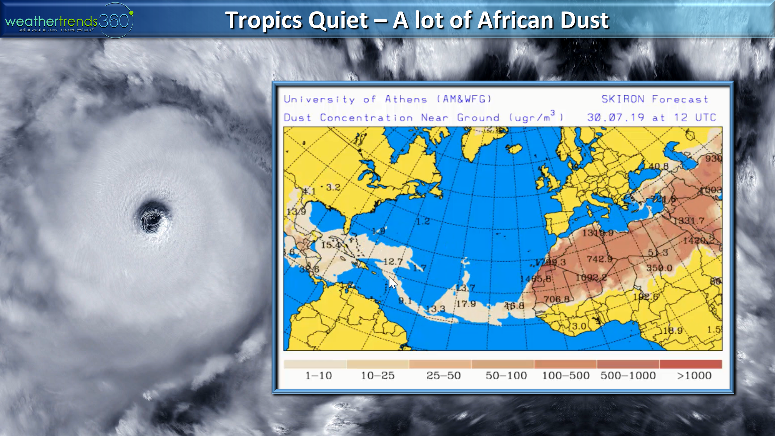
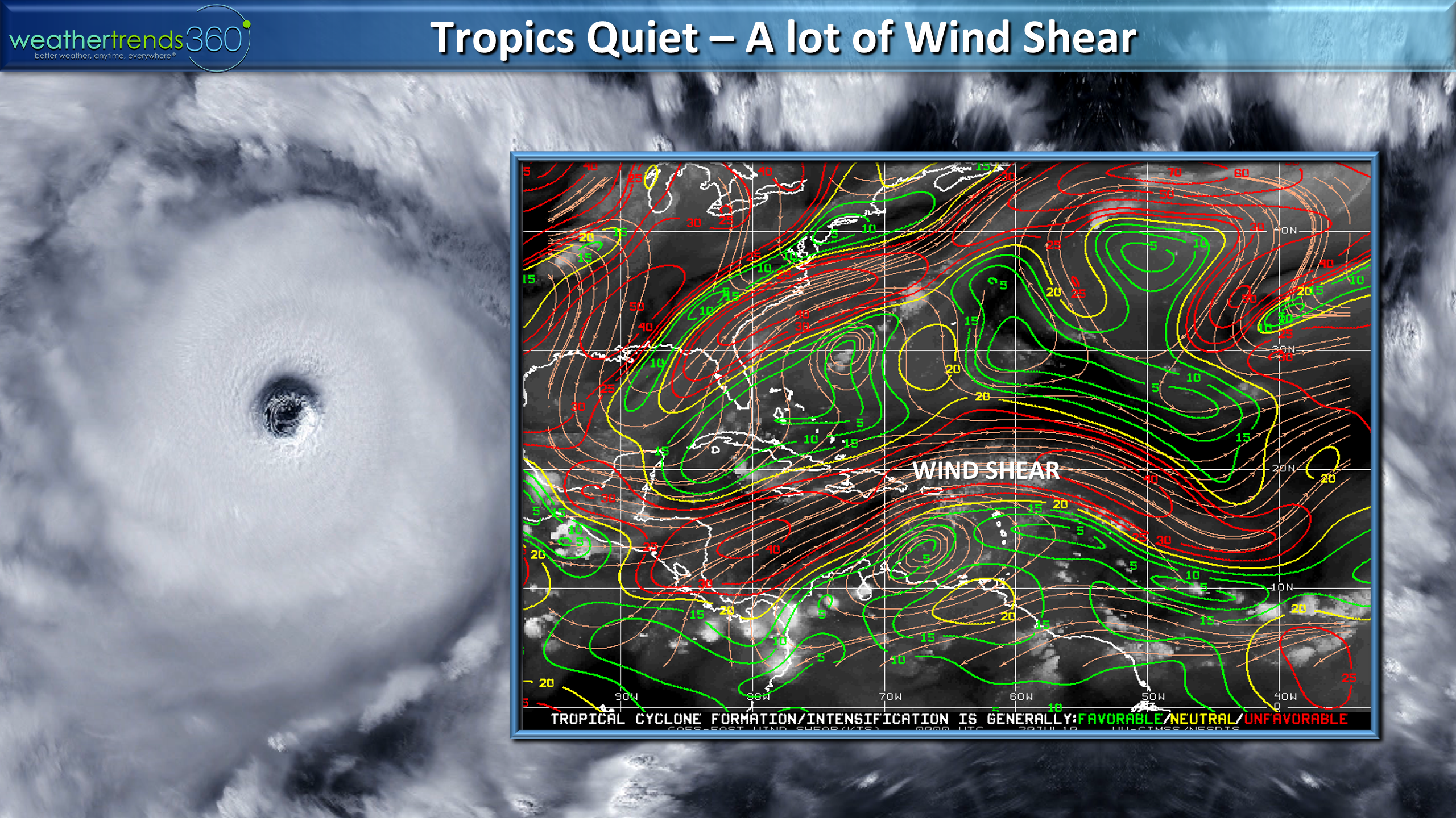
The inhibiting factors include dust off Africa and a lot of Wind Shear in the Atlantic. Only 2 named systems so far, but we are entering the period when things ramp up in August and peak in September.
WTI is still expecting a below average hurricane season but close in threats are still concerning, especially Southeast Florida and the Bahamas.
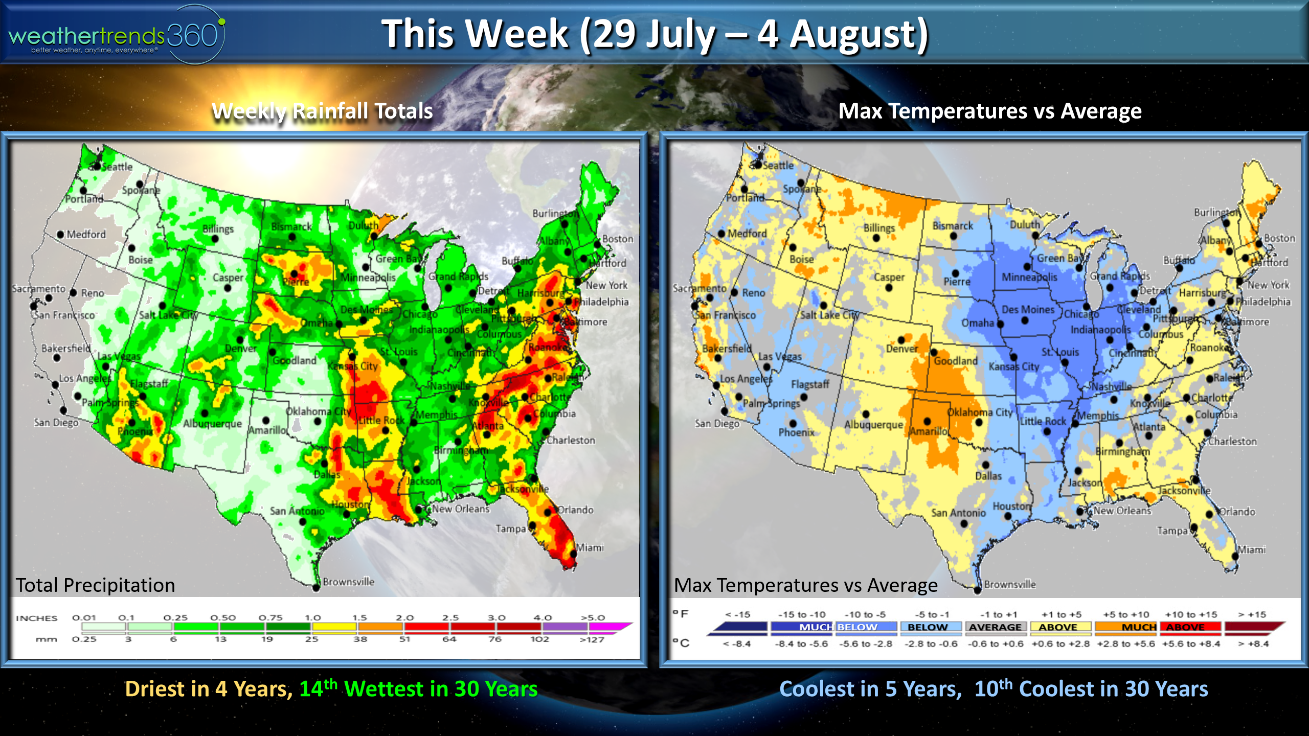
This week (29 July - 4 August) looks to trend the coolest in 5 years ant 10th coolest in 30 years for the U.S. overall with the heat confined to the East Coast, Western Plains and California. Rainfall looks to be driest in 4 years but still 14th wettest of the past 30 years.
Next week (5-11 August) the trends get even cooler with the U.S. expected to trend cooler than last year and 6th coolest of the past 30 years and potentially stormy with a stalled cold front in the Southeastern U.S.
August for the world shows cooler trends in the U.S. and Europe compared to last year with the U.S. likely to trend 11th coolest of the past 30 years with similar rainfall trending 3rd wettest in 30 years nationally.
We hope you have a great week and don't forget to follow us on social media for frequent updates.Facebook,Twitter,YouTube,PinterestandLinkedin
- Captain Kirk out.